
Emerald Triangle Hike
View Photos
Emerald Triangle Hike
Difficulty Rating:
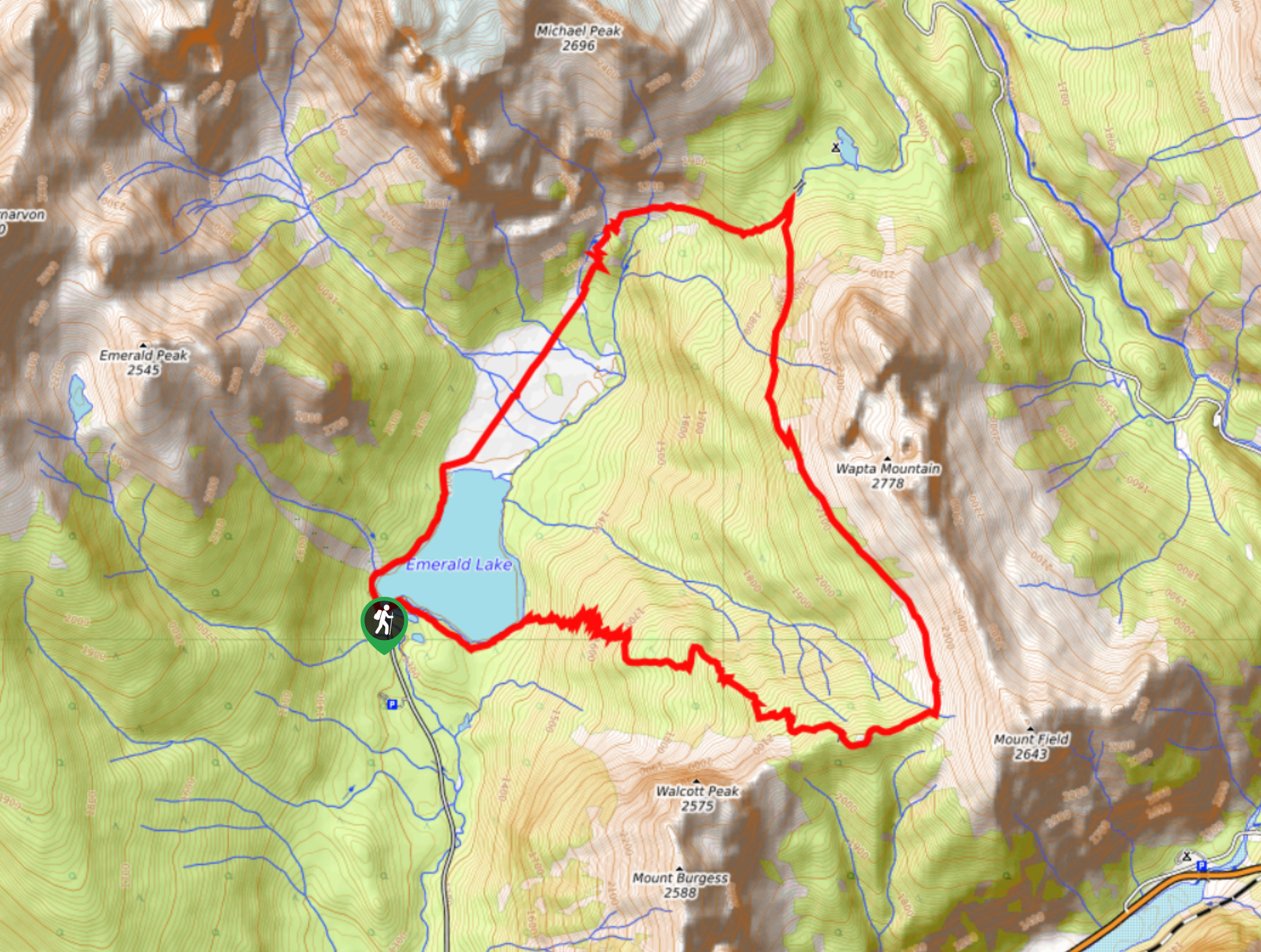
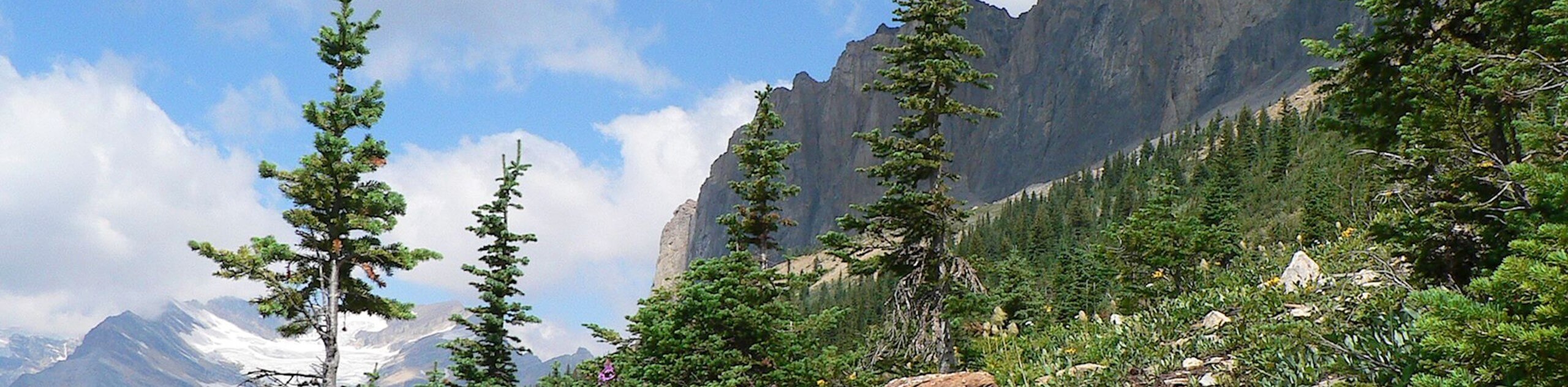
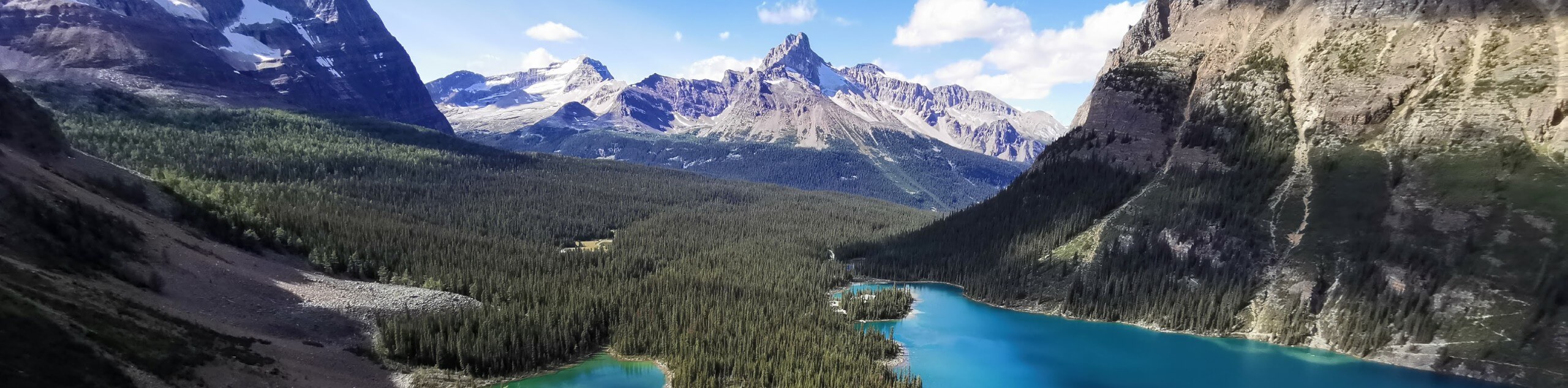
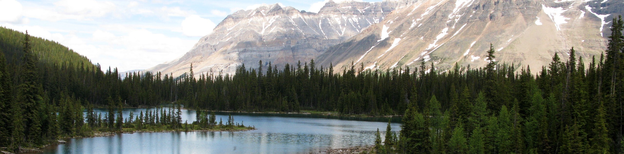
The Emerald Triangle Hike is a stunning route in Yoho National Park that will take you around the picturesque shores of Emerald Lake and uphill along the slopes of Wapta Mountain and Mount Field for some breathtaking views of the park. The trail does feature a fair bit of elevation gain and some demanding switchbacks along the mountainside; however, the portion along the ridge is fairly level and pleasant to hike through. Make sure to arrive early, as the parking area can become quite chaotic during peak hours.
Getting there
To get to the parking area for the Emerald Triangle Hike from Field, make your way to the southwest along BC-1W for 1.0mi and turn right onto Emerald Lake Road. Continue on for 5.6mi to arrive at the parking lot.

About
| When to do | February-November |
| Backcountry Campsites | Yoho Lake |
| Pets allowed | Yes - On Leash |
| Family friendly | No |
| Route Signage | Average |
| Crowd Levels | Moderate |
| Route Type | Circuit |
Emerald Triangle Hike
Elevation Graph
Weather
Emerald Triangle Hike Description
Although certain aspects of the route will prove to be a bit of a challenge, the Emerald Triangle Hike is an amazing adventure in Yoho National Park that will certainly reward you for your efforts climbing up the steep mountain side. Be sure to pack any gear that may be required for the season, such as gaiters, microspikes, or crampons in the shoulder seasons when ice and snow are likely still on the trail. Additionally, hikers should make sure to arrive early, as the trail begins at the busy parking lot next to Emerald Lake, which services a number of popular routes in the area.
This route can be completed in either direction; however, for the sake of this guide – and your knees – the trail will be followed in a counterclockwise direction. Setting out from the car park, follow the trail along the southern shoreline of Emerald Lake and take in the beautiful views of its calm surface and the surrounding mountain peaks. The trail will begin to climb up the steep mountainside along a series of switchbacks toward Burgess Pass before turning to the north under the summit of Mount Field. From here, you will have a pleasant walk along the elevated position of the trail, enjoying the stunning views of Wapta Mountain on your right and the blue waters of Emerald Lake below you on the left. Make your descent of the mountain towards Yoho Pass and make a sharp left turn along the trail to head further downhill. Here, you will traverse some flat terrain and cross several rivers and streams, eventually wrapping up your adventure with a scenic walk along the western shores of Emerald Lake.
Similar hikes to the Emerald Triangle Hike hike
Burgess Shale Hike
The Burgess Shale Hike is an amazing experience that will take you uphill along the slopes of Wapta Mountain for…
Lake O’Hara Alpine Circuit
Hiking the Lake O’Hara Alpine Circuit is an amazing experience that will see you traverse the rugged, yet beautiful terrain…
Linda Lake Hike
The Linda Lake Hike is a fantastic excursion that will lead you through some beautiful terrain in Yoho National Park…
Comments