
Stough Creek Basin Trail
View Photos
Stough Creek Basin Trail
Difficulty Rating:
The Stough Creek Basin Trail boasts awe-inspiring scenery. This incredible adventure wanders through alpine forests and montane meadows, past ponds, and glacial pools. Yielding some technical terrain at high altitudes, this route will get your heart pumping.
Getting there
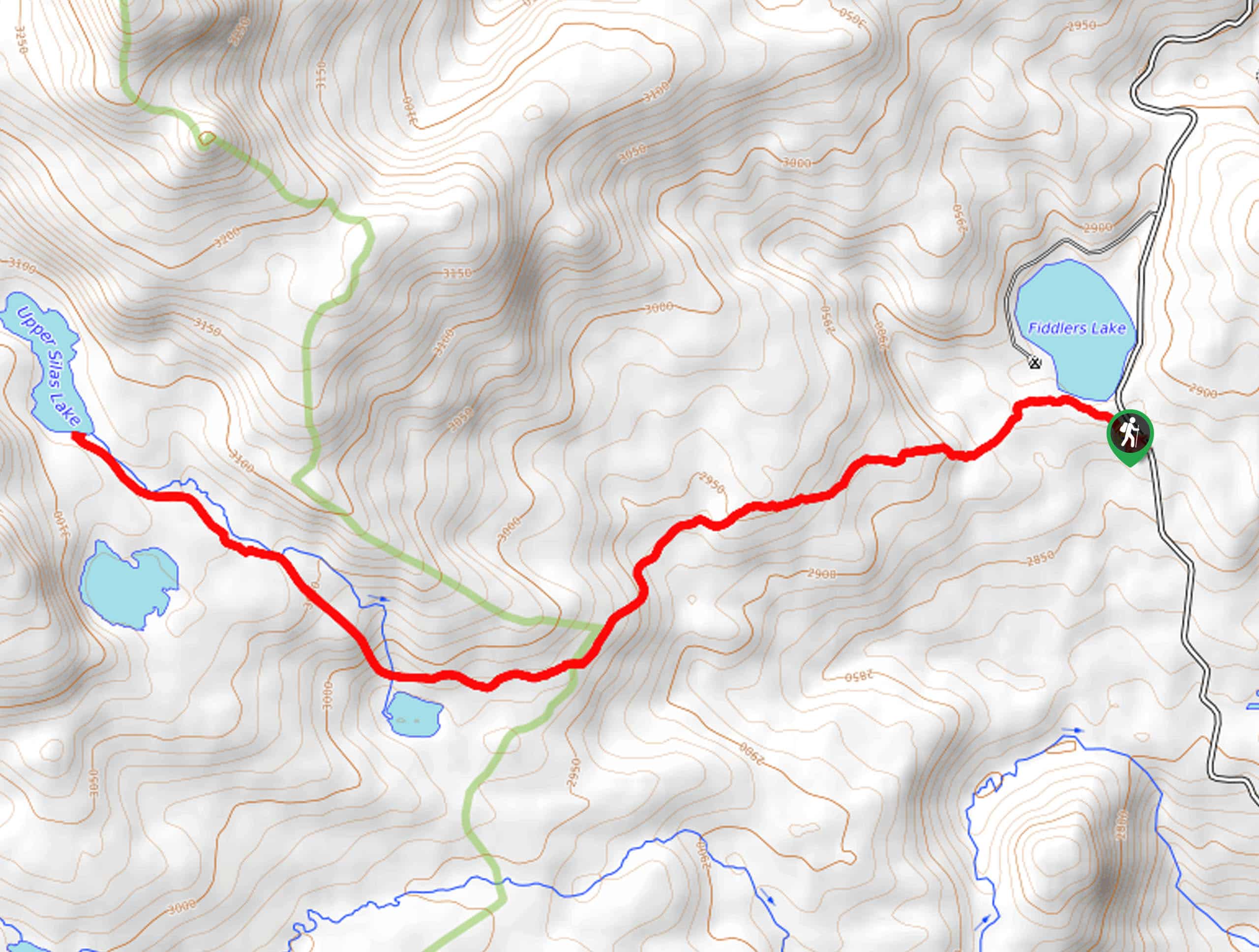
Access this hike from the Stough Creek Lakes Trailhead off Forest Road 302.

About
| Backcountry Campground | Backcountry Camping |
| When to do | May-October |
| Pets allowed | Yes - On Leash |
| Family friendly | No |
| Route Signage | Average |
| Crowd Levels | Low |
| Route Type | Out and back |
Stough Creek Basin Trail
Elevation Graph
Weather
Stough Creek Basin Trail Description
While demanding, the Stough Creek Basin Hike offers captivating views of the Wind River Mountain Range. This incredible adventure travels through vibrant alpine tundra, blossoming meadows, and lush woodlands to the crystalline alpine lakes. Exploring exposed terrain in the high country warrants extreme conditions, including thunderstorms and wind, so check the forecast before departure and dress in layers. Though unlikely, bear encounters are possible, so make sure at least one person in your group carries a can of bear spray.
Setting out from the Stough Creek Lakes Trailhead, you will begin your adventure by passing the Roaring Fork Lake. Keep left at the intersection here, and the Stough Creek Lakes Trail will progress through stands of mixed pine woodlands and blossoming meadows. Keep an eye out for wildlife as you hike, notably in the meadowlands. Soon the path will ascend into the alpine tundra, offering breathtaking views of the Wind River Range’s granite mountains. After some hiking, you will reach another junction, veer left, and the trail will plateau, heading southwardly.
This lovely path will deliver you to the Stough Creek Basin laden with countless charming alpine pools. Revel in the beauty of the crystal-clear lakes and Roaring Fork Mountain, West Atlantic Peak, and Atlantic Peak rising above the basin. When you are ready, retrace your footing back to the trailhead.
Similar hikes to the Stough Creek Basin Trail hike
Glacier Trail
The Glacier Trail is a demanding day hike in the Winds that boasts a scenic and secluded experience. Wander through…
Sheep Bridge Trail
The Sheep Bridge Trail checks all the boxes—short, scenic, and secluded. What more could you ask for? Mountain views? It…
Francis Lake Trail
The Francis Lake Trail is a great hike worth the detour into the Winds. While this area is extremely popular,…
Comments