
Roaring Fork Mountain Hike
View Photos
Roaring Fork Mountain Hike
Difficulty Rating:
Indulge yourself with spellbinding scenery as you hike the Roaring Fork Mountain Hike. Reserved for the intrepid, this backcountry adventure demands some off-trail navigation and a low-class scramble to the summit of Roaring Fork Mountain. While taxing, the captivating views of Wind River along this route are unrivaled.
Getting there
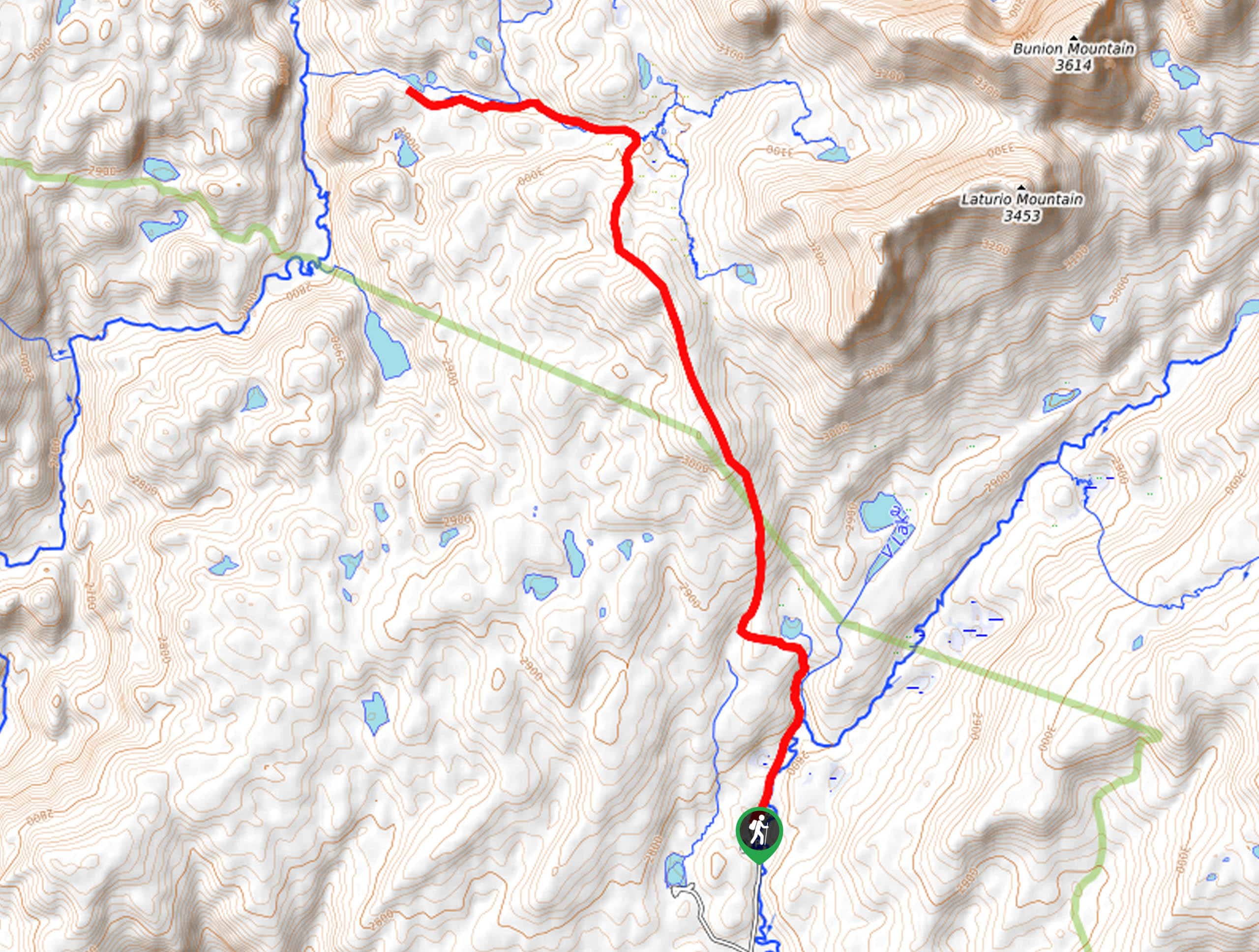
The Roaring Fork Mountain Hike departs from the Stough Creek Lakes Trailhead off Forest Road 302.

About
| Backcountry Campground | Backcountry Camping permitted |
| When to do | May-September |
| Pets allowed | Yes - On Leash |
| Family friendly | No |
| Route Signage | Poor |
| Crowd Levels | Low |
| Route Type | Out and back |
Roaring Fork Mountain Hike
Elevation Graph
Weather
Roaring Fork Mountain Hike Description
Yielding breathtaking panoramas every step of the way, the Roaring Fork Mountain Hike is undeniably one of our favorite trails in the Wind River Range, though it does not come without its challenges. Traveling along exposed terrain in the high country warrants extreme conditions, including thunderstorms and wind. Check the forecast prior to departure, dress in layers, and try to summit before noon to mitigate the chances of getting caught in a storm. Additionally, as will all sorts of exploration in bear country, make sure you have a can of bear spray handy as you wander. Note this trek requires an off-trail scramble up to the summit of Roaring Fork Mountain, so make sure you download the trail GPS prior to departure.
Traveling through incredibly beautiful subalpine and alpine settings, the Roaring Fork Mountain will not cease to amaze. While challenging in sections, this route rewards hikers for their efforts with unparalleled views of the Wind River Mountains and the bounding lively environments—including the vibrant alpine tundra, countless crystalline lakes, blossoming meadows, and lush woodlands. Within these locations, you will likely observe wildlife, such as marmots, pika, elk, moose, bears, and more. The spell-binding scenery will motivate you as you ascend into the high country, don’t forget your camera; this trail is quite photogenic.
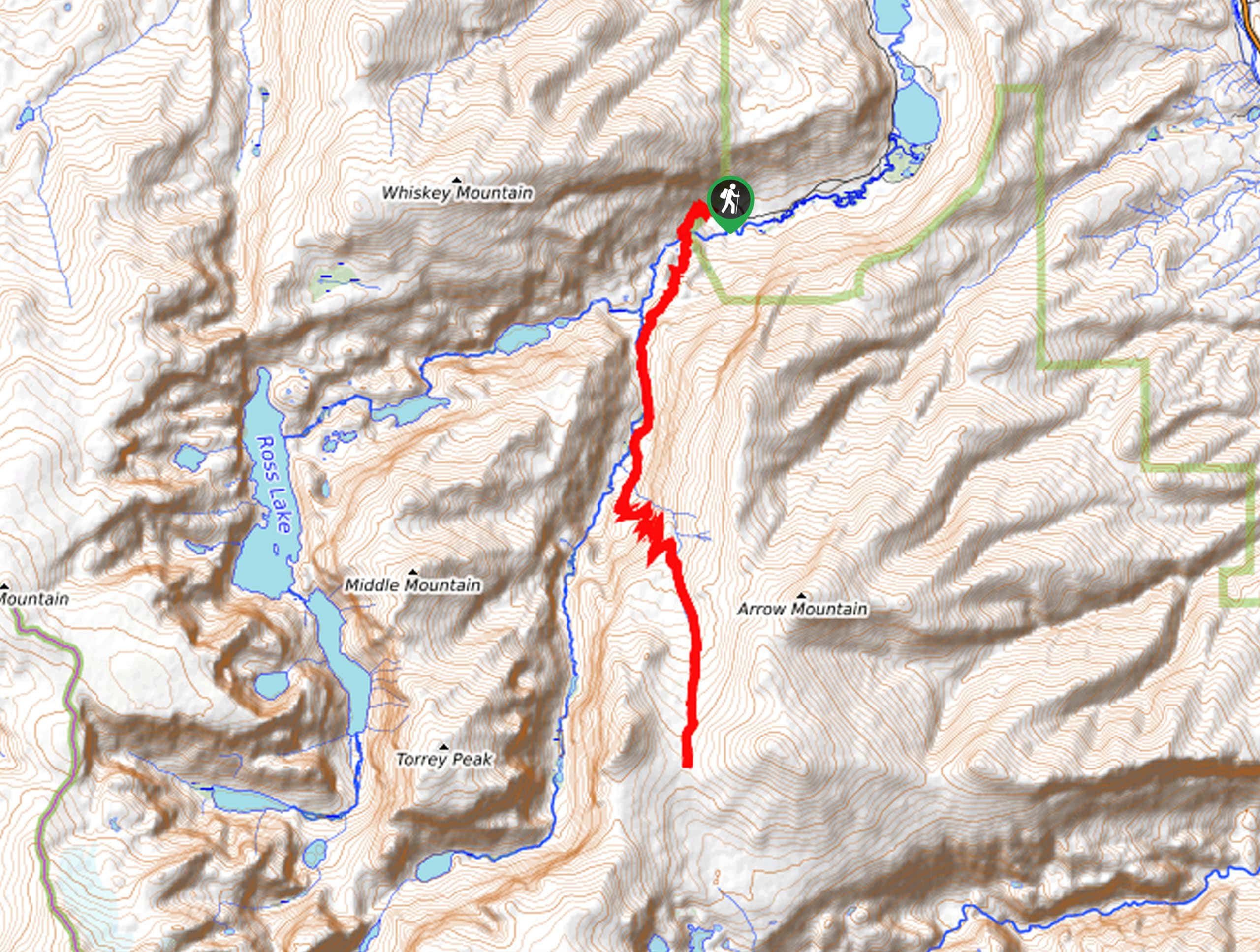
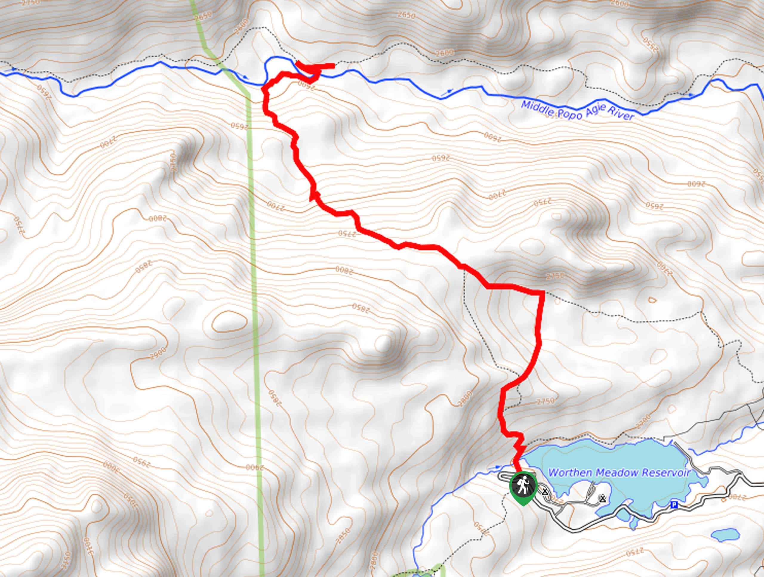
With bear spray, plenty of water, and the trail GPS in tow, you are ready to begin your adventure along the Roaring Fork Mountain Trail. Setting out from the Stough Creek Lakes Trailhead, the Stough Creek Lakes Trail heads west, gradually climbing into the woodlands to an intersection at the Roaring Fork Lake. Admire the charm of the small pool, then continue your journey, keeping right at the junction. As you travel along the Roaring Creek Stream beneath the tree canopy, be sure to keep an eye and ear out for wildlife camouflaging in the brush.
The further you progress into the wilderness, the sparser will the tree coverage become, exposing wonderful views of the Wind Rivers rising above the landscape. Just before summiting the treeline, you will pass through a vast meadow often abundant with grazing elk. Beyond this point, the terrain becomes increasingly rocky and technical as you begin to navigate the Stough Saddle. Using the trail GPS, you will be led up a collection of switchbacks into the high country. Mind your footing on the rocky terrain, but make sure to take the time to admire the beauty and vibrance of the encompassing tundra. After some hiking, you will reach an intersection; this is where you divert off the beaten path and begin trailblazing.
Using the trail GPS, you will track southwestwardly, away from the Stough Creek Lakes Basin—don’t worry, you’ll get to enjoy the basin from above, which is much more rewarding in our opinion. At this point, you will begin your low-class scramble up the loose scree, ascending the northern slope of Roaring Fork Mountain. Though the trail GPS might direct you one way, use your judgment and find the path of least resistance. After some climbing, you will ultimately reach the summit of Roaring Fork Mountain.
Now atop the mountain, you will likely be blown around by the strong wind, but that’s all part of the experience, right? Marvel at the 360-degree views of the Wind River Mountains and the bounding sub-alpine landscapes. Find the Atlantic Peaks in the south across the saddle and the Cirque of the Towers in the opposite direction. Directly below the mountain on the east, you will notice the terrain you tackled to get here, in addition to the Stough Creek Lakes Basin. Revel in the beauty of the countless alpine lakes that adorn the landscape and the cirques. Enjoy the seclusion and the gobsmacking scenery, then head back to the trailhead the way you came.
Trail Highlights
Roaring Fork Mountain
Roaring Fork Mountain sits along the Continental Divide in Wyoming, US. Standing at an elevation of 12224ft, this summit is not the grandest in the Wind River Range, though it boasts unrivaled scenery from its peak. Though there is no definitive answer, we speculate the name was derived from the forks that extend from the mountain top or the roaring winds that usually gust.
Insider Hints
Dress in layers, conditions at the summit are often windy
Wear a sturdy pair of footwear, much of the terrain is rocky and uneven
Be mindful of afternoon storms
Make sure at least one person in your party has bear spray
Download the trail GPS prior to departure
Charge your camera, the scenery is quite photogenic
Depending on the season, you may have to tackle a creek crossing
Similar hikes to the Roaring Fork Mountain Hike hike
Glacier Trail
The Glacier Trail is a demanding day hike in the Winds that boasts a scenic and secluded experience. Wander through…
Sheep Bridge Trail
The Sheep Bridge Trail checks all the boxes—short, scenic, and secluded. What more could you ask for? Mountain views? It…
Francis Lake Trail
The Francis Lake Trail is a great hike worth the detour into the Winds. While this area is extremely popular,…
Comments