
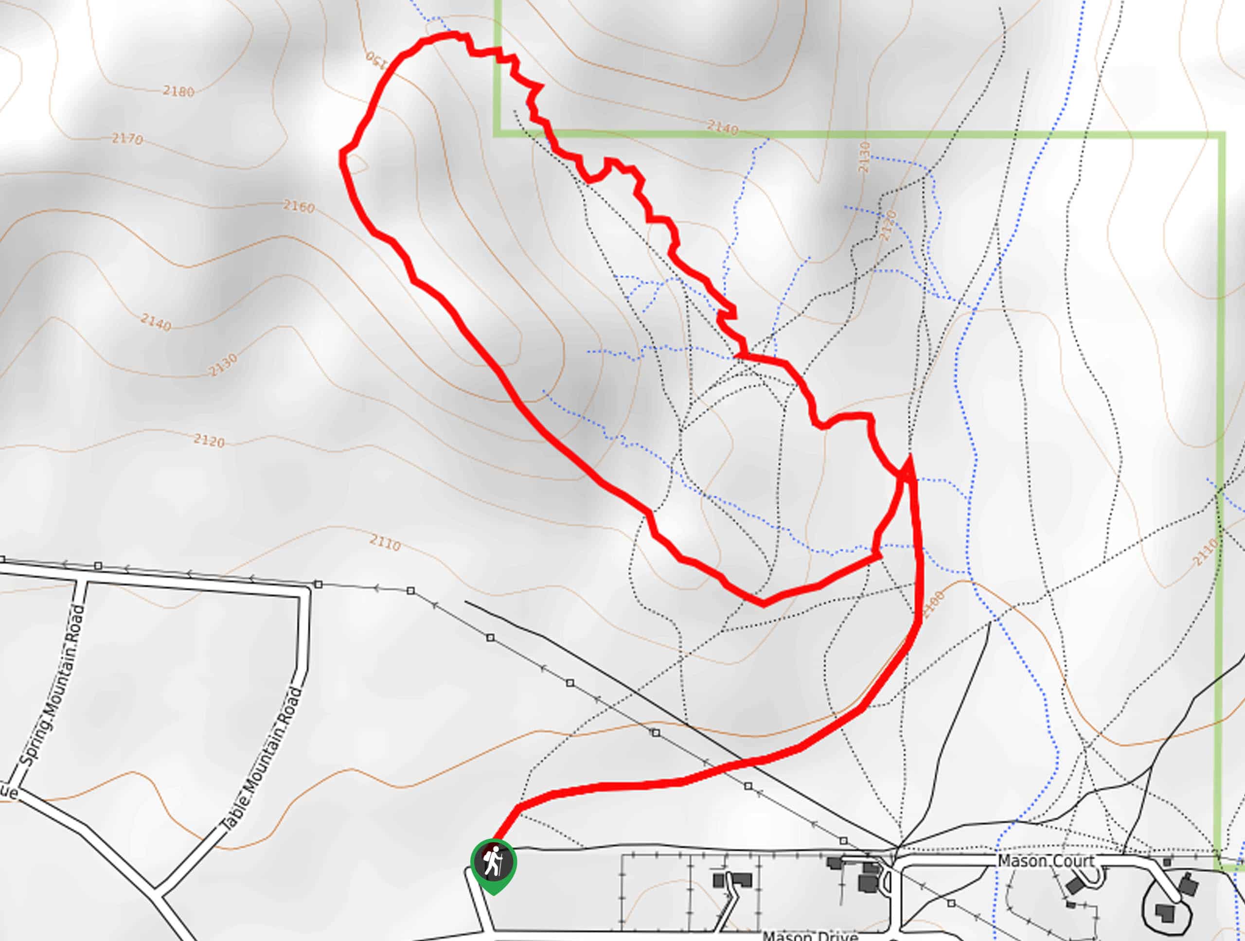
Ridge to Riverbed Badlands Trail
View Photos
Ridge to Riverbed Badlands Trail
Difficulty Rating:
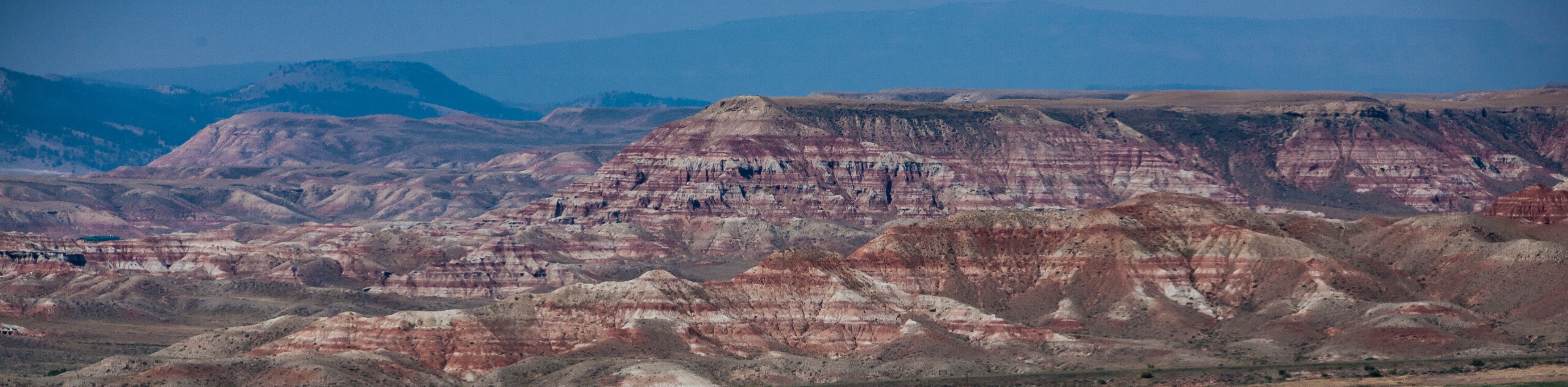
The Ridge to Riverbed Badlands Trail explores an area of unique topography. Explore the painted desert abundant with badlands and mesas and enjoy incredible views of the Wind River Mountains. This short but scenic trek is worth adding to your hiking itinerary.
Getting there
The Ridge to Riverbed Badlands Trail departs from the trailhead off Kingfisher Road.

About
| Backcountry Campground | No |
| When to do | May-October |
| Pets allowed | Yes - On Leash |
| Family friendly | Yes |
| Route Signage | Poor |
| Crowd Levels | Moderate |
| Route Type | Lollipop |
Ridge to Riverbed Badlands Trail
Elevation Graph
Weather
Ridge to Riverbed Badlands Trail Description
Immerse yourself in the desert-like terrain along the Ridge to Riverbed Badlands Hike. Revealing the area’s topographic variety, this hike is unlike no other. Note as much of the path is cloaked with sagebrush and outcrops, the exposed path sees extreme conditions. Wear SPF and check the forecast before your departure. Additionally, it is important to be mindful of wildlife, including elk, deer, rattlesnakes, and bears, as you wander. After rainfall, this route sees muddy and slippery conditions, so avoid the trail at these times. Note this route goes off-trail, so use the trail GPS.
Hike amongst towering badlands and up ridges that expose unrivaled views of the mountainous landscape on the Ridge to Riverbed Badlands Hike. Setting out from the trailhead, the path will progress northeast into the rock garden. Using the trail GPS, you will eventually be diverted southwest from an intersection. Wander this route up a rocky red ridge that offers incredible views of the encompassing landscape. Mind your footing as you descend the other side of the bluff, down to a seasonal riverbed.
Beyond this point, the path will gradually descend along the creek, offering dramatic views of the bounding ridges. After some hiking, you will eventually reconnect with the initial junction. From here, follow the GPS and retrace your steps back to the trailhead.
Similar hikes to the Ridge to Riverbed Badlands Trail hike
Upper Brewers Trail
The charm of a one-way trek is unrivaled. Enjoy new scenery every step of the way as you hike the…
Dubois Recreation Area Scenic Overlook Hike
The Dubois Recreation Area Scenic Overlook Hike is an epic adventure that explores the painted hills. Located just outside the…
Downtown Dubois Walk
While not technically a hiking route, the Downtown Dubois Walk is a great adventure. Many people visiting the Winds or…
Comments