
North Slope Trail
View Photos
North Slope Trail
Difficulty Rating:
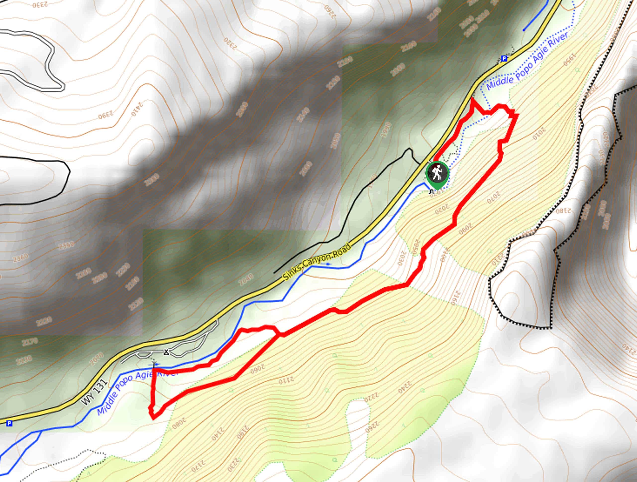
The North Slope Trail is an epic expedition that affords anyone a good time. A magnet for outdoor enthusiasts and geologists, this wonderful hike reveals the famous Sinks where the Popo Agie River vanishes into an underground limestone cavern.
Getting there
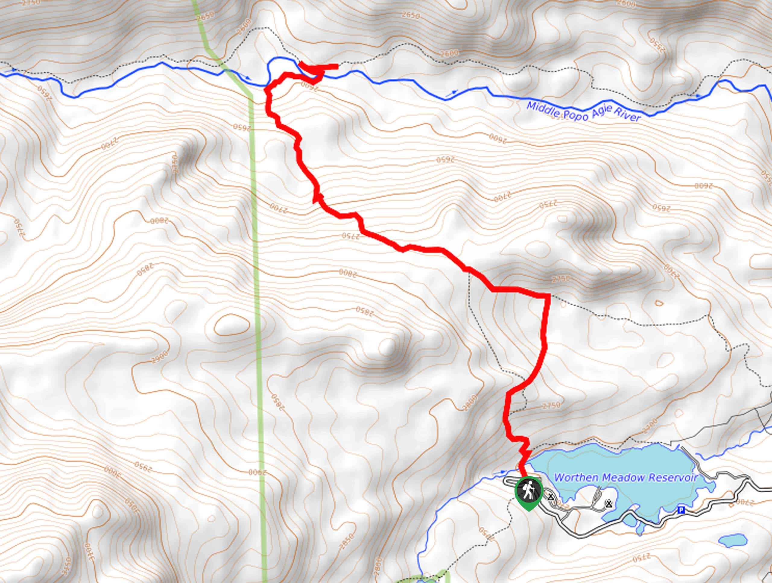
The North Slope Trail departs from The Sinks and The Rise Trailhead off the Sinks Canyon Road.

About
| Backcountry Campground | |
| When to do | May-October |
| Pets allowed | Yes - On Leash |
| Family friendly | Yes |
| Route Signage | Average |
| Crowd Levels | Moderate |
| Route Type | Lollipop |
North Slope Trail
Elevation Graph
Weather
North Slope Trail Description
The North Slope Hike boasts a memorable experience. Conveniently located near Lander, WY, this route explores the dramatic Sinks Canyon, abundant with various unique geological features. Enjoy distant views of the Wind River Mountains and revel in the mystery of the Sinks. Though this route is beautiful year-round, we encourage springtime exploration during peak run-off season when the waters surge and wildflowers blossom. Note the terrain is rocky and uneven, so make sure you wear a comfy pair of footwear and mind your footing.
Setting out from the trailhead at the visitor’s center, the North Slope Trail travels northeast along The Sinks to The Rise Trail. After marveling at the Sinks, begin your hike along the Popo Agie River. Soon after your departure, you will reach an intersection and veer right here onto the North Slope Trail. Wandering up the canyon walls through sagebrush and junipers, you will be granted impressive views of the craggy limestone bluffs and the Winds in the distance.
You will ultimately reach an intersection; keep right here, nearing the Popo Agie River again. This route will lead you towards the campground; take a left at this junction onto the Popo Agie Nature Trail. Follow this route east, ultimately reconnecting with the North Slope Trail. From here, simply retrace your footing along the path all the way back to the trailhead.
Similar hikes to the North Slope Trail hike
Glacier Trail
The Glacier Trail is a demanding day hike in the Winds that boasts a scenic and secluded experience. Wander through…
Upper Brewers Trail
The charm of a one-way trek is unrivaled. Enjoy new scenery every step of the way as you hike the…
Sheep Bridge Trail
The Sheep Bridge Trail checks all the boxes—short, scenic, and secluded. What more could you ask for? Mountain views? It…
Comments