Brandywine Falls hike
View Photos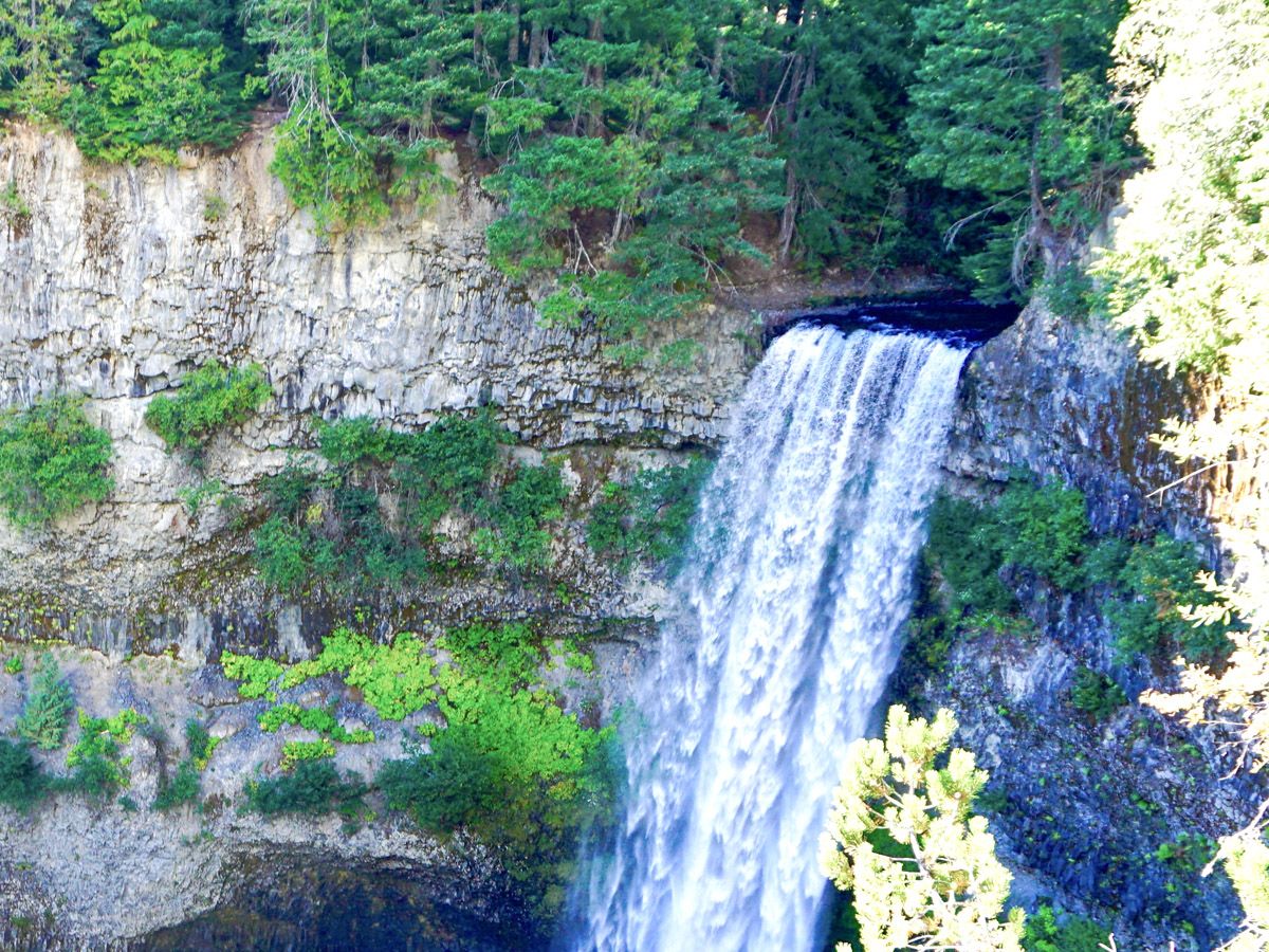
Brandywine Falls hike
Difficulty Rating:
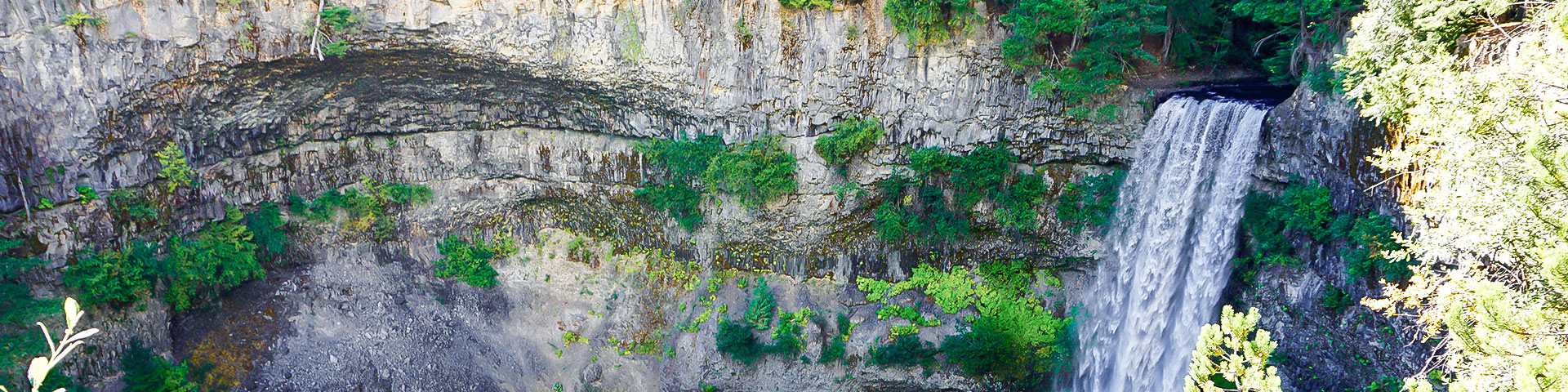
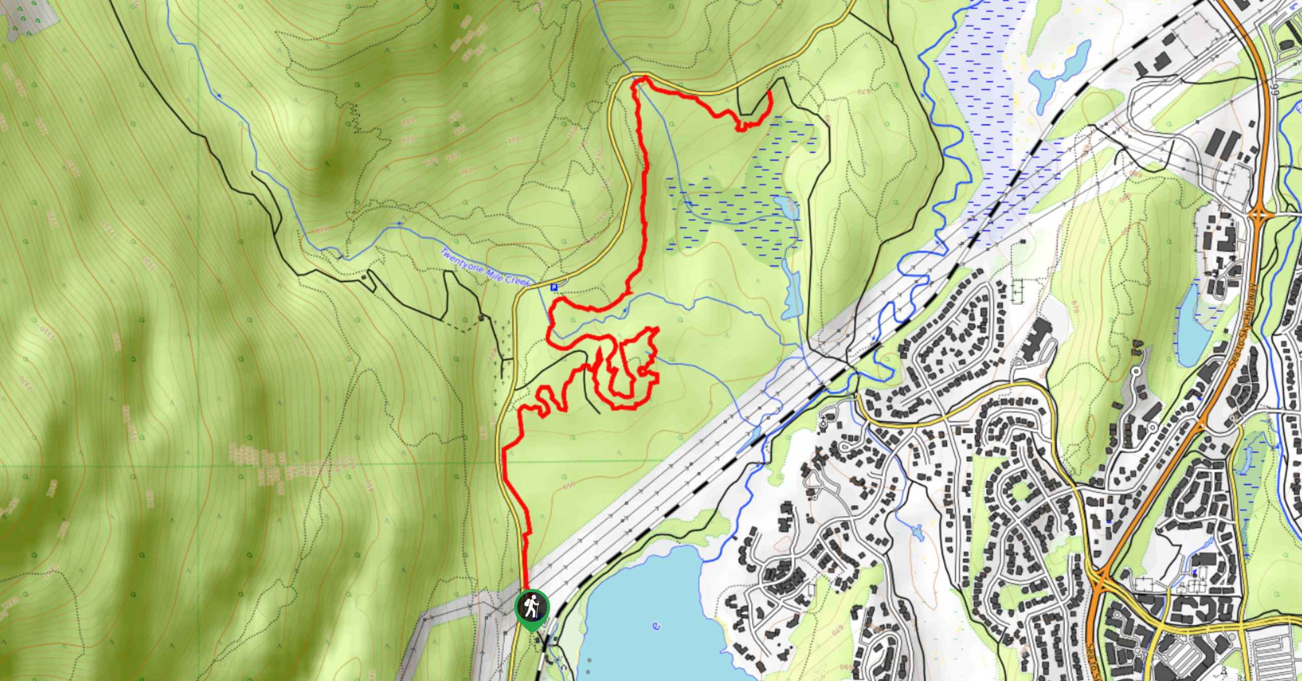
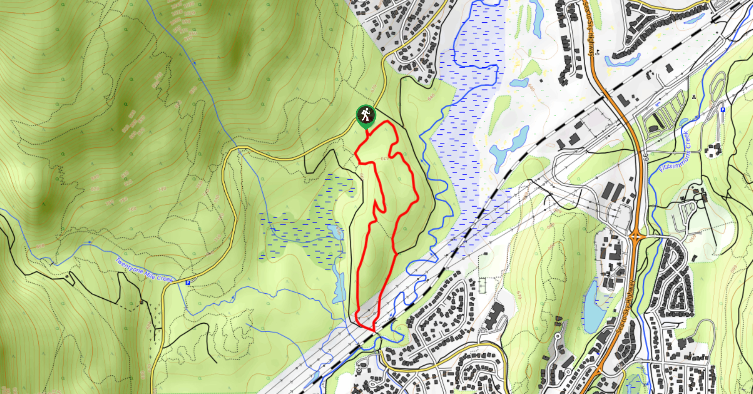
Brandywine Falls hike is only a stone throw from the parking lot. Who would imagine that a 230ft cascading waterfall that eventually fills Daisy Lake is tucked just out of sight? This wide, flat trail is also perfect for inexperienced hikers in the Whistler region.
Getting there
From Whistler, drive south along the Sea to Sky highway (Highway 99) until you see the turnoff for Brandywine Falls. Turn left into the parking lot and – hopefully – find a spot. There are picnic tables and outhouses here.

About
| When to do | All Year |
| Backcountry Campsites | No |
| Toilets | Parking Lot |
| Family friendly | Yes |
| Route Signage | Average |
| Crowd Levels | Moderate |
| Route Type | Out and back |
Brandywine Falls
Elevation Graph
Weather
Route Description for Brandywine Falls
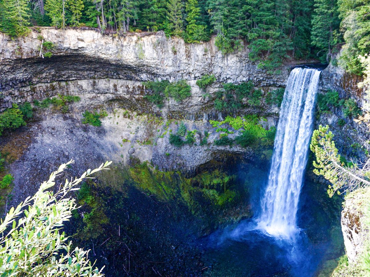
The hike is wonderful for families and those looking for a breath of fresh air. The wide, flat trail meanders for under a kilometer towards the viewpoint for the falls. You will start by crossing a bridge over the Brandywine Creek, and then walk through a dense forest. You will cross a set of train tracks, and shortly thereafter reach the viewpoint for Brandywine Falls. This 70-meter waterfalls are breathtaking, as are the rock features that exist around it. To the left of the falls is a spherical roof carved out of the rock, with trees growing right above it!
Continue a little way more to reach the second viewpoint. This one gives another perspective on the falls, and lets you look down to Daisy Lake. Return the way you came.
Want to find more amazing hikes around Whistler? Check out the Garibaldi Lake hike, Panorama Ridge hike or the Black Tusk hike.

Similar hikes to the Brandywine Falls hike
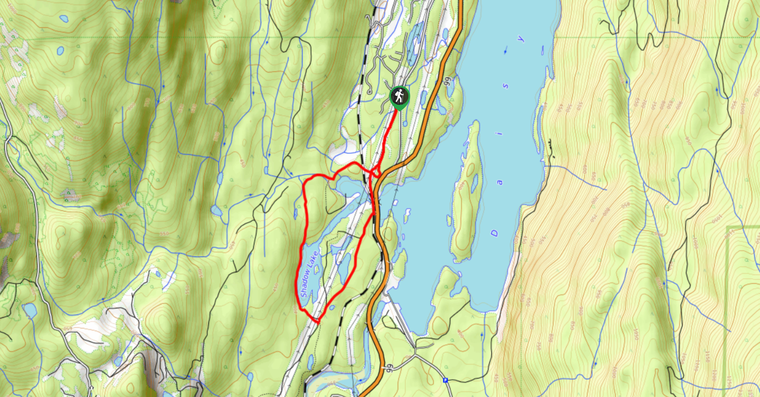
Shadow Lake Loop
Travel along the Shadow Lake Loop for a quick and easy hiking route just off the Sea to Sky Highway,…
A River Runs Through It Trail
The A River Runs Through It Trail is a 5.6mi out-and-back hiking route in Whistler that features scenic…
Emerald Forest Trail
The Emerald Forest Trail is a short 1.7mi hiking route located just northwest of Whistler that is set…
Ethan Welch 4 years ago
Everything was fantastic. It offers some great views and stretch for the legs.
Tara Green 4 years ago
Beautiful falls, Bring your camera
Lacey J 4 years ago
It's a kilometre and a half, so it's funny calling it a hike. Maybe that's just me. Either way, very pleasant nature walk to a great waterfall. Almost anyone could make it here.
Haydes 4 years ago
Brandywine Falls was hauntingly beautiful! It got this incredible charm that I can't explain.
Joji L. 5 years ago
Gorgeous falls! The water was flowing beautifully.
joselitocruz 5 years ago
Brandywine Falls was spectacular. Great trails, even the kids can do it. Safe hike in general.
MM 5 years ago
nice walk, we saw a rainbow
Brittany Wonders 5 years ago
I'm not really a waterfall girl.
Jack_99 5 years ago
It's a good short hike and the Brandywine waterfall is really spectacular. I mean I came here just for the name.
Peggy Rosie 5 years ago
Amazing falls, a really special place!