
Mount Galiano Hike
View Photos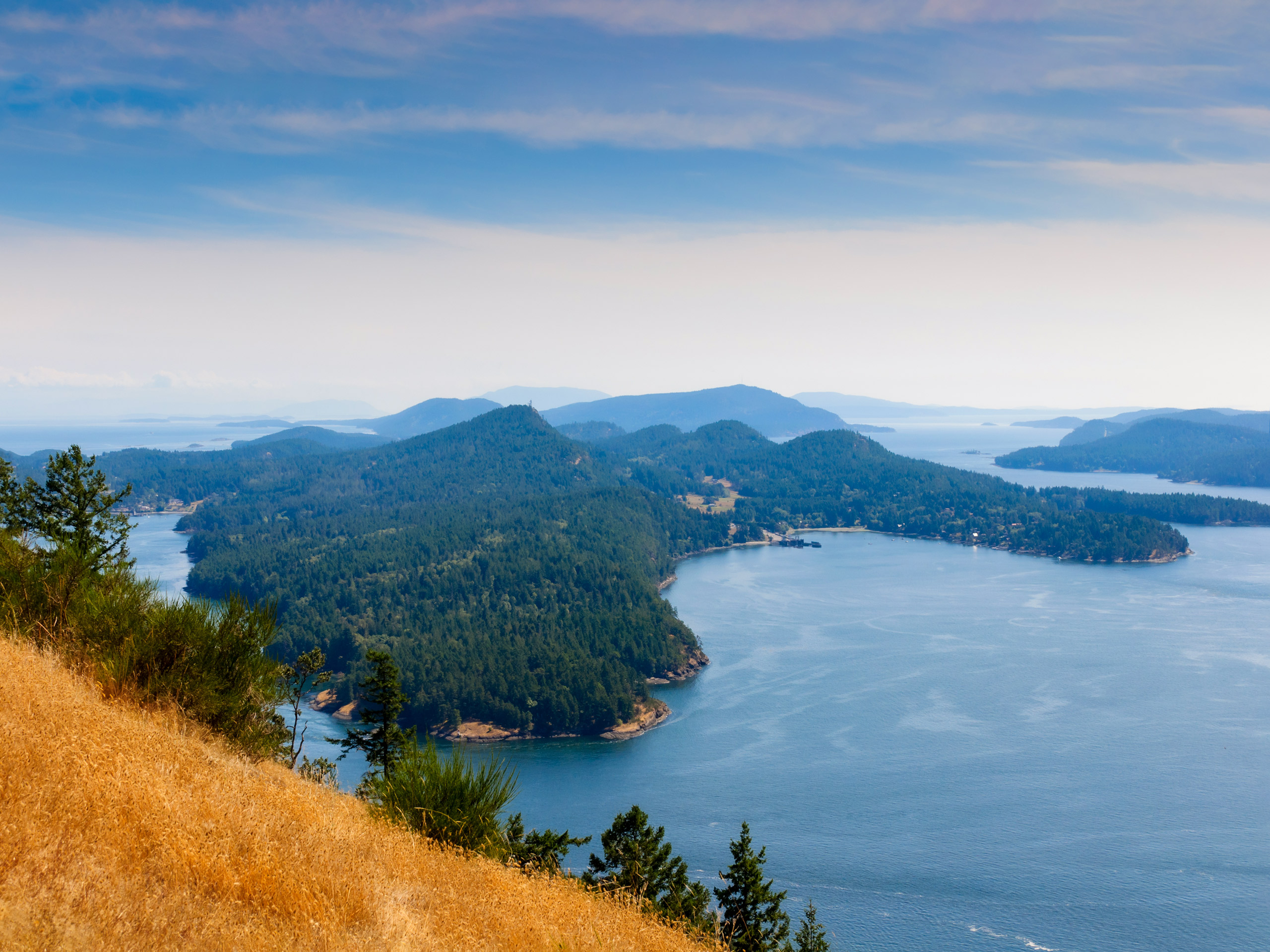
Mount Galiano Hike
Difficulty Rating:
The hike up Mount Galiano follows a 3.3mi lollipop route that climbs uphill to the summit for scenic views overlooking the nearby Gulf Islands. Along the trail, you will experience an amazing temperate rainforest setting before arriving at the lookout for views of the ferries motoring by. The trail features a loop around the summit of the mountain; however, if you would like to shorten your hike you can complete the route as an out-and-back to the viewpoint.
Getting there
To reach the Mount Galiano trailhead from the Sturdies Bay Ferry Terminal, drive northwest on Sturdies Bay Road for 1.7mi and continue straight onto Georgeson Bay Road. After 1.7mi, turn right on Active Pass Drive and follow it for 1640ft to find the trailhead on your right.

About
| When to do | May-October |
| Backcountry Campsites | No |
| Pets allowed | Yes - On Leash |
| Family friendly | Older Children only |
| Route Signage | Average |
| Crowd Levels | Low |
| Route Type | Lollipop |
Mount Galiano Hike
Elevation Graph
Weather
Mount Galiano Hike Description
If you find yourself on Galiano Island and looking for a moderate hike with some truly breathtaking views for the effort, then the Mount Galiano Hike will be right up your alley. The route sets out from the parking area and heads west through an amazingly atmospheric stretch of Pacific temperate rainforest that is packed with moss-covered trees and a plentiful amount of ferns along the forest floor. After making your way up to the summit, you will be able to sit and watch as the ferries stream across the water and drop off their passengers at nearby islands. After taking in the scenic views across the deep blue water, work your way around the trail loop at the summit of Mount Galiano before heading back down the main trail to return to the parking area where you began your hike.
Similar hikes to the Mount Galiano Hike hike
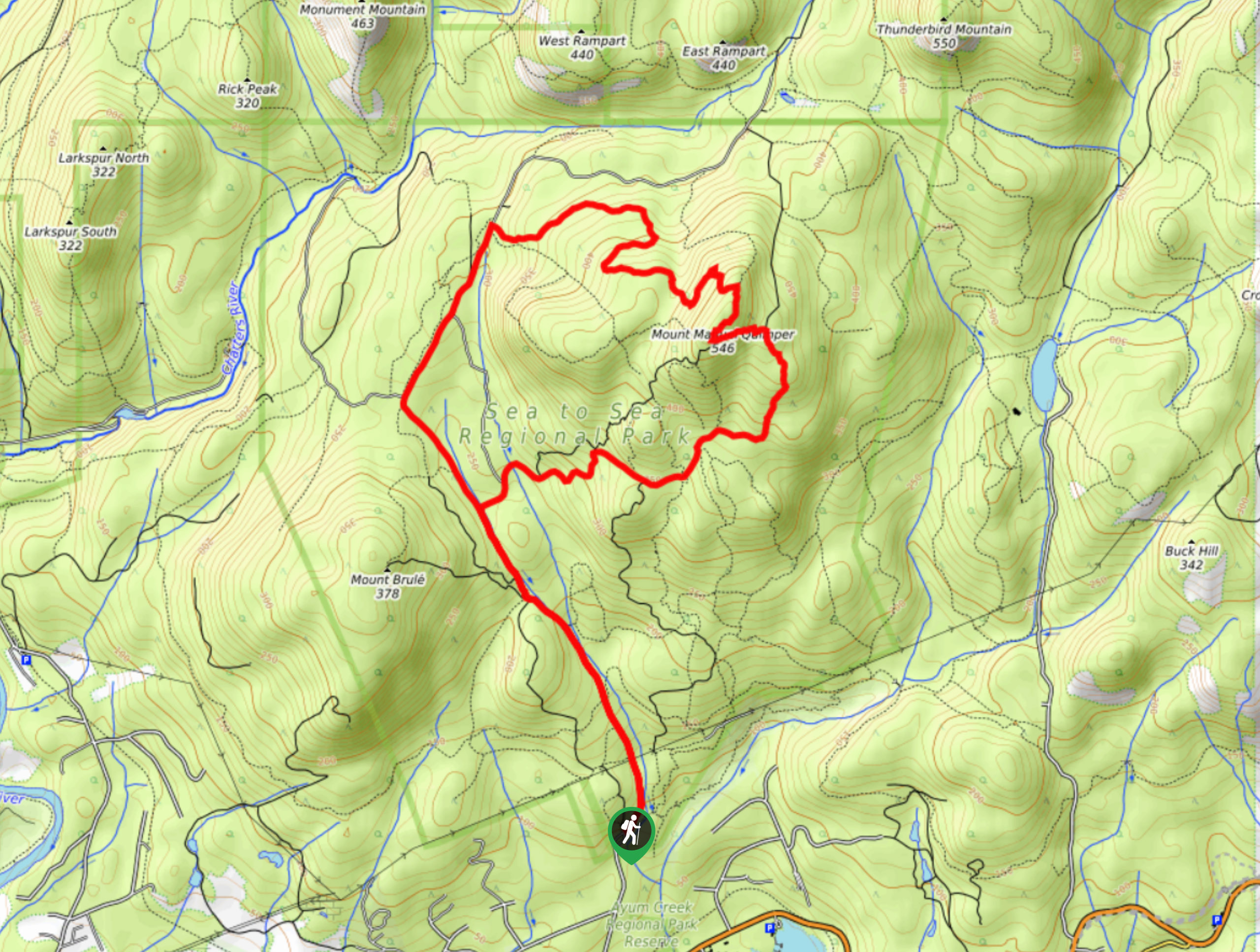
Mount Manuel Quimper Trail
The trek to Mount Manuel Quimper is a 6.2mi lollipop hiking route that climbs uphill through the forest…
Prior and Thetis Lakes Loop Hike
The Prior and Thetis Lake Loop will take you along an 5.0mi lollipop hiking route through a beautifully…
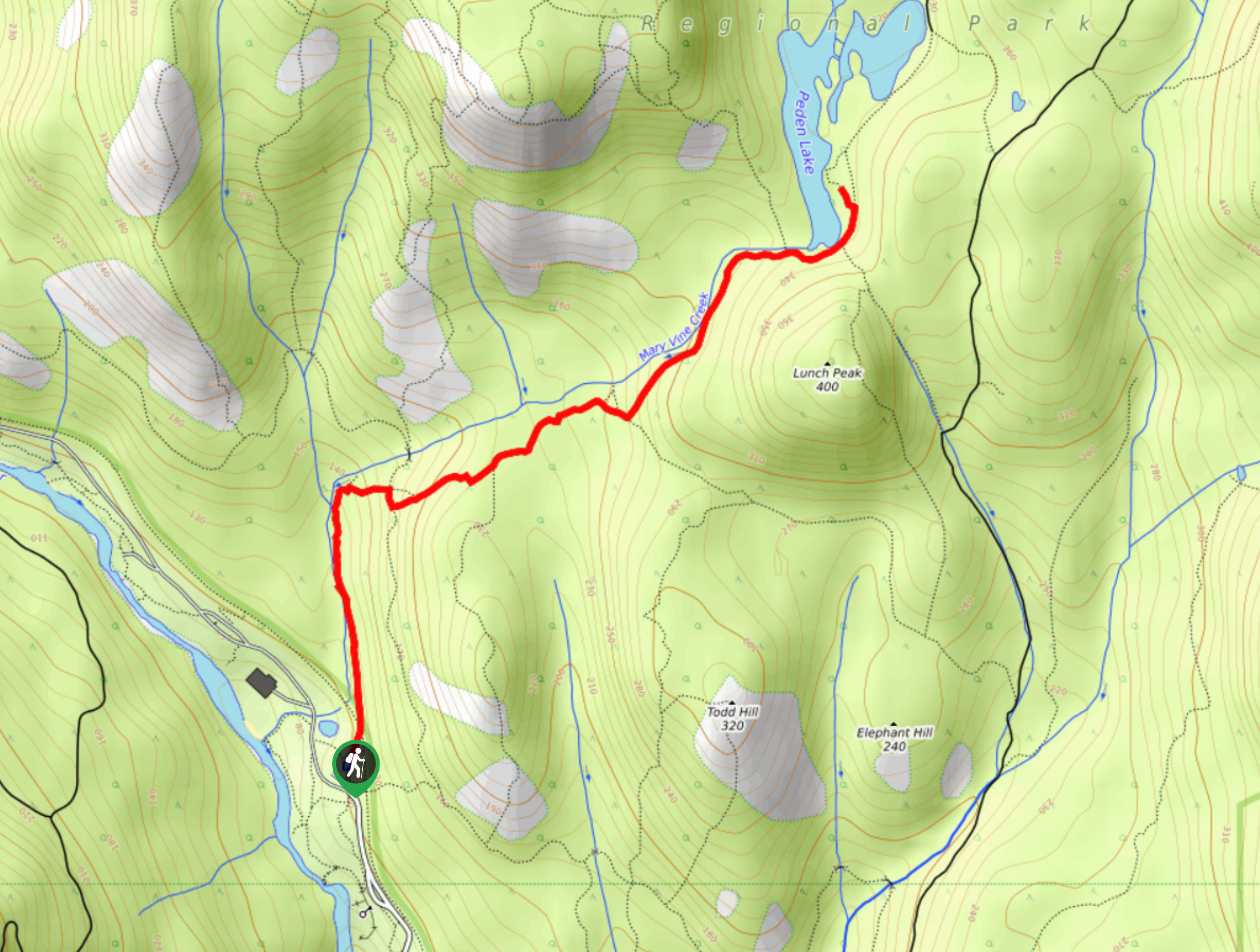
Peden Lake via Mary Vine Trail
Peden Lake via the Mary Vine Trail is a 3.2mi out-and-back hiking route in the Seas to Sea…
Comments