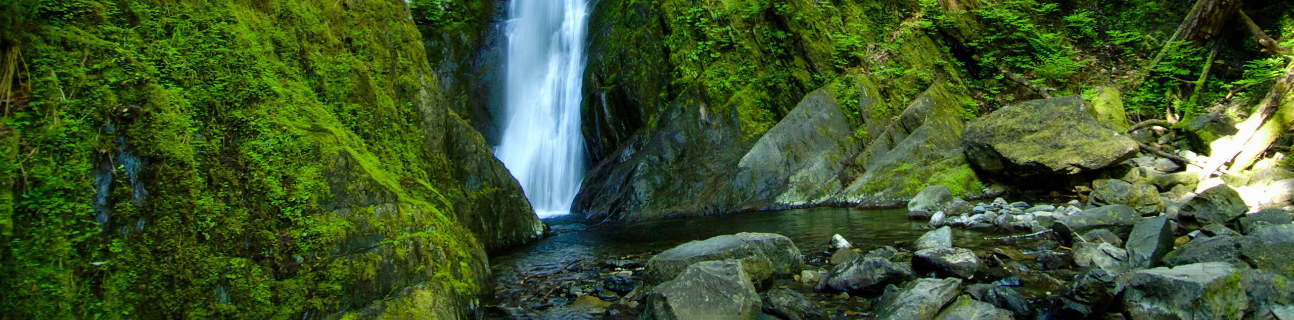
Goldstream Falls
View Photos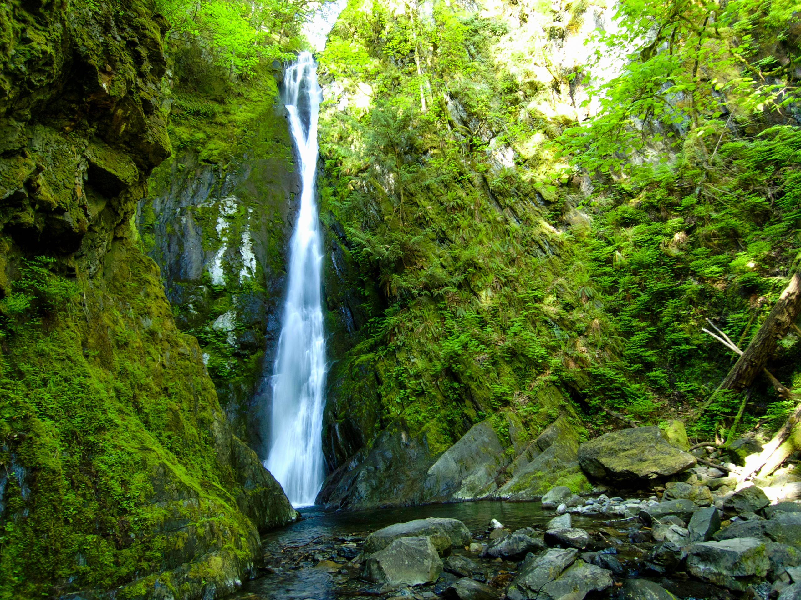
Goldstream Falls
Difficulty Rating:
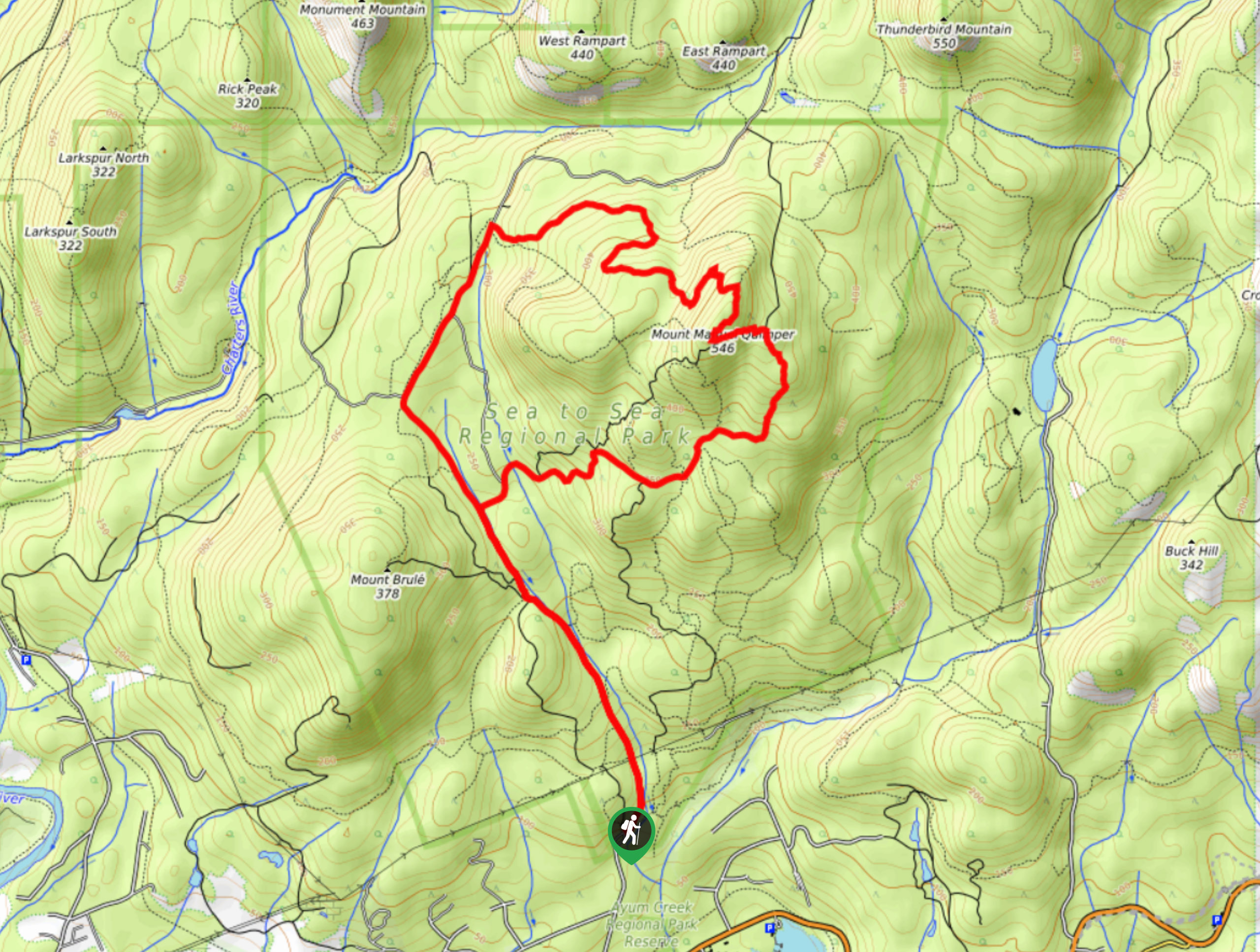
The trek to Goldstream Falls follows a 6.3mi hiking circuit through the dense forests of Goldstream Provincial Park that will allow you to experience that natural beauty of the landscape within the park. Along the trail, you will be immersed in a wonderfully atmospheric West Coast temperate rainforest with unique natural features, as well as those left behind as part of the region's gold mining past. This hike is the perfect accompaniment to a weekend of camping at one of the campgrounds within the park.
Getting there
To reach the Goldstream Falls trailhead from Goldstream, drive northwest on BC-1 for 1.8mi and turn right on Finlayson Arm Road. Make an immediate left turn to enter into the parking area.

About
| When to do | May-October |
| Backcountry Campsites | Goldstream Campground |
| Pets allowed | Yes - On Leash |
| Family friendly | Older Children only |
| Route Signage | Average |
| Crowd Levels | Moderate |
| Route Type | Circuit |
Goldstream Falls
Elevation Graph
Weather
Goldstream Falls Trail Description
The Goldstream Falls Hike offers explorers the perfect way to explore this beautiful corner of British Columbia and experience the true beauty of the rainforests that characterize the landscape in the area. Setting out from the parking area, follow the trail to the north and into the dense canopy of the forest. When you reach Niagara Creek, head left to cross the highway and meet up with a picturesque waterfall on the other side. Make your way over the creek and head south through the moss-covered trees until you arrive at an old gold mine that stands as a relic of the region’s gold mining past.
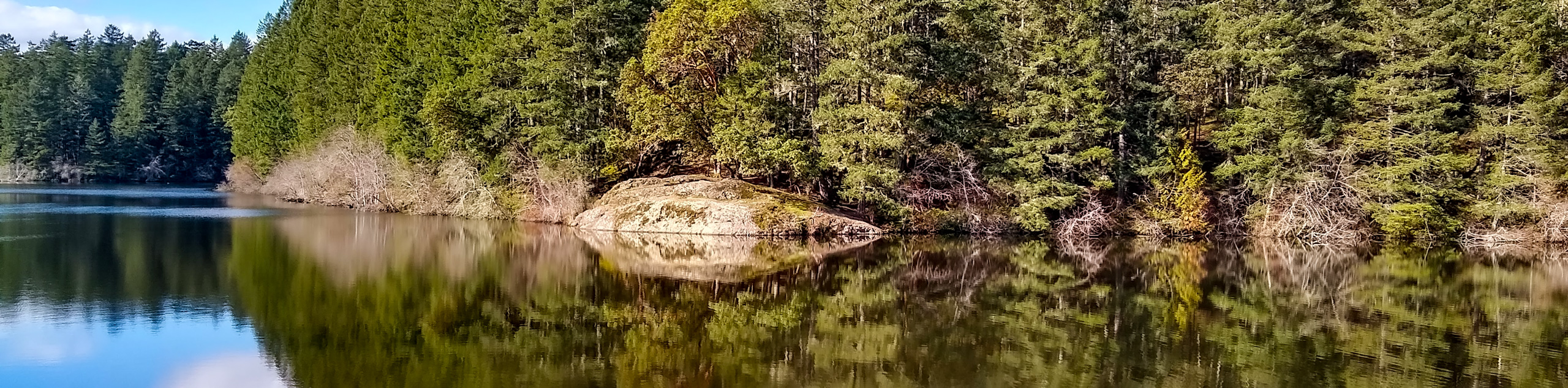
Continue south to loop around the Goldstream Campground, where you will arrive at the Goldstream Falls at the southwestern corner of the trail. Take some time to explore the area and admire the cascading water of the falls before heading east to skirt alongside the southern edge of the campground on a route towards the Prospector Trail Viewpoint. From here, you will have a nice sightline over the forested landscape and the rushing Goldstream River that dissects it. Make your way north along the trail to enjoy the last bit of temperate rainforest terrain before you arrive back at the parking area where you began.
Similar hikes to the Goldstream Falls hike
Mount Manuel Quimper Trail
The trek to Mount Manuel Quimper is a 6.2mi lollipop hiking route that climbs uphill through the forest…
Prior and Thetis Lakes Loop Hike
The Prior and Thetis Lake Loop will take you along an 5.0mi lollipop hiking route through a beautifully…
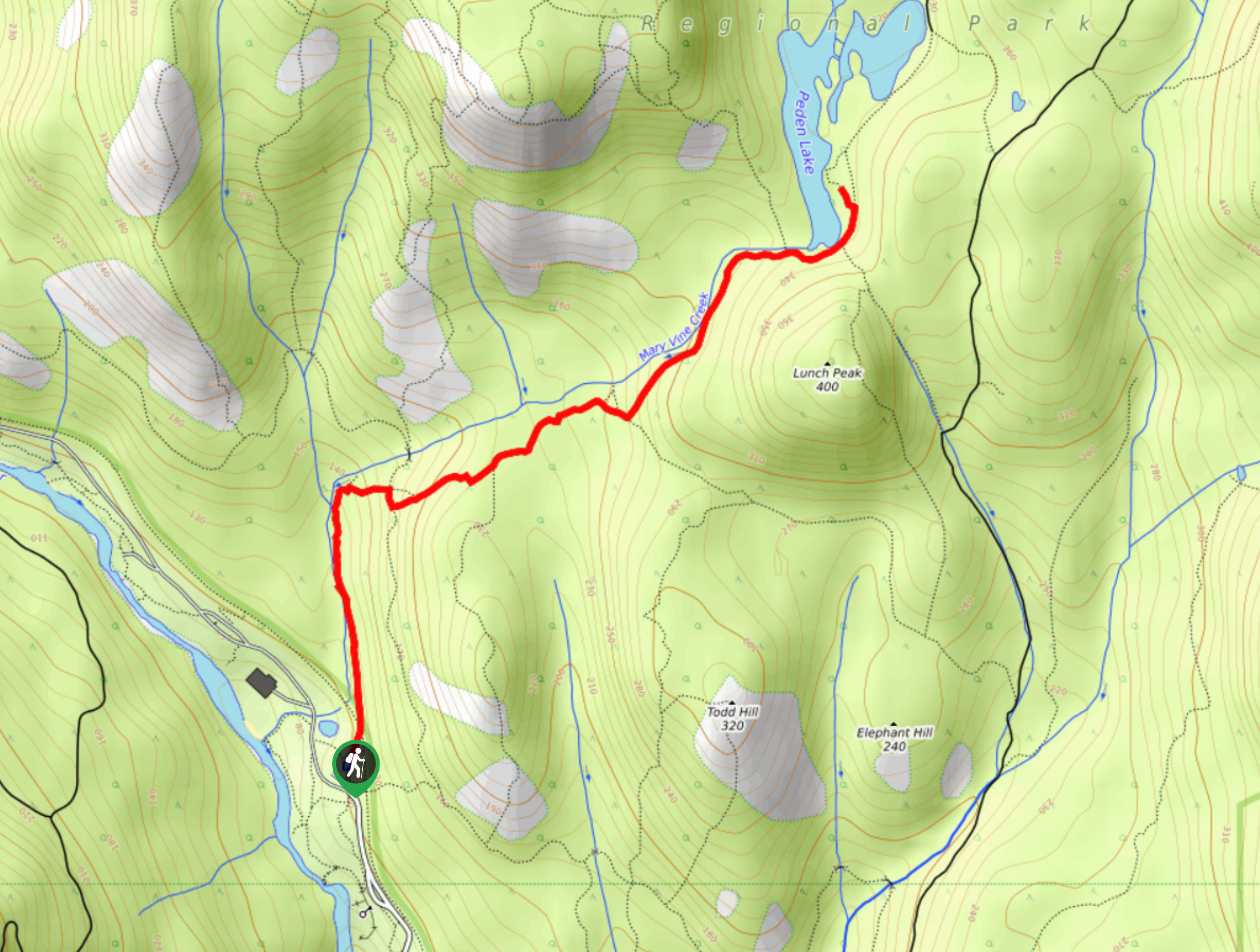
Peden Lake via Mary Vine Trail
Peden Lake via the Mary Vine Trail is a 3.2mi out-and-back hiking route in the Seas to Sea…
Comments