Avatar Grove Nature Trail
View PhotosAvatar Grove Nature Trail
Difficulty Rating:
The Avatar Grove Nature Trail is a 1.0mi lollipop hiking route north of Port Renfrew on the west coast of Vancouver Island that will take you through a scenic stretch of old-growth forest. Along this two-part trail, hikers can expect to pass through breathtaking sections of forest with mammoth, moss-covered trees and a vibrant green forest floor covered with ferns. Don’t forget to explore the western half of the route for the chance to visit the knotty and twisted frame of a giant cedar known as ‘Canada’s gnarliest tree’.
Getting there
To reach the trailhead for the Avatar Grove Nature Trail from Port Renfrew, drive north on Deering Road for 1.9mi and turn left onto Pacific Marine Road. Follow this for 3.2mi before turning left onto Gordon River Road. In 1.2mi, you will arrive at the trailhead at the side of the road.

About
| When to do | Year-Round |
| Backcountry Campsites | No |
| Pets allowed | Yes - On Leash |
| Family friendly | Yes |
| Route Signage | Average |
| Crowd Levels | Low |
| Route Type | Lollipop |
Avatar Grove Nature Trail
Elevation Graph
Weather
Avatar Grove Nature Trail Description
While the Avatar Grove Nature Trail is fairly accessible, the road into the trailhead can be a bit rough at certain times of the year. Make sure that your vehicle is able to handle rugged terrain and bumpy roads in order to reach the trailhead. Additionally, the trail itself can often be in rough shape during the spring and fall when the likelihood of precipitation is higher. To combat the mud along the trail, make sure to wear proper hiking shoes or waterproof footwear to stay safe and comfortable along the hike.
This hiking route is the perfect way to explore the breathtaking West Coast temperate rainforest environment that can be found throughout Vancouver Island. In addition to the huge cedar trees, douglas firs, and plentiful plant life that can be found along this route, hikers will also have the chance to visit Canada’s Gnarliest Tree, a massive cedar with a 10ft diameter bulge in the centre of its trunk. With such amazing sights and easy to navigate trails, this is the perfect spot to bring the family for a fun day of exploring the rainforest.
Setting out from the parking area at the side of the road, head to the southeast to complete the loop portion of the trail first and pass through the beautiful Avatar Grove. On this half of the trail, you will hike along rooty-dirt covered paths and sections of boardwalk for 110m before heading right around the trail loop. Here, you will be able to take in the lush, green landscape of the rainforest that is characterized by small ferns and large, knotty cedar trees. After making your way around the 1247ft loop, head back down the main trail to cross over the road and complete the out-and-back portion of the hike.
After re-entering into the dense cover of the rainforest, you will once again traverse a series of wooden boardwalks and climb slightly uphill to arrive at a creek crossing in 656ft. Make your way across the water and relax along the serene forest path, as you hike the final 80m to the giant, knotty cedar known as Canada’s gnarliest tree. After visiting the ancient tree and snapping a few photos of the breathtaking forest landscape, head back along the same trail to return to the parking area, having fully explored the Avatar Grove Nature Trail.
Insider Hints
The road to the trailhead can be a bit rough, so make sure your vehicle is capable of handling rugged terrain.
There are lots of roots along the trail, so wear proper hiking boots and watch your footing.
As with most rainforest hiking routes, this tral can become very muddy after a good rainfall. Waterproof footwear is advised during wet seasons.
Similar hikes to the Avatar Grove Nature Trail hike
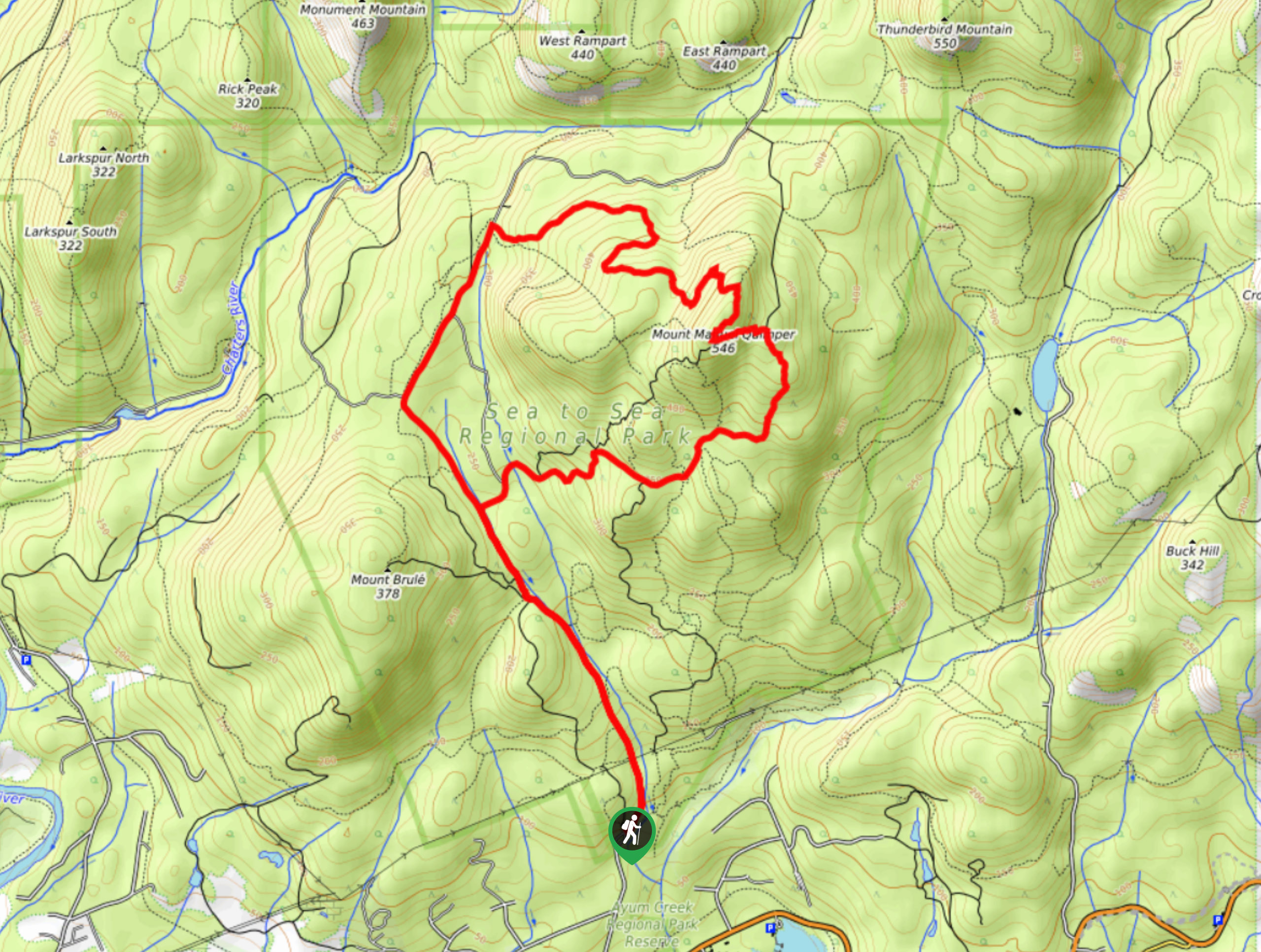
Mount Manuel Quimper Trail
The trek to Mount Manuel Quimper is a 6.2mi lollipop hiking route that climbs uphill through the forest…
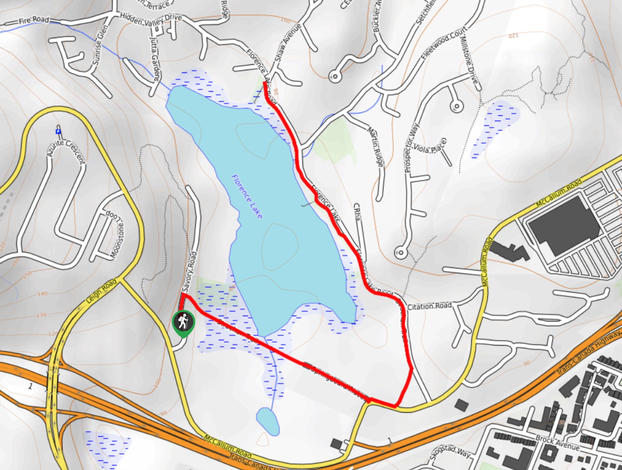
Florence Lake
The hike around Florence Lake follows a 1.9mi out-and-back route in Langford that travels around the southern edge…
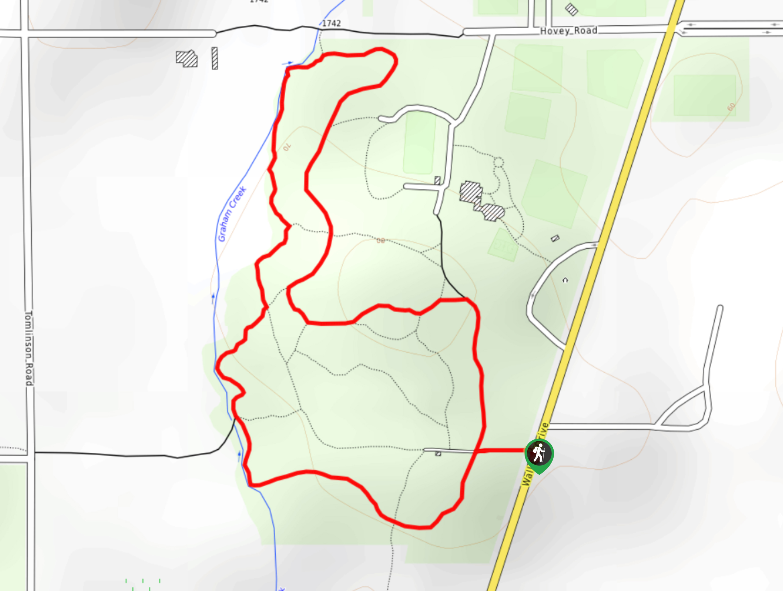
Centennial Park Loop Hike
The Centennial Park Loop is a 1.0mi lollipop hiking route north of Victoria, BC, that travels through an…
Comments