Shadow Falls Hike
View Photos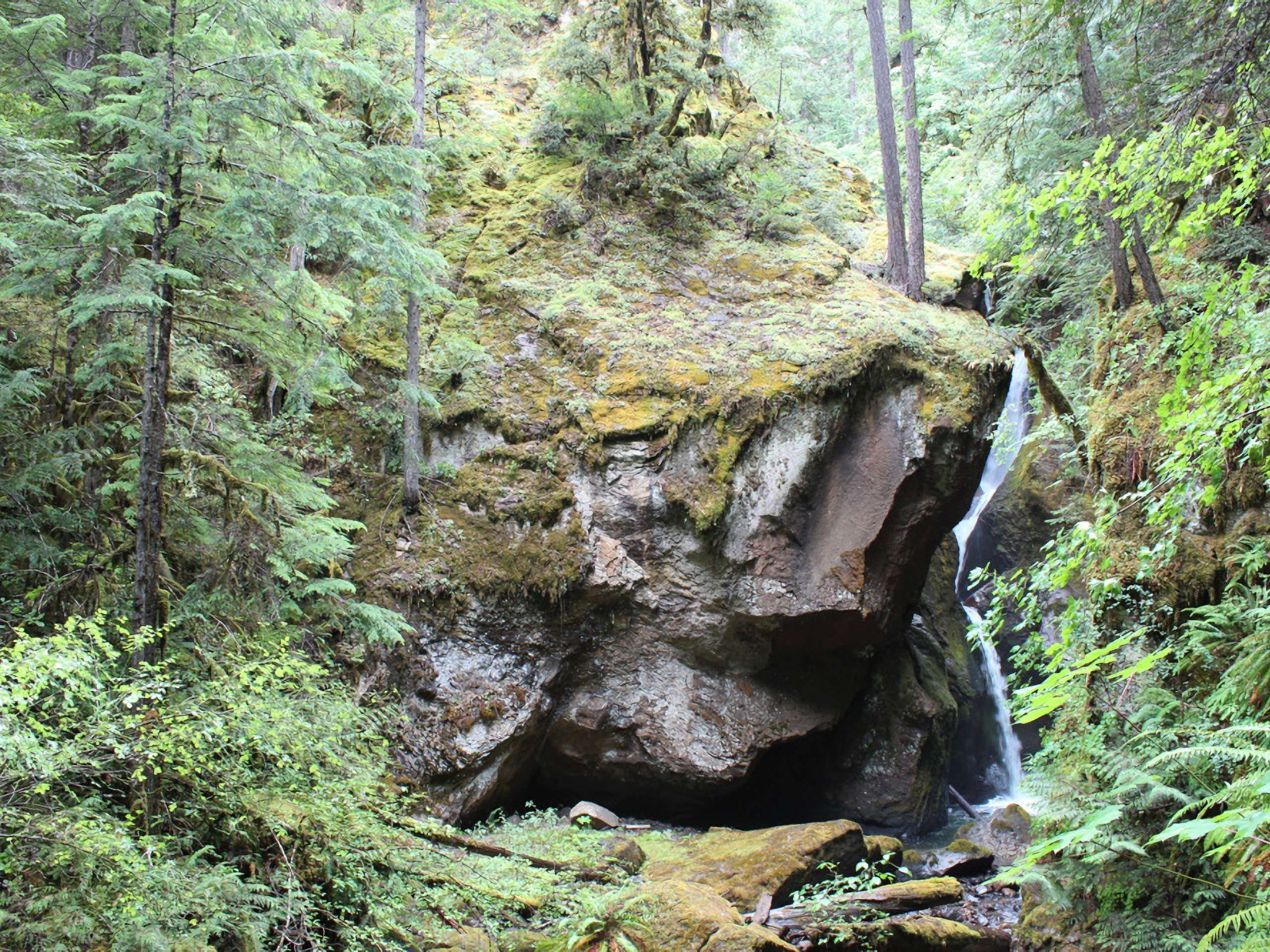
Shadow Falls Hike
Difficulty Rating:
The Shadow Falls Hike is a short adventure in Umpqua National Forest that will take you along the edge of Cavitt Creek to reach a charming waterfall. While out on the trail, you will navigate through the forest and listen to the sound of the rushing water, before arriving at the cascading waters of Shadow Falls. Make sure that your vehicle has a decent amount of clearance, as the road leading into the trailhead is a bit rough and rugged.
Getting there
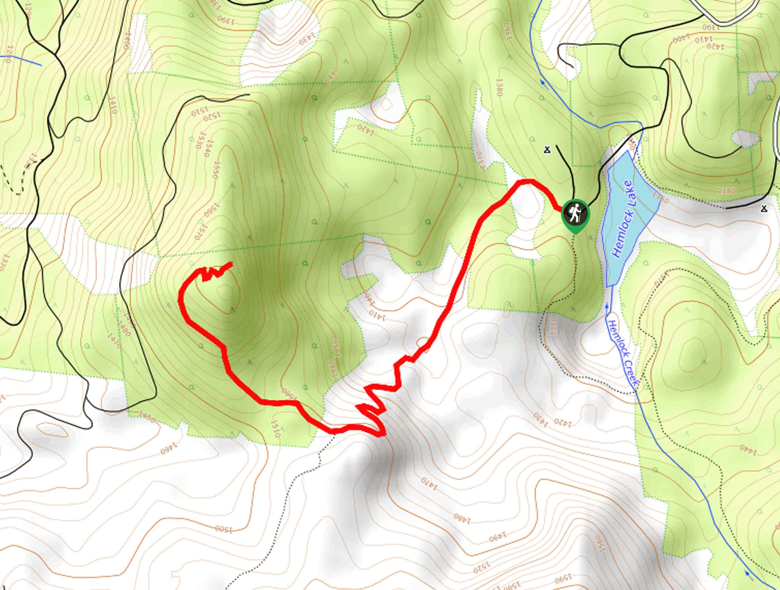
The trailhead for the Shadow Falls Trail can be found along Cavitt Creek Road/FS 25, just 19.0mi southeast of Glide.

About
| Backcountry Campground | No |
| When to do | Year-Round |
| Pets allowed | Yes - On Leash |
| Family friendly | Yes |
| Route Signage | Average |
| Crowd Levels | Moderate |
| Route Type | Out and back |
Shadow Falls Hike
Elevation Graph
Weather
Shadow Falls Hike Description:
Hiking along the Shadow Falls Trail is a fairly laid back experience, but the drive into the trailhead is a whole other story. Make sure that your vehicle has a high enough clearance to safely navigate the single lane, pothole marked road. Additionally, you will still want to wear proper hiking boots, even though the trail isn’t overly challenging.
These two minor points aside, the Shadow Falls Trail is a fun little trail to explore if you love waterfalls and want to get away from the crowds. A scenic 75ft cascade and peaceful woodland setting await on this short and sweet hiking trip in Oregon.
Setting out from the Shadow Falls Trailhead on Cavitt Creek Road, you will enter into the dense cover of the forest and make your way south along the path. Where, you will be surrounded by a serene forest atmosphere, as you descend slightly toward the edge of Cavitt Creek.
After crossing over the water, the trail will bend to the southwest, running parallel to the edge of the creek. Take your time here to appreciate your surroundings and listen to the calming sounds of the water, before arriving at the site of Shadow Falls.
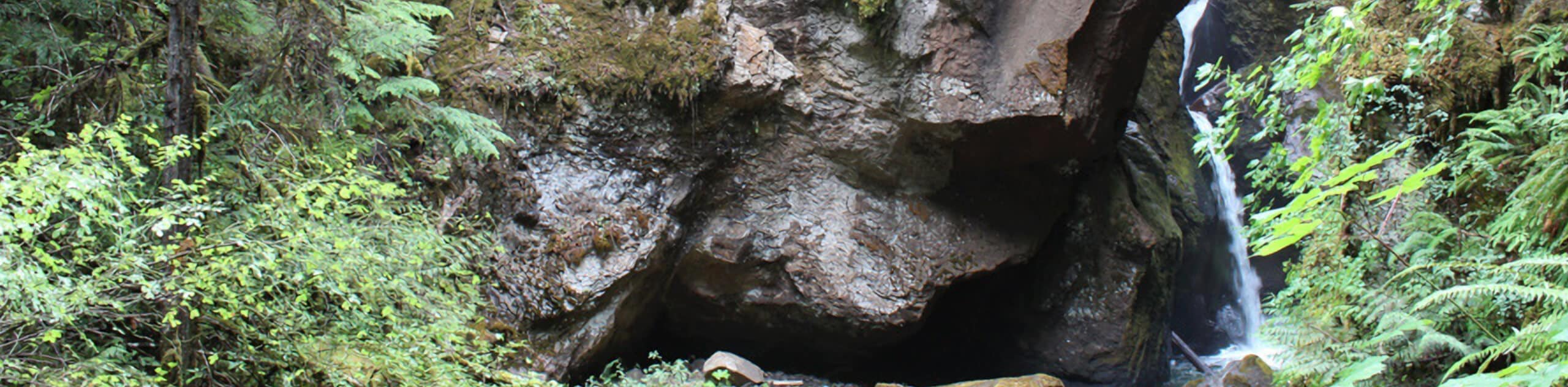
With the narrow structure of the gorge it is a bit tricky to get a full view of the 3-tiered waterfall, but you can still get a good view of the cascading waters. Once you have fully explored the area, simply turn back along the same path and make your way to the trailhead where you began your excursion on the Shadow Falls Trail.
Trail Highlights
Shadow Falls
Named after the deep, dark chasm that the waterfall plunges into, the Shadow Falls can be found along the coursing Cavitt Creek. With a total height of 75ft across three tiers and an average width of 5ft, it’s easy to see how this narrow and hidden waterfall got its name.
Insider Hints
The road to the trailhead is rough, so make sure that your vehicle has a high enough clearance.
Be sure to wear proper hiking footwear.
Keep your dog on a leash at all times.
Similar hikes to the Shadow Falls Hike hike
Flat Rock Trail
The Flat Rock Trail is a beautifully scenic hiking route in Umpqua National Forest that leads through a stretch of…
North Umpqua Trail: Marsters Segment
The North Umpqua Trail: Marsters Segment is a short stretch of the much longer North Umpqua Trail that follows along…
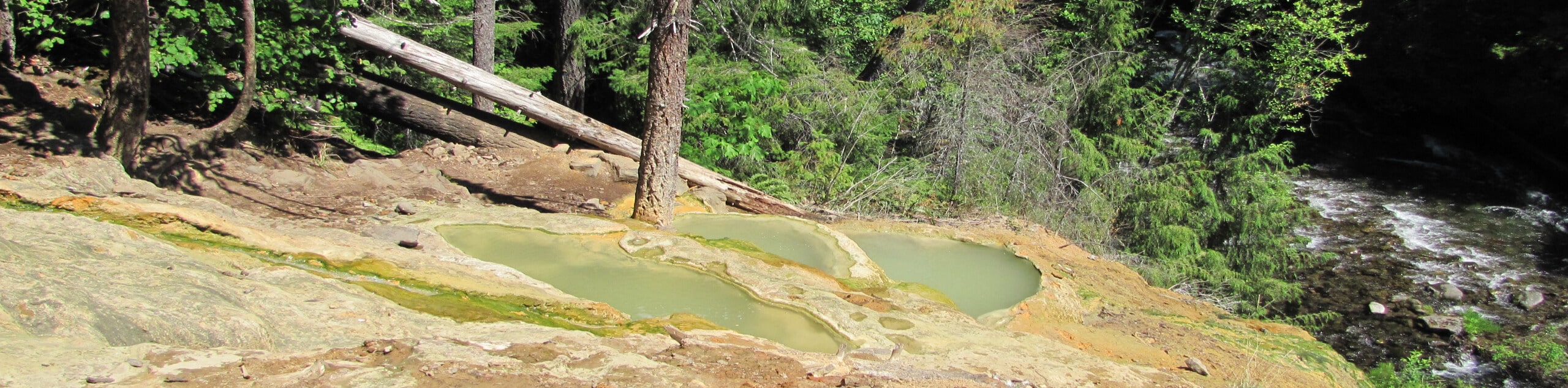
Umpqua Hot Springs vis Road 3401
The Umpqua Hot Springs via Road 3401 Hike is a pleasant adventure in Oregon that will take you to a…
Comments