Mount Bailey Trail
View Photos
Mount Bailey Trail
Difficulty Rating:
The Mount Bailey Trail is a challenging adventure in Umpqua National Forest that will take you up to a scenic summit viewpoint. While out on the trail, you will steadily climb uphill through a peaceful swathe of forest, before pushing up through the mountainous terrain to reach the top of Mount bailey. While there are blue markers for much of the trail, at times it can be easy to lose your way. Be sure to bring a GPS and/or a trail map to help with navigation.
Getting there
The starting point for the Mount Bailey Trail can be found at the Mount Bailey Trailhead on Forest Road 4795-300.

About
| Backcountry Campground | No |
| When to do | June-October |
| Pets allowed | Yes - On Leash |
| Family friendly | No |
| Route Signage | Average |
| Crowd Levels | Low |
| Route Type | Out and back |
Mount Bailey Trail
Elevation Graph
Weather
Mount Bailey Trail Description
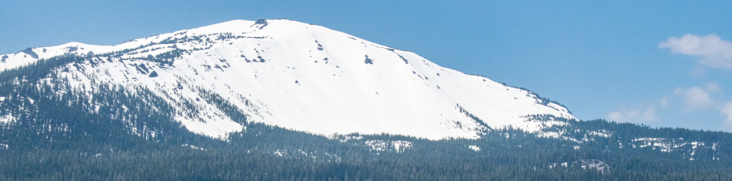
If you are planning to visit Umpqua National Forest in Oregon and want to set out on a more challenging adventure, then the Mount Bailey Trail is the perfect route for you. A lengthy climb through serene forests and a bit of a rocky scramble to the summit characterize this hike, so be sure to wear sturdy boots and come prepared.
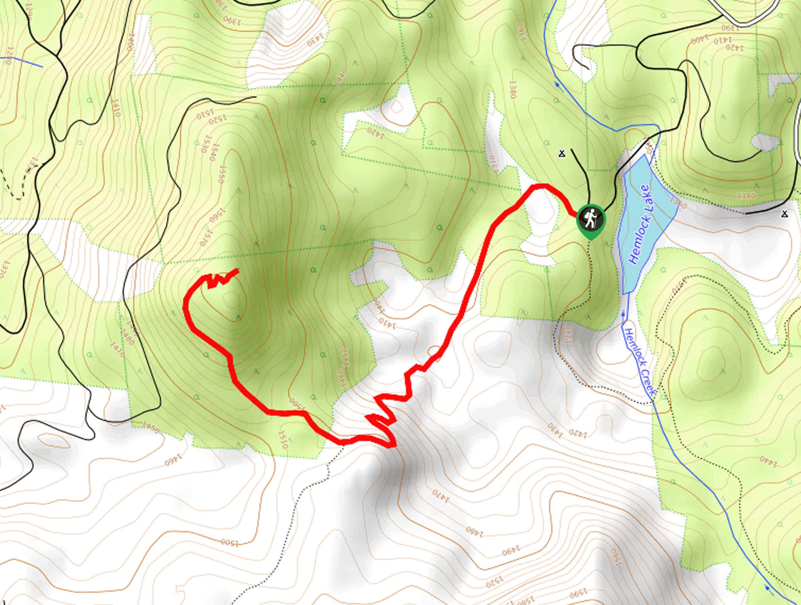
Setting out from the trailhead, you will make your way west along Mount Bailey Trail #1451 as it cuts across the woodland landscape. Here, you will climb uphill just below the summit of Hemlock Butte, following the trail as it turns more to the northwest.
Passing straight through a junction with the Hemlock Butte Trail, the trail will begin to climb more sharply uphill, eventually breaking free of the tree cover on the ascent of Mount Bailey. Here, you will need to traverse some loose scree and rocky terrain in order to reach the summit viewpoint, where you will have a great sightline overlooking Diamond Lake.
Take a moment to appreciate the views, before carefully heading back down along the same trail to return to the MountBailey Trailhead where you began.
Similar hikes to the Mount Bailey Trail hike
Flat Rock Trail
The Flat Rock Trail is a beautifully scenic hiking route in Umpqua National Forest that leads through a stretch of…
Rodley Butte Trail
Hiking the Rodley Butte Trail is a tough experience in Umpqua National Forest that will take you uphill through a…
North Umpqua Trail: Marsters Segment
The North Umpqua Trail: Marsters Segment is a short stretch of the much longer North Umpqua Trail that follows along…
Comments