Wasson Peak via Sweetwater Trail
View Photos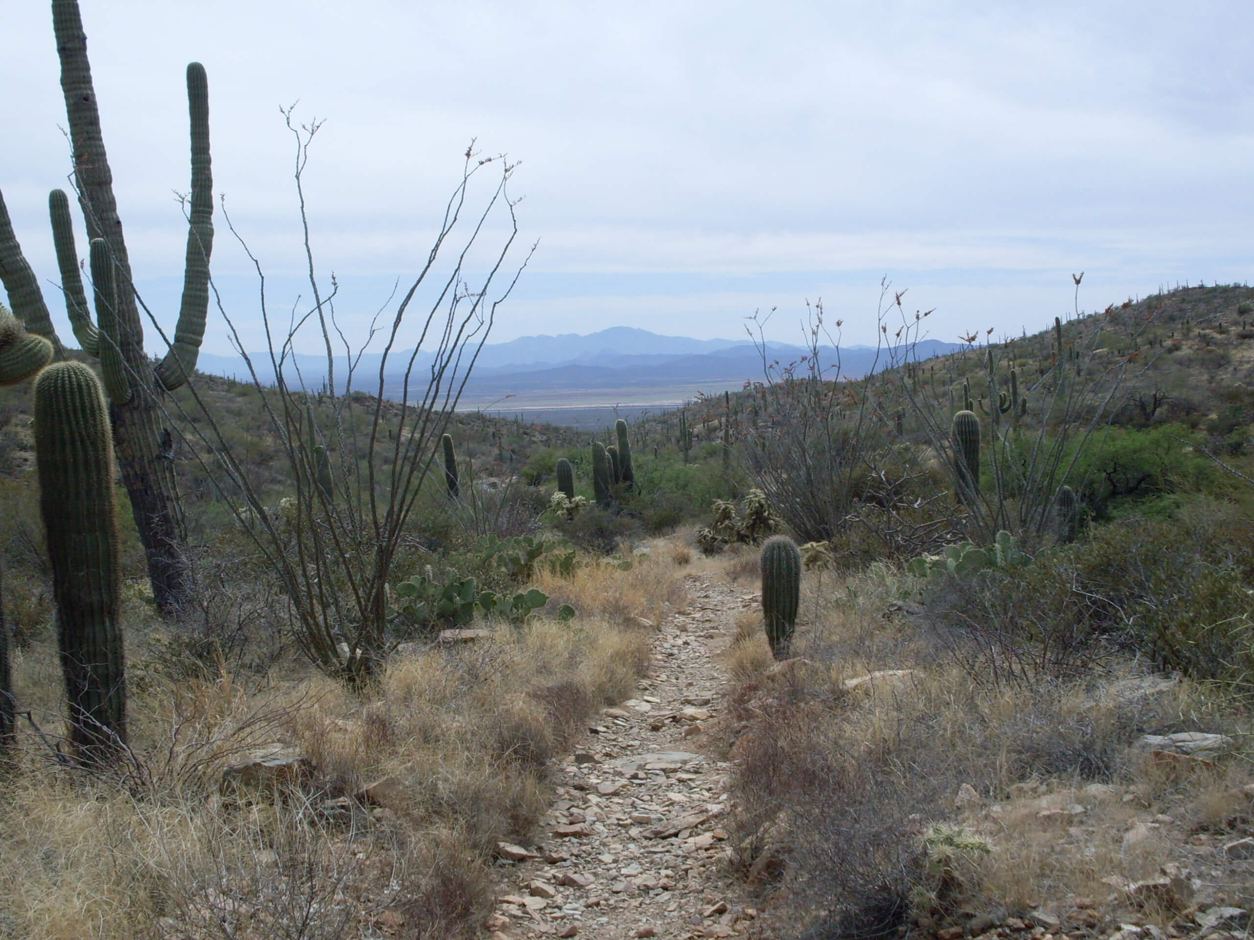
Wasson Peak via Sweetwater Trail
Difficulty Rating:
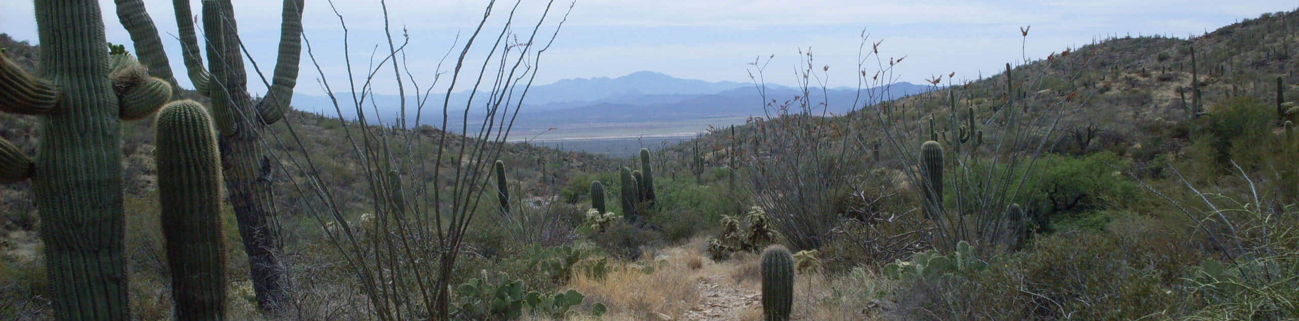
Wasson Peak via Sweetwater Trail is a 9.0mi lightly-trafficked and challenging route in Saguaro National Park West near Tucson. While most hikers bound for Wasson Peak choose the approach on King Canyon Trail, this route is much quieter. You’ll hike through a collection of prickly pear, ocotillo, and saguaros for a fantastic view of the surrounding park. This hike can get very hot up to the peak, which can be windy and cool. We suggest wearing layers and sun protection to adapt to the changing temperatures.
Getting there
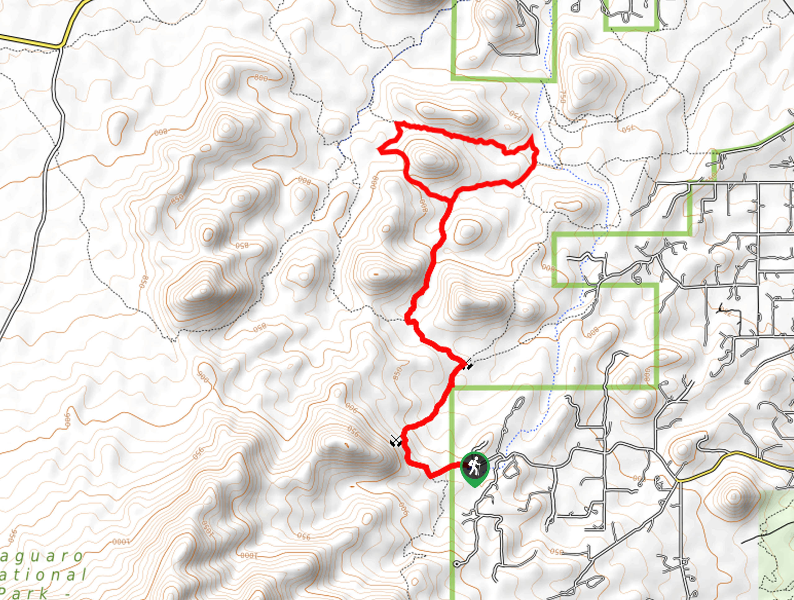
The trailhead for Wasson Peak via Sweetwater Trail is on W El Camino del Cerro.

About
| Backcountry Campground | No |
| When to do | October-May |
| Pets allowed | No |
| Family friendly | Older Children only |
| Route Signage | Good |
| Crowd Levels | Low |
| Route Type | Out and back |
Wasson Peak via Sweetwater Trail
Elevation Graph
Weather
Wasson Peak via Sweetwater Trail Description
Wasson Peak is the tallest mountain in the Tucson Mountain District of Saguaro National Park. The hike to the top along Sweetwater Trail is an interesting trip with an impressive variety of local plant life lining your hike. Check out the plentiful ocotillo, prickly pear, and (of course) saguaros.
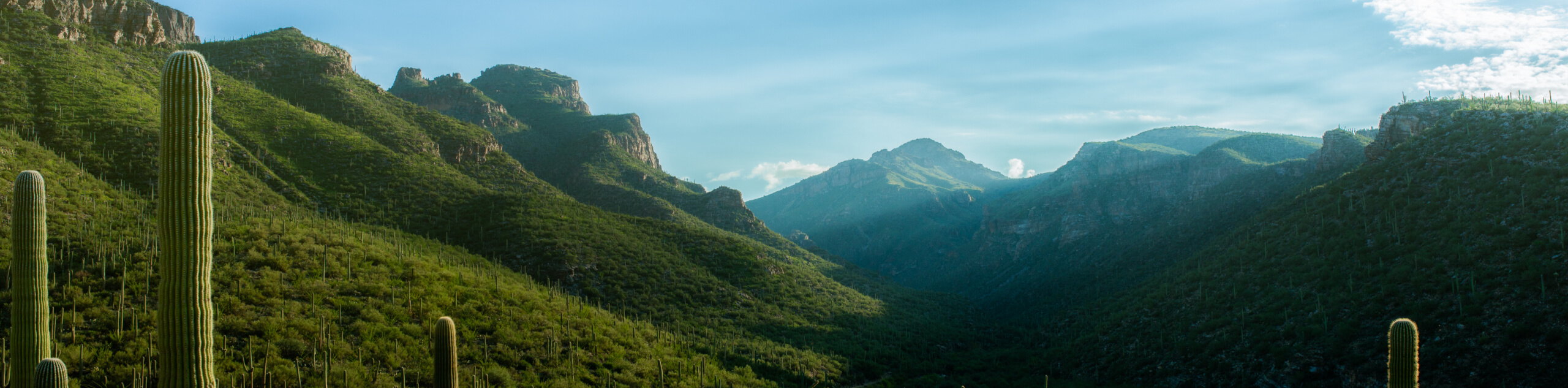
This is a difficult hike, but it’s also a very enjoyable one for stronger hikers thanks to its scenery. It’s a good way to earn a summit view without needing to hike all day, or it can be used as a rewarding challenge for hikers wanting to step up their fitness level. Bring plenty of water and be prepared for very hot weather at the base of the hike with potentially chillier winds at the summit.
From the trailhead, take the route that starts from the end of the road and then take a left at the T-junction. You’ll hike south towards the mountain, hiking through a few wide switchbacks to ascend the base. The route tucks into a canyon and follows it straight up the peak. Stay right at the junction at the base of the final push. From the top, you’ll retrace your steps. You can also take a quick ridge traverse west to Amole Peak if you’d like.
Similar hikes to the Wasson Peak via Sweetwater Trail hike

Hugh Norris, Sendero Esperanza, and Dobbie Wash Loop
The Hugh Norris, Sendero Esperanza, and Dobbie Wash Loop is a bit of a mouthful, but it’s a great hike…
Bear Canyon Trail
Bear Canyon Trail is one of the main routes in Tucson’s Sabino Canyon Recreation Area. The entire trail is almost…
Cactus Canyon and Gila Monster Loop
The Cactus Canyon and Gila Monster Loop is a 6.0mi hike in Tucson’s Saguaro National Park that puts…
Comments