Mount Kimball via Finger Rock Trail
View Photos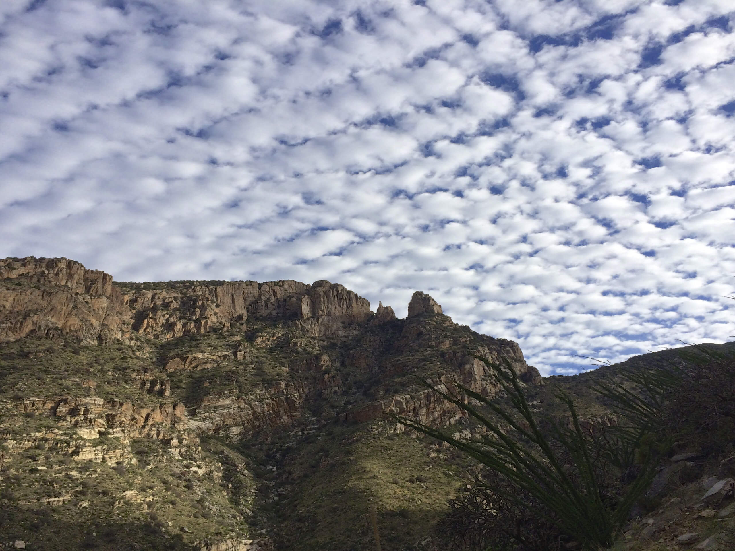
Mount Kimball via Finger Rock Trail
Difficulty Rating:
Mount Kimball is one of the most accessible major summits in the Santa Catalina Mountains near Tucson. With 4200ft of elevation gain to complete in around 5 miles, this is no walk in the park. This route reaches the top via Finger Rock Trail. While the entire hike is too demanding for some users, it’s a fine hike to go as far as you like on if you can’t complete it all since the views are still quite rewarding without reaching the top. For those going the distance, expect difficult footing and a tiring grade. Poles will be helpful.
As with all hikes in this area, bring plenty of water and get your hike in before the heat of the day hits.
Getting there
The trailhead for Mount Kimball via Finger Rock Trail is on N Alvernon Way.

About
| Backcountry Campground | No |
| When to do | October-May |
| Pets allowed | No |
| Family friendly | No |
| Route Signage | Average |
| Crowd Levels | High |
| Route Type | Out and back |
Mount Kimball via Finger Rock Trail
Elevation Graph
Weather
Mount Kimball via Finger Rock Trail Description
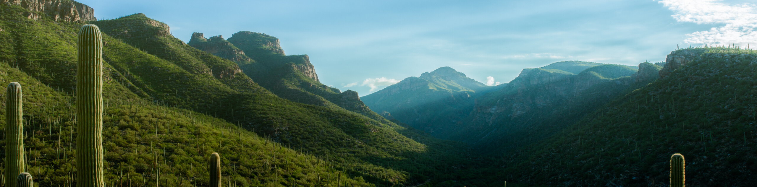
Mount Kimball is no small objective, but it is one of the most accessible major summits in the Catalinas, and it’s easy to get to from Tucson. This is a hike that’ll leave you feeling very accomplished when you reach the top, especially since a fair share of the hikers who start this route won’t finish. That’s part of the appeal of this hike, though–you can turn around partway and still be rewarded with great views. If you can push all the way to the summit, you’ll feel on top of the world.
This hike gains around 4200ft of elevation in about 5.0mi. That’s a bit stiff, so we recommend poles and good boots. Some of the footing feels a bit precarious and rocky, especially as you approach the summit, so give yourself enough time to hike this entire trail safely.
This hike is out in the sun without much shade and you’ll be working very hard. Bring more water than you think you may need, bring nutrition, and wear sun protection.
Note that the Pusch Ridge Wilderness contains an annual closure area from January 1 to May 1 for bighorn sheep lambing season. Additionally, dogs are not allowed on this trail.
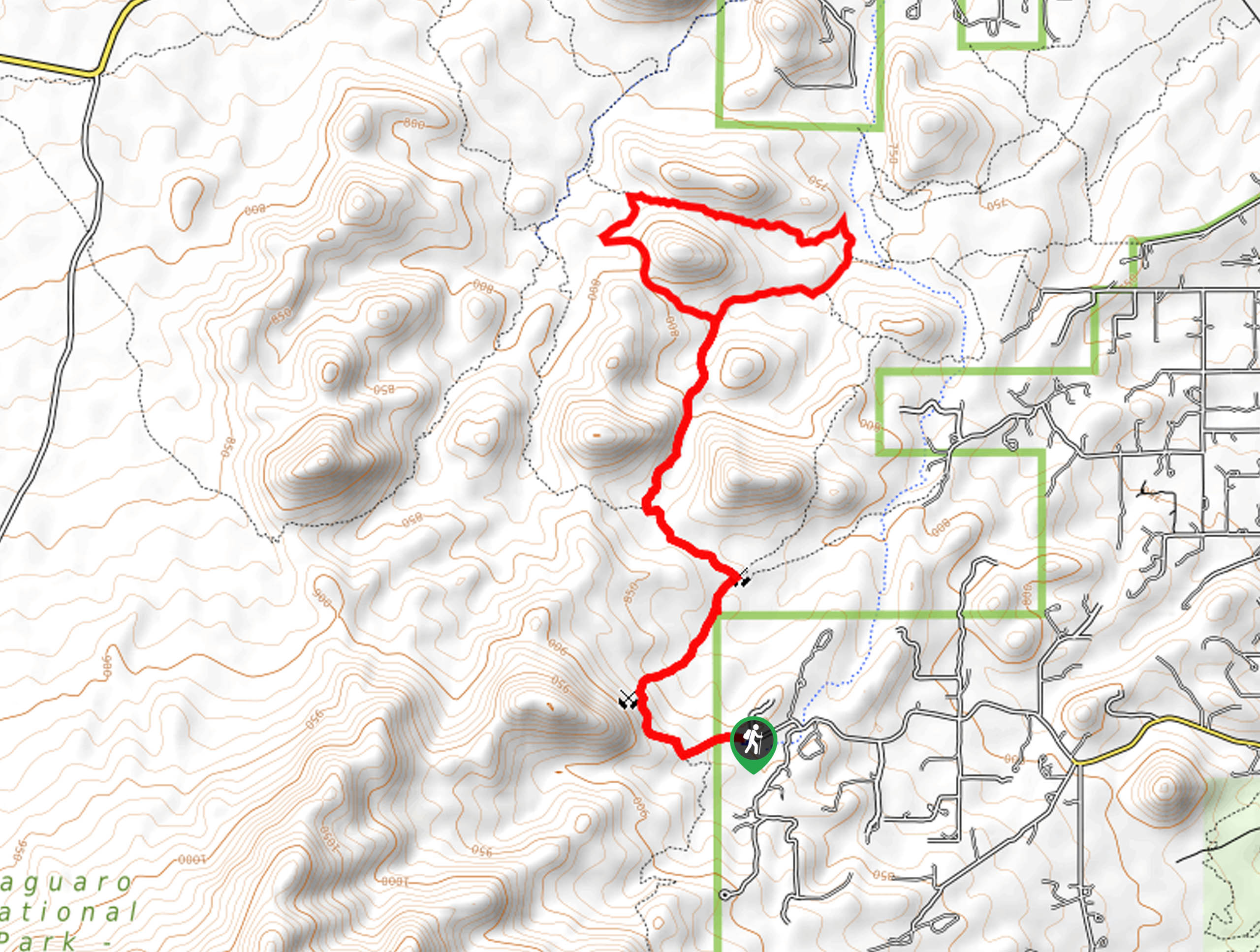
From the parking lot, head up the street towards the signage for the Coronado National Forest and hop onto the trail. A few steps in, keep left onto Finger Rock Trail. Warm-up on the relatively flat beginning as you approach the valley.
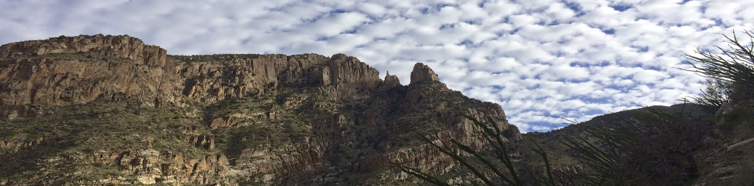
After about a mile, the ascent through the valley begins. Check out Finger Rock as you hike (there isn’t a trail up to it, so you’ll have to admire it from afar). You’ll also want to look back at the views opening up behind you.
Around three miles in, you’ll arrive on a saddle called Linda Vista. This is a good spot for a break or a nice turnaround point. Past the saddle, hike up into a manzanita forest, where the trail reaches its steepest grade.
When you hit the Forest Service sign indicating the junction of Finer Rock and Pima Canyon trails, take a left onto Pima Canyon Trail. It’s easy to miss this turn, so keep it in mind.
With a half-mile left to cover, you’ll climb steeply up through the trees. Once you hit the summit, you’ll probably be wondering where the views are. Take the side trail on your right heading east. About 50 yards down this trail is where you’ll find the open summit viewpoint.
From here, retrace your steps back to the trailhead.
Hiking Route Highlights
Santa Catalina Mountains
The Santa Catalina Mountains, often called the Catalinas by locals, span across the desert north of Tucson. These mountains are the most prominent in the Tucson area with the highest average elevation, making them ideal for hikers seeking more challenging routes with the best views in the area. The highest peak in the Catalinas is Mount Lemmon at 9157ft. On top of Mount Lemmon, there is a survey project underway to discover comments, asteroids, and near-Earth objects.
Frequently Asked Questions
How tall is Mount Kimball?
Mount Kimball is 7258ft tall.
Are dogs allowed on Finger Rock Trail?
No, dogs are not allowed on this trail.
Is Mount Kimball open?
This route may be affected by seasonal closures for bighorn sheep lambing season. Additionally, the route is occasionally closed because of wildfires in the area.
Insider Hints
If you run out of water on the ascent, we recommend turning back and returning another day. Users report a strenuous climb and needing more water than they packed.
Similar hikes to the Mount Kimball via Finger Rock Trail hike

Hugh Norris, Sendero Esperanza, and Dobbie Wash Loop
The Hugh Norris, Sendero Esperanza, and Dobbie Wash Loop is a bit of a mouthful, but it’s a great hike…
Bear Canyon Trail
Bear Canyon Trail is one of the main routes in Tucson’s Sabino Canyon Recreation Area. The entire trail is almost…
Cactus Canyon and Gila Monster Loop
The Cactus Canyon and Gila Monster Loop is a 6.0mi hike in Tucson’s Saguaro National Park that puts…
Comments