Catalina Canyon Loop
View Photos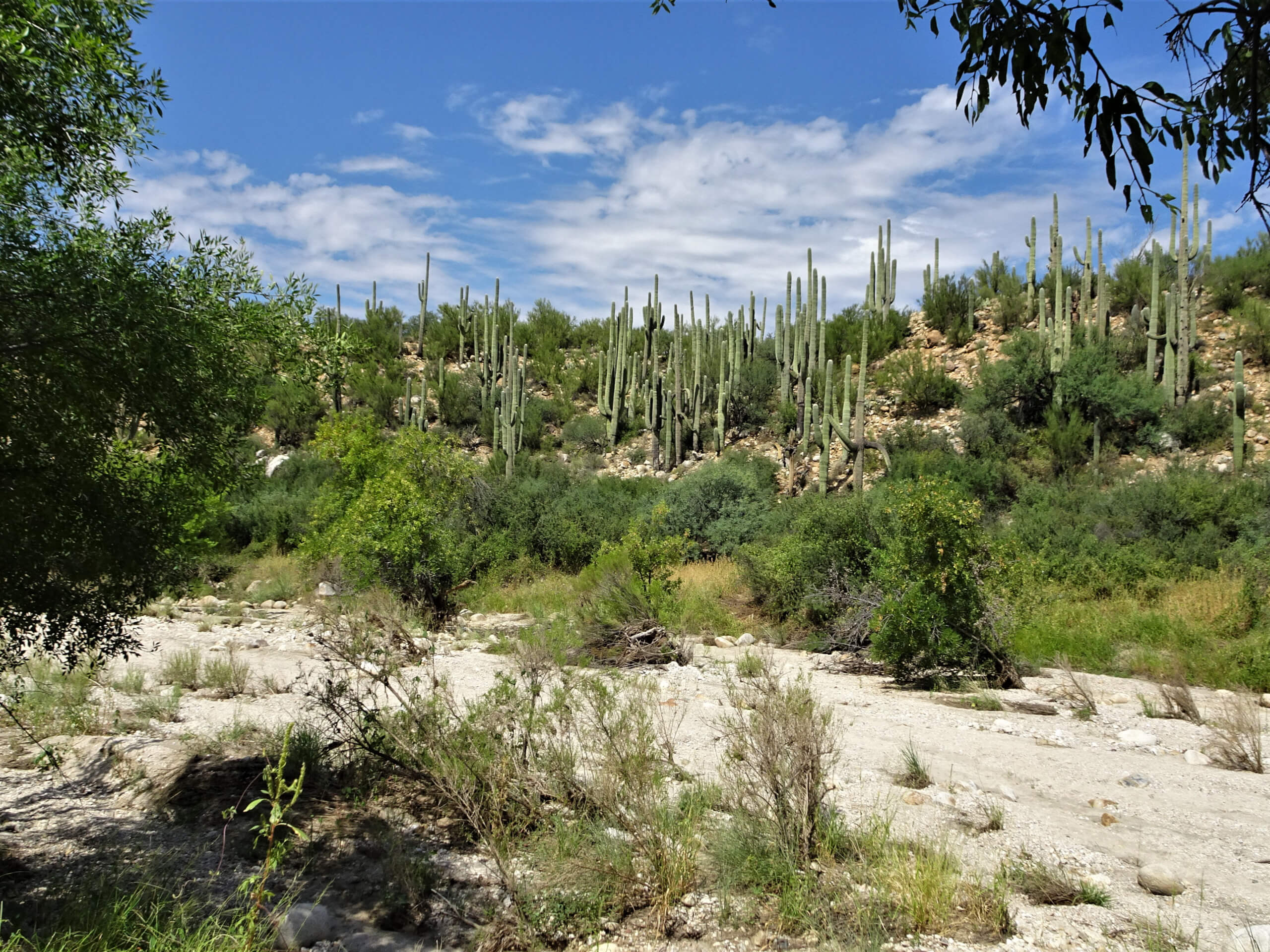
Catalina Canyon Loop
Difficulty Rating:
The Catalina Canyon Loop is an enjoyable, easy 2.3mi hike in Catalina State Park north of Tucson. Tucked just north of the Pusch Ridge Wilderness and sitting near the convergence of two washes, this area has great views and more water to enjoy than most other areas around Tucson.
This route crosses the Sutherland Wash several times. It’s good for days when you want to cool your feet off (because they will get wet) and since it's dog-friendly and has water to enjoy, it’s a favorite for local dog owners. As with all hikes in this area, bring plenty of water and get your hike in before the heat of the day hits.
Getting there
The trailhead for the Catalina Canyon Loop is off Catalina State Park Road.

About
| Backcountry Campground | No |
| When to do | October-May |
| Pets allowed | Yes |
| Family friendly | Yes |
| Route Signage | Good |
| Crowd Levels | High |
| Route Type | Loop |
Catalina Canyon Loop
Elevation Graph
Weather
Catalina Canyon Loop Description
The Catalina Canyon Loop is a wonderful hike in Catalina State Park, which sits at the north end of the Pusch Ridge Wilderness north of Tucson. It’s a moderate hike with some moderate elevation change, but it’s within the abilities of most levels and ages.
This hike is dog-friendly and it explores the area around the Sutherland Wash. This is a very popular hike for dog owners, especially since most trails in the Saguaro National Parks are not dog-friendly.
Since you’ll be crossing the wash several times, consider bringing wading shoes. If it’s been dry lately there may not be much water, but after a good rain, you’ll have enough water to cross that you won’t be able to keep your boots dry.
Some of the footing is quite sandy, which might be hard for very young kids or those with less stamina. Good footwear will help in these sandy and rocky areas.
Since this is such a pleasant area to hang out in, you might want to pack a picnic and plan to hang out for a while.
The trailhead is in the parking area. Head up to the Sutherland Trailhead in the loop and take Sutherland Trail to the edge of the wash. Cross the wash twice, then hike alongside it for a stretch before crossing again. Keep right after this third crossing.
No hiking along the Romero Canyon Creek, you’ll continue to a 4-way junction. Stay on Canyon Loop, turning back to head west and then keeping right where three trails intersect one after the other.
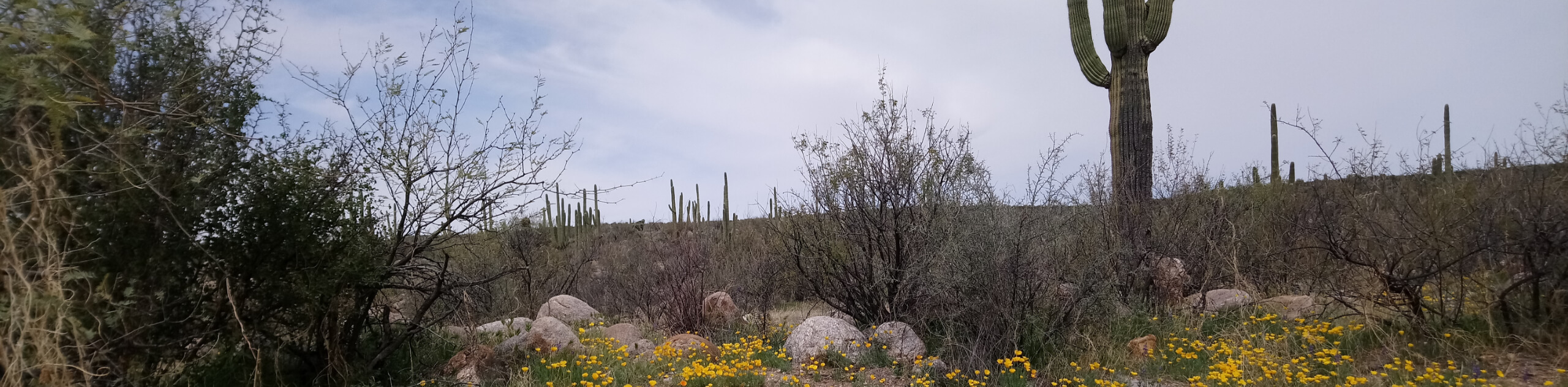
On this stretch of the Canyon Loop, you’ll head back through the park towards the trailhead. Take your time, enjoy the views. The landscape here is quite pristine, so we recommend taking it slow and soaking it up.
You’ll cross back over the wash one last time to make it back to the trailhead.
Hiking Route Highlights
Catalina State Park
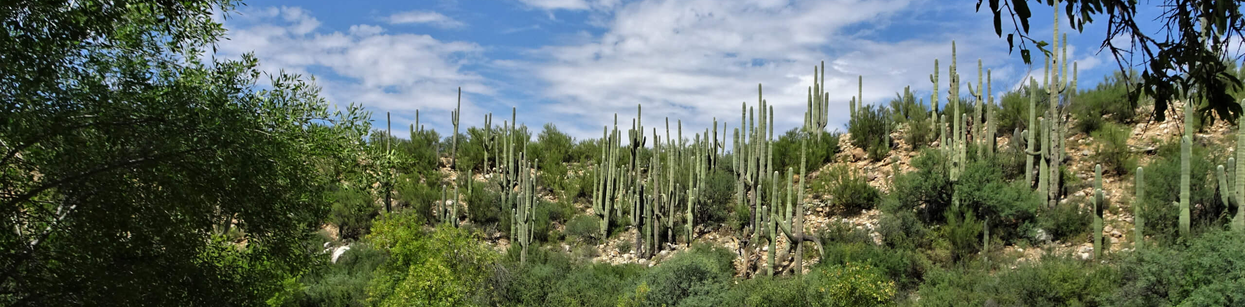
Catalina State Park is at the base of the Santa Catalina Mountains in a particularly beautiful area of saguaros, mountain foothills, and washes. There are nearly 5,000 saguaros in the park in addition to an impressive range of desert plants. With 5,500 acres of pristine foothills and canyons, this park is a popular destination for hikers, campers, trail runners, and bikers.
Frequently Asked Questions
Is there water flowing at Catalina State Park?
There tends to be the most water in the park after snowmelt in the mountains in early spring or after heavy or prolonged spells of rain.
Are dogs allowed on the Catalina Canyon Loop?
Yes, dogs are allowed on this trail.
Is Catalina State Park free to visit?
There is a modest day-use fee required. The fees are $7 per vehicle and $3 for bicycles. Fees are subject to change.
Insider Hints
This route can get busy. Consider a midweek visit to have more of the trail to yourself.
Similar hikes to the Catalina Canyon Loop hike

Shantz, Cholla, and Cactus Forest Loop
The Shantz, Cholla, and Cactus Forest Loop is an easy trail in Tucson’s Saguaro National Park East. The star of…

Cactus Forest, Squeeze Pen, and Pink Hill Loop
The Cactus Forest, Squeeze Pen, and Pink Hill Loop is an easy trail in Tucson’s Saguaro National Park East. This…
Dripping Spring via Sutherland Trail
Starting off in Tucson’s lovely Catalina State Park, the hike to Dripping Springs on Sutherland Trail is a charming easy…
Comments