
Leopold Point via Incinerator Ridge Trail
View Photos
Leopold Point via Incinerator Ridge Trail
Difficulty Rating:
Beginning from the scenic San Pedro Vista and climbing a ridge past Barnum Rock to Leopold Point, Incinerator Ridge Trail is a stunning hike and one of our go-to's for quickly accessible views outside of Tucson. This route makes you feel like you’re getting away from the city, but it’s short enough that you can complete it in the morning and then go about your day. The balance of effort and reward is right where it should be.
Getting there
The trailhead for the Leopold Point via Incinerator Ridge Trail is off General Hitchcock Highway.

About
| Backcountry Campground | No |
| When to do | October-May |
| Pets allowed | No |
| Family friendly | Older Children only |
| Route Signage | Average |
| Crowd Levels | Moderate |
| Route Type | Out and back |
Leopold Point via Incinerator Ridge Trail
Elevation Graph
Weather
Leopold Point via Incinerator Ridge Trail Description
If you want to step outside the city limits for your next adventure but can’t squeeze in a full-day hike, the trek to Leopold Point on Incinerator Ridge Trail is an awesome pick. This route is quite short, but it still offers a good workout and the views are great. While this route is quick, it does have a more moderate elevation profile for its length, so small children might find it too difficult.
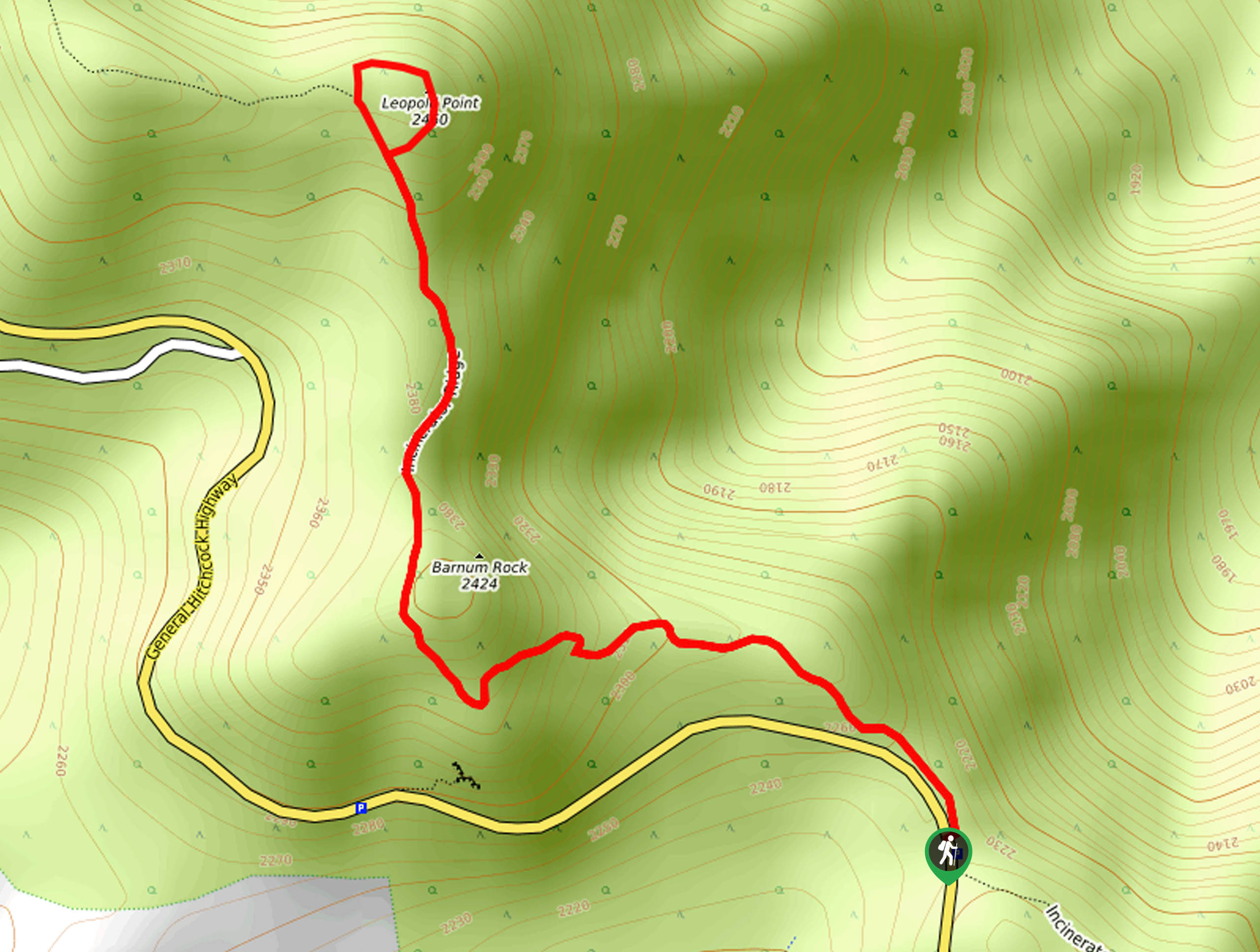
From the San Pedro Vista, take Incinerator Ridge Trail as it follows the highway before pulling away towards Barnum rock. This beginning part of the route is steeper than the end, so if you’ve made it to Barnum Rock, you’re past the hardest point. Hike up the west side of the rock and continue north.
Once you approach Leopold Point, take a moment to take in the views. You can complete a quick loop around the point, but if you find it to be overgrown, it might be easier to retrace your steps without the loop. You’ll take the same route back to the trailhead.
Similar hikes to the Leopold Point via Incinerator Ridge Trail hike

Shantz, Cholla, and Cactus Forest Loop
The Shantz, Cholla, and Cactus Forest Loop is an easy trail in Tucson’s Saguaro National Park East. The star of…

Cactus Forest, Squeeze Pen, and Pink Hill Loop
The Cactus Forest, Squeeze Pen, and Pink Hill Loop is an easy trail in Tucson’s Saguaro National Park East. This…

Hugh Norris, Sendero Esperanza, and Dobbie Wash Loop
The Hugh Norris, Sendero Esperanza, and Dobbie Wash Loop is a bit of a mouthful, but it’s a great hike…
Comments