
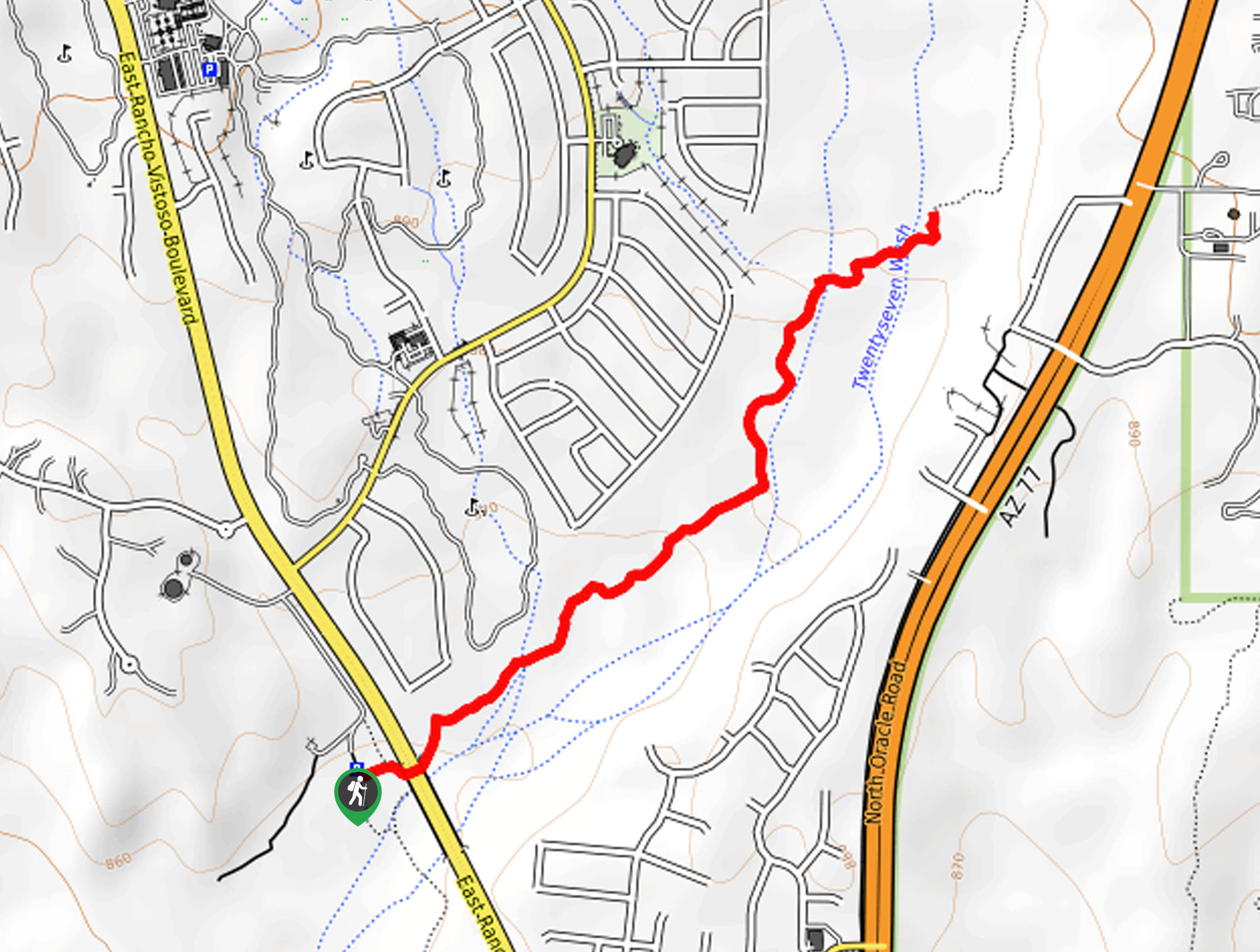
Big Wash Trail
View Photos
Big Wash Trail
Difficulty Rating:
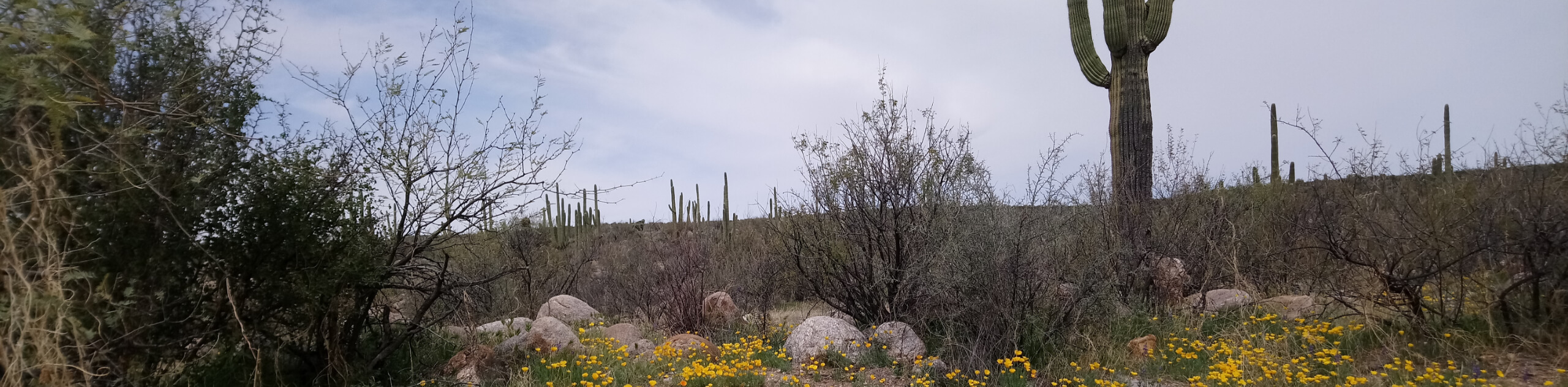
Big Wash Trail is a 2.4mi easy trail in Tucson that can be used for mountain biking and hiking. This route is beginner-friendly with almost no elevation gain required. It’s scenic and easy to get to from the north end of the city. While the route is easy, you’ll want to wear good footwear to deal with the sandy and rocky footing. Dogs are allowed on this route but we recommend keeping them on a leash due to the mixed nature of the traffic on this route.
Getting there
The trailhead for Big Wash Trail is off E Rancho Vistoso Boulevard.

About
| Backcountry Campground | No |
| When to do | October-May |
| Pets allowed | Yes - On Leash |
| Family friendly | Yes |
| Route Signage | Average |
| Crowd Levels | Low |
| Route Type | Out and back |
Big Wash Trail
Elevation Graph
Weather
Big Wash Trail Description
The Big Wash Trail is a delightful 2.4mi hike on the far northern reaches of Tucson. This route is favored by beginner hikers and mountain bikers thanks to its almost completely flat elevation profile. It’s surprisingly scenic for being so close to the city, and it won’t take you long to complete.
This route is sandy and rocky, so good shoes are recommended. Additionally, since hikers and bikers share this route, we recommend keeping dogs on a leash at all times.
From the trailhead, cross the road and follow the obvious trail. You’ll cross Chalk Creek, which will likely be dry unless there’s been heavy rain very recently. The route meanders along Big Wash and a neighborhood before crossing Big Wash and Twentyseven Wash. The hike ends here, so turn back and retrace your steps to the trailhead. Note that the Big Wash Connector continues on, so you could go a bit further if you wanted to.
Similar hikes to the Big Wash Trail hike

Shantz, Cholla, and Cactus Forest Loop
The Shantz, Cholla, and Cactus Forest Loop is an easy trail in Tucson’s Saguaro National Park East. The star of…

Cactus Forest, Squeeze Pen, and Pink Hill Loop
The Cactus Forest, Squeeze Pen, and Pink Hill Loop is an easy trail in Tucson’s Saguaro National Park East. This…
Dripping Spring via Sutherland Trail
Starting off in Tucson’s lovely Catalina State Park, the hike to Dripping Springs on Sutherland Trail is a charming easy…
Comments