
Mt Myra hike
View Photos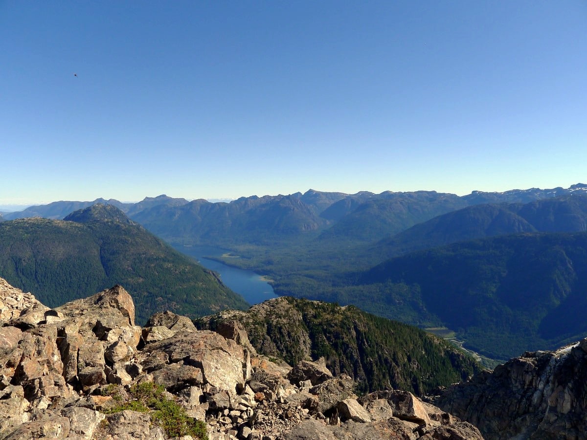
Mt Myra hike
Difficulty Rating:
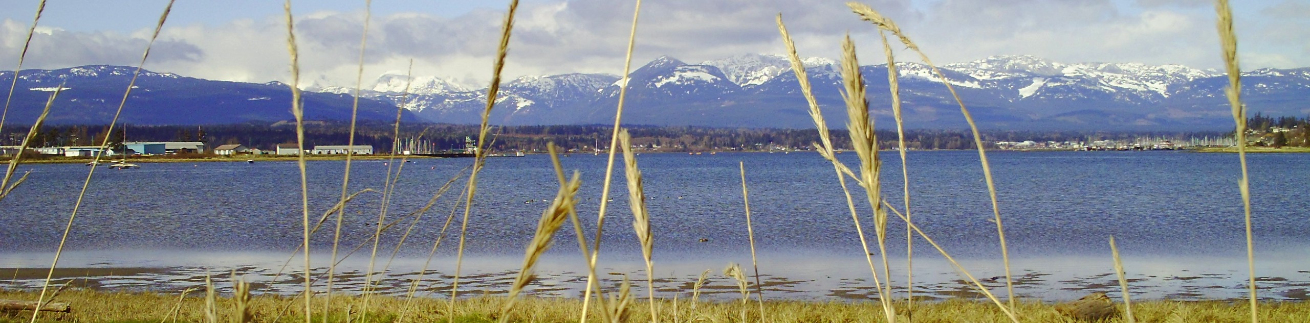
Hiking up Mt Myra is a Vancouver Island Classic Hike. Mt Myra is the second most famous hiking peak in Strathcona Provincial Park, typically completed after Mt. Albert Edward. Though at a lower elevation, Mt Myra is located more centrally in the park and the panoramic views of the Bedwell Lake area mountains and glaciers are nothing short of stunning.
Getting there
From Campbell River head west along High 28 for just under 31.1mi. Just as you reach Buttle Lake you will come to a junction where you will continue straight, following signs for the Westin Mine. Follow this road for 23.6mi until you enter the mine area. Following the gravel road as it passes through the operational mine, following signs with a little Hiker icon to the parking lot.

About
| When to do | July - September |
| Backcountry Campsites | Numerous opportunities at Tennant and Sandbag Lakes |
| Toilets | At trailhead |
| Family friendly | No |
| Route Signage | Poor |
| Crowd Levels | Low to Moderate |
| Route Type | Out and back |
Mt Myra
Elevation Graph
Weather
Route Description for Mt Myra
The hike up Mt Myra starts directly from the parking lot. Here you will find a pit toilet and a map outlining the various routes.
Begin by crossing the road and hiking along the gated dirt road. Sadly, you must follow this road all the way to the hydroelectric dam at its end. Even if the gate is open, do not go down the road as you may end up being locked in! After arriving at the small dam, cross the creak and begin along the Tennent Lake Trail.
Though it’s called a trail, the hiking route up to Tennent Lake is actually an old cat track. Hence it is extremely steep and contains many loose rocks. Up until this point, you may be questioning why you woke up so early to do such a crummy hike. Don’t worry, the hike to Mt Myra gets better. Much better.
Finally, after 1969ft of elevation gain you will arrive at the north end of the large Tennent Lake. Here you’ll get a few glimpses of the Mt Myra peak up ahead. Cross the dams to get to the east side of the creek and begin along the unofficial trail that goes up to the summit. You will hike up to a shoulder above the east side of Tennent Lake, switch backing up a somewhat steep and at times bushy trail.
The only potential for getting somewhat lost on the Mt Myra hike comes when you finally crest a plateau and come to a small alpine meadow. The trail at first appears to go straight, but that path dies out quite quickly. Instead turn up to the left and continue gaining elevation.
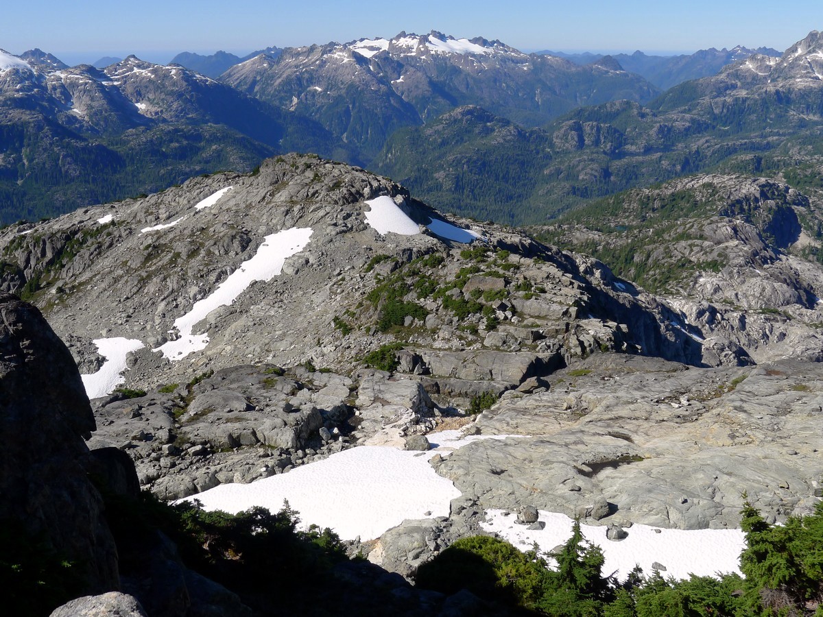
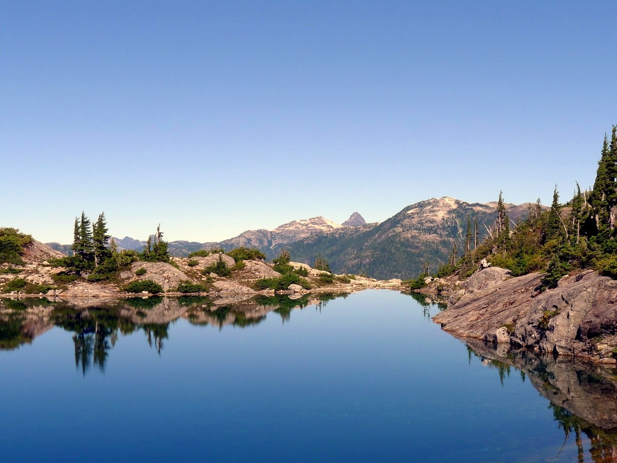
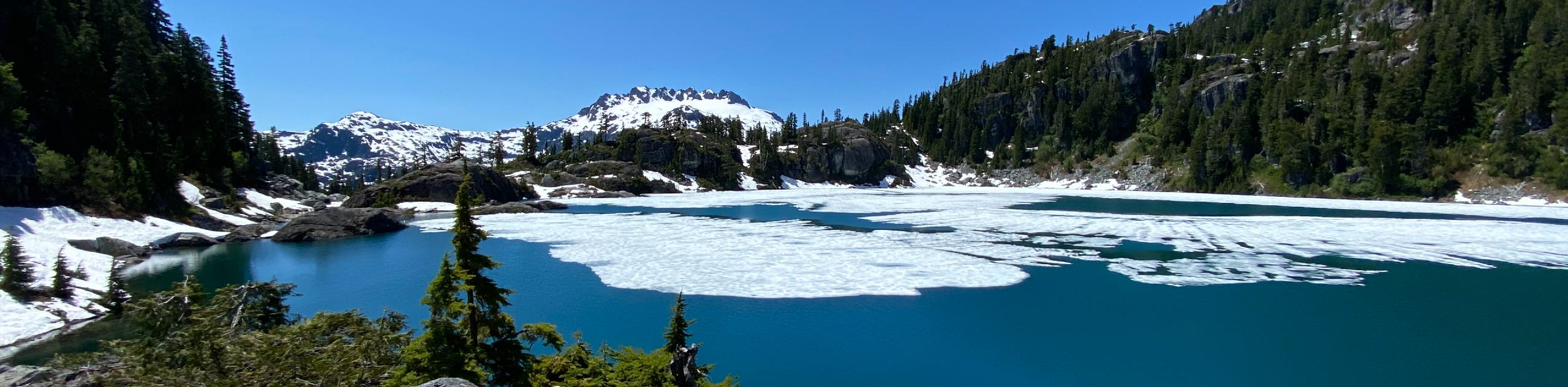
A short while on you will come to the stunning beautiful Sandbag Lake. Here you will get your first truly stunning views. Both the small, beautifully clear aqua blue lake and the surrounding scenery are nothing short of unbelievable. You could stop here and save yourself another 1640ft of elevation gain if you are feeling tired.
Continue around the left (northeast) side of Sandbag and find the path continuing up the ridge. You will get your hopes up as you see a false summit rising ahead of you. Contour around to the right of this heart breaker to save yourself going up and over. After the false summit the ridge turns abruptly to the Northeast.
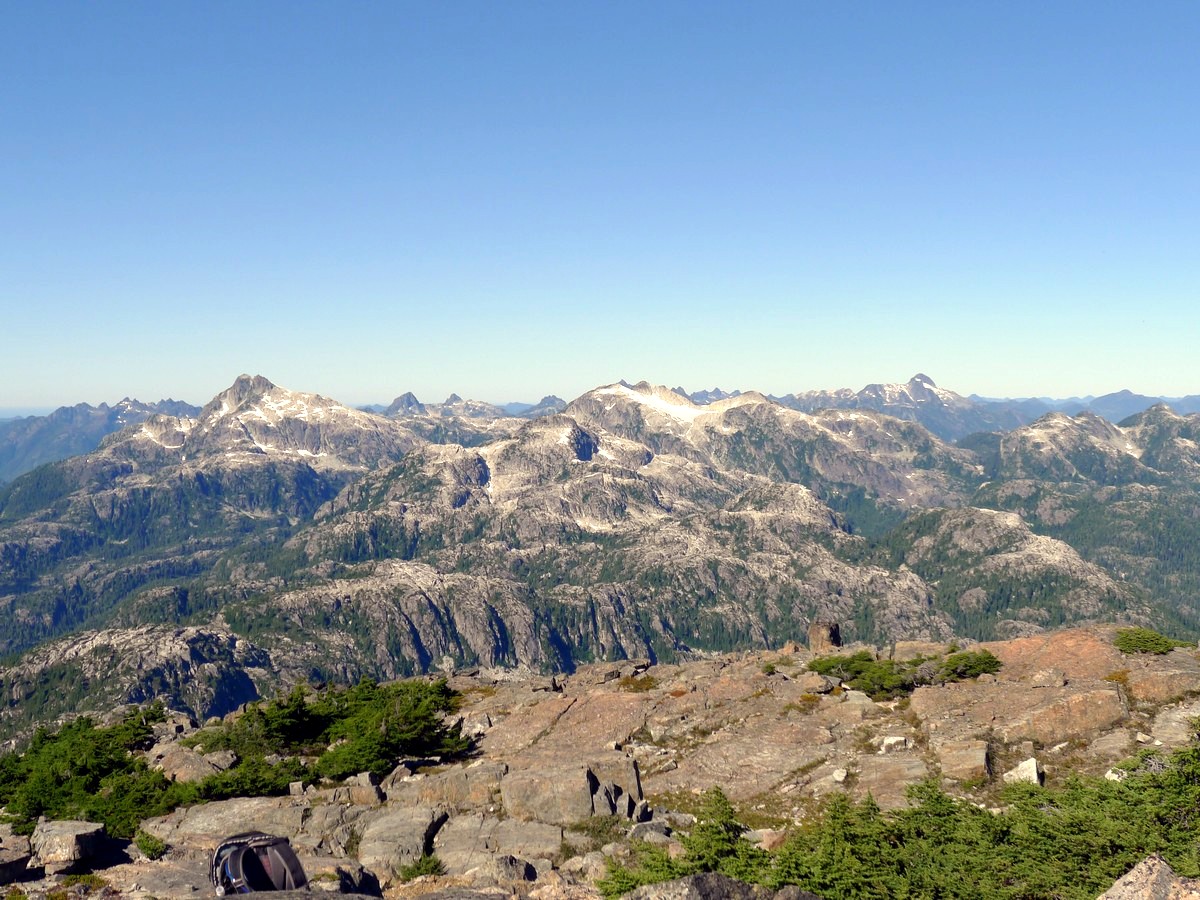
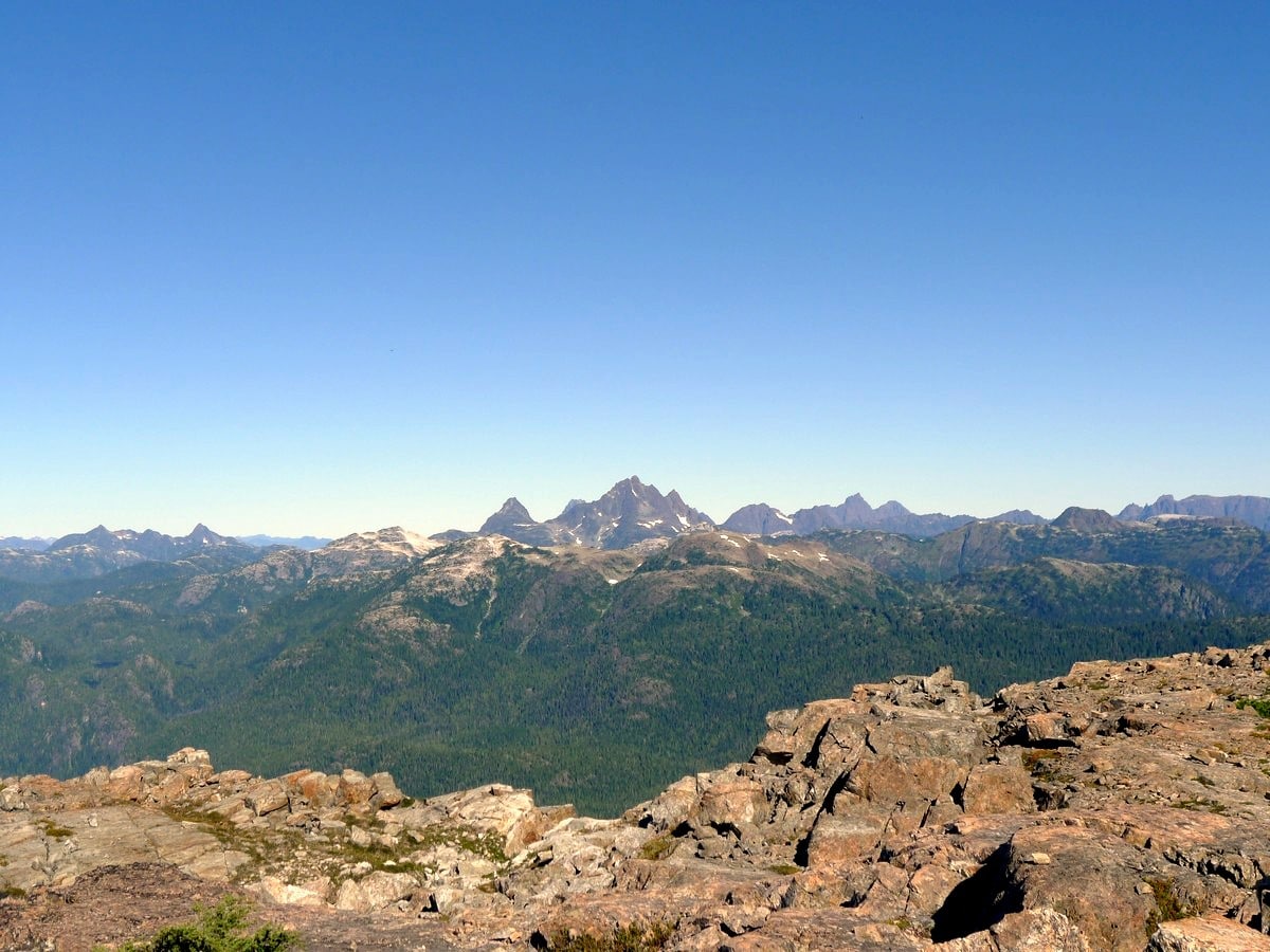
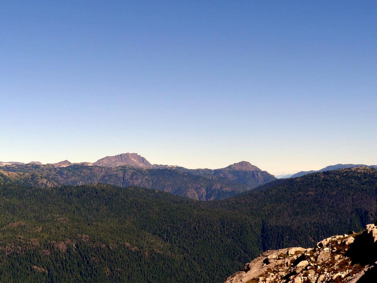
After following the ridge for a short way, you will find yourself below the summit block. Find the path of least resistance up dirt gullies between the rock faces as you finally crest the peak of Mt Myra. The stunning peaks of Strathcona Provincial Park will lay out in front of you, beckoning to be photographed and appreciated.
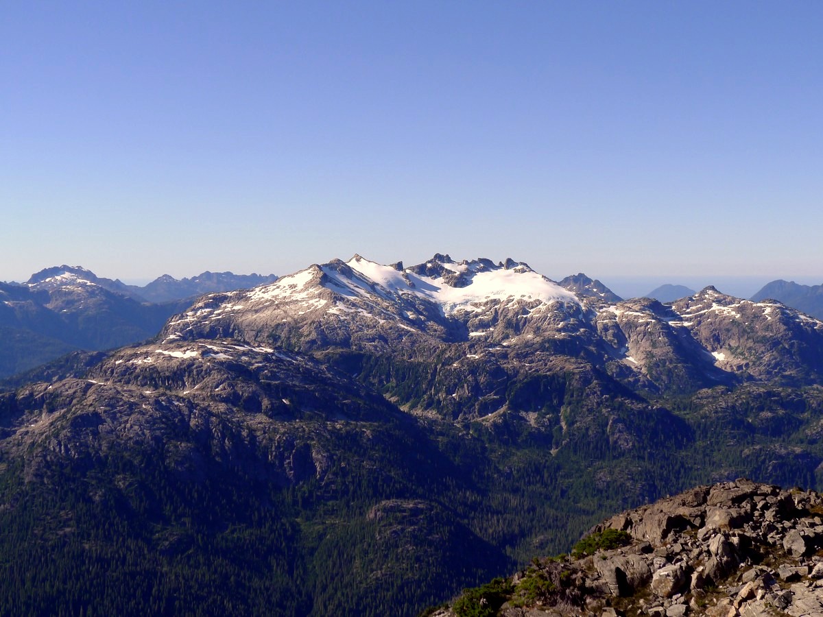
To the north you can glimpse the top of the Golden Hinde, the tallest mountain on Vancouver Island. More prominently, however, will be Mt Tom Taylor to the south, with the massive north glacier facing you directly. Looking west along the summit ridge you will be able to see Mt. Tellwood as well.
Enjoy the summit of Mt Myra, sign the registry, and then begin the knee crushing hike back to the car.
Insider Hints
Start this hike early in the day. It’s easy to eat up plenty of time taking breaks at the lakes and enjoying the summit.
Poles can be very helpful on the way down to save your knees, especially on the cat track down from Tennent Lake.

Similar hikes to the Mt Myra hike
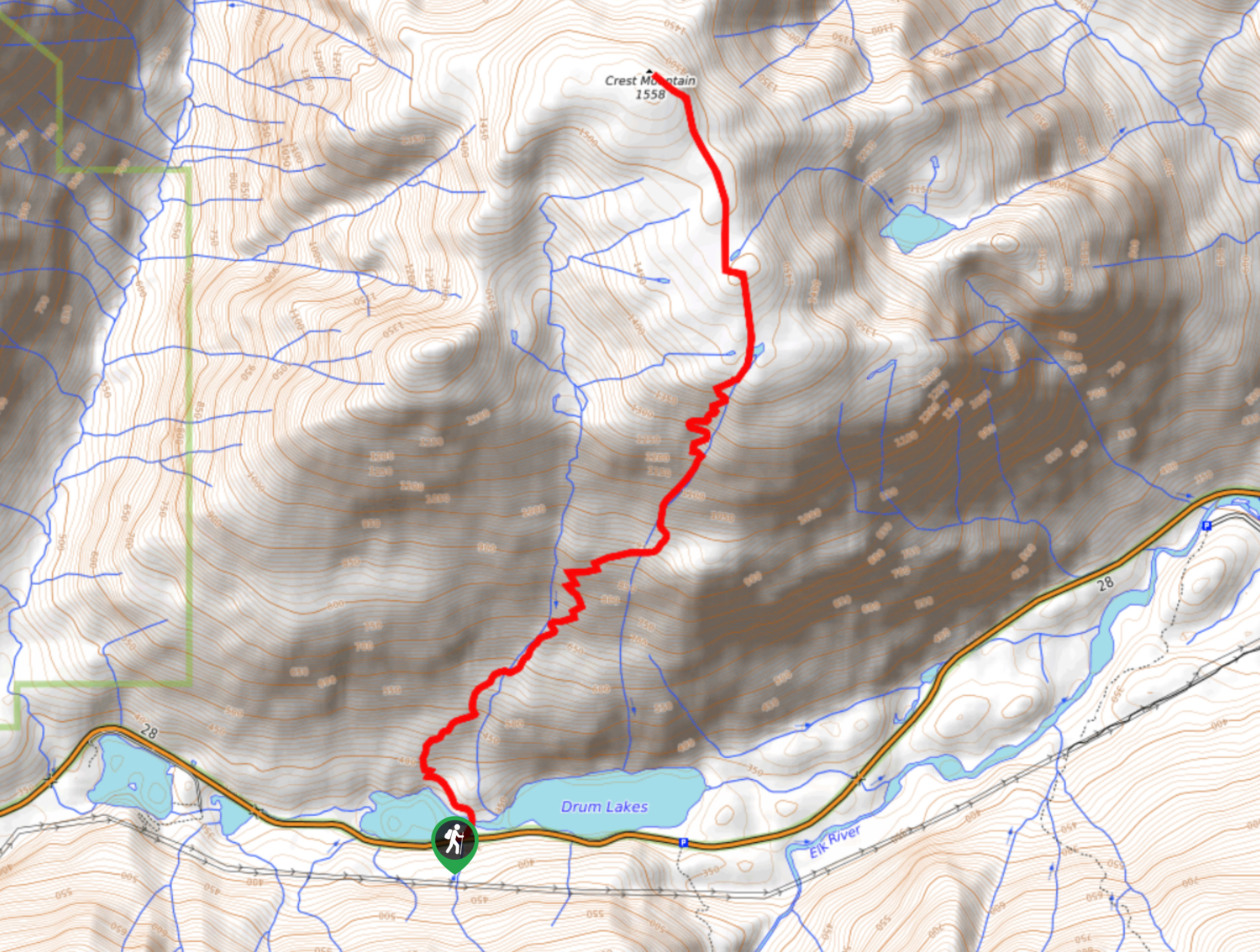
Crest Mountain Trail
The Crest Mountain Trail is an 7.1mi out-and-back hiking route in Strathcona Provincial Park that climbs up a…
Comox Glacier
The Comox Glacier Trail is a difficult 11.2mi out-and-back trail that climbs steeply uphill to traverse the glacier…
Love Lake Trail
The Love Lake Trail is a 3.3mi out-and-back hiking route in Strathcona Provincial Park that can only be…
matsuomako 4 years ago
Endless walks, endless sights to see and endless picnic areas as you would expect.
solosurferr 4 years ago
You can really see everything from up here. Love the view of Bedwell. It is a long, hard day but perfect for a challenge.
YukihiroSato 4 years ago
Reminds me of my country. We love nature that's why we try to preserve as much as we could. I was challenged by this hike but I conquered it!
rphylands 4 years ago
Just did a day hike up Mt. Myra with my partner yesterday. It's still very snowy up there. We made it to Sandbag Lake and after around a half hour of exploring beyond that we decided to turn around. Could not see any cairns and the snow was very deep, slippery and hiding most of the trails. Bring any spikes for your shoes if you have any (we did not)! That said, was a gorgeous hike! Did what we could in just over 7 hours.
Rowan Sanders 4 years ago
A hidden gem which makes it less crowded and all the more special.
Olivia P. 4 years ago
Bring your camera, walking shoes and be prepare for some of nature's most breathtaking beautiful scenery.
Tara Green 4 years ago
Bedwell Lake view is stunning, peaceful, and an absolutely beautiful hike
Meighan 4 years ago
It's an arduous hike but definitely rewarding.
SophieM. 4 years ago
The clear blue waters of the lake looks so fabulous! So much to see in this hike!
Sonya Strut 5 years ago
The glaciers were stunning! The trail was extremely steep but it's absolutely worth it.