Karst Creek Trail
View PhotosKarst Creek Trail
Difficulty Rating:
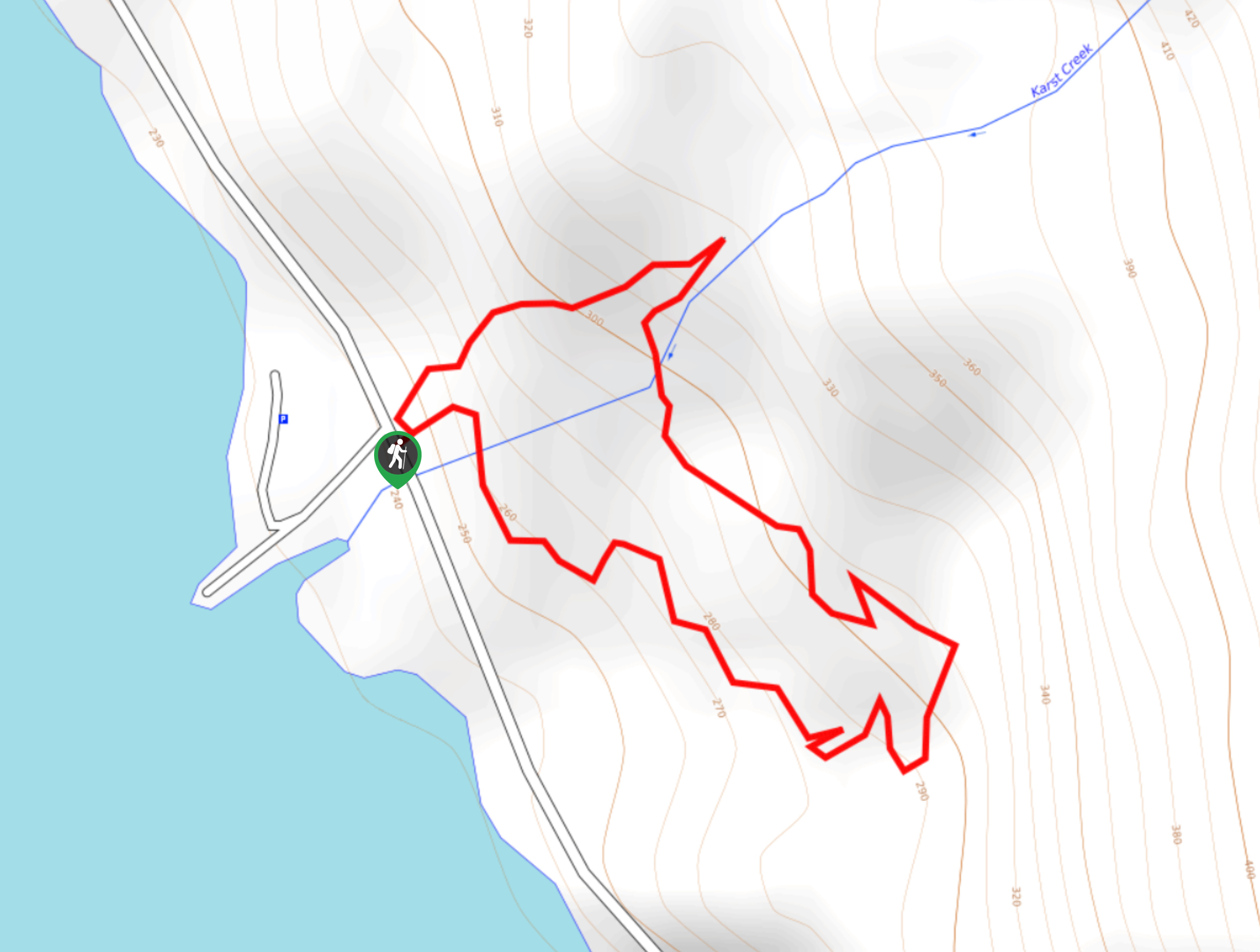
The Karst Creek Trail is a 0.8mi hiking loop that will take you through a beautiful stretch of Pacific temperate rainforest near the shores of Buttle Lake in Strathcona Provincial Park. The forested route traverses various terrain, including dirt paths and rocky creek beds, making it an ideal area for exploring with kids. Along the trail, you will experience a peaceful rainforest setting and a small cascading waterfall.
Getting there
To get to the Karst Creek trailhead from Campbell River, drive northwest along BC-28 for 29.3mi and continue straight onto Westmin Road. In 14.0mi, you will arrive at the trailhead next to the picnic area.

About
| When to do | May–October |
| Backcountry Campsites | No |
| Pets allowed | Yes - On Leash |
| Family friendly | Yes |
| Route Signage | Average |
| Crowd Levels | Moderate |
| Route Type | Circuit |
Karst Creek Trail
Elevation Graph
Weather
Karst Creek Trail Description
Hiking along the Karst Creek Trail is a short but scenic experience that will allow you to admire the beauty of the Pacific temperate rainforest atmosphere. The trail is accessible for hikers of most skill levels; however, the route crosses over a rocky creek bed that will restrict mobility for families with strollers. That aside, this is a magical hike for exploring the natural beauty of Strathcona Provincial Park.
The trail heads into the forest and follows a path to the left on a parallel route to the creek. Eventually, you will come to a charming little waterfall before crossing over the rocky creek bed and continuing along the trail. As you work your way around the loop, the trail will begin to descend slightly, and you will arrive back at the trailhead. After your hike, head across the road to sit by Buttle Lake and enjoy a nice lunch by the water’s edge.
Similar hikes to the Karst Creek Trail hike
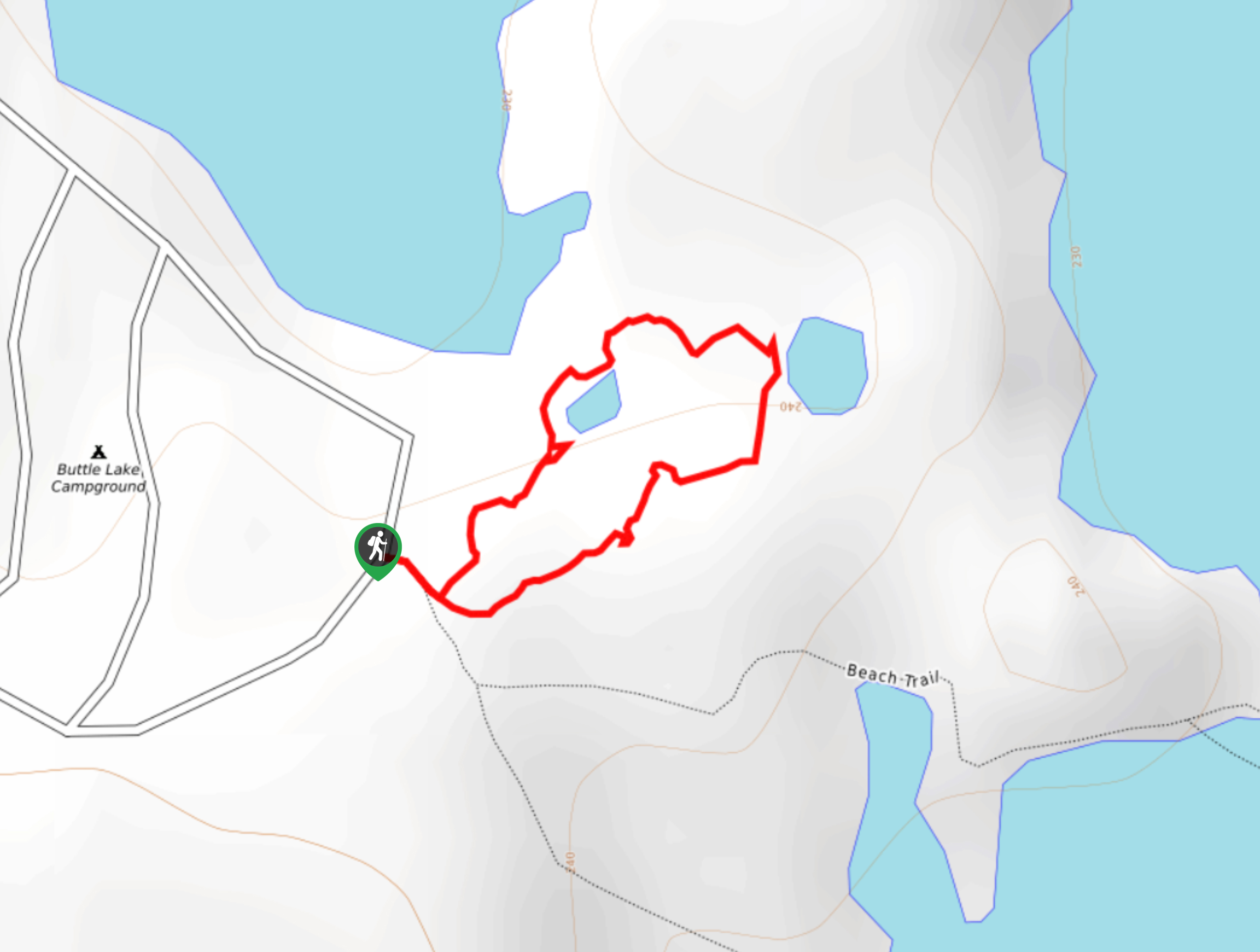
Three Pond Loop Trail
The Three Pond Loop Trail is a 0.4mi hiking route in Strathcona Provincial Park that passes through a…
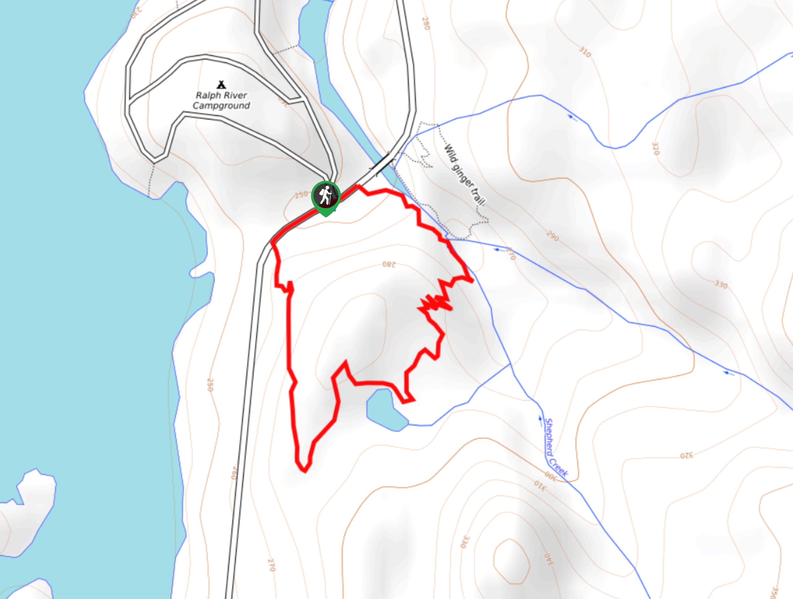
Shepherd Creek Trail
The Shepherd Creek Trail is a quick 1.1mi hike in Strathcona Provincial Park that offers a perfect way…
Rossiter’s Rise Trail
The Rossiter’s Rise Trail is an overgrown hiking route in Strathcona Provincial Park that loops through the area around Paradise…
Comments