
Della Falls
View Photos
Della Falls
Difficulty Rating:
Hiking to Della Falls is an awesome adventure that will take you across the vast waters of the Great Central Lake to a trailhead leading into Strathcona Provincial Park. From here, you’ll begin the 18.3mi out-and-back journey to the cascading waterfall that passes through a remarkable stretch of terrain and includes a cable car crossing over a creek. Most often split up into a multi-day journey, seasoned adventurers can complete the hike in a day, but only by taking the water taxi to the trailhead.
Getting there
Accessing the Della Falls trailhead can only be achieved by boat. Hikers can either paddle the 28.0mi across the Great Central Lake to get to the trailhead or hire a water taxi to expedite the journey.

About
| When to do | June-September |
| Backcountry Campsites | Della Falls Camp |
| Pets allowed | Yes - On Leash |
| Family friendly | No |
| Route Signage | Average |
| Crowd Levels | Low |
| Route Type | Out and back |
Della Falls
Elevation Graph
Weather
Della Falls Description
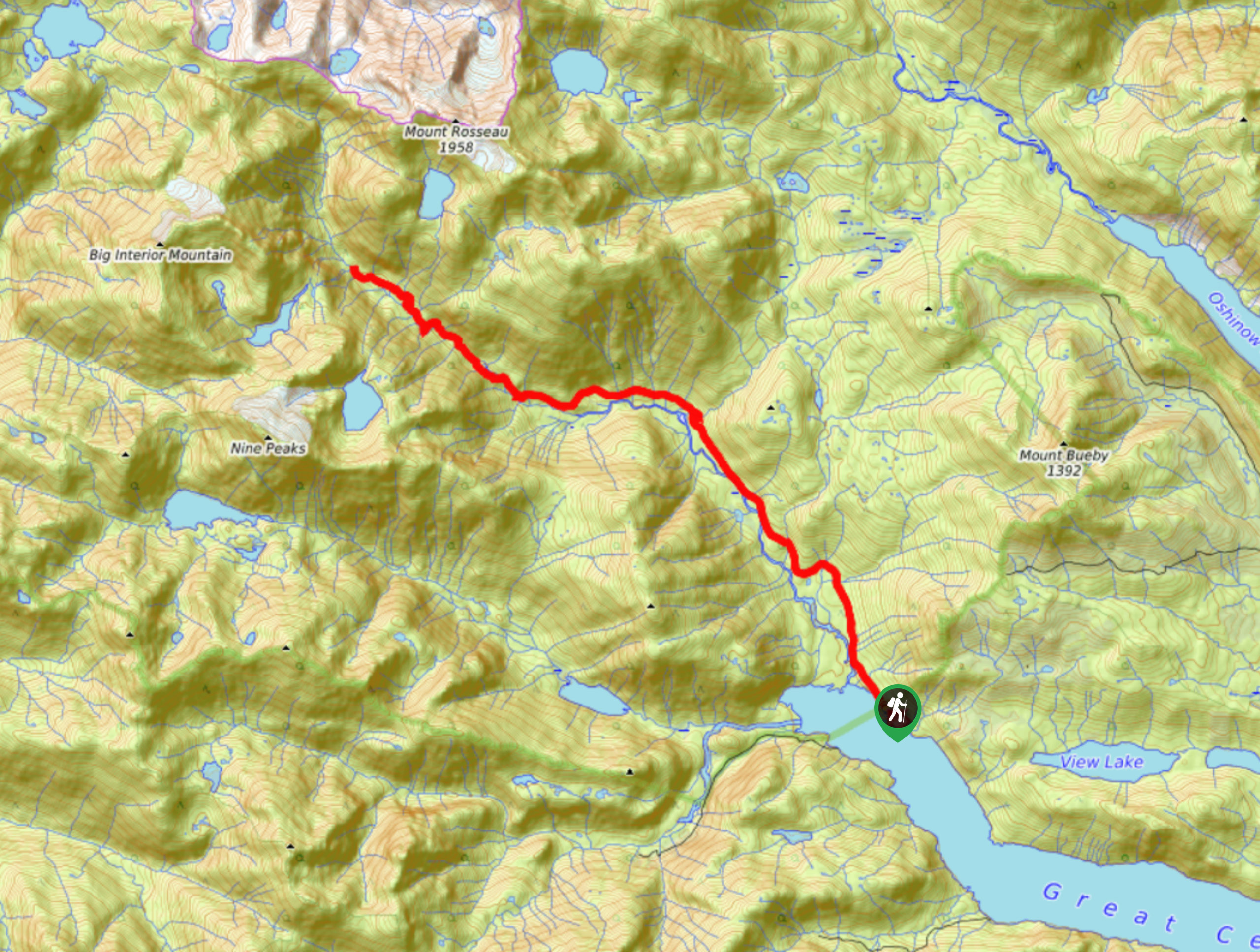
Making the trek out to Della Falls is an unforgettable outdoor experience in Strathcona Provincial Park; however, make sure to plan as the journey is long and will require some planning to accomplish. First, you should decide whether to tackle this hike as a single-day trip or spread it out over a few days. The trailhead to Della Falls is only accessible by boat, meaning hikers will need to either paddle to the trailhead or hire a water taxi for the 28.0mi ride across the lake.
Hikers with great fitness that chose to hire a taxi can complete the hike in a single day; however, there are several campsites along the trail to facilitate the needs of those that decide to break it up into a multi-day journey. Additionally, to reach the falls, hikers will need to use a cable car to cross over a creek when on the trail. You should practice extreme caution when using the cable car as injuries have occured from improper use.
Whether you are ambitious enough to pack this entire journey into a single day or approach it as a multi-day trip, the hike to Della Falls is a spectacular adventure into Strathcona Provincial Park that reveals some truly stellar scenery. After crossing the Great Central Lake, hikers will make their way towards the falls along a trail that runs parallel to Drinkwater Creek. Hiking through the dense forest, you will cross over the creek several times, both by bridge and using a pulley-driven cable car. With intermittent views of the surrounding mountains, you’ll eventually arrive at Della Falls Camp and, after a short distance, the falls themselves. Here, you will see the majestic 1444ft high rock formation and the cascading waters that make Della Falls the 16th highest waterfall in Canada. From here, hikers can either set up camp or continue back along the trail to catch their return ride back across the Great Central Lake.
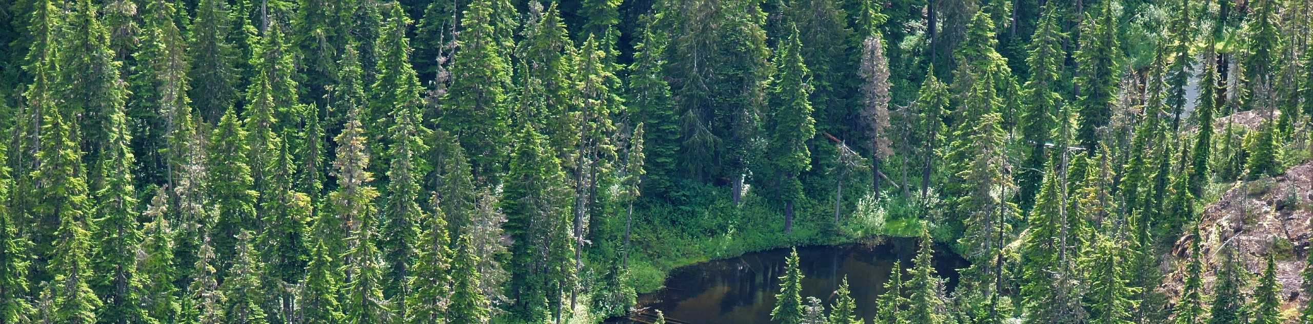
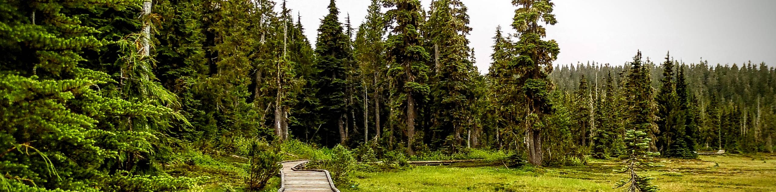
Once you make your way across the Great Central Lake via your desired method of transportation, set out on the Della Falls Trail as it passes by the first campsite along the route and heads north through the thick tree cover. After roughly 0.6mi of hiking through the forest, the trail will meet up with Drinkwater Creek and run parallel to it for most of the hike. This is a strong-flowing creek—much like a small river—and can be used as a water source as you make your way along the trail.
As you wind through the forest alongside the creek, you will cross over several smaller streams and hike past countless species of vegetation, including wild blueberries and salmonberries that provide you with a nice energy boost during summer.
After approximately 4.0mi from the trailhead, you will reach another campsite near Margaret Creek. Here, you will cross over a bridge and follow the trail as it turns to the west. Continuing for about 2.5mi from the bridge, hikers will approach the cable car crossing that spans Drinkwater Creek. Be careful as you use the pulley system to make your way over the rocky creek bed and pick the trail back up on the other side.
Continue following closely alongside the creek as you work in and out of the forest, catching glimpses of the surrounding mountains on the approach to Della Falls. Three kilometres after the cable car, you will come to a junction in the trail, with the right path leading to a steep climb up to Love Lake. For those on a multi-day trek, this is an optional day-hike that provides views of Mount Rosseau and the option to swim in the refreshing waters of the lake.
From the junction to Della Falls, take the path to the left to continue. In about 984ft, you will come to the Della Camp, a great place to stay if you are spending the night in the area. Pressing on for another 2133ft, you will come to the base of Della Falls and be greeted by the majestic sight of the mammoth rock formation. Take some time to explore the area and appreciate the natural beauty of the cascading falls, as well as the surrounding mountains that include Mount Rosseau and Septimus to the east and Big Interior Mountain to the west.
When you’ve finished at the falls, head back along the same route to either set up camp for the night or make your way back to the trailhead to catch your return trip across the Great Central Lake.
Trail Highlights
Della Falls
Standing at 1444ft, Della Falls is Vancouver Island’s 2nd tallest waterfall and the 16th tallest in Canada. Discovered in 1899 by a prospector named Joe Drinkwater, who named it after his wife, the waterfall is fairly isolated and can only be reached by helicopter or boating to the trailhead.
Great Central Lake
The Great Central Lake is a 28.0mi long inland lake that stretches from the area around Port Alberni to the southern edge of Strathcona Provincial Park. Relatively undeveloped, this narrow lake is surrounded by mountains and is Vancouver Island’s 2nd deepest lake, with a mean depth of 407ft.
Frequently Asked Questions
How long does it take to reach Della Falls?
The hike to reach Della Falls will take about 7 hours depending on your fitness; however, this does not account for the 28.0mi trip by boat to reach the trailhead.
How tall is Della Falls?
Della Falls is a series of three cascading waterfalls that stand at 1444ft in height. This makes them the 16th highest waterfall in Canada.
Insider Hints
Take the water taxi in to save some energy for the hike.
Bring bug spray.
Break up the trip into a multi-day journey if you want to spend some extra time exploring the area.
Several campsites are available along the trail, including the Della Falls Camp.
A difficult side trail up to Love Lake will reveal some alternate views of the falls and the option to swim in the lake.
Practice caution when utilizing the cable car crossing as injuries have occurred from improper use of the mechanism.
Similar hikes to the Della Falls hike
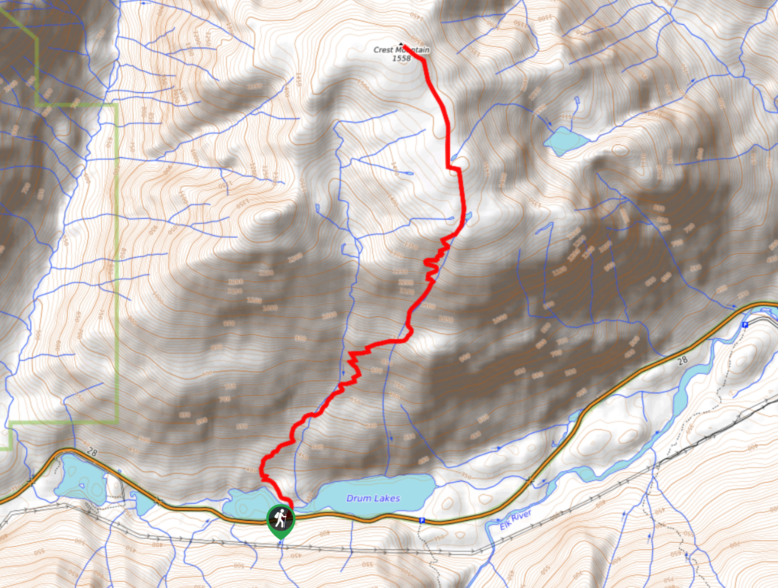
Crest Mountain Trail
The Crest Mountain Trail is an 7.1mi out-and-back hiking route in Strathcona Provincial Park that climbs up a…
Cruikshank Canyon Lookout
The hike to the Cruikshank Canyon Lookout is a lengthy 12.7mi out-and-back journey that will take you past…
Paradise Meadows Trail
The Paradise Meadows Trail is an 5.3mi loop trail in Strathcona Provincial Park that passes through a beautiful…
Comments