Pinecrest Peak Trail
View Photos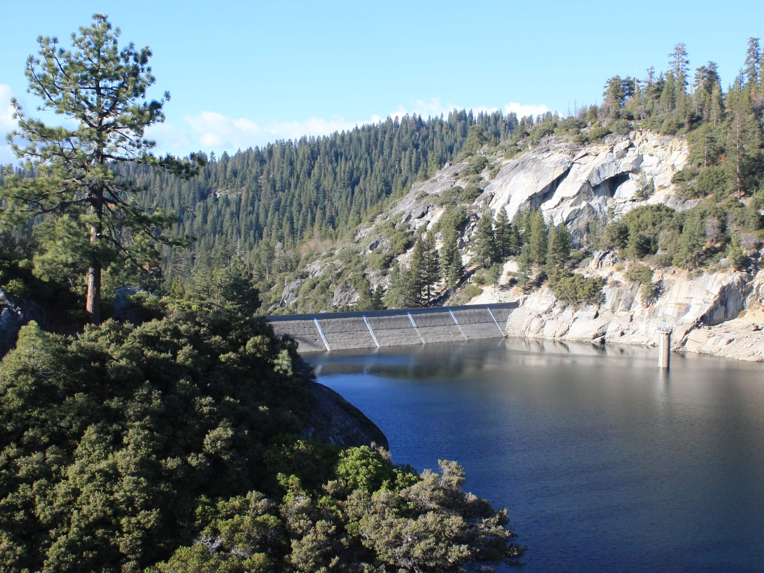
Pinecrest Peak Trail
Difficulty Rating:
The Pinecrest Peak Trail is an epic excursion in the high country. The picturesque views and lush forestlands afford anyone a good time. Though demanding, this trek is a must-add to your Stanislaus National Forest hiking itinerary.
Getting there
Find the trailhead off Pinecrest Avenue.

About
| Backcountry Campground | Backcountry Camping, wilderness permit required. |
| When to do | April-November |
| Pets allowed | Yes - On Leash |
| Family friendly | No |
| Route Signage | Poor |
| Crowd Levels | Moderate |
| Route Type | Lollipop |
Pinecrest Peak Trail
Elevation Graph
Weather
Pinecrest Peak Trail Description
This particular hike is no walk in the park, but the incredible views from atop the peak rationalize the sweat. Put your navigational skills to the test as you venture this backcountry route and test out your bushwhacking capabilities. Though primitive, this route provides an awesome experience. Be sure to pack plenty of water and snacks to stay fueled and wear a sturdy pair of footwear—your ankles will thank us! Don’t forget to download the trail GPS and be sure to dress in layers as insurance against changing conditions.
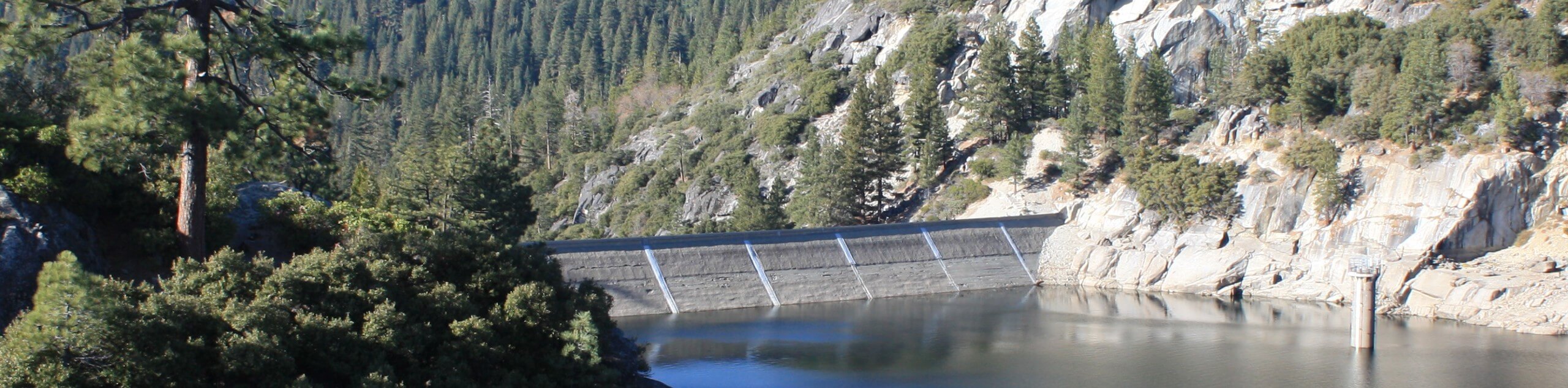
Embark on your adventure along the Pinecrest Peak Trail from the trailhead off Pinecrest Avenue. From here, track Lakeshore Avenue northeast before merging onto the Pinecrest Lake Trail. This path will guide you along the northern shore of the shimmering alpine lake. Continue hiking this route over the dam before diverging from the shoreline onto the Pinecrest Peak Trail. This path will guide you up through the forestlands along the rocky terrain to a junction, keep right, and you will begin hiking along Forest Route 5N31. This path is more primitive and intense. After navigating the vertiginous terrain, you will eventually be delivered to the summit of Pinecrest Peak.
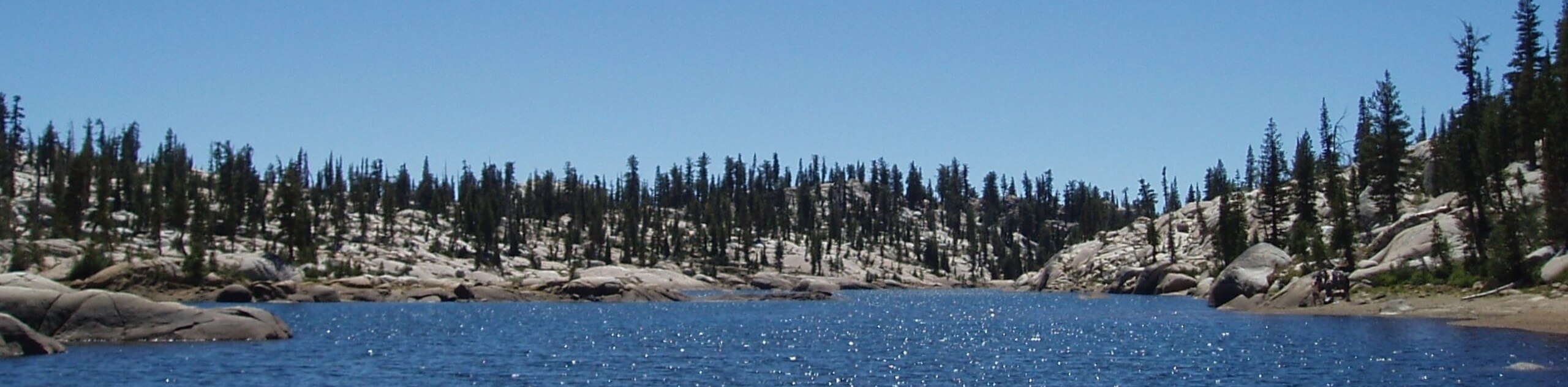
Marvel in the expansive views of the mountainous wilderness and Pinecrest Lake below. When you are ready, retrace your footing down Forest Route 5N31, back to the shoreline. At this point, you will turn left, heading east along the Pinecrest Lake Trail. Follow this route along the southern shoreline and all the way back to the trailhead, marking the end of your adventure.
Similar hikes to the Pinecrest Peak Trail hike
Folger Peak Hike
The Folger Peak Hike is an awesome adventure that boasts 360-degree, panoramic vistas of the high country. This wonderful adventure…

Pinecrest Lake and Pinecrest Peak Loop
The alpine terrain is just waiting to be explored, and the Pinecrest Lake and Pinecrest Peak Loop is a great…
Y Meadow Lake Trail
Why hike the Y Meadow Lake Trail? Well, the Y Meadow Lake Trail is an incredible adventure through the Stanislaus…
Comments