Stawamus Chief hike
View Photos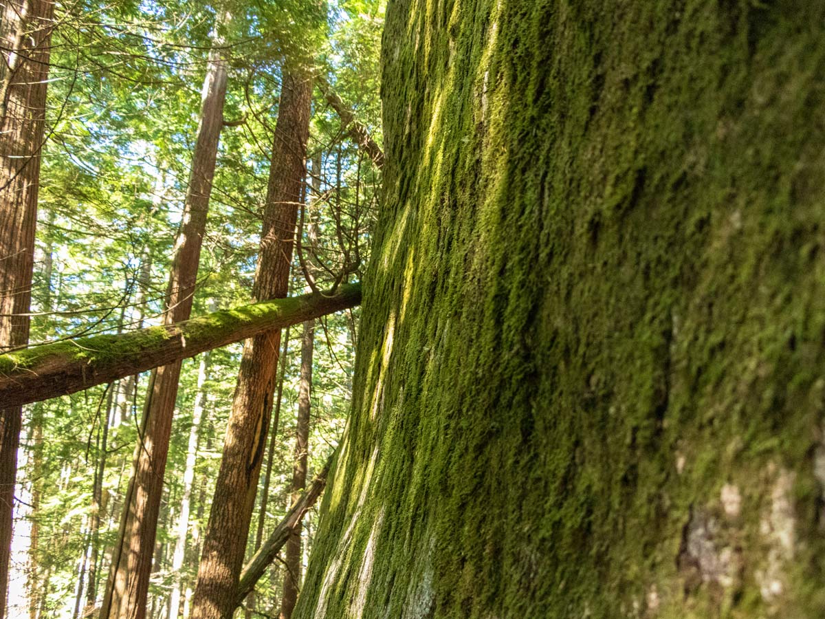
Stawamus Chief hike
Difficulty Rating:
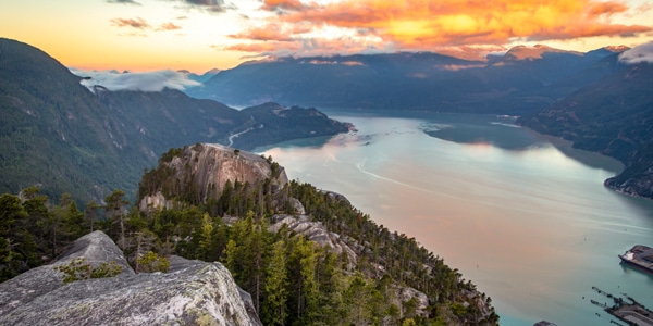
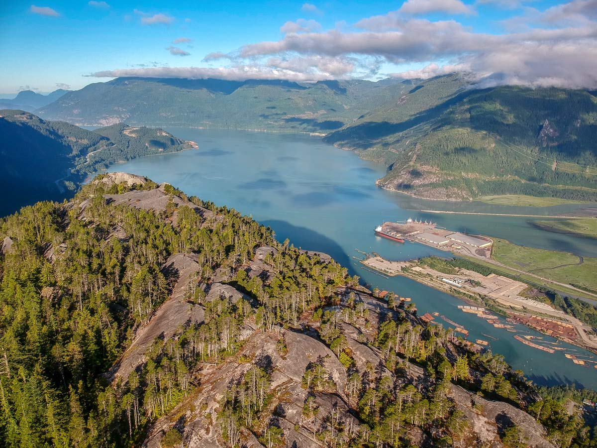
For one of the most popular hikes in Squamish, try hiking up Stawamus Chief. Located within Stawamus Chief Provincial Park, The Chief provides amazing views of Howe Sound over three different summits and is a can’t miss British Columbia experience.
Getting there
Take Highway #99 heading north past Horseshoe Bay towards Squamish. Keep driving along the Sea to Sky highway all the way towards Squamish for about 35 minutes. Watch for the signs for Shannon Falls. If you keep driving north for a few seconds more, past the Shannon Falls lot, you can park in the Stawamus Chief Provincial Park parking lot for free.

About
| When to do | March to November |
| Backcountry Campsites | Yes |
| Pets allowed | Yes |
| Family friendly | Older Children only |
| Route Signage | Average |
| Crowd Levels | High |
| Route Type | Lollipop |
Stawamus Chief
Elevation Graph
Weather
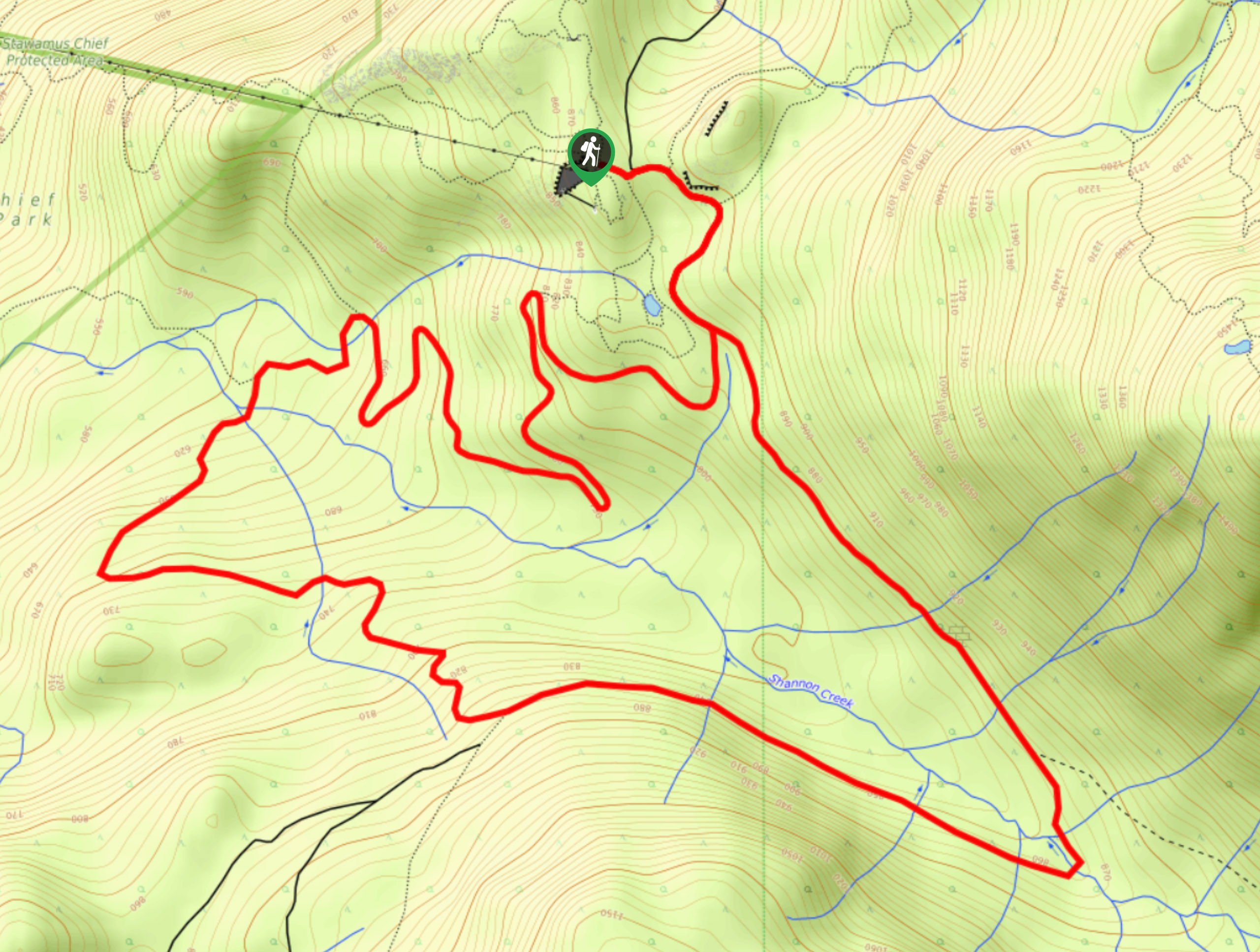
Route Description for Stawamus Chief
Kick off the Stawamus Chief hike in the Stawamus Chief campground, where the trailhead leads almost immediately into a series of wooden stairs. You’ll know you are on the main trail when you spot the Oleson Creek, which the path runs parallel too. At the first split in the road, stay left following signs for Shannon Falls.
Continue at the next junction in the trail left, continuing to follow signs for Upper Shannon Falls and Sea to Summit Trail. At the third split in the trail, take a left once more. Then, you’ll eventually reach a junction with sign posts. Go left here, towards Peak 1. Once at the next split, go left and head up Peak 1. We like Peak 1, but it is also the busiest. So if you’re pressed for time Peak 1 is the peak to skip. In addition, we think the views are best from Peak 2 and 3.
After enjoying the views from Peak 1, retrace your steps back to the junction and go left, on the trail to head towards Peak 2.
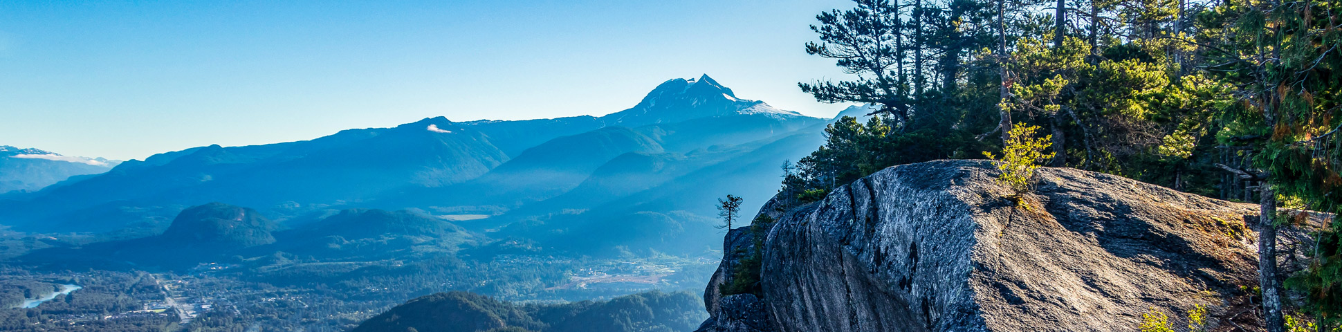
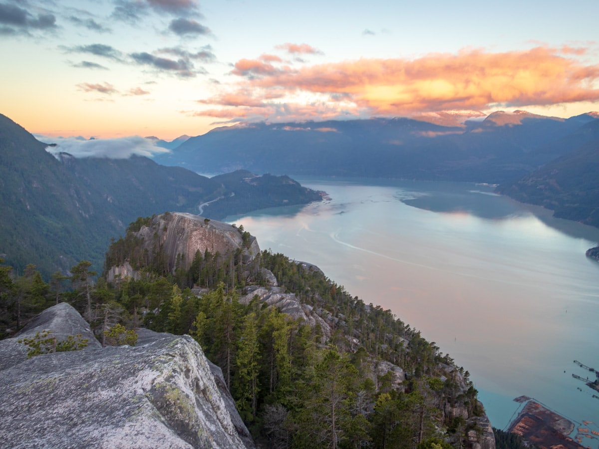
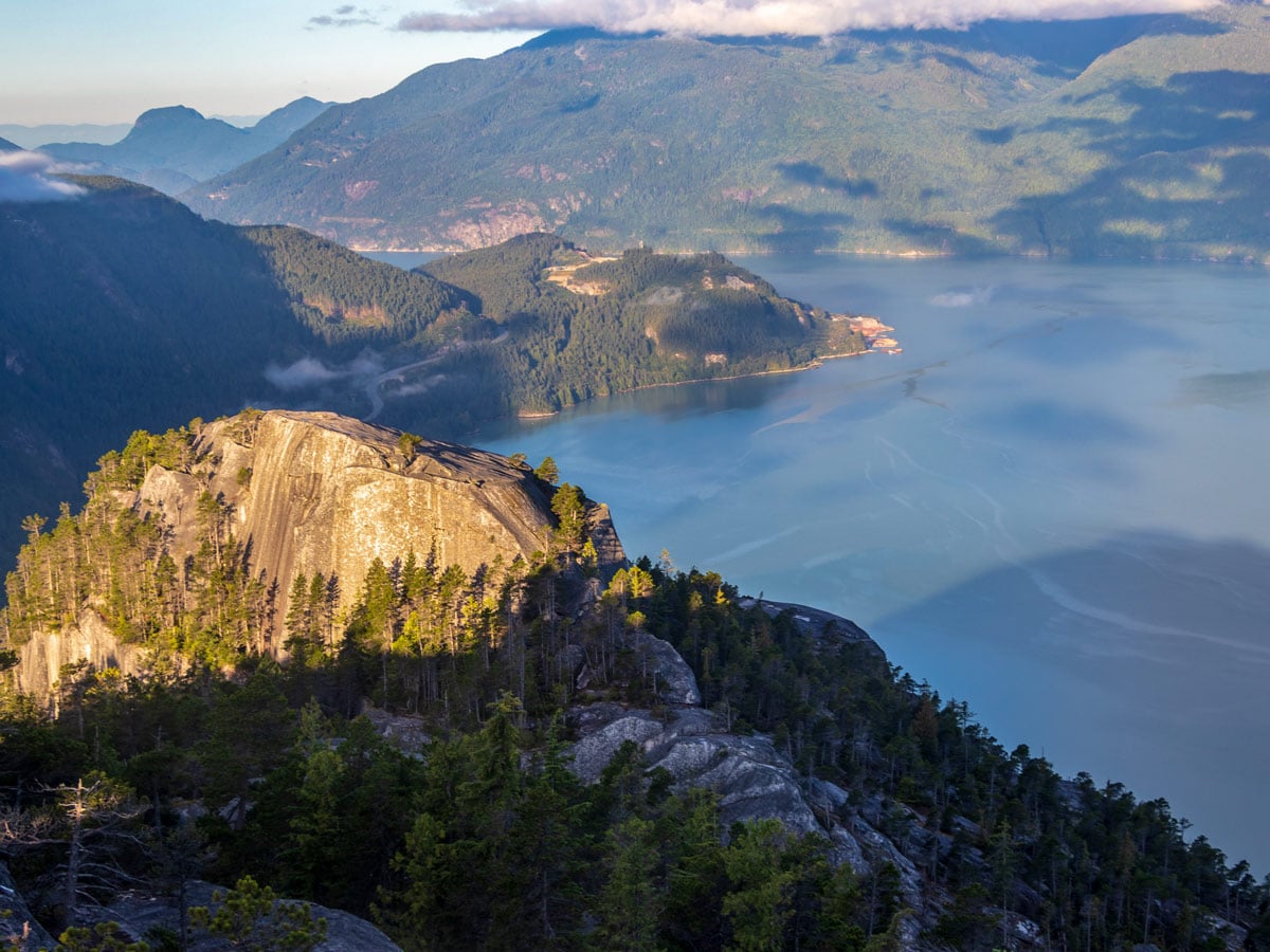
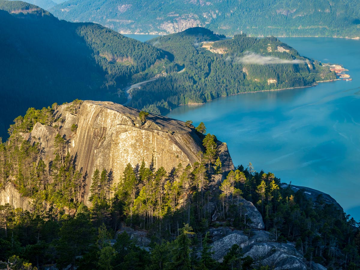
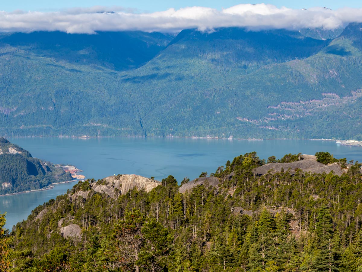
From the junction, continue hiking onwards, until you reach the rocky, open surface of Peak 2. A quick scramble (though be cautious as the rocks can be slippery) will take you to a top of Peak 2. Enjoy views back to Peak 1, Squamish and Howe Sound. Take a rest here to enjoy the scenery and regain some strength.
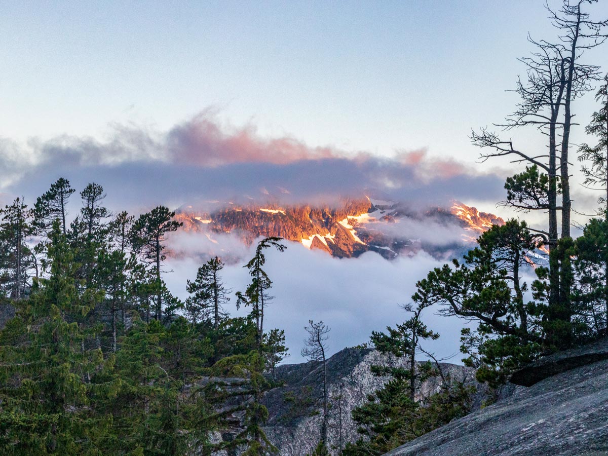
Continue over the summit and follow the orange markers located in the trees, following the trail back down through the North Gully, stopping to look out over Mount Garibaldi. Push onwards as the trail slowly goes uphill again. .
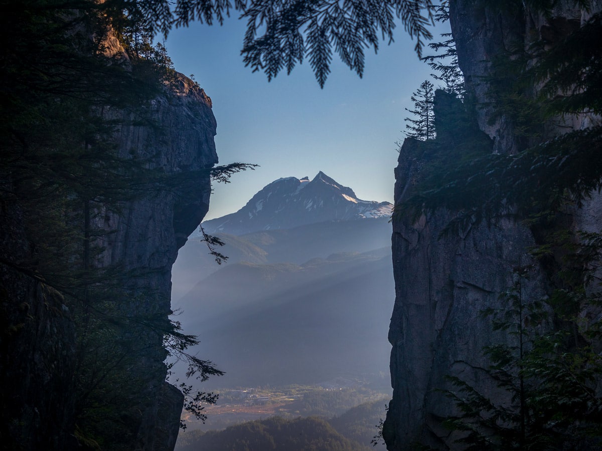
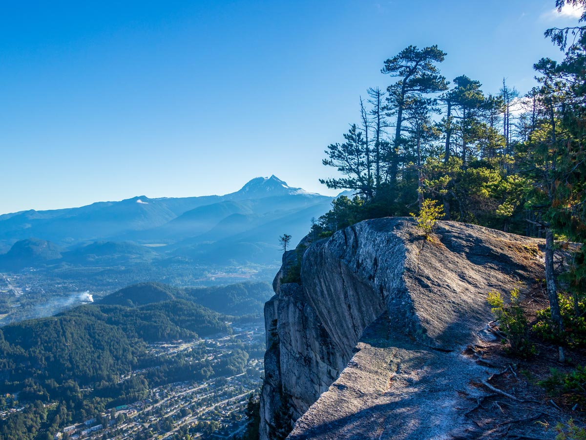
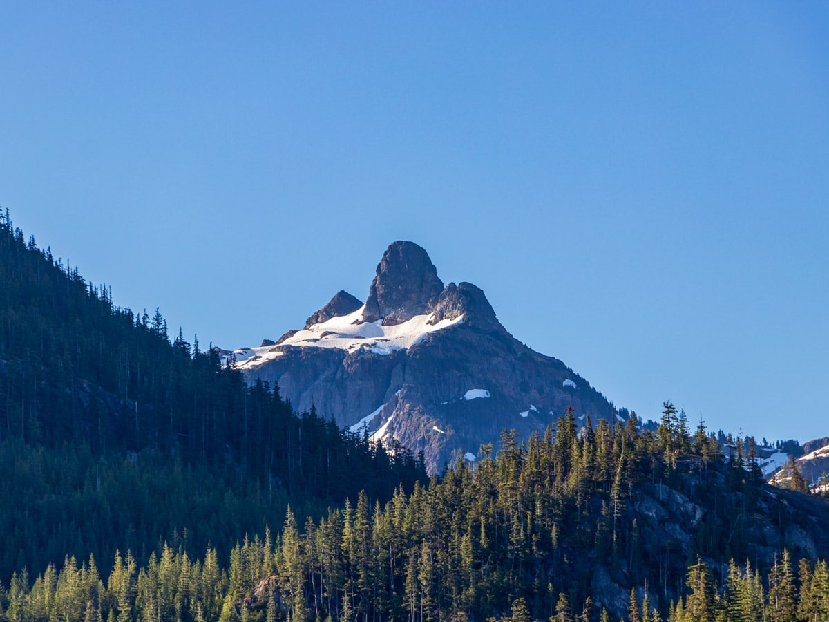
Eventually, you’ll arrive at narrow ledge and a chain, which will help you ascend. Continue to follow the orange flags, until you reach the top of Peak 3. Take care as you go up a few steep and narrow sections, which again can be very slippery if its’ been wet. From the tip top of Stawamus Chief, revel in the views overlooking Mount Garibaldi and the Tantalus Range and rest your legs for the long descent back to the car. To return back to the parking lot, reverse down Peak 3 back to the North Gully. If you want a shortcut, you can take the trail that bisects Peak 2 and 3, directly into the gully.
Head down the hill, taking your time along the challenging terrain, then cross back over Oleson Creek and onto the main trail, following it to the parking lot.
Insider Hints
The summit at The Chief is usually free of snow in the early spring, making this a great warm-up hike for the summer months ahead.
Stawamus Chief is one of the most popular hikes around Vancouver, and the trail gets exceptionally busy during the summer. If you want to avoid the long lines of people hiking up and down the trail, you’re best to go during a weekday, or in the spring and fall.
If you wish to camp overnight, the Stawamus Chief Campground is close by, but book your site far in advance, as it can be busy all-year-round.

Similar hikes to the Stawamus Chief hike
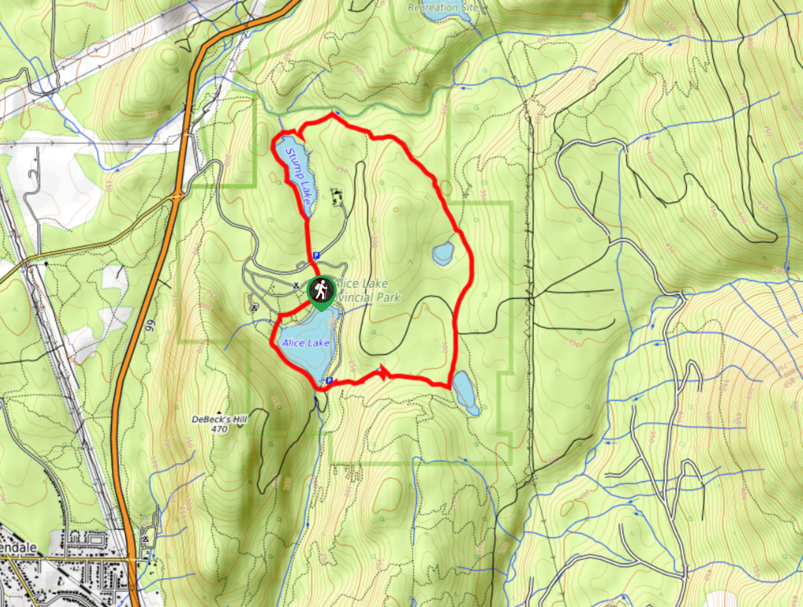
Four Lakes Trail
The Four Lakes Trail is a 4.5mi hiking route that travels through Alice Lake Provincial Park on a…
Shannon Basin Loop
The Shannon Basin Loop is a 5.9mi lollipop trail near Squamish, BC, that sets out from the top…
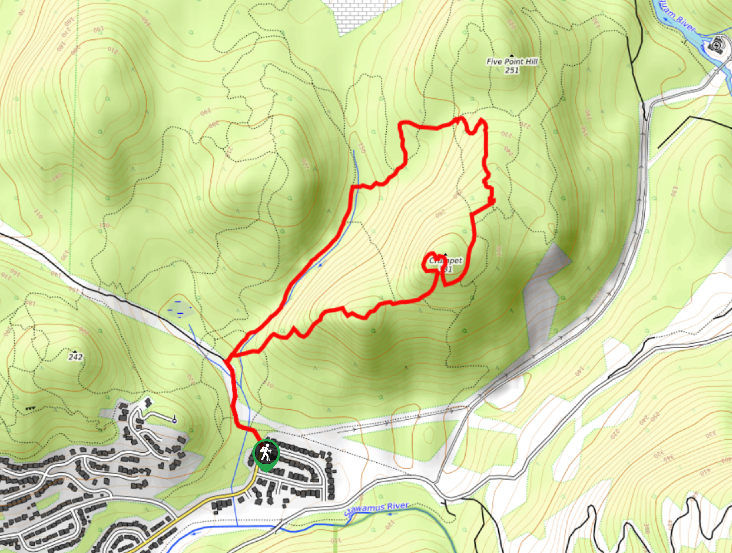
Mount Crumpit Trail
If you are into short hikes that will get your heart pumping and also have amazing mountain views, then the…
Allison Bailler 4 years ago
Stunning view of the summits! Take water, lunch, or protein bars. Lovely walk in the park
Jessie Illumin 4 years ago
Pretty awesome trails and views. If you don't feel like hiking up to the peaks you may go for a walk around the lower level trails. Great option for kids!
Emma Stanley 5 years ago
really great and well-maintained trails with a fabulous view of the surrounding area. i'm seeing myself visiting here again next summer!
Florian L. 5 years ago
Intermediate hike for non-hikers. But always worth it just for the stunning view alone. Would like to visit again if I would have the chance.
Kat Colada 5 years ago
This is an awesome hike. The place presents itself as an excellent option for outdoor activities for every profile.
EthelB. 5 years ago
Balance number of push & pull. Gravity is hard to beat, glad there's not much incline.
genevaoftheeast 5 years ago
Pretty good hike. Felt somehow secure while doing the hike. It was perfect for me and my 2 children.
loneranger 5 years ago
Superb hike with minimal effort. The scenery was astonishing.
Amethyst S. 5 years ago
View of the summits are stunning- the trail is noticeable, we had no trouble in following at all.
Wade Atkinson 5 years ago
It was awesome, easy with some challenge at times, lots of good views. Would do it again!