Garibaldi Highlands
View Photos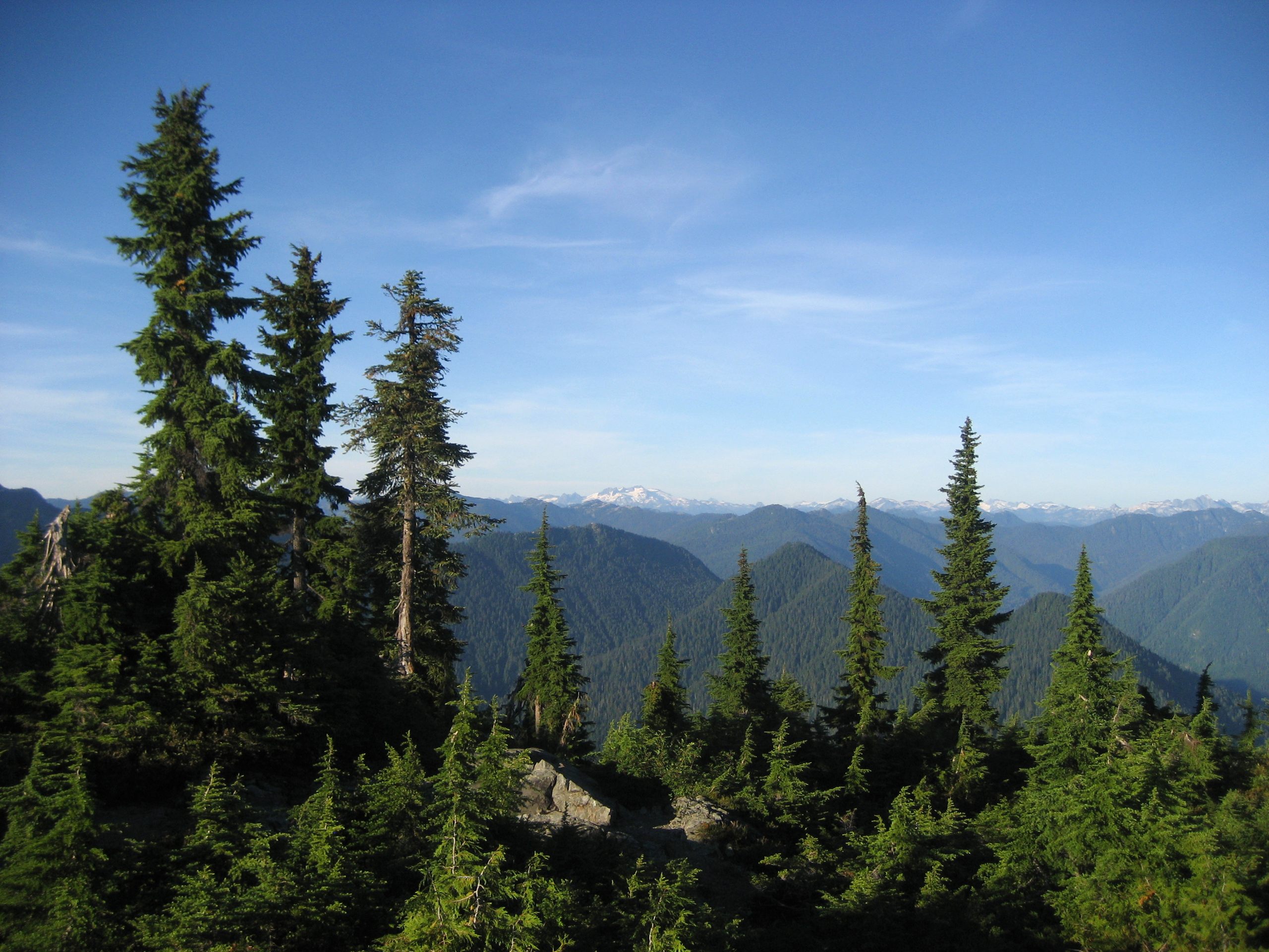
Garibaldi Highlands
Difficulty Rating:
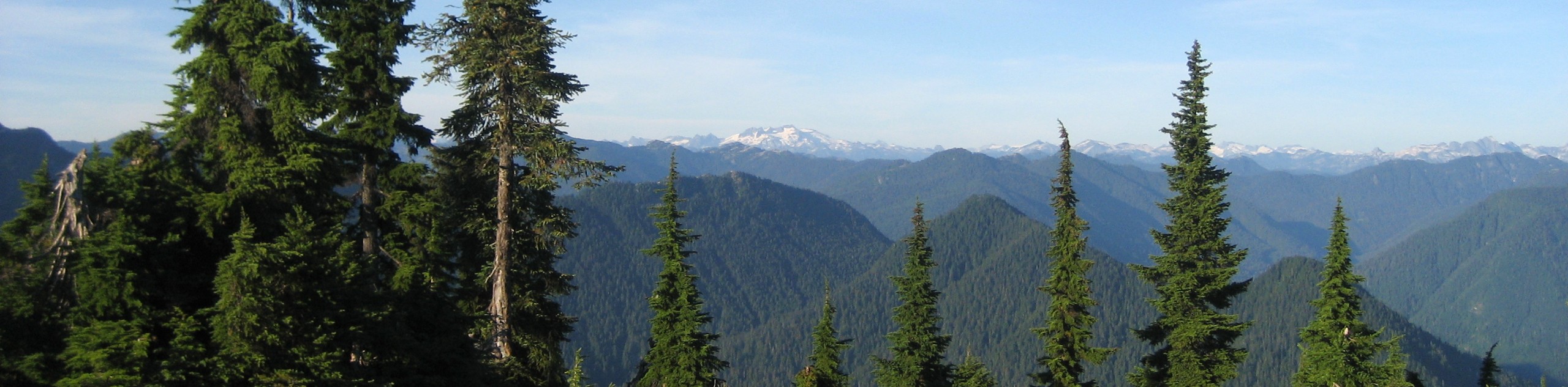
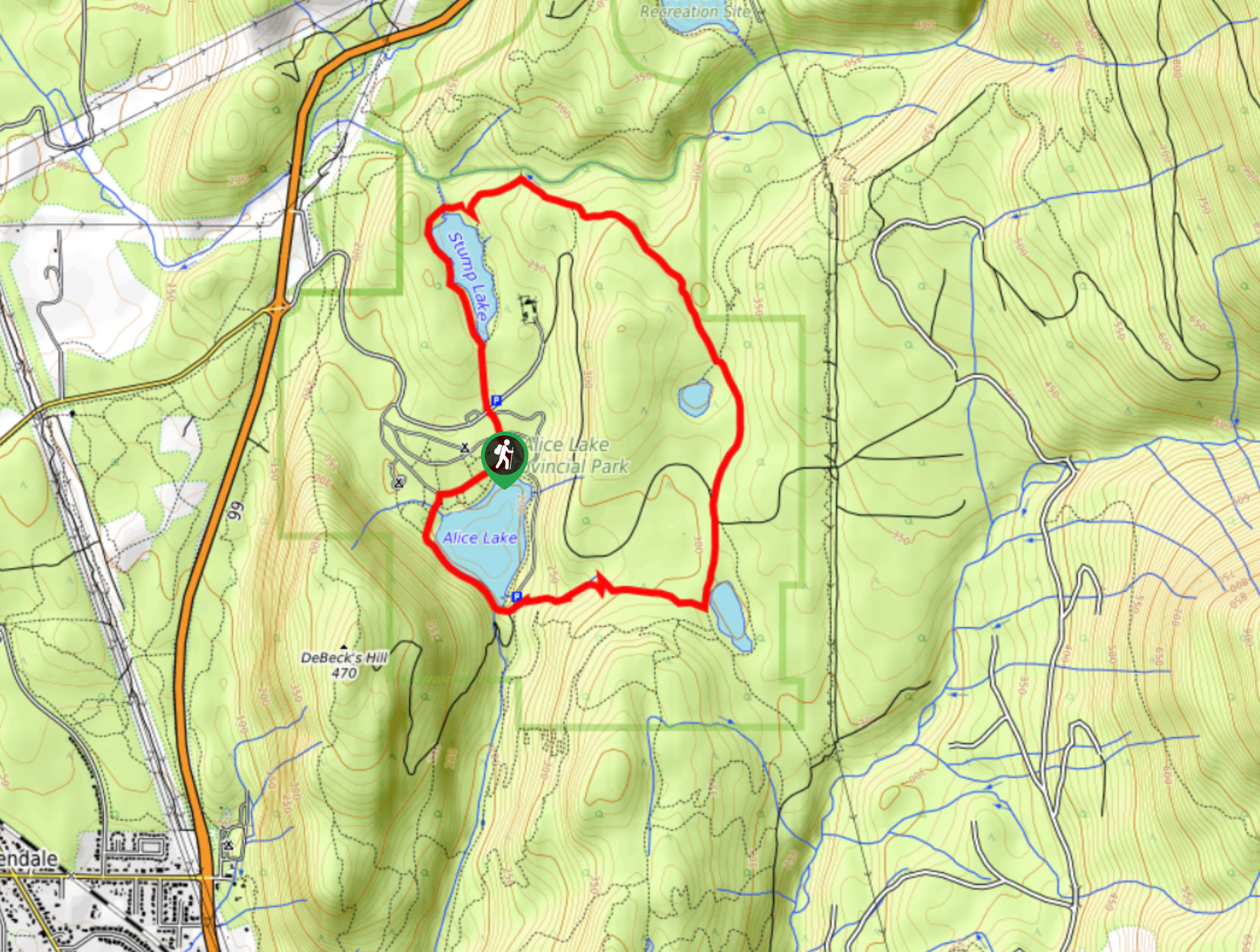
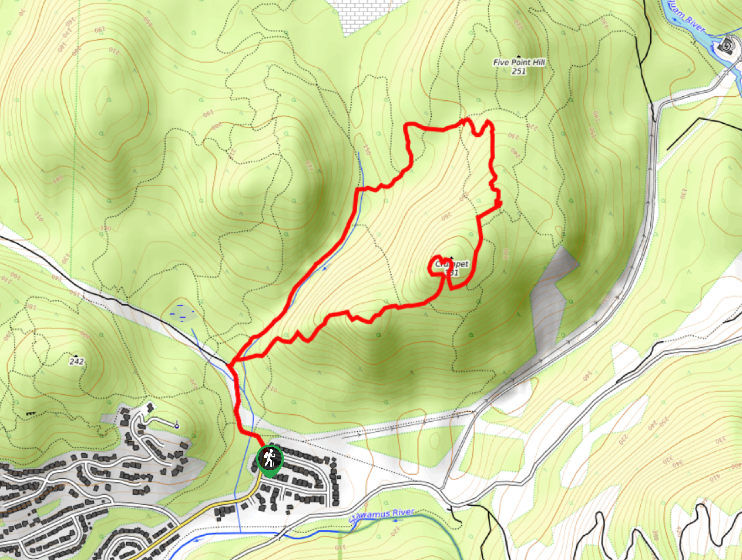
The Garibaldi Highlands hike is a 8.0mi lollipop trail that passes through the densely forested areas east of Squamish. Hikers will experience a beautifully scenic forest setting along the entirety of the route and witness beautiful views of the lakes within Alice Lake Provincial Park. With all of the shade provided by the lush tree canopy above, this route is perfect for a hot summer day outdoors.
Getting there
To reach the trailhead for the Garibaldi Highlands hike from the Sea to Sky Highway in Squamish, turn off onto Mamquam Road and follow it east for 2625ft. Turn left here onto Highlands Way S, following it for 2625ft until you reach a roundabout. Take the first exit on the roundabout onto The Boulevard and the second exit at the next roundabout onto Perth Drive. You will find the trailhead straight ahead in 0.7mi.

About
| When to do | May-October |
| Backcountry Campsites | Alice Lake Campground |
| Pets allowed | Yes - On Leash |
| Family friendly | Older Children only |
| Route Signage | Average |
| Crowd Levels | Moderate |
| Route Type | Lollipop |
Garibaldi Highlands
Elevation Graph
Weather
Garibaldi Highlands Trail Description
The Garibaldi Highlands hike is an amazing route along the eastern edge of Squamish that follows a densely forested trail into the recreation area within Alice Lake Provincial Park. This moderate 8.0mi trail passes through bear/cougar territory, so make sure to travel in groups and bring bear spray to prevent any incidents. It’s also advised to bring a GPS or trail map as the route is connected to a dense network of bike and hiking trails and it can be easy to get lost.
Along the trail you will hike under the dense, green canopy of the tree cover as you make your way north into the provincial park. From here, hikers will follow a loop that skirts alongside the scenic lakes within the provincial park. Take in the views of the tranquil Alice, Stump, Fawn, and Edith lakes before returning along the same route that you came in on. This trail has a small elevation gain, and the terrain isn’t very technical, making this a great intermediate-length outing for both casual and experienced hikers.
Similar hikes to the Garibaldi Highlands hike
Four Lakes Trail
The Four Lakes Trail is a 4.5mi hiking route that travels through Alice Lake Provincial Park on a…
Shannon Basin Loop
The Shannon Basin Loop is a 5.9mi lollipop trail near Squamish, BC, that sets out from the top…
Mount Crumpit Trail
If you are into short hikes that will get your heart pumping and also have amazing mountain views, then the…
Comments