
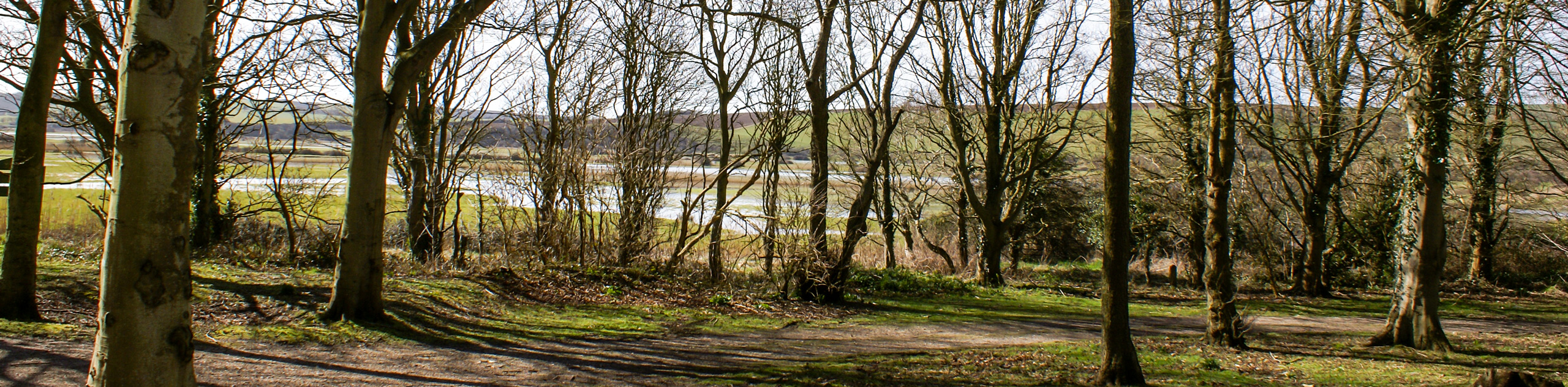
Hassocks to Lewes hike
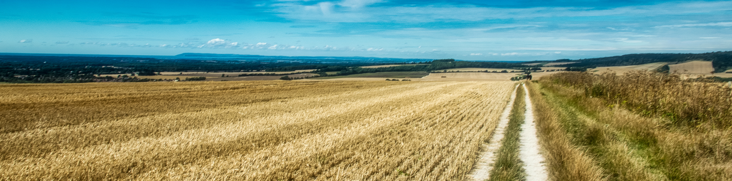
View Photos
Hassocks to Lewes hike
Difficulty Rating:
Another gem of a walk in the South Downs. This hilly walk leaves Hassocks and heads steeply uphill to the Jack and Jill windmills of Clayton. The walk then follows a relatively flat stretch of the South Downs Way, where hikers can relax and enjoy the panoramic views. The trail finishes along the River Ouse and into the historic town of Lewes, a wonderful place to explore or visit the castle.
Getting there
Both Hassocks and Lewes have direct train links to the surrounding area and London, making it an ideal hike to complete via public transport. If driving, park at Hassocks station using postcode BN6 8JD and then return by train from Lewes, with a train change half way in Brighton.

About
| When to do | April - September |
| Backcountry Campsites | No |
| Toilets | Yes, Hassocks and Lewes railway stations |
| Family friendly | No |
| Route Signage | Average |
| Crowd Levels | Low |
| Route Type | One Way |
Hassocks to Lewes
Elevation Graph
Weather
Route Description for Hassocks to Lewes
Exit Hassocks station via platform 2 and follow the footpath until you reach another footpath on your right, opposite The Hassocks pub. Follow the path downhill and when you reach Keymer Road (B2116) at the bottom turn right, then cross over to pick up the footpath on the other side, waymarked for the South Downs, just before the bridge. Continue straight ahead on this trail, for 1.0mi, as it follows the path of the railway line heading south.
Soon you hit a road (Brighton Road) and turn left. You immediately come to the B2112 (Clayton Hill), which you must cross over and then turn left down Underhill Lane (signed to Clayton) shortly afterwards. Walk down the lane, past The Church of Saint John the Baptist Clayton, and then right up the public bridleway just after Clayton Court Barn.
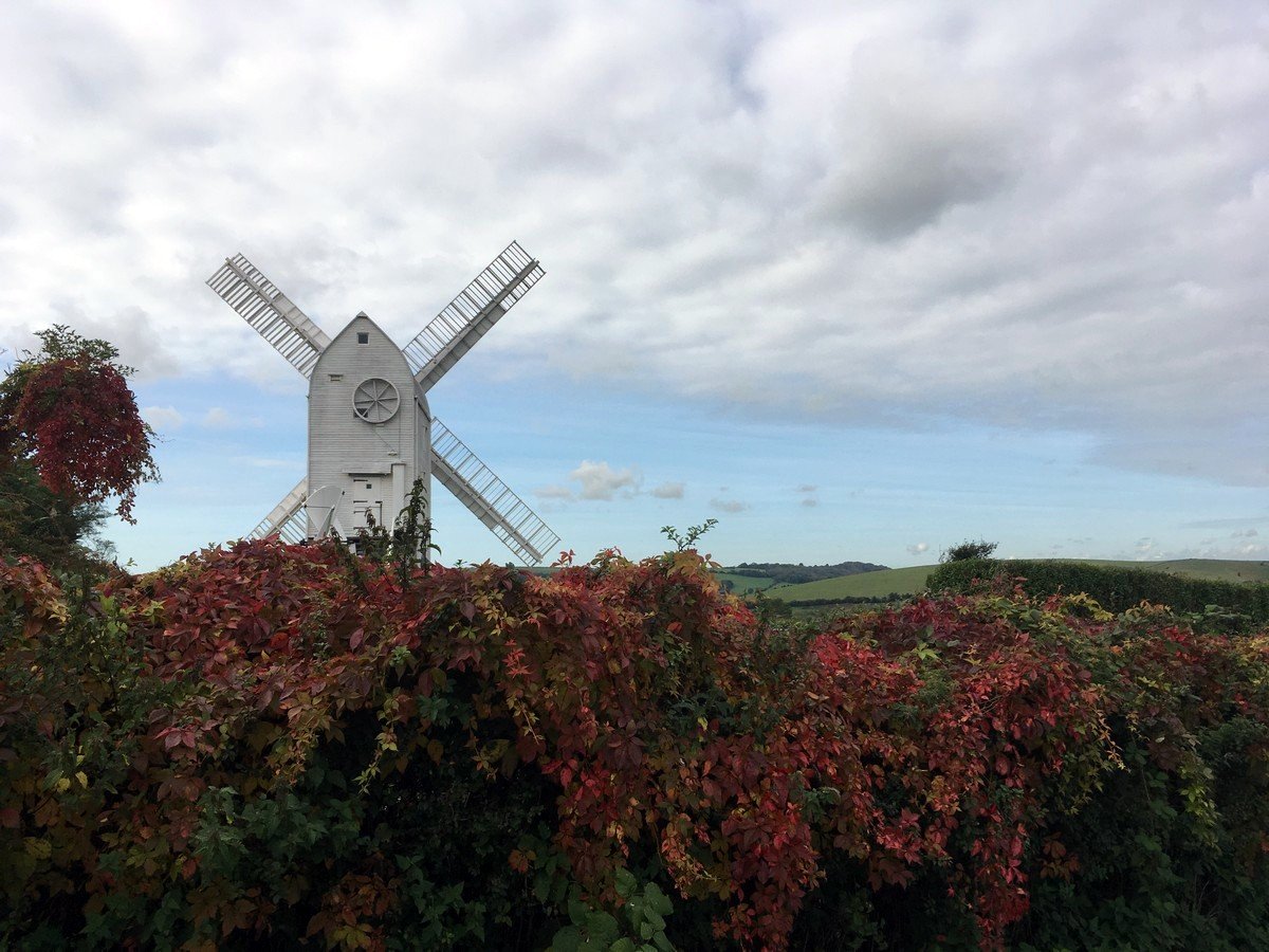
Turn left after passing through the gate at the top. The trail curves left then right as it climbs steeply uphill to the Jack and Jill Windmills at the top. Turn around here to enjoy impressive views over Clayton Holt.
At the top of the hill pass through the gate onto a narrow fenced in trail alongside the windmills. When you reach the T-Junction turn left, then left again after about 656ft to join the South Downs Way, in the opposite direction to Devils Dyke.
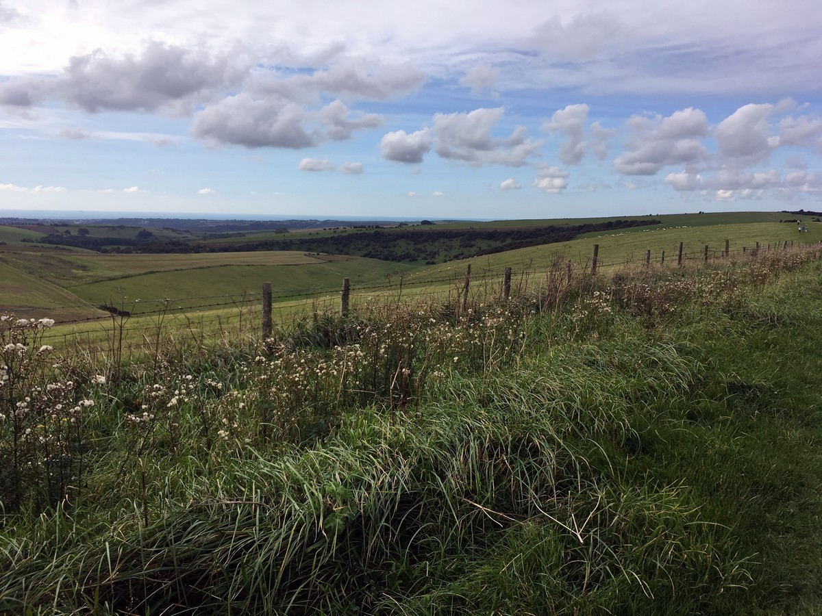
Continue on the clearly marked South Downs Way for just over 4.0mi. Along the way you’ll pass through six gates and Ditchling Beacon, enjoying continually far reaching views.
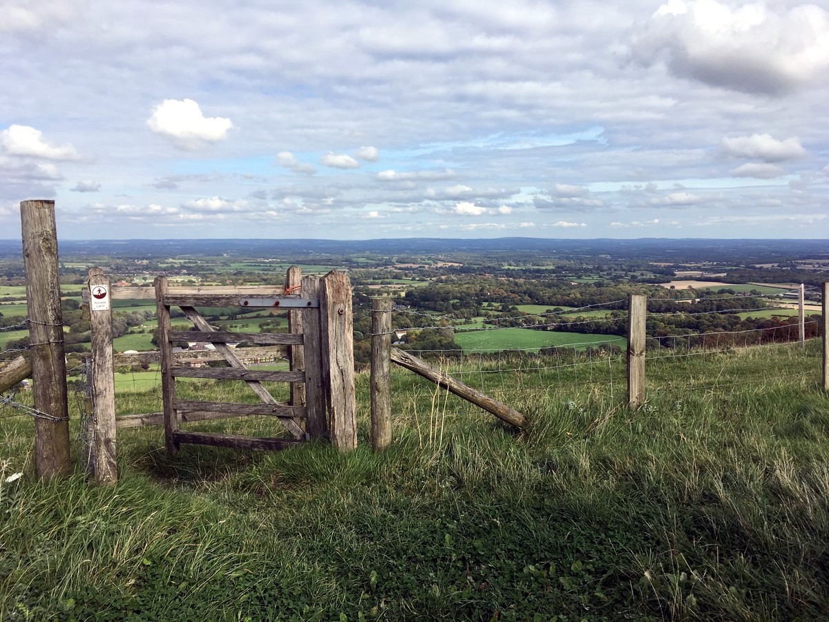
The South Downs Way turns right just before gate seven. At this point, leave the South Downs Way behind and pass through the gate, following the trail straight ahead into the Black Cap National Trust site.
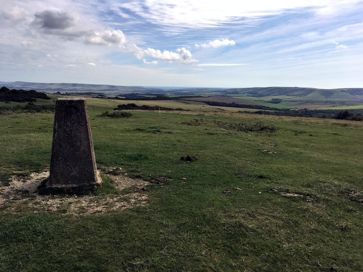
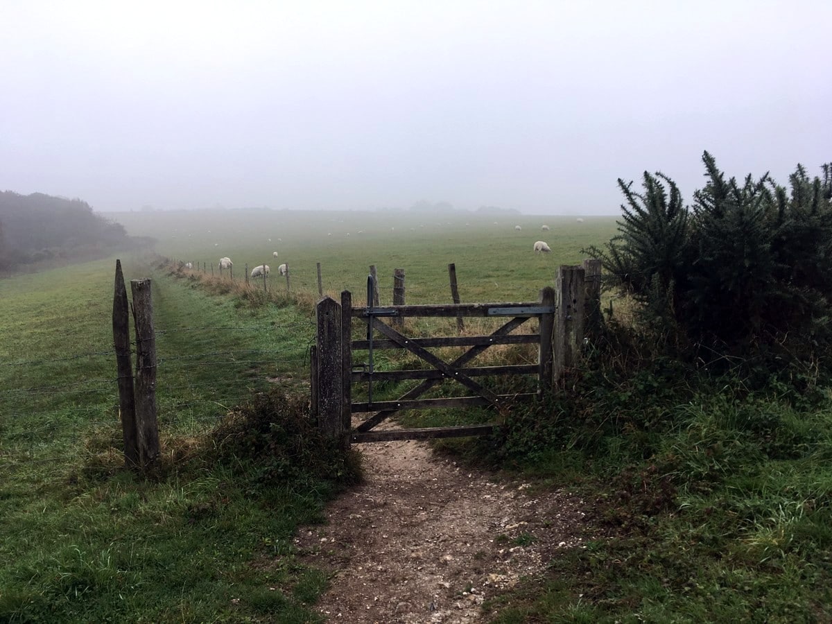
The trail forks shortly after the Black Cap trig marker, take the right-hand fork and follow it down-hill, until you reach a gate. Do not pass through the gate, instead turn left, across the field, until you reach another gate on your right.
Pass through this gate and continue on the main grassy trail, straight ahead. Go through the gate when you reach it and follow the narrow trail along the fence line on your right, ignoring all side trails. The trail turns to the right uphill and then to a T-junction shortly afterwards. Turn left and follow the grassy trail with a different fence line now on your right.
Turn right after passing through the gate and follow the trail into the woods and onto another gate. Pass through the gate and continue straight ahead until you reach another trail junction shortly afterwards. Turn left here, into the woods, and follow the narrow trail steeply downhill.
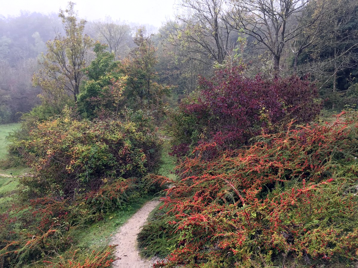
The trail exits the woods on top of a disused chalk pit, which makes for a great contrast in scenery, with views of Lewes ahead to the right. Follow the trail down the embankment and then turn left on the grass below, following the downhill trail all the way until you reach the A275 road at Offham.
Cross the A275 and go left for a short distance. Very quickly go right down The Drove. Just after passing the church look for the wide track directly ahead of you, before the road dips down to the left. Follow this main track for half a mile until another wide track joins from the left. Pass through the gate and walk on the grassy trail until you reach the River Ouse, just after passing under the railway bridge.
Turn right to follow the river for almost 1.5mi, crossing over the bridge along the way and continuing in the same direction on the other side. Pass under the road bridge (A2029) and then up the embankment as the river side trail comes to an end.
Follow Jenners Way to the right, alongside the brewery and straight ahead into the town. Turn right onto Cliffe High Street and follow the pedestrianised street back over the river and uphill until you reach Eastgate Street. The many cafes and shops make this a great place to pause before returning to the station.
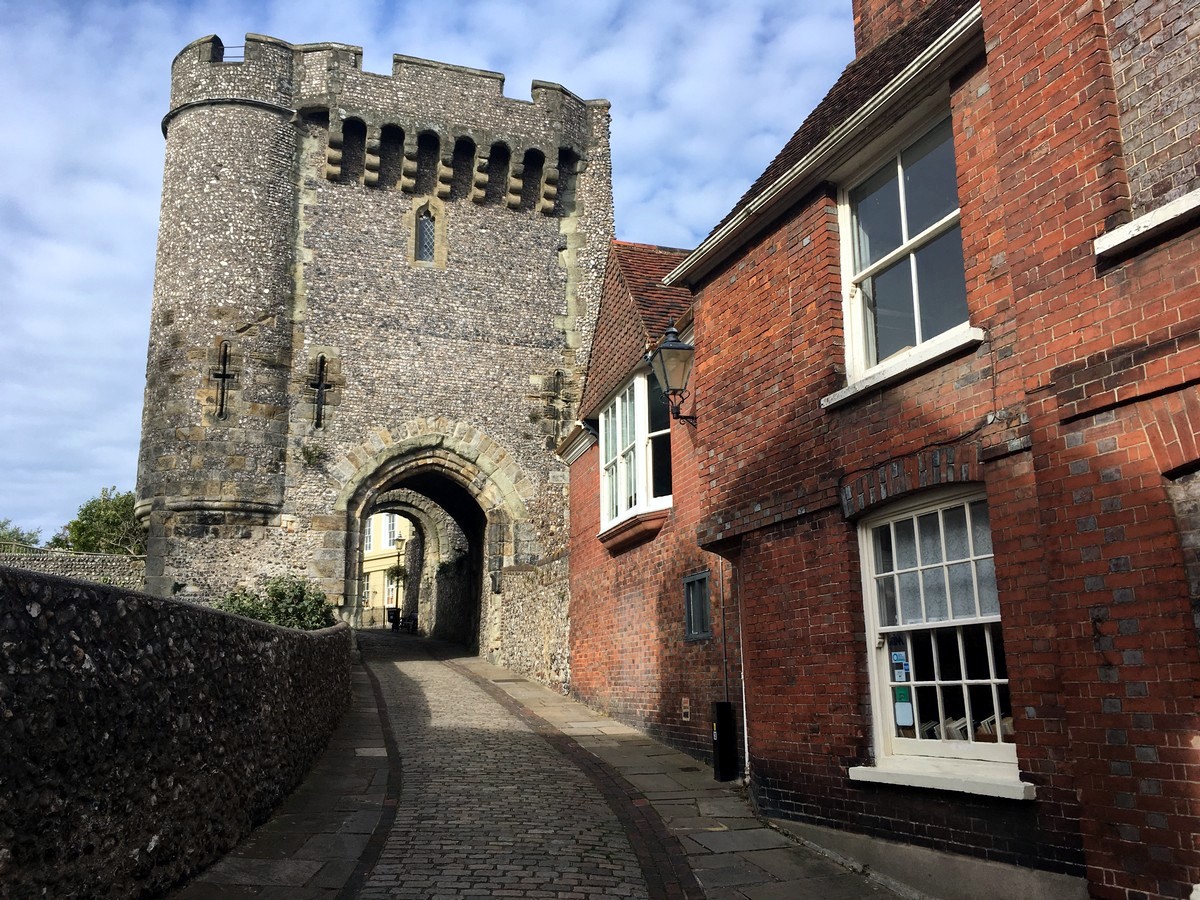
Turn left on Eastgate street then over the next road and continue in the same direction on Friars Walk until you reach Station Road. Turn left to access the station or turn right for visitor information and Lewes Castle.
Insider Hints
The Jill Windmill in Clayton, which you pass 1.5mi into the trail, is a fully restored 19th Century corn windmill open to visitors. Check for up to date opening times.
The shorter, but almost as challenging, Glynde and Mount Caburn hike is very nearby and offers spectacular views out to the ocean.
Blackberry Wood Glamping Campsite, between Hassocks and Lewes, offers fun opportunities to sleep overnight in a tree house, double decker bus or even a 1965 helicopter!

Similar hikes to the Hassocks to Lewes hike
Amberley Wild Brooks Walk
The Amberley Wild Brooks and Bignor Roman Villa Walk offers a special mix of views, wildlife and history. The George…
Friston Forest Walk
The Friston Forest Walk is a beautiful, pet-friendly walk. Take in the stunning, rolling hill views of the surrounding English…
Trundle and Devils Humps Walk
Take in the stunning views of Solent and Isle of Wight that can be seen in the distance. Another wonderful…
Ray M 4 years ago
Amazing countryside experience. The windmill and farms were magnificent.
Sun Lee 4 years ago
It's nice to see that they have restored the old Jill Windmill. It's a nice attraction to visit.
Teresita 4 years ago
It was quite a long walk but nothing challenging so It's perfect for me!
Avamichelle82 4 years ago
Hassocks to Lewes is brilliant! Came here early in the morning to enjoy its full glory. Highly recommended!
Hunter156 4 years ago
Started as a difficult hike with many elevated terrain. Ended with a rewarding view of the river and a beautiful castle.
summernathan 4 years ago
The views are unbelievable. I never thought I'll find such interesting views in here.
AnnePark 4 years ago
We had a pleasant walk around the village and open fields.
OscarDavid 4 years ago
It's nice that they were able to preserve the castle. It's so cool.
WanderLee 4 years ago
Jill Windmills at the top was great, challenging hike with generous views
Harrypotter 4 years ago
Great hike. Bit long, not the best weather but still enjoyed it plenty.