Elidir Fawr from Deiniolen
View Photos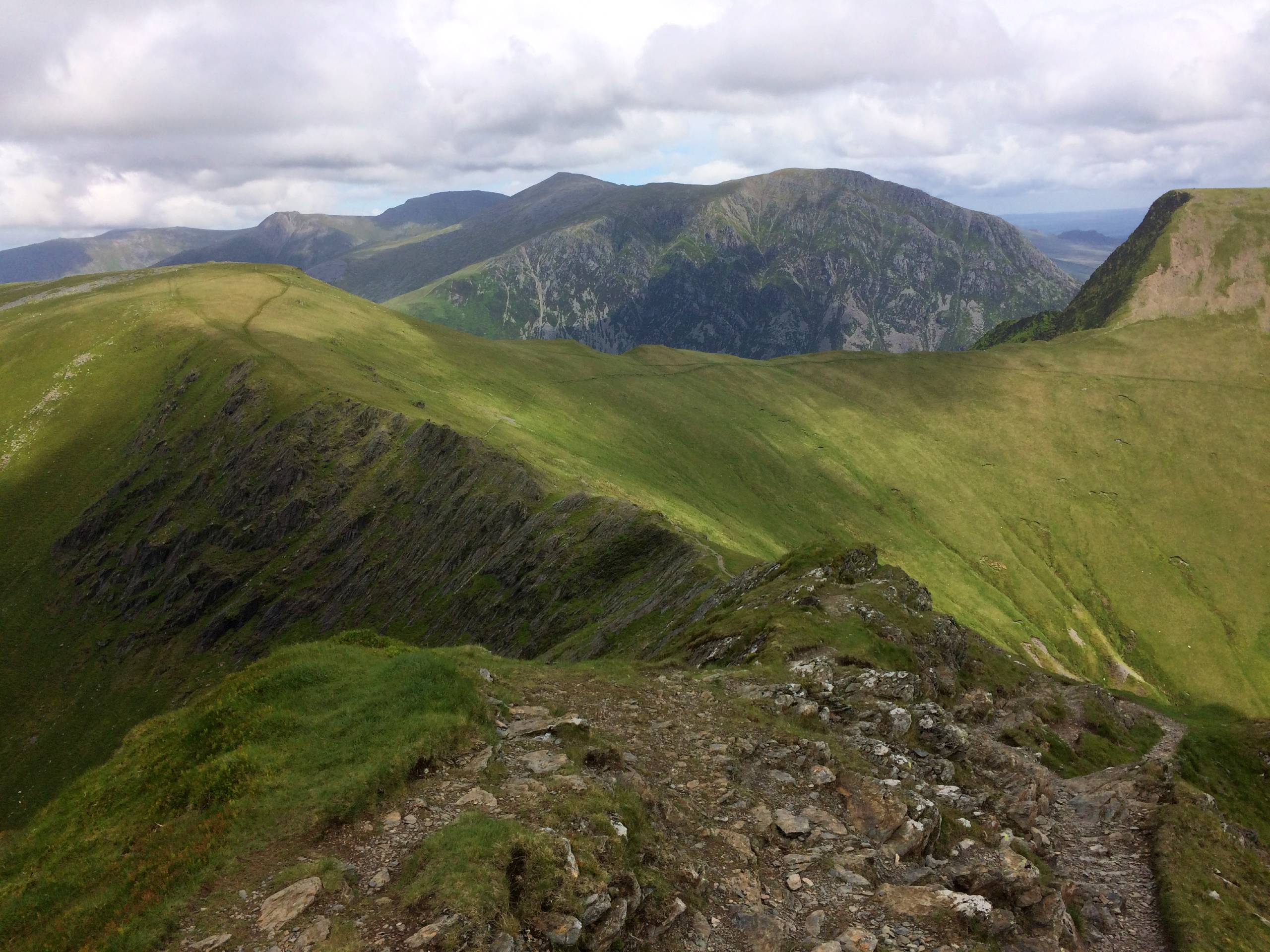
Elidir Fawr from Deiniolen
Difficulty Rating:
Elidir Fawr is known as the “Electric Mountain” for the hydro station hidden deep within—and the views from the top will have you feeling pretty electric yourself. This walk from Deiniolen offers convenient access to the northern reaches of the Glyderau range, with four summits to conquer. It’s an excellent adventure for seasoned walkers with a half-day to spare.
Getting there
To access Elidir Fawr from Deiniolen, drive east from the village and head for a car park marked on online maps as the “start of walk to Marchlyn Reservoir.” Parking is free.

About
| When to do | March–November |
| Backcountry Campsites | No |
| Pets allowed | Yes - On Leash |
| Family friendly | Older Children only |
| Route Signage | Poor |
| Crowd Levels | Moderate |
| Route Type | Lollipop |
Elidir Fawr from Deiniolen
Elevation Graph
Weather
Elidir Fawr from Deiniolen Description
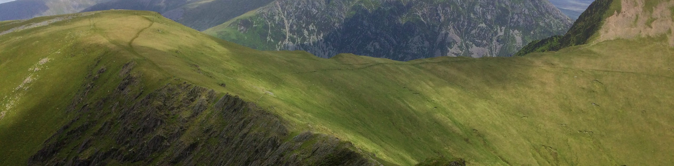
From the car park, head straight along the road, following the signs for the Marchlyn reservoir. The direct route takes you to the right of the smaller lake (Marchlyn Bach), where you clamber over a locked gate and begin a steep ascent. A wall to your right is the best guide to keep as there’s not much of a path on the way to Elidir Fach, the first summit on the walk. Wonderful views of Llanberis and the sparkling waters of Llyn Padarn unfold to the west.
The peak of Elidir Fawr awaits just east of you. There’s a flat section, then a short but steep climb through rocky scree to reach a cairn at the top of the path. As the high point of this route, there’s plenty to see in clear weather, from Llyn Padarn and Llyn Peris in the west to the imposing peaks of the Glyderau range in the near southeast. Take plenty of care along the rocky ridge of the Elidir Fawr summit, as the surface can be very loose.
The same advice applies as you descend to Bwlch y Brecan. Stick close to the ridgeline with views over the placid Marchlyn Mawr on your left. A faint path back up to Mynydd Perfedd leads you to a third summit on the day. There’s a handrail to guide your way to the summit shelter, particularly handy in poor conditions. A flat section stretching for roughly a kilometre leads you to the cliffs of Carnedd y Filiast, where you hop over a stile against a stone wall to reach the final summit.
Your descent follows a north-northwest path that angles left through areas of higher ground. Keep your eyes peeled for a sharp right that provides a clear path for the rest of your descent; otherwise, there will be plenty of boulders to navigate. At a small pool in the col, turn left onto a wider path and continue a fairly straightforward descent past Marchlyn Bach and onto the road that you came in on.
Similar hikes to the Elidir Fawr from Deiniolen hike

Foel Goch via Bwlch Tryfan Walk
A walk up Foel Goch via Bwlch Tryfan is an excellent way to take in the iconic beauty of Tryfan…
Snowdon via Crib Goch and Miner’s Track
Of all the many routes up Snowdon, this approach via Crib Goch may be the most demanding! The walk starts…
Y Garn and the Glyderau
The Glyderau may be the most celebrated mountain range within Snowdonia National Park, and this full-day adventure visits the highlights!…
Comments