Rhinog Fawr from Graigddu-isaf
View Photos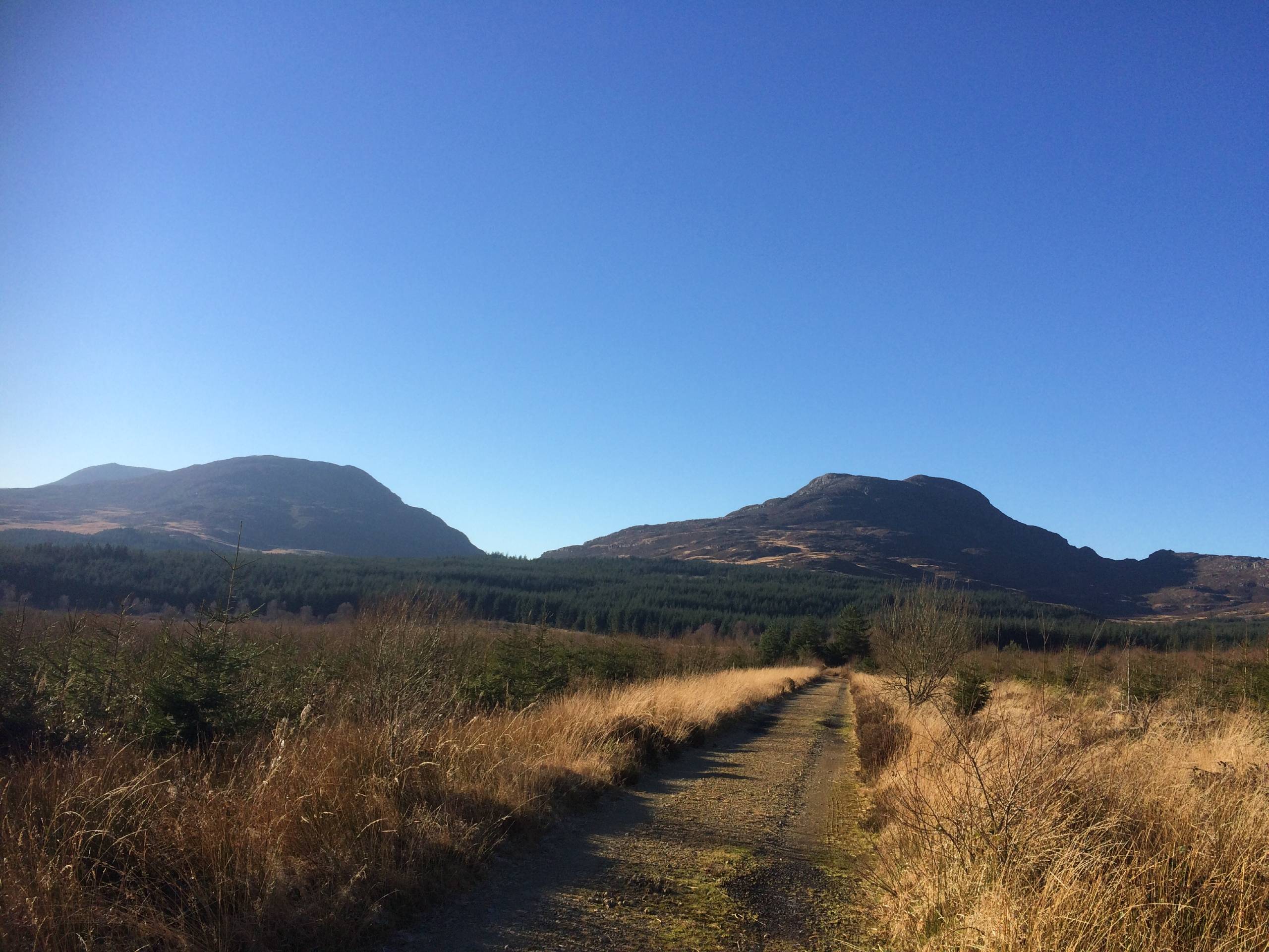
Rhinog Fawr from Graigddu-isaf
Difficulty Rating:
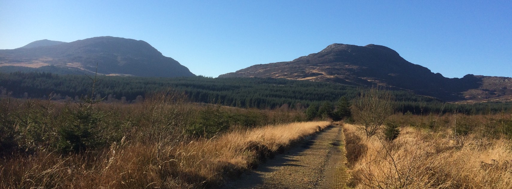
Rhinog Fawr is known as one of Snowdonia’s wildest mountains. This walk from Graigddu-isaf provides relatively easy access to one of the most remote and breathtaking corners of Snowdonia National Park. It’s a climb that requires a good deal of effort and route-finding, but the views from the summit are worth the work.
Getting there
To access the start of this Rhinog Fawr walk, head for the Graigddu-isaf car park. The closest village is Bronaber; head south from here along the A470 for about a mile, and take your first right along an access road. The car park is approximately two miles down this road.

About
| When to do | March–October |
| Backcountry Campsites | No |
| Pets allowed | Yes - On Leash |
| Family friendly | No |
| Route Signage | Poor |
| Crowd Levels | Low |
| Route Type | Lollipop |
Rhinog Fawr from Graigddu-isaf
Elevation Graph
Weather
Rhinog Fawr from Graigddu-isaf Description
From the car park, set off on a signed track to your right for Pistyll Gwyn. An easy path through the woods passes by a lovely little waterfall—but don’t linger too long since there’s a mountain to climb. Cross over a broad forestry track and continue along the path, with signs for Bwlch y Tiddiad pointing the way. You’ll come to the edge of the forest and find an information board for the Rhinog National Nature Reserve.
Continue along the path just past the board for about 1640ft until you see a path off to the left. It’s likely to be wet, so prepare for a bit of muck. Take this path to the shores of Llyn Du, a serene little lake. Bear left and cross a small stream, coming to large rock slabs and then a boulder field near the eastern end of the lake. There’s a small path on the right that may take keen eyes to spot. Once you’re through this section, a flatter portion with a broad path leading from Cwm Bychan awaits, but the real approach to the summit lies to the left with a faint path leading into a rocky gully.
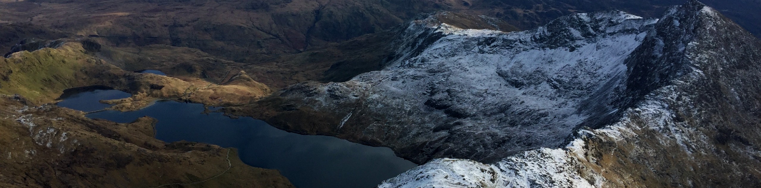
You’ll need to do a brief scramble up these rocks to reach the summit plateau. In clear weather, the views over Rhinog Fach and the distant Llyn Peninsula are simply stunning. Your descent requires great care—look for a path that leads southwest to a wall along the western flank of the mountain. A cairn marks the spot where you can follow the wall along a path that leads down to Llyn Du. From here, stick close to the water as you round the lake, then return through the forest the way you came.
Similar hikes to the Rhinog Fawr from Graigddu-isaf hike

Foel Goch via Bwlch Tryfan Walk
A walk up Foel Goch via Bwlch Tryfan is an excellent way to take in the iconic beauty of Tryfan…
Snowdon via Crib Goch and Miner’s Track
Of all the many routes up Snowdon, this approach via Crib Goch may be the most demanding! The walk starts…
Y Garn and the Glyderau
The Glyderau may be the most celebrated mountain range within Snowdonia National Park, and this full-day adventure visits the highlights!…
Comments