Aberglaslyn Pass Walk
View Photos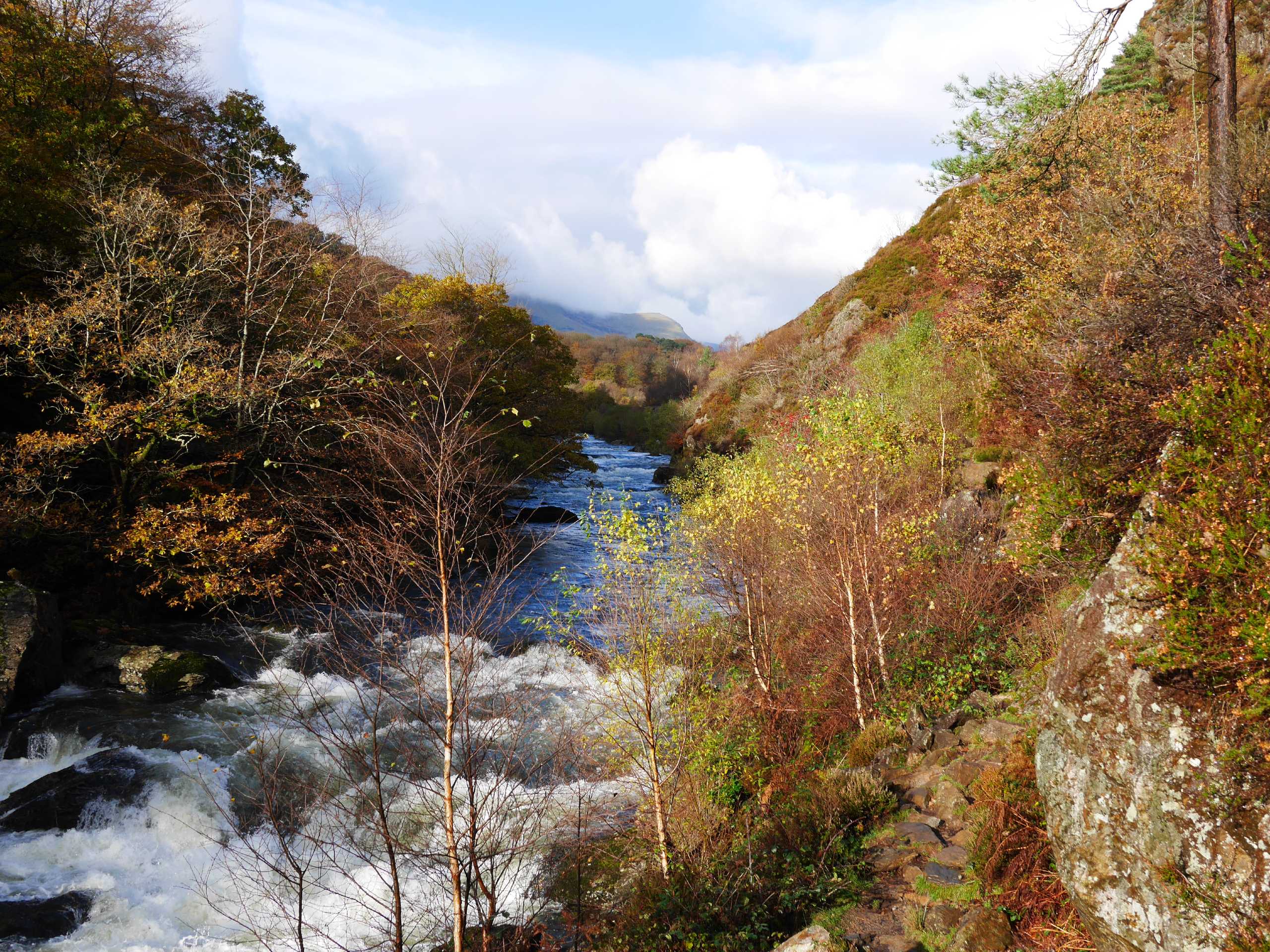
Aberglaslyn Pass Walk
Difficulty Rating:
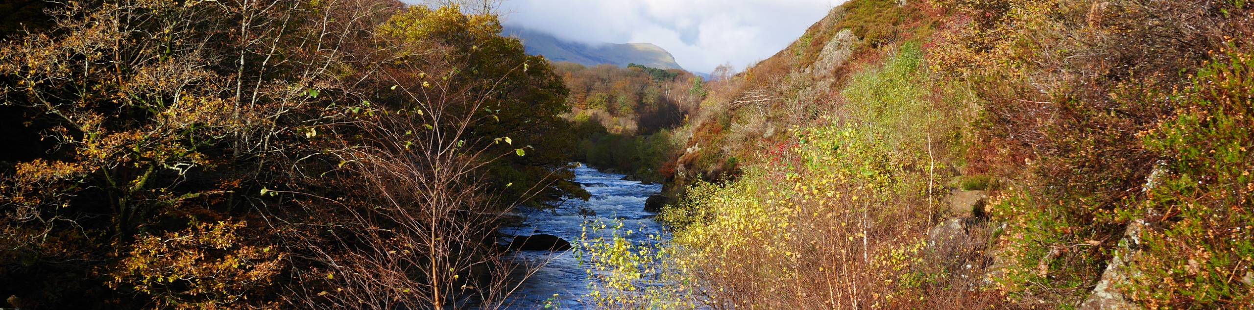
The Aberglaslyn Pass Walk is an excellent choice for those with their eyes on a hearty adventure but want something other than a mountain climb. This circular walk takes you through the Aberglaslyn Gorge and follows the Afon Glaslyn River along much of its first half. You’ll reach the shores of stunning Llyn Dinas, then turn south away from the lake for the return portion. Ascend a hill to reach the highest point of the walk, then descend along the valley, where the remains of an aerial ropeway can be found as you make your way back to the starting point.
Getting there
To start the Aberglaslyn Pass Walk, head for the village of Nantmor, only about 5 minutes driving south from Beddgelert along the A498. If you are going this way, take a left onto the A4085. Almost immediately, you’ll find a National Trust car park to start the walk from.

About
| When to do | March–November |
| Backcountry Campsites | No |
| Pets allowed | Yes - On Leash |
| Family friendly | Older Children only |
| Route Signage | Average |
| Crowd Levels | Moderate |
| Route Type | Circuit |
Aberglaslyn Pass Walk
Elevation Graph
Weather
Aberglaslyn Pass Walk Description
Starting from the Nantmor car park, head through a gate near the toilets and turn left for Aberglaslyn. When you reach the Afon Glaslyn River, turn right along a fisherman’s path and follow it upstream. Be sure to walk carefully along this section of the gorge, where the rocks can be quite slippery. Eventually, you’ll reach a point where the path intersects with the railway line beside a bridge. Cross over the tracks with caution, then cross the bridge and continue upstream, the river now on your right-hand side.
At Beddgelert, cross back over the river on a footbridge, then turn left to keep walking upstream. You’ll quickly cross over a street, where a gate awaits. Pass through this gate and continue. At the next gate, you’ll spot a narrow path leading to the right—turn onto this and take the path past the Sygun copper mine. This path leads a short way from the river but eventually returns to its banks, where another right turn takes you along the final stretch to Llyn Dinas.
Enjoy some lovely views of the lake. When you’re ready to head back, find a zig-zag footpath on your right, quite close to where you came in. This is the major ascent portion of the route as you walk up the hill relatively quickly. At the top, continue for about 2625ft, taking the second right at a fork. At Bwlch Y Segun, you’ll begin your descent. Take the left path heading south, then stick right for a straightforward shot back to the Nantmor car park.
Similar hikes to the Aberglaslyn Pass Walk hike

Foel Goch via Bwlch Tryfan Walk
A walk up Foel Goch via Bwlch Tryfan is an excellent way to take in the iconic beauty of Tryfan…
Snowdon via Crib Goch and Miner’s Track
Of all the many routes up Snowdon, this approach via Crib Goch may be the most demanding! The walk starts…
Y Garn and the Glyderau
The Glyderau may be the most celebrated mountain range within Snowdonia National Park, and this full-day adventure visits the highlights!…
Comments