Hite Cove Trail
View Photos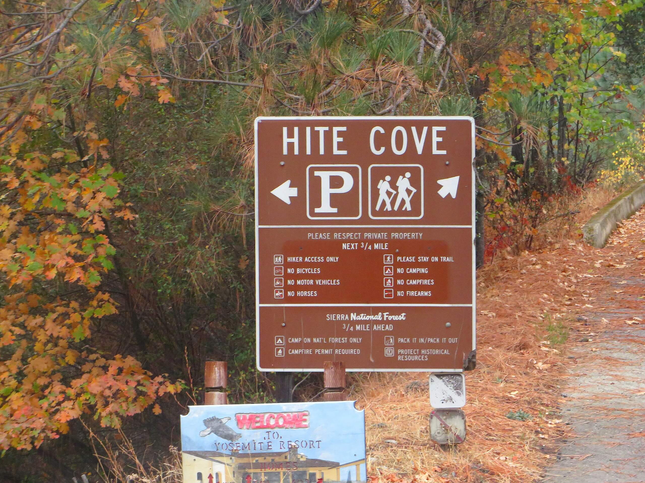
Hite Cove Trail
Difficulty Rating:
The Hite Cove Trail is a wonderful adventure in the Sierra National Forest that boasts awe-inspiring views of the Sierra Nevada Mountains. Wander through the South Fork Merced River valley, along the rushing waters, and through the meadowlands abundant with wildflowers.
Getting there
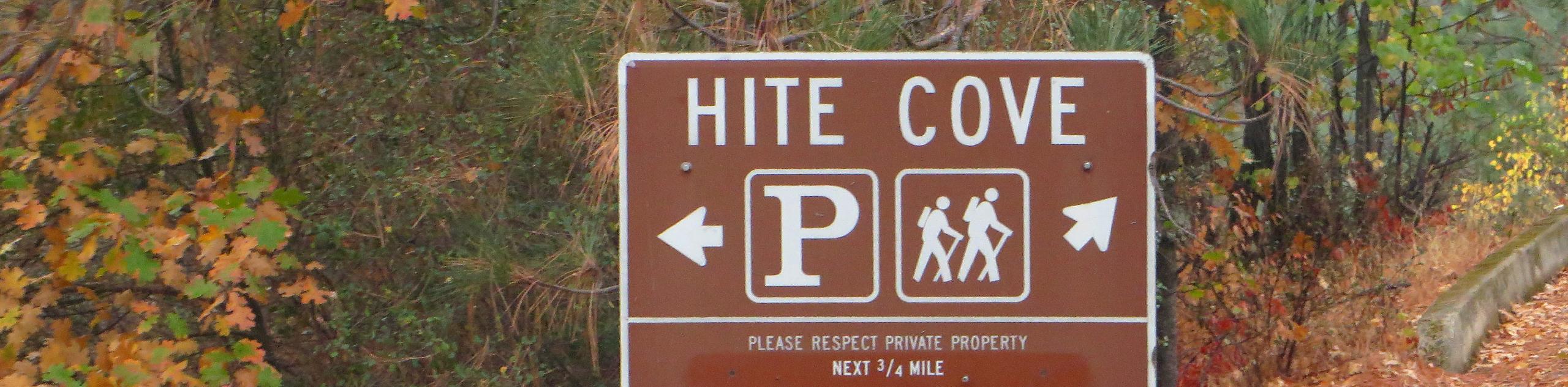
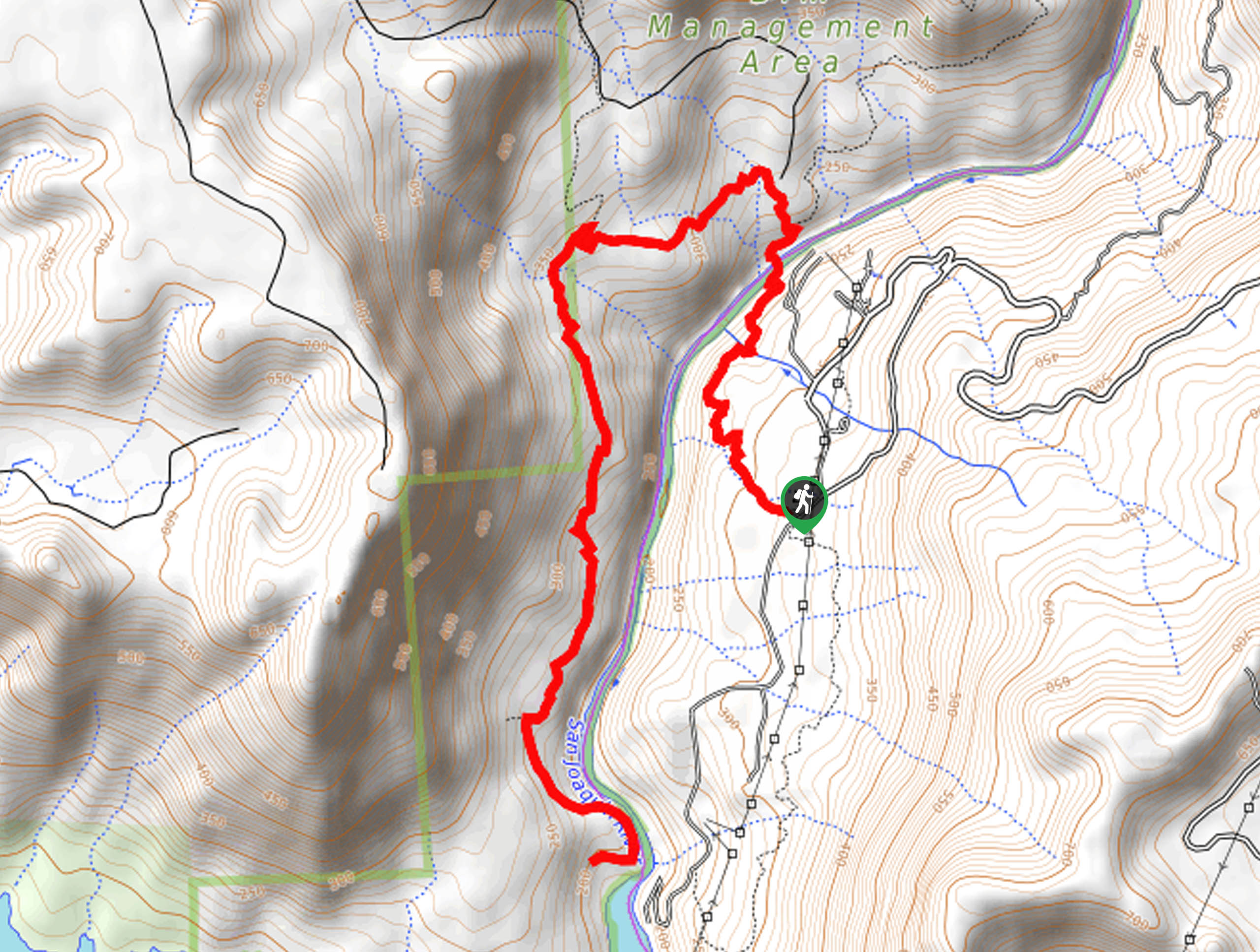
The Hite Cove Trail departs from the trailhead off Central Yosemite Highway.

About
| Backcountry Campground | Backcountry Camping, wilderness permit required. |
| When to do | Year-round |
| Pets allowed | Yes |
| Family friendly | Older Children only |
| Route Signage | Average |
| Crowd Levels | Moderate |
| Route Type | Out and back |
Hite Cove Trail
Elevation Graph
Weather
Hite Cove Trail Description
Indulge yourself in the stunning alpine scenery along the Hite Cove Trail. This epic adventure exposes breathtaking views of the Sierra Nevada Mountains as you wander through the river valley below. Let the stunning wildflowers motivate you as you meander the undulating path through the exposed valley. Note this unshaded path gets extremely hot in the summer months, and many have been subject to heatstroke, so wear sun protection, pack plenty of water, and head out in the morning to beat the heat.
Unfortunately, this route is also subject to sporadic closure due to fire danger.
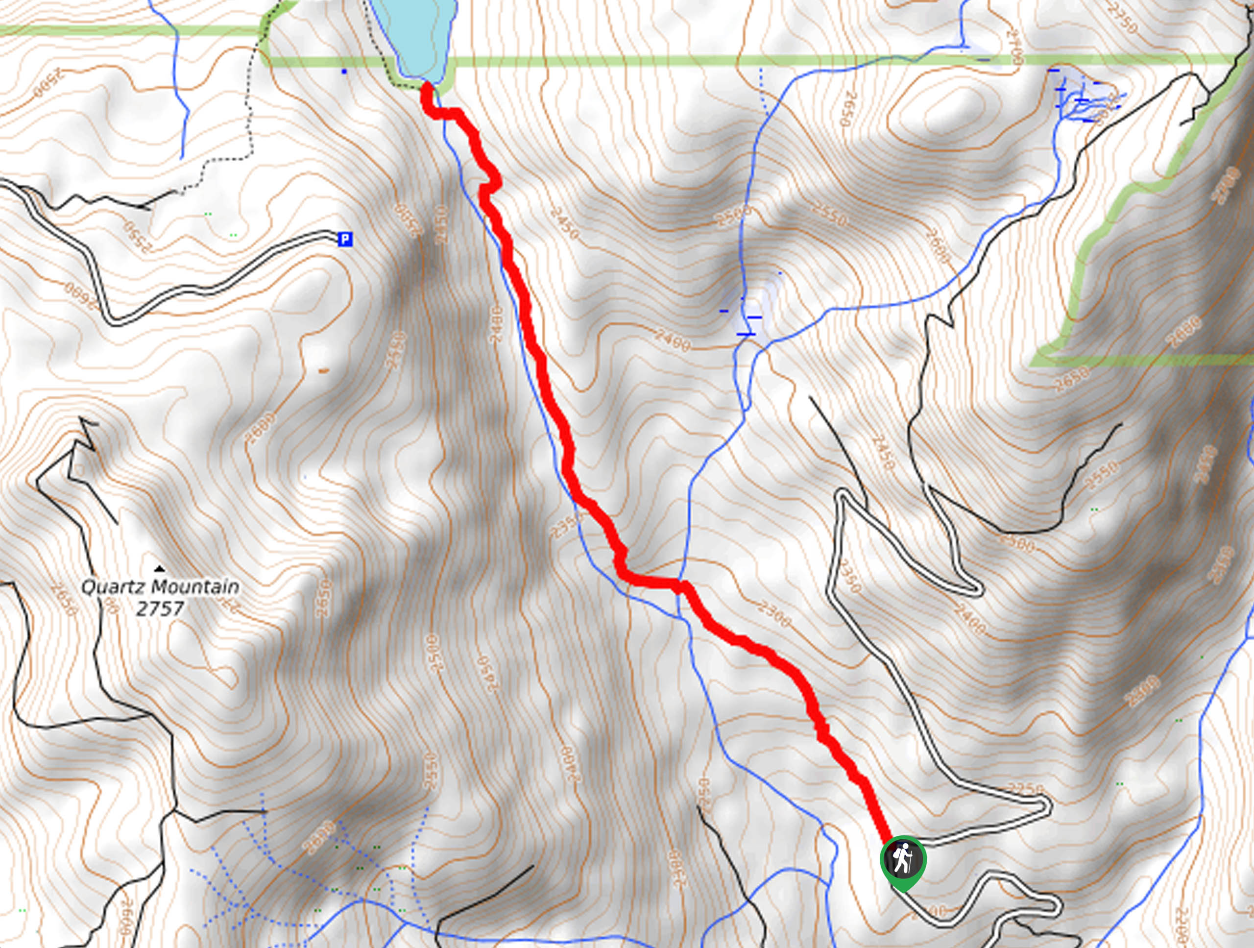
Setting out from the trailhead, the Hite Cove Hike follows the Hite Cove Trail southeast. Setting out from the trailhead, the path will climb before undulating through the valley. As you hike, the path will climb and descend through wildflower meadows along the rushing waters of the Merced River. Revel in the beauty of the imposing mountains as you wander and dip your tired feet in the chilly alpine waters to cool off. Mind your footing on the rocky terrain as you navigate the narrow sections of the path.
You will eventually reach the turnaround point at the intersection with Hite’s Mine Road. From here, turnaround and retrace your footing along the path all the way back to the trailhead.
Similar hikes to the Hite Cove Trail hike
Post Corral Meadows Trail
A popular backpacking route turned epic day hike, the Post Corral Meadows Trail is an epic back-country expedition. Hike amongst…
Chiquito Pass Trail
The Chiquito Pass Trail is arguably one of the most scenic adventures in the Sierra National Forest. Wander up through…
Wuh-Ki'o Trail
The Wuh-Ki'o Trail is an unassumingly picturesque adventure in the Sierra National Forest. Traveling through meadowlands, brush, over bridges, and…
Comments