
Sunset Rock Hike
View Photos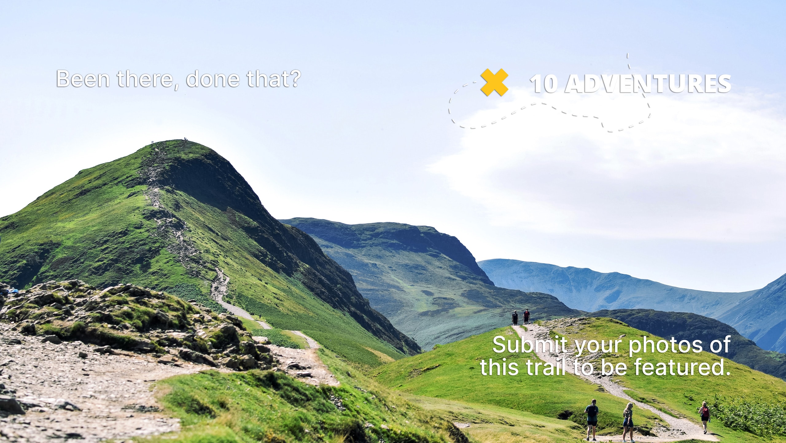
Sunset Rock Hike
Difficulty Rating:
The Sunset Rock Hike is an easy-going adventure in the Sequoia National Park that reveals spell-binding panoramas of the High Sierra and Kaweah Valley. Head out in the evening for an unforgettable experience—watching the sunset over the granite mountainscape.
Getting there
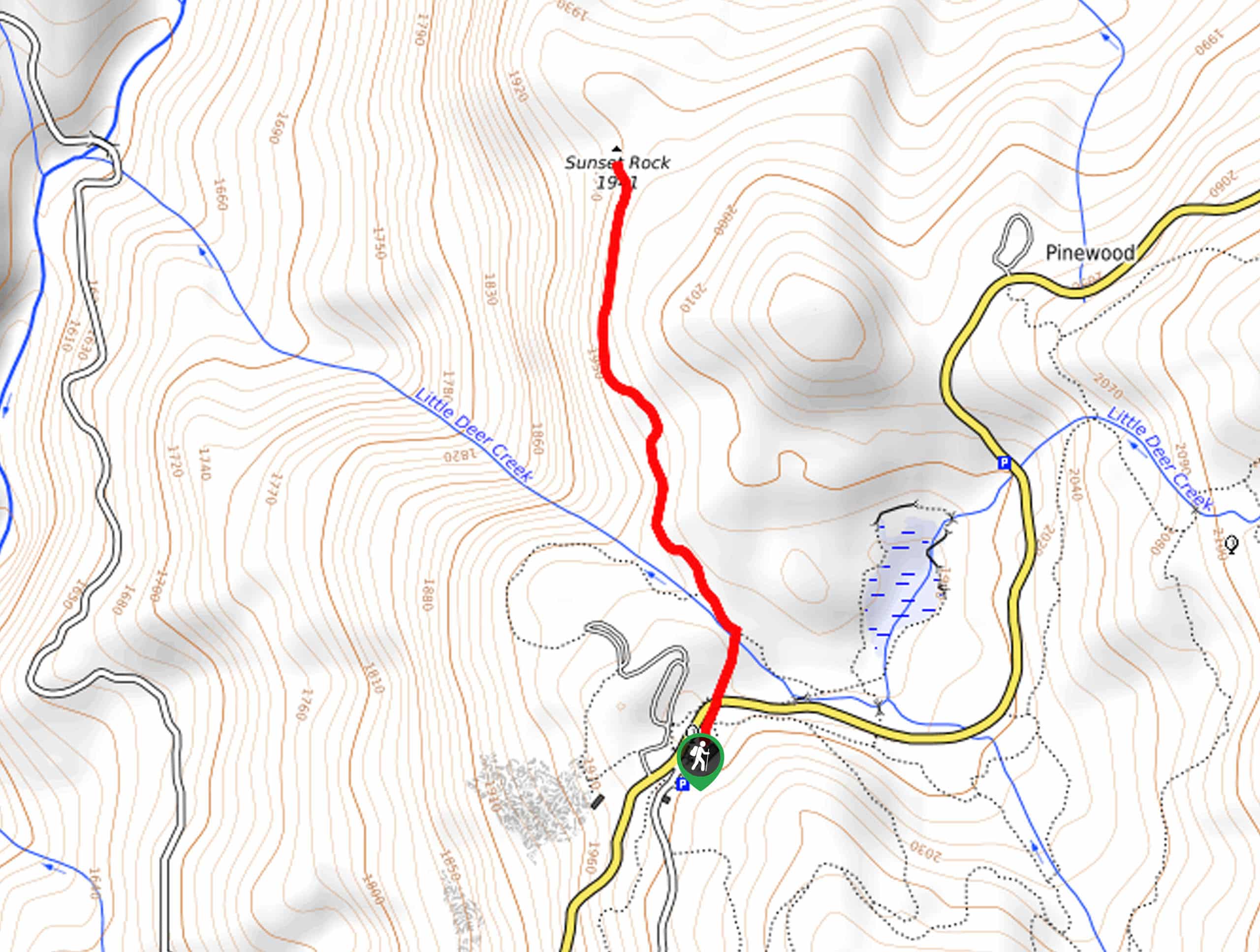
The Sunset Rock Hike is accessed via the trailhead off Generals Highway.

About
| Backcountry Campground | No |
| When to do | April-October |
| Pets allowed | No |
| Family friendly | Yes |
| Route Signage | Average |
| Crowd Levels | Moderate |
| Route Type | Out and back |
Sunset Rock Hike
Elevation Graph
Weather
Sunset Rock Hike Description
Boasting the perfect overlook of the sun setting over the Sierra Nevada, the Sunset Rock Hike is a well-traveled route in the National Park. The undulating path progresses through the mixed forestland to the barren overlook above the river valley– note there are some sheer drop-offs here, so mind your footing and maintain a safe distance from the edge.
Revealing dumbfounding views, the exposed granite bluff warrants extreme conditions, so check the forecast and dress accordingly! In the afternoon sun, SPF is a must and plenty of water! Unlike most hikes in the area, this trail is busiest in the evening, so mornings boast a more tranquil experience. Note entrance to the park costs $35USD per vehicle or $20USD per person for pedestrians or cyclists.
Besides the incredible vistas from Sunset Rock, this nature trail exhibits the beauty and diversity of the area’s native flora and fauna. Trek along a meandering stream through the sequoia grove interspersed with incense cedars, red firs, Jeffery pines, and seasonal wildflowers. You may also encounter wildlife along this route, including bears, deer, and plenty of birds.
Make sure your camera is charged, and your picnic basket is filled prior to heading out. When you are ready, begin your adventure along the Sunset Rock Trail from the trailhead off Generals Highway. Setting out from here, you will be guided northwardly along the Sunset Rock Trail, gently descending down to Little Deer Creek.
As you progress, the undulating path will weave between lush forestlands and meadows. Keep an eye out for grazing deer as you travel further into the wilderness, and you will soon reach a clearing. Mind your footing on the uneven granite terrain, and you will ultimately reach the trail’s end at Sunset Rock.
Once you escape the shade of the woodlands, the path will open to mesmerizing views of the High Sierra. Revel in the scene of Mount Baldy in the north and Colony Peak in the southwest towering above the canyon. Snap a few photos and marvel in the grandeur of the wilderness before commencing your return. Head back the way you came to the trailhead.
Frequently Asked Questions
Where is the best place to watch the sunset in the Sequoia National Park?
The best place to watch the sunset in the Sequoia National Park is on Sunset Rock.
How long is the Sunset Rock Hike?
The Sunset Rock Trail is a 2.0mi out-and-back hike.
Insider Hints
Head out in the evening and enjoy a majestic overlook of the sunset
Make sure your camera is charged before setting out!
Pack a picnic and have lunch overlooking the mountainscape
Bring a flashlight for your walk back after watching the sunset
Mind your footing on the granite rock as it is uneven and slippery when yet
Similar hikes to the Sunset Rock Hike hike

Eagle and Bobcat Loop Hike
The Eagle and Bobcat Loop Hike is an amazing adventure that the whole family can enjoy. Wander through luxuriant meadows…
Bobcat Point Loop Hike
Seeking incredible vistas of the Sierra Nevada Mountain Range? The Bobcat Point Loop Hike is an incredible adventure in the…

Huckleberry and Alta Loop Hike
The Huckleberry and Alta Loop Hike is a beautiful adventure that offers a wealth of incredible scenery for hikers to…
Comments