Paradise Ridge Trail
View Photos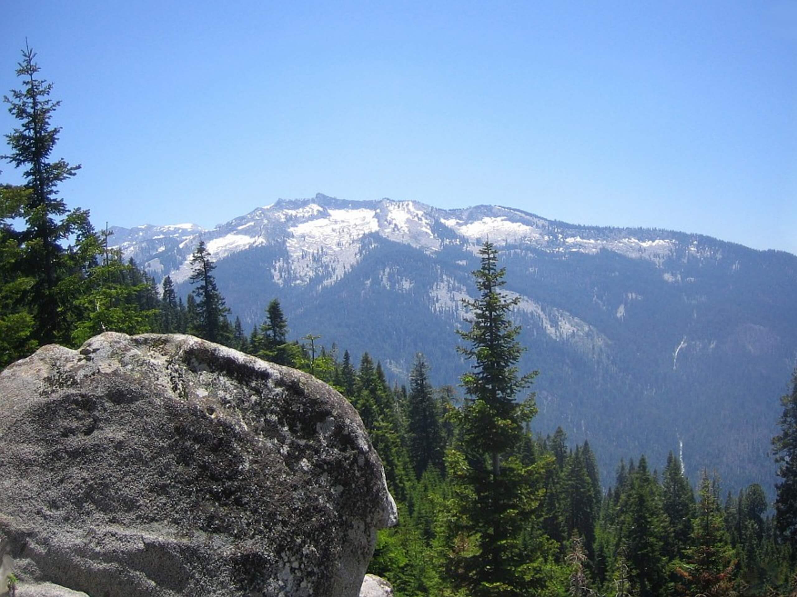
Paradise Ridge Trail
Difficulty Rating:
Explore a swathe of wilderness occupied with towering sequoias, blooming wildflowers, granite outcroppings, and fire-scarred conifers along the Paradise Ridge Trail. This wonderful trek culminates at a fire lookout that boasts inspiring views of the High Sierra.
Getting there
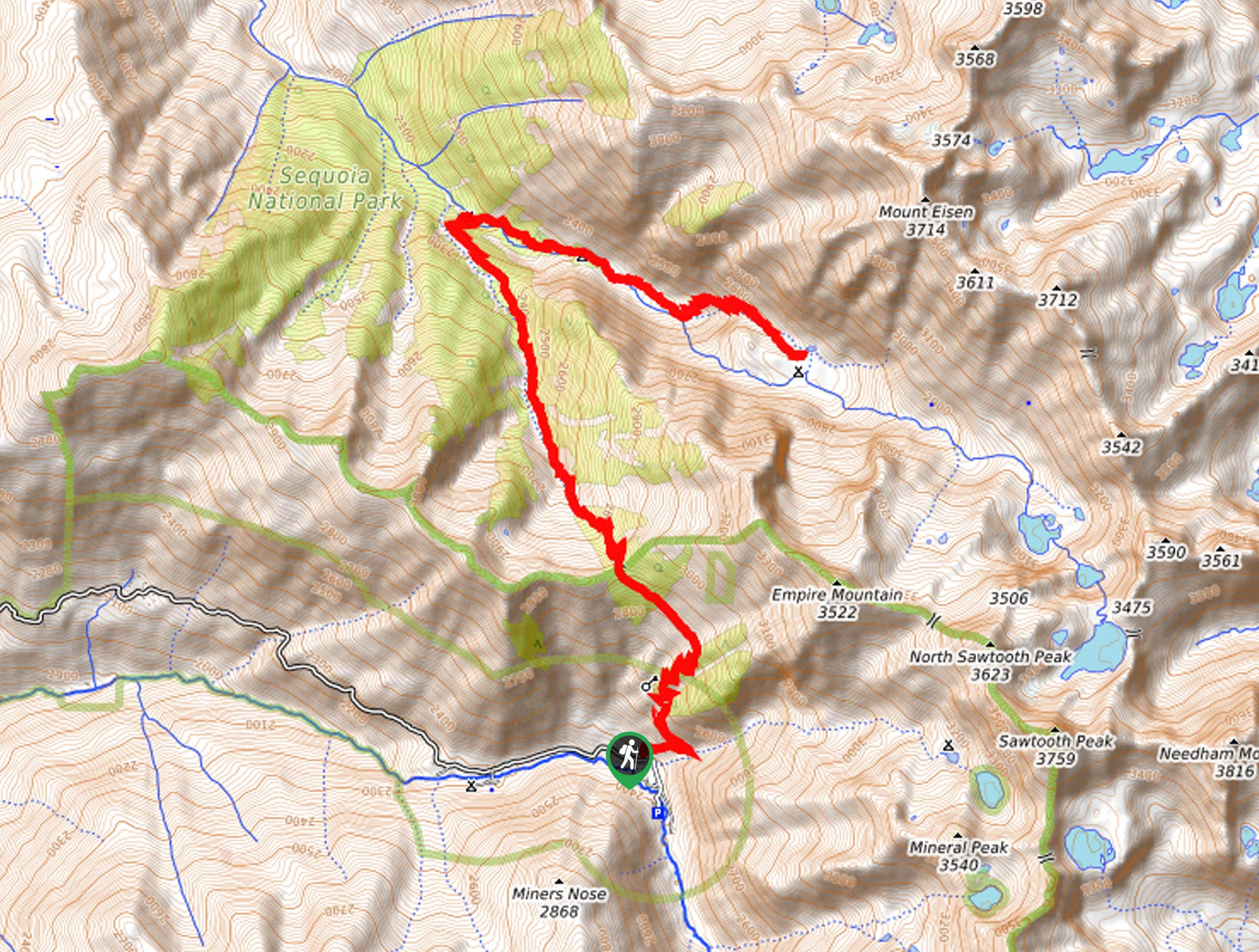
Access this hike via the trailhead off Mineral King Road.

About
| Backcountry Campground | No |
| When to do | March-November |
| Pets allowed | No |
| Family friendly | Older Children only |
| Route Signage | Average |
| Crowd Levels | Moderate |
| Route Type | Out and back |
Paradise Ridge Trail
Elevation Graph
Weather
Paradise Ridge Trail Description
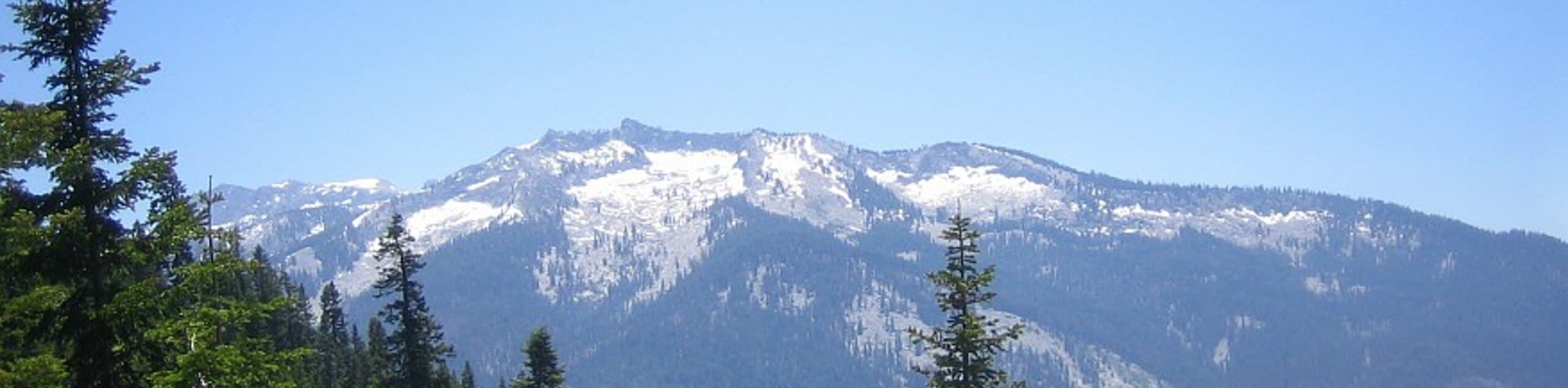
Explore the beautiful Californian wilderness along this scenic footpath. A hidden gem amongst the busy footpaths in the Sierra National Forest, hiking this route provides a tranquil experience. Though demanding, this trek rewards its tired conquerors with amazing views of the mountainous landscape bound by verdant forestlands. When hiking this route, be mindful of wildlife, including bears, deer, and sociable marmots! Note entrance to the park costs $35USD per vehicle or $20USD per person for pedestrians or cyclists.
The Paradise Ridge Trail departs from the trailhead off Mineral King Road. Immediately after departing from the trailhead, the path will begin to climb into the woodlands. Take your time as you navigate the vertiginous terrain, and be sure to appreciate the beauty of the surrounding wilderness. In the spring, the path will be adorned with lupines that add a vibrance to the forest. Mind your footing on the uneven terrain as you navigate the seemingly never-ending set of switchbacks.
Ultimately you will reach the trail’s end after summiting Paradise Ridge. Give yourself and pat on the back and enjoy the incredible panoramas of the High Sierra. Have a snack, rest, and rehydrate before commencing your return. To get back to the trailhead, simply head back down the way you came.
Similar hikes to the Paradise Ridge Trail hike

Eagle and Bobcat Loop Hike
The Eagle and Bobcat Loop Hike is an amazing adventure that the whole family can enjoy. Wander through luxuriant meadows…
Pinto Lake Trail
Beckoning the exploration of intrepid spirits and experienced hikers, the Pinto Lake Trail is a no walk in the park.…

Huckleberry and Alta Loop Hike
The Huckleberry and Alta Loop Hike is a beautiful adventure that offers a wealth of incredible scenery for hikers to…
Comments