Midgley Bridge Hike
View Photos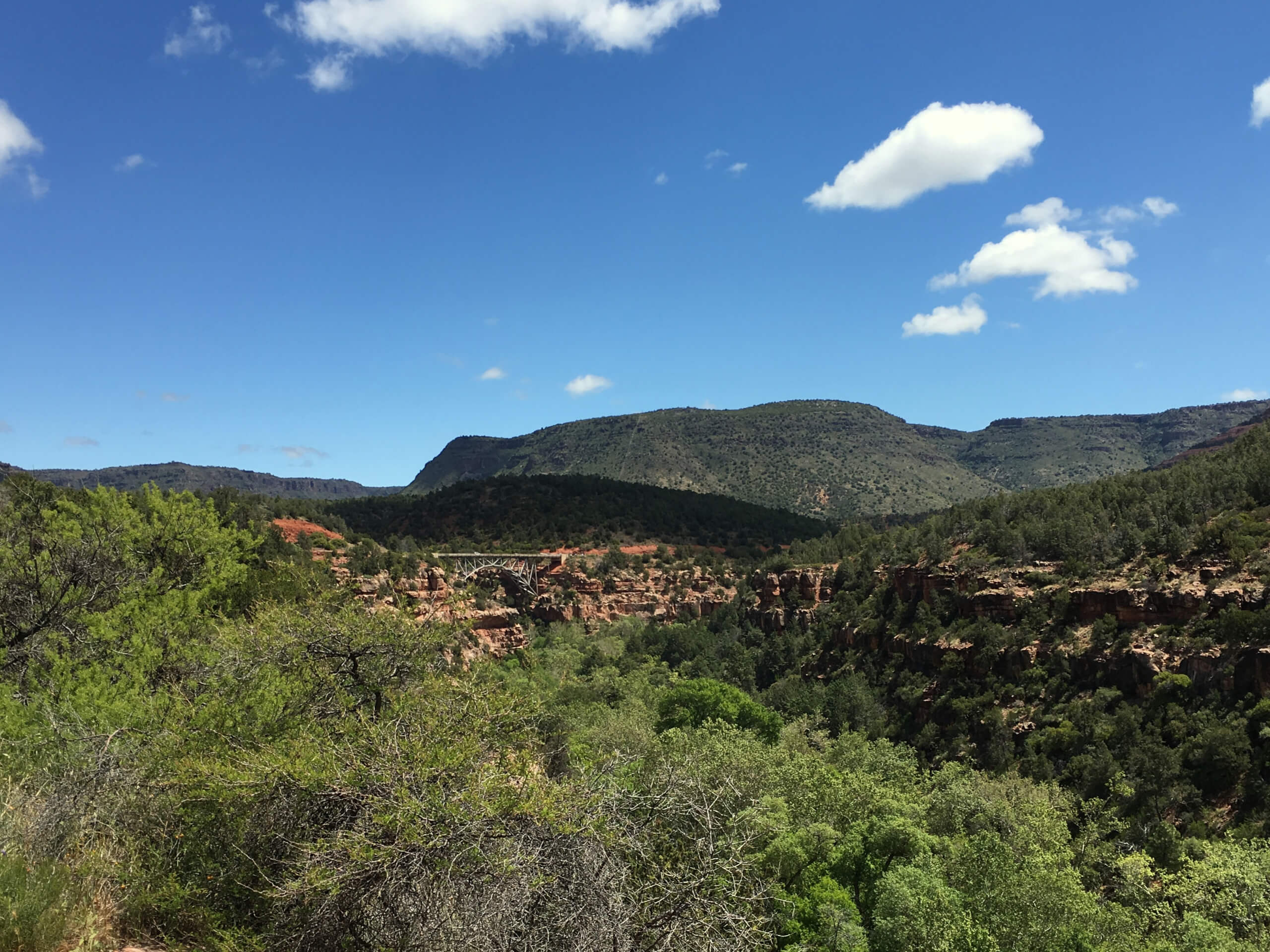
Midgley Bridge Hike
Difficulty Rating:
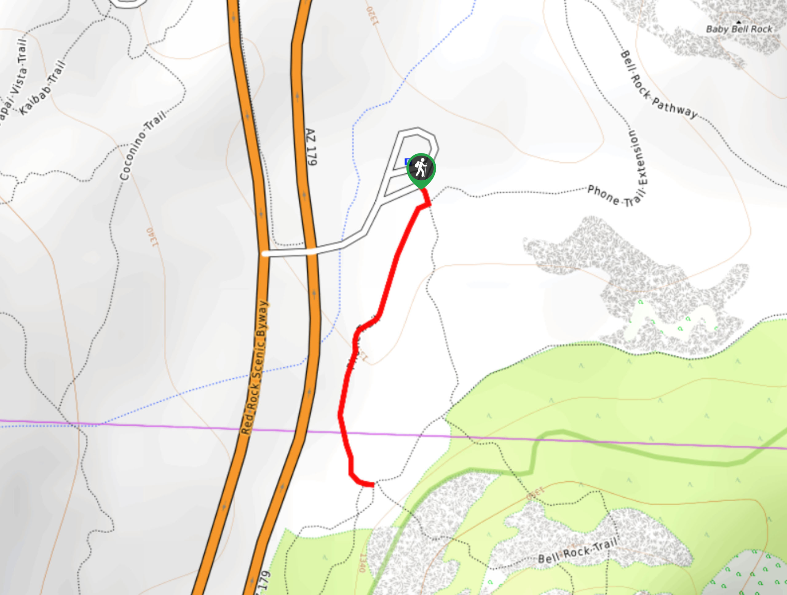
The Midgley Bridge hike is an easy trip that takes you along Oak Creek to a viewpoint where you can check out the bridge and explore it. The hike is 1.2mi long and very easy, so this is a great pick for families and beginners. The hike starts near a picnic area, so pack some snacks to enjoy after your hike. Expect moderate traffic on this route.
Getting there
The trailhead for the Midgley Bridge hike is at the Midgley Bridge Picnic Area off State Route 89A.

About
| Backcountry Campground | No |
| When to do | Year-round |
| Pets allowed | Yes - On Leash |
| Family friendly | Yes |
| Route Signage | Average |
| Crowd Levels | Moderate |
| Route Type | Out and back |
Midgley Bridge Hike
Elevation Graph
Weather
Midgley Bridge Hike Description
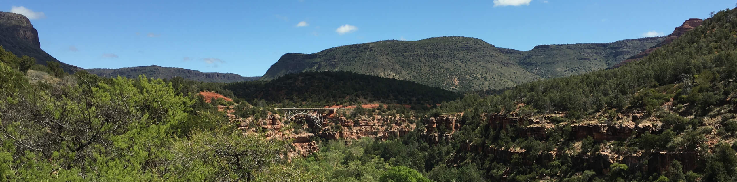
The Midgley Bridge hike is a fun trip for hikers of all ages that leads you to a viewpoint over the Midgley Bridge and down the Huckaby Trail. It’s a mostly flat hike that makes for a relaxing stroll before a picnic in the picnic area or as a warm-up for other hikes in the area.
Start from the picnic area. You’ll head down across the road (cross carefully) to the Oak Creek Vista, where you can snap photos of the bridge and admire the unique scenery of this canyon. Turn around to hike along Huckaby Trail, continuing where it becomes Oak Creek Spur A.
The canyon here is beautiful, with lush forest and red rock canyons making for a scene not often associated with Arizona. The trail ends near the Grasshopper Point Picnic Area. From here, you can turn back and follow the same route to the trailhead. Set up your picnic or head on to your next adventure!
Similar hikes to the Midgley Bridge Hike hike

Margs Draw Trail
Margs Draw Trail is a bit of a hidden gem. This trail doesn’t get as much traffic as other nearby…
Broken Arrow and Morgan Road Loop
Broken Arrow Trail is a very popular route in Sedona used by hikers, mountain bikers, and off-roaders. This route uses…
Phone Trail
If you’re hiking to Bell Rock from the Bell Rock Trailhead, Phone Trail can be used instead of the Bell…
Comments