
Margs Draw Trail
View Photos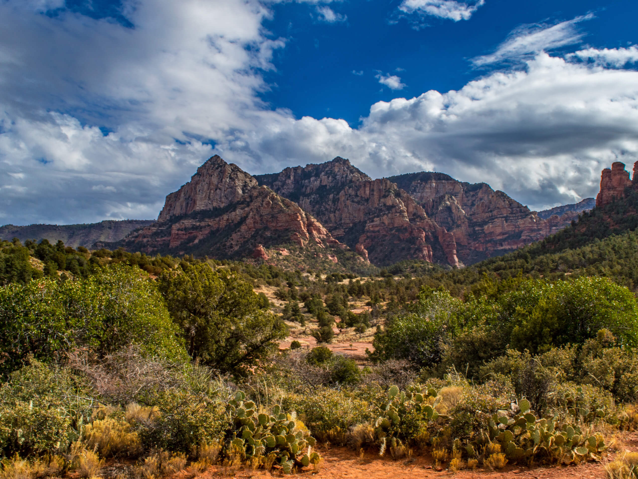
Margs Draw Trail
Difficulty Rating:
Margs Draw Trail is a bit of a hidden gem. This trail doesn’t get as much traffic as other nearby routes despite its impressive, panoramic view of many of Sedona’s most recognizable mountains and rock formations. It’s a very easy hike with only a bit of loose rock to consider. Expect moderate traffic on this route.
Getting there
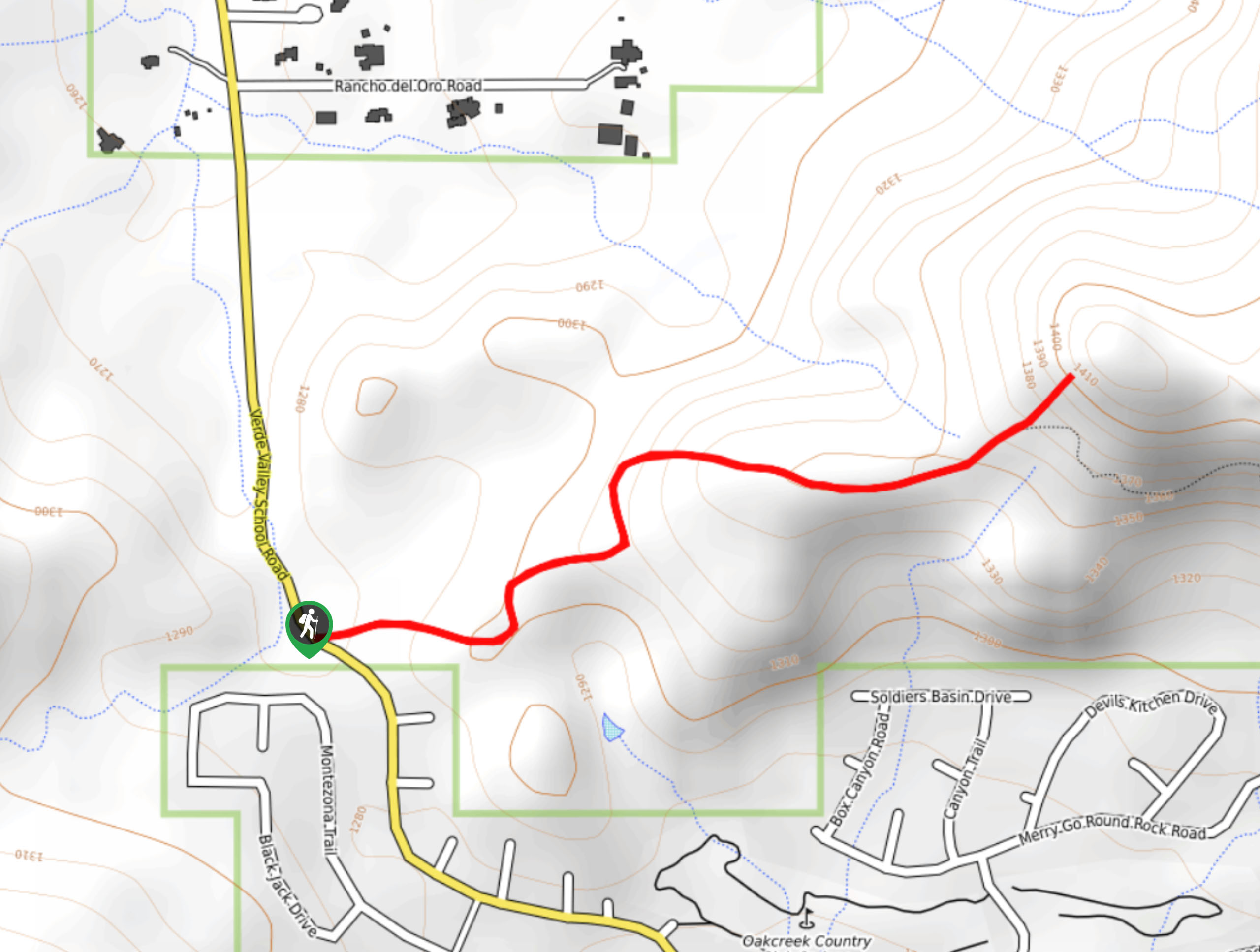
The trailhead for Margs Draw Trail is at the end of Morgan Road.

About
| Backcountry Campground | No |
| When to do | Year-round |
| Pets allowed | Yes - On Leash |
| Family friendly | Yes |
| Route Signage | Good |
| Crowd Levels | Moderate |
| Route Type | Out and back |
Margs Draw Trail
Elevation Graph
Weather
Margs Draw Trail Description
Margs Draw Trail is an awesome pick for hikers who want grand views without too much effort required. The trail is long enough to have ample time to enjoy the view, but it doesn’t require much elevation gain. It also doesn’t get as busy as nearby trails, which can be a godsend in the busy season.
This trail has some rocky sections, so we recommend hiking it in sturdy boots or other trail-appropriate shoes. Open-toed shoes aren’t recommended because of the rocks and also because of the plentiful cacti on this route.
From the trailhead, take Margs Draw Trail north. There are two other trails that leave from this trailhead, so make sure you head in the right direction. You’ll wander alongside the farthest-reaching arm of Munds Mountain, with Munds and Lee to your right and The Teapot and Pointed Dome ahead. To your left is the city.
Pass by Snoopy Rock and Camel Head Rock, whereafter your trail ends just past the crossing of Schnebly Hill Road. Turn around and head back to the trailhead on the same route. This hike can also be started from Schnebly Hill Road and hiked in the opposite direction.
Insider Hints
The gorgeous Tlaquepaque Arts and Crafts Village isn’t far from this trailhead. It’s one of our favorite spots in Sedona.
Similar hikes to the Margs Draw Trail hike

Baby Bell, Llama, and Bail Loop
The Baby Bell, Llama, and Bail Loop is a 3.6mi hike in Sedona near Bell Rock and Courthouse…

Herkenham Trail
Herkenham Trail is a 2.0mi out and back trail in the Coconino National Forest near Sedona. This route…
Transept Trail
The Transept Trail is a route less travelled in Sedona, Arizona. This hike is pretty quick and suitable for most.…
Comments