
Mescal Mountain Trail
View Photos
Mescal Mountain Trail
Difficulty Rating:
Mescal Mountain Trail is a 6.0mi out and back hike in Sedona that skirts around the base of Mescal Mountain. This hike is rated as moderate, but we consider it to be on the easy side of moderate. You can do this route by itself or use it to enjoy other connecting trails in the area. Expect moderate traffic on this route.
Getting there
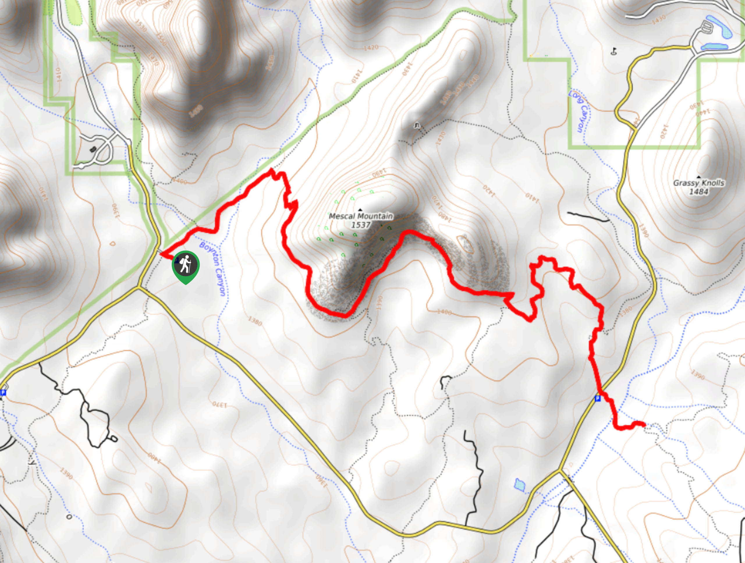
The trailhead for Mescal Mountain Trail is off Boynton Canyon Road.

About
| Backcountry Campground | No |
| When to do | Year-round |
| Pets allowed | Yes - On Leash |
| Family friendly | Yes |
| Route Signage | Average |
| Crowd Levels | Moderate |
| Route Type | Out and back |
Mescal Mountain Trail
Elevation Graph
Weather
Mescal Mountain Trail Description
Mescal Mountain Trail is an enjoyable hike suitable for all skill levels near Boynton Canyon. The route is easy to follow and can be hiked alone or used to access connecting trails for a longer adventure. Enjoy the views without needing to work too hard!
Beginning from the Boynton Canyon Trailhead, take the trail to where it splits, then stay right. You’ll wrap right around the base of Mescal Mountain. Stay towards the mountain at the next two junctions. The trail takes you across the road and ends at a split just past Dry Creek. You can keep exploring if you’d like, or you can turn around and hike back to the trailhead, enjoying the view of magnificent Boynton Canyon on your return trip.
It’s possible to make a loop around Mescal Mountain by turning left just before the road and then taking another left onto Deadman’s Pass Trail.
Similar hikes to the Mescal Mountain Trail hike

Margs Draw Trail
Margs Draw Trail is a bit of a hidden gem. This trail doesn’t get as much traffic as other nearby…

Baby Bell, Llama, and Bail Loop
The Baby Bell, Llama, and Bail Loop is a 3.6mi hike in Sedona near Bell Rock and Courthouse…

Herkenham Trail
Herkenham Trail is a 2.0mi out and back trail in the Coconino National Forest near Sedona. This route…
Comments