Devil’s Bridge from Long Canyon Road
View Photos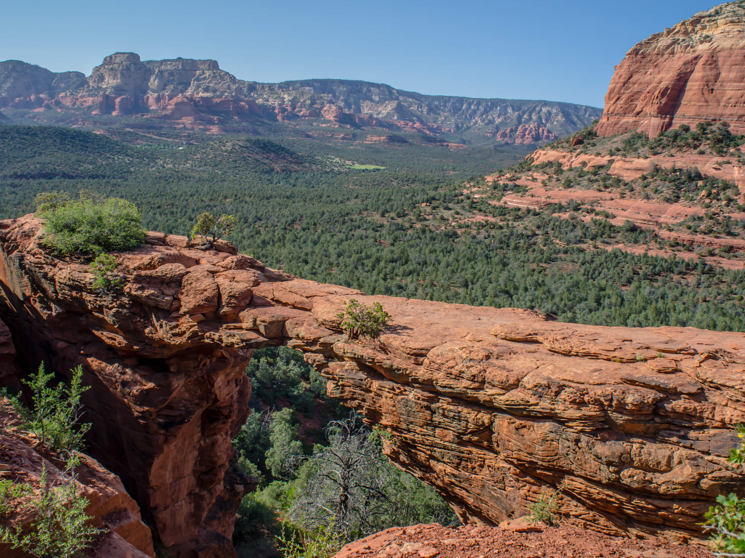
Devil’s Bridge from Long Canyon Road
Difficulty Rating:
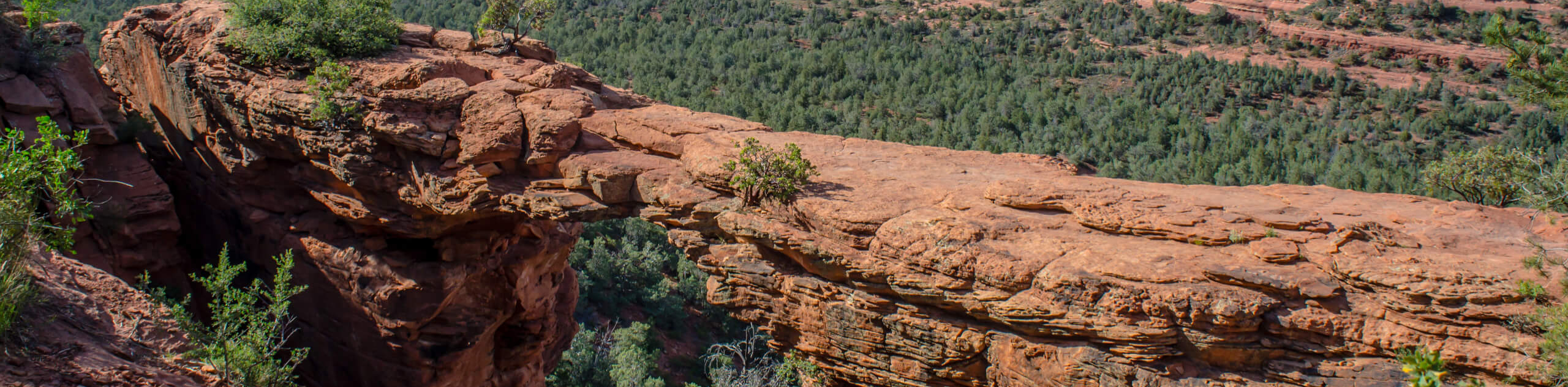
Devil’s Bridge is a natural sandstone arch in Sedona. Climb out onto the bridge and look out over a great view of the iconic red rocks of Sedona. This is a fun hike for most ages and definitely one to bring a camera for. This approach to Devil’s Bridge starts at Long Canyon Road, which is a different way than the traditional Devil’s Bridge hike.
Getting there
The trailhead for Devil’s Bridge from Long Canyon Road is on Long Canyon Road.

About
| Backcountry Campground | No |
| When to do | Year-round |
| Pets allowed | Yes - On Leash |
| Family friendly | Yes |
| Route Signage | Good |
| Crowd Levels | Extreme |
| Route Type | Out and back |
Devil’s Bridge from Long Canyon Road
Elevation Graph
Weather
Devil’s Bridge from Long Canyon Road Description
Devil’s Bridge is one of the most popular hikes in the Sedona area. At the end of this trail, a magnificent sandstone bridge extends across Red Rock Country and the viewing area next to it provides a perfect spot to take photos from. Most of the trail is gradual, but there’s a steep incline near the end that may require a bit of hands-on help for some. Active children and beginners should still be able to make it, especially since the steep climbing section has some rocky steps to help you out.
From Long Canyon Road, you’ll hike across the Dry Creek creekbed and stay left at the split. This trail meanders up to meet the usual Devil’s Bridge Trail at the junction with Dry Creek Road.
At the scrambling section, make use of the step-shaped rocks and climb up. From here, you can either kick back on the viewing area and admire the bridge or climb over the arch for a photo. There’s also a trail on the left that takes you underneath the bridge if you want to gaze up at it. It’ll be very busy here, so the earlier you arrive, the less waiting you’ll do for a photo on the bridge.
Once you’re ready, retrace your steps to the road.
Similar hikes to the Devil’s Bridge from Long Canyon Road hike

Margs Draw Trail
Margs Draw Trail is a bit of a hidden gem. This trail doesn’t get as much traffic as other nearby…

Baby Bell, Llama, and Bail Loop
The Baby Bell, Llama, and Bail Loop is a 3.6mi hike in Sedona near Bell Rock and Courthouse…

Herkenham Trail
Herkenham Trail is a 2.0mi out and back trail in the Coconino National Forest near Sedona. This route…
Comments