
Carroll Canyon Trail
View Photos
Carroll Canyon Trail
Difficulty Rating:
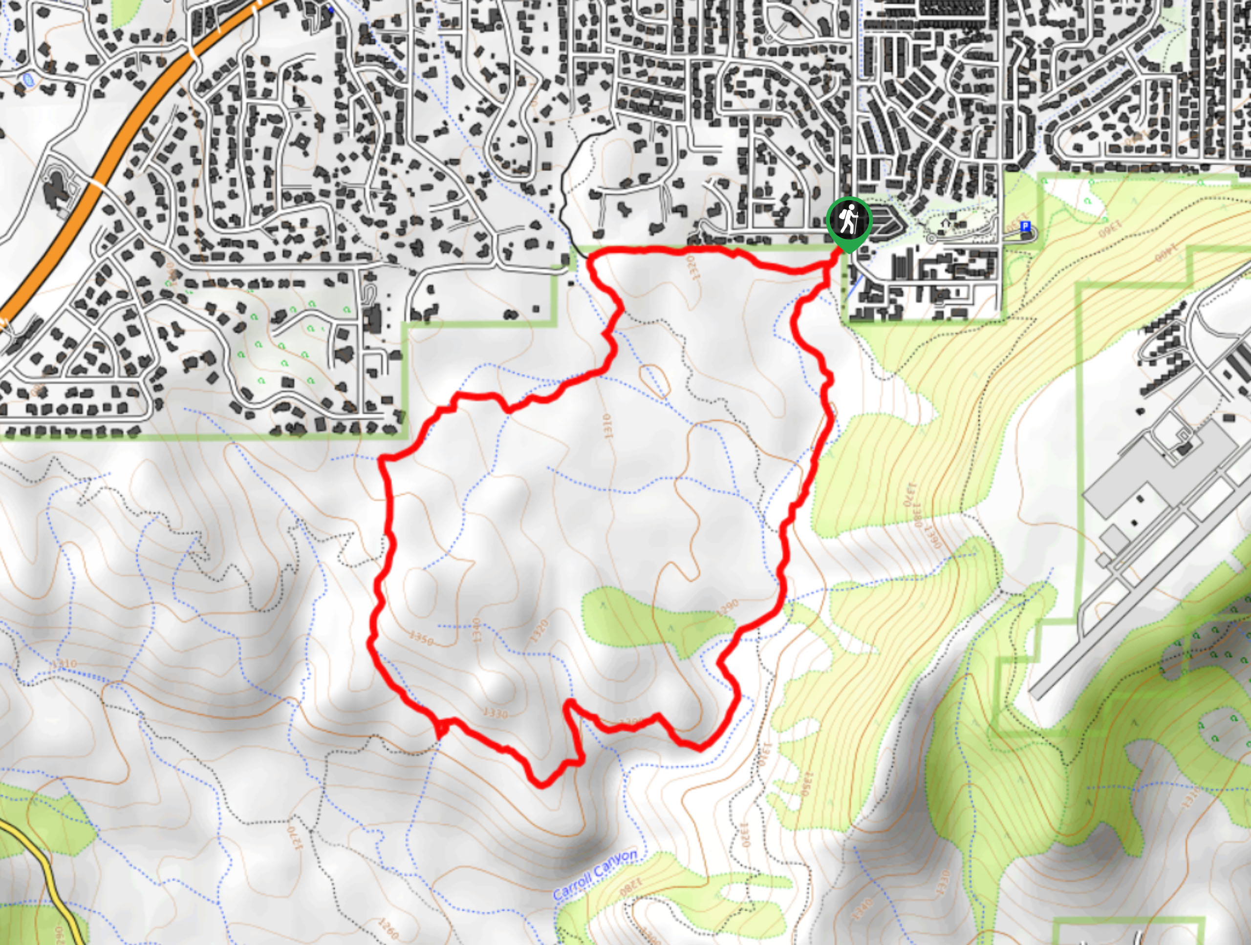
Carroll Canyon Trail is a 3.2mi loop hike that explores the area underneath Airport Mesa in Sedona. The canyon on this hike is very cool to see, and the trail is still easy enough for most skill levels to complete. The views are awesome, but we recommend bringing a downloaded GPS track as it can be easy to make a wrong turn on this route.
Getting there
The trailhead for the Carroll Canyon Trail is off Shelby Drive.

About
| Backcountry Campground | No |
| When to do | Year-round |
| Pets allowed | Yes - On Leash |
| Family friendly | Yes |
| Route Signage | Average |
| Crowd Levels | Moderate |
| Route Type | Loop |
Carroll Canyon Trail
Elevation Graph
Weather
Carroll Canyon Trail Description
Carroll Canyon Trail is a scenic hike that feels very adventurous without being too difficult. This hike loops around underneath Airport Mesa with awesome views of the mesa and the scenery beyond. This hike is suitable for most skill levels.
It can be easy to take a wrong turn on this route, so we recommend bringing a map or following a GPS track as you go. Bring lots of water as well, and consider a windbreaker if you’re here in the offseason. This route is quite exposed to the elements.
From the trailhead, head right onto Old Post Trail. You’ll take a left to remain on the trail, then go straight through the next junction. Stay left where a spur trail breaks off at the top of the loop, now making your way around the edge of the butte. You’ll head back right underneath Airport Mesa and back to the trailhead.
Similar hikes to the Carroll Canyon Trail hike

Margs Draw Trail
Margs Draw Trail is a bit of a hidden gem. This trail doesn’t get as much traffic as other nearby…

Baby Bell, Llama, and Bail Loop
The Baby Bell, Llama, and Bail Loop is a 3.6mi hike in Sedona near Bell Rock and Courthouse…

Herkenham Trail
Herkenham Trail is a 2.0mi out and back trail in the Coconino National Forest near Sedona. This route…
Comments