Adobe Jack, Coyote, and Crusty Loop
View Photos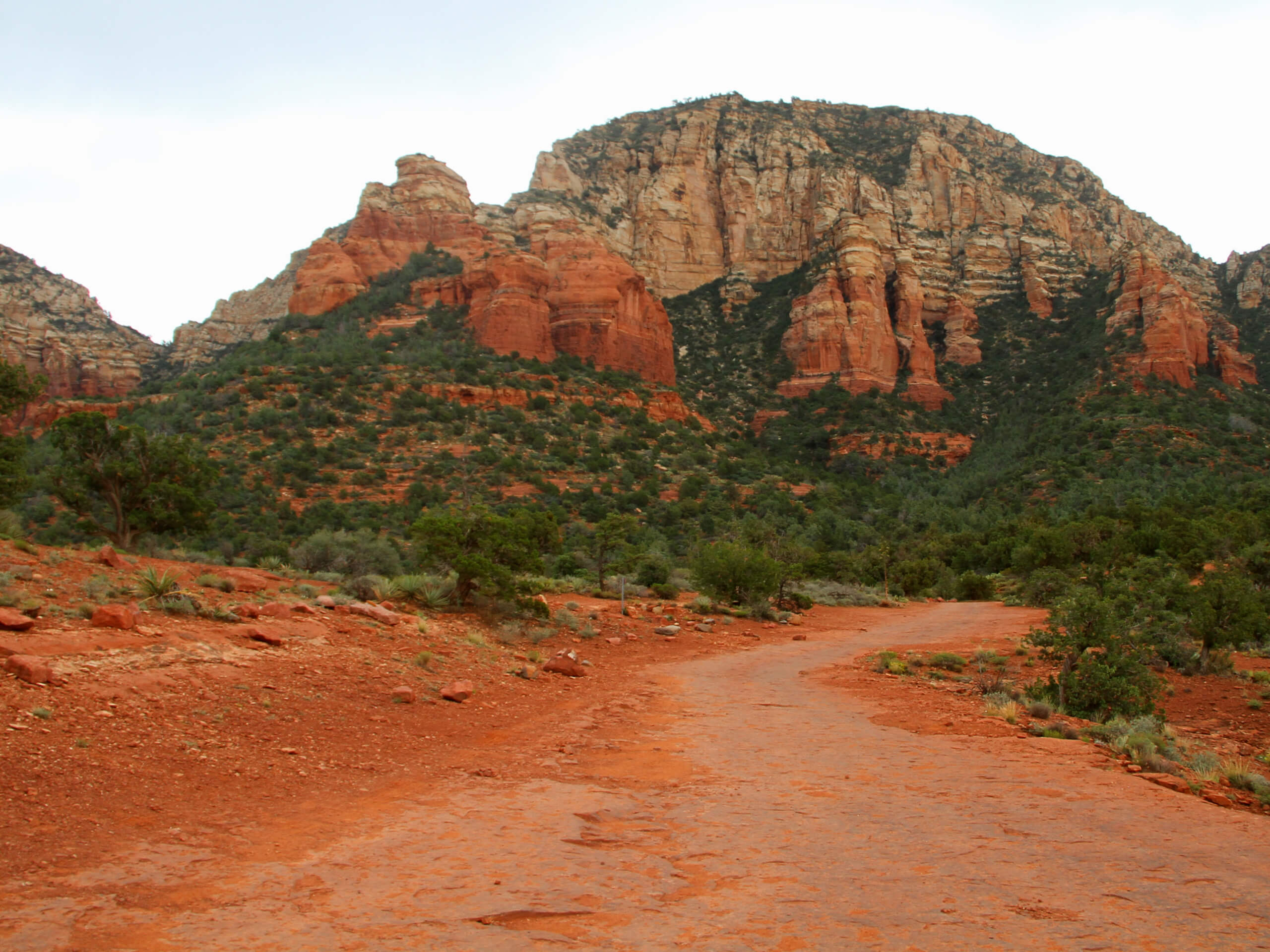
Adobe Jack, Coyote, and Crusty Loop
Difficulty Rating:
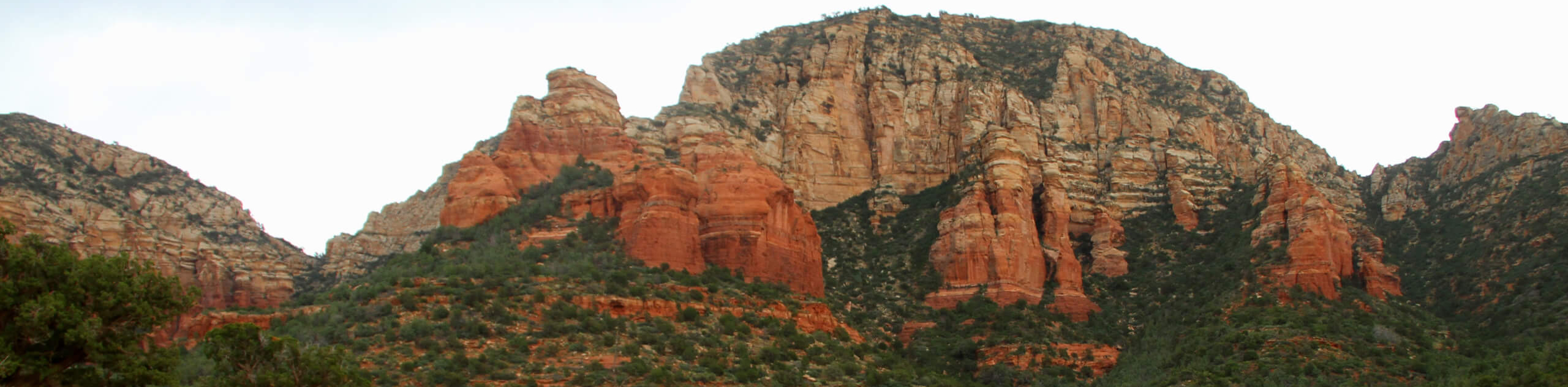
Sounding like something out of a Saturday morning cartoon, the Adobe Jack, Coyote, and Crusty Loop is a fun 1.8mi hike not far from downtown Sedona. This hike offers awesome views without needing to go too far. The terrain is varied and shared by mountain bikers. This trail sees heavy traffic.
Getting there
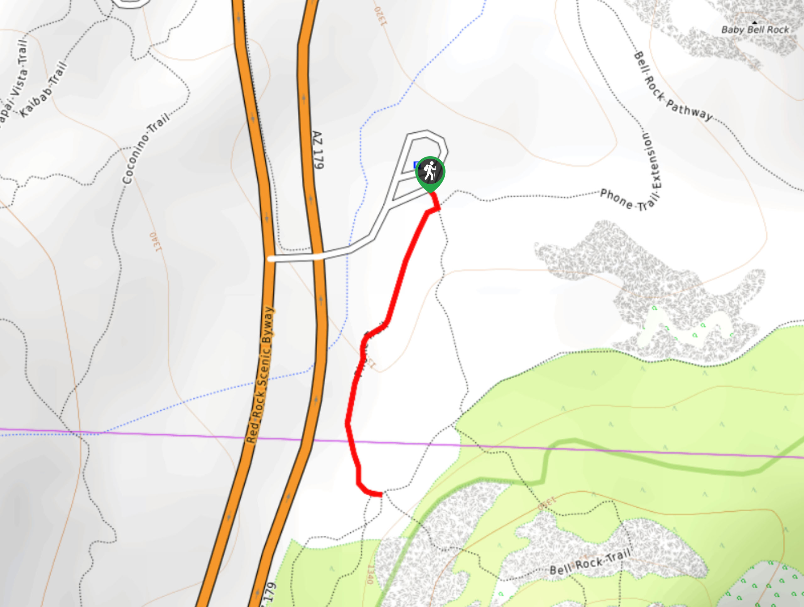
The trailhead for the Adobe Jack, Coyote, and Crusty Loop is off Highway 89A.

About
| Backcountry Campground | No |
| When to do | Year-round |
| Pets allowed | Yes - On Leash |
| Family friendly | Yes |
| Route Signage | Average |
| Crowd Levels | High |
| Route Type | Loop |
Adobe Jack, Coyote, and Crusty Loop
Elevation Graph
Weather
Adobe Jack, Coyote, and Crusty Loop Description
The Adobe Jack, Coyote, and Crusty Loop hike is a great way to get outside and soak up Sedona’s red rock views without needing to go far from downtown. If you’re staying in town, the trailhead may be accessible for you without a vehicle, which can be handy.
There isn’t much parking available at the trailhead, so we recommend arriving early if you can. While the signage is okay, having a map might be helpful if you’re not familiar with the area.
From the trailhead, take a few steps on Adobe Jack Trail before it splits. Go left and stay right immediately after. The loop is quite level, so you won’t be doing much climbing, but sections can be quite rocky. At the top of the loop, go right onto Coyote Trail. Climb over Soldier Wash and then stay right onto Grand Central Trail. Stay right onto Crusty Trail, which will take you back to the trailhead.
Similar hikes to the Adobe Jack, Coyote, and Crusty Loop hike

Margs Draw Trail
Margs Draw Trail is a bit of a hidden gem. This trail doesn’t get as much traffic as other nearby…
Broken Arrow and Morgan Road Loop
Broken Arrow Trail is a very popular route in Sedona used by hikers, mountain bikers, and off-roaders. This route uses…
Phone Trail
If you’re hiking to Bell Rock from the Bell Rock Trailhead, Phone Trail can be used instead of the Bell…
Comments