
Proctor Mountain Trail
View Photos
Proctor Mountain Trail
Difficulty Rating:
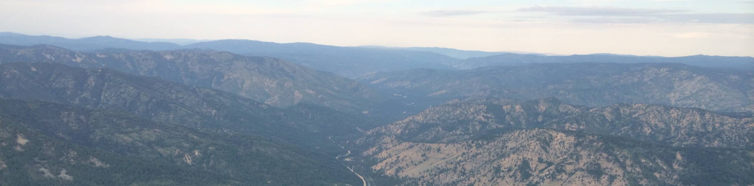
The Proctor Mountain Trail is a well-loved hiking route in Sun Valley, Idaho. This scenic expedition climbs up the forested and sagebrush stepped slopes of Pioneer Mountain, offering incredible views of Idaho’s mountain ranges. Don’t forget your camera, the scenery is picture-perfect.
Getting there
The Proctor Mountain Trail is accessed from the trailhead off Sun Valley Road.

About
| Backcountry Campground | No |
| When to do | Year-round |
| Pets allowed | Yes - On Leash |
| Family friendly | Older Children only |
| Route Signage | Average |
| Crowd Levels | High |
| Route Type | Lollipop |
Proctor Mountain Trail
Elevation Graph
Weather
Proctor Mountain Hike Description
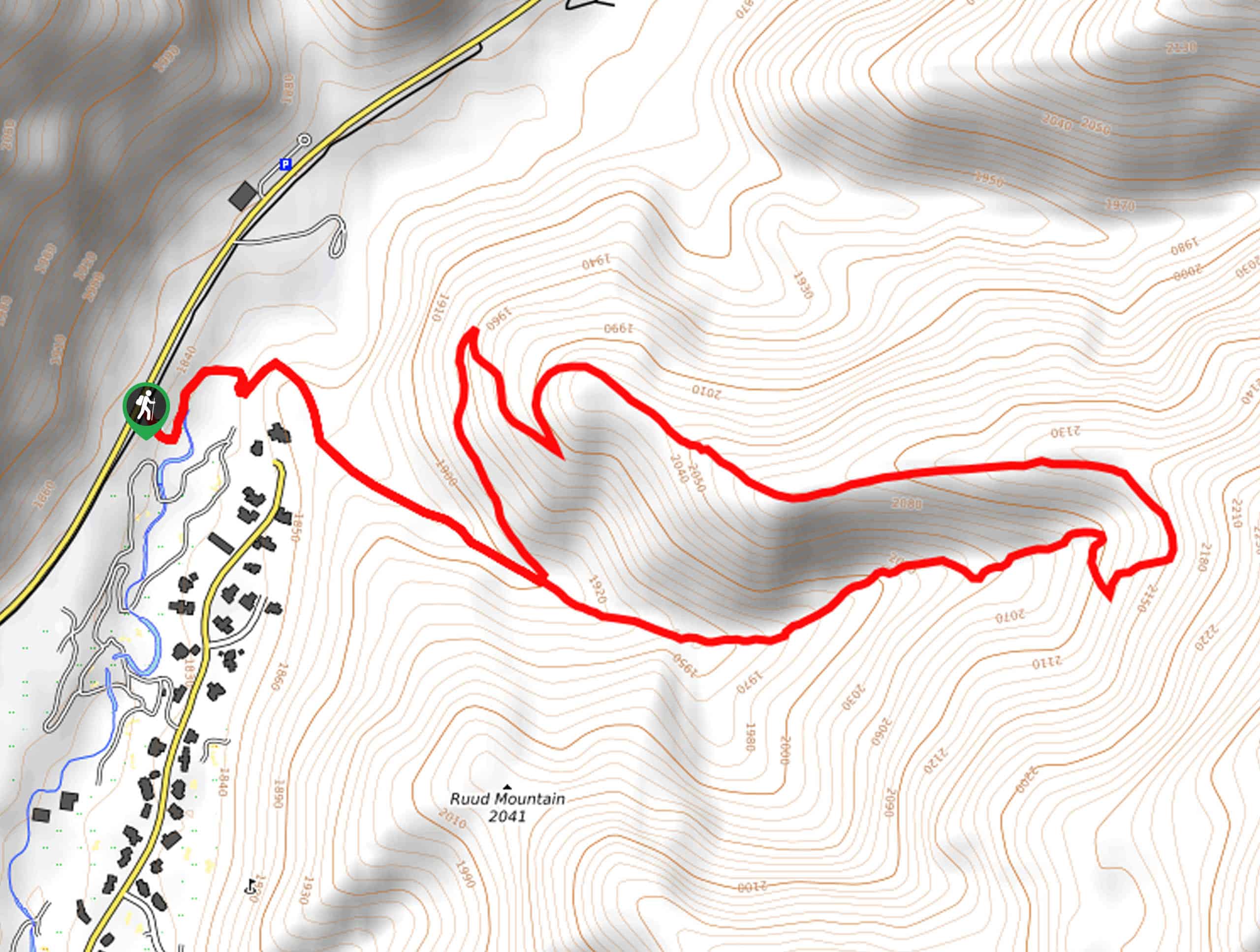
Get a great workout and indulge in spell-binding mountain views as you hike up the slopes of Proctor Mountain. Conveniently located above Sun Valley, this scenic trail sees plenty of traffic—no matter the season. In the summer months, you will likely be in the company of intrepid trail runners conditioning for their next big adventure, and in the winter, tired snowshoers braving the snow-cloaked mountainside. As much of the terrain is exposed, it is wise to SPF and check the forecast before heading out to dress accordingly! Note that those who park on Fairway Road are subject to getting ticketed, but there are additional spots across from the Hemingway Memorial off Sun Valley Road.
Embark on your journey along the Proctor Mountain Trail from the parking area off Sun Valley Road. From here, you will follow the Hemingway Trail through the memorial before merging onto the Proctor Mountain Trail. Soon after departing the memorial, you will confront yet another intersection; keep right here, traveling counterclockwise around the loop. Gradually climbing, the eastbound path explores the forested gulch. After some hiking, you will gain a ridge, confronting another junction, veer left, and you will be diverted westwardly. This sagebrush crest will reward you with mesmerizing views of Idaho’s impressive mountainscape.
Revel in the scenery as you hike, and after descending the slope, you will turn right at the trail fork back to the intersection with the Hemingway Trail. From here, simply retrace your footing through the memorial and back to your vehicle.
Similar hikes to the Proctor Mountain Trail hike
Hyndman Creek Trail
The Hyndman Creek Trail is an enchanting adventure up the slopes of the highest peak in the Hyndman Mountains. Explore…
Heart Lake Trail
The Heart Lake Hike explores an area of tree burn that is abundant with lush regrowth in the Sawtooth National…
Warm Springs Loop Hike
Remarkable mountain views await you on the Warm Springs Loop Hike in the Sawtooth National Forest. What is a popular…
Comments