
Lady Face Falls Hike
View Photos
Lady Face Falls Hike
Difficulty Rating:
Discover a hidden oasis in the Sawtooth National Forest on the Lady Face Falls Hike. This incredible adventure guides intrepid explorers through vast meadowlands down into a rocky canyon adorned with a picturesque tumbling waterfall.
Getting there
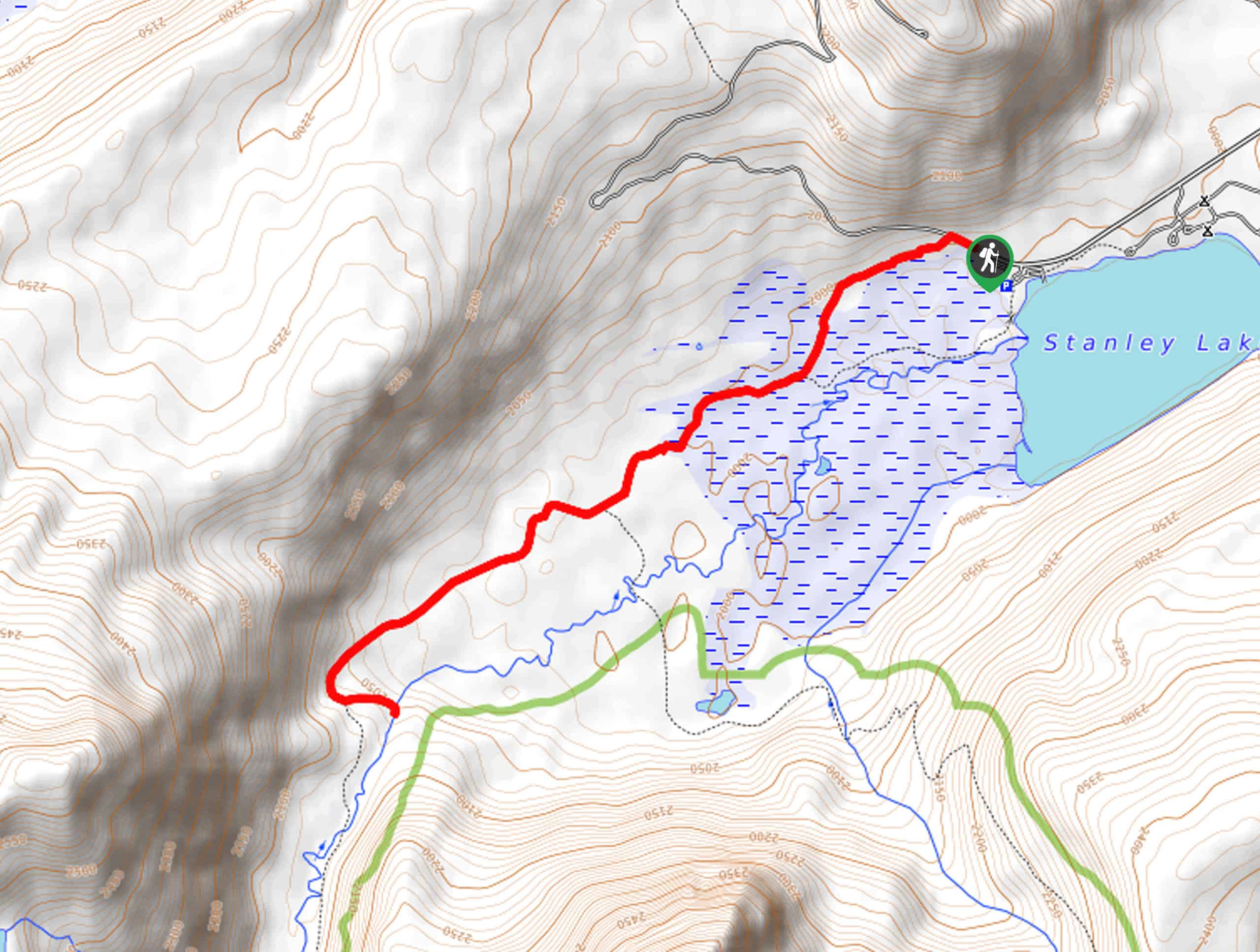
The Lady Face Falls Hike departs from the Iron Creek Trailhead off National Forest Development Road 649.

About
| Backcountry Campground | No |
| When to do | April-October |
| Pets allowed | Yes - On Leash |
| Family friendly | Older Children only |
| Route Signage | Poor |
| Crowd Levels | Low |
| Route Type | Out and back |
Lady Face Falls Hike
Elevation Graph
Weather
Lady Face Falls Hike Description
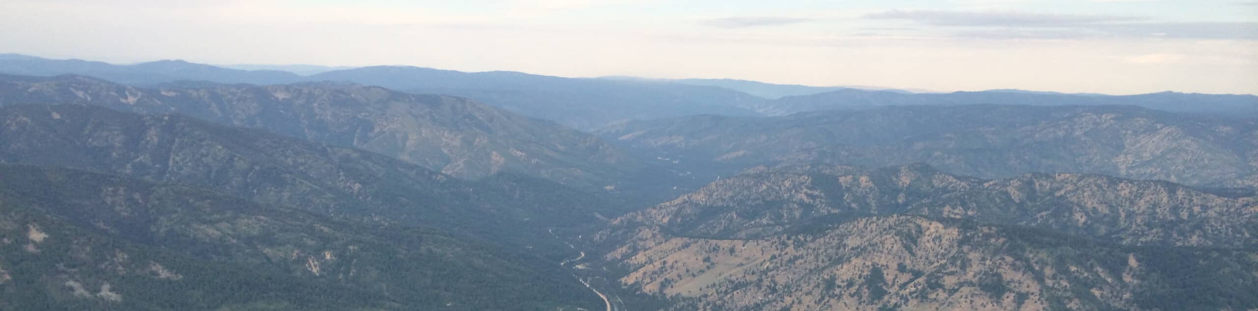
Uncover a treasure nestled in nature near Stanley, Idaho. This scenic excursion travels through lovely landscapes, offering great views of the surrounding Sawtooth and Bitterroot Mountains. Get into the fresh air and explore the unspoiled backcountry, cooling off in the cool alpine waters beneath the falls! While the established trail into the wilderness is well marked and easy, the route down to the rocky canyon demands come careful footing and scrambling, which is not suitable for young children. Those bringing along their pup should also exercise caution as the rocky terrain may hurt their feet.
Setting out from the trailhead, your adventure along the Lady Face Falls Hike follows the Iron Creek-Stanley Lake Trail southwest. From here, the fairly level path will travel through a lush meadow on the western end of Stanley Lake, offering wonderful views of the nearby mountains, most notably McGown Peak rising above the landscape. After some hiking, you will notice a small sign posted on a tree that reads “Lady Face Falls.” Turn left here onto the primitive route, intensely climbing up a ridge before plunging down into the rocky ravine.
Take your time and mind your footing as you scramble down into the canyon. After some creative navigating, you will reach the creekside, where you will be rewarded with the scenes of Lady Face Falls tumbling through the forested valley. Admire the mesmerizing view, then head back up the rocky walls and retrace your footing along the path back to the trailhead.
Similar hikes to the Lady Face Falls Hike hike
Hyndman Creek Trail
The Hyndman Creek Trail is an enchanting adventure up the slopes of the highest peak in the Hyndman Mountains. Explore…
Heart Lake Trail
The Heart Lake Hike explores an area of tree burn that is abundant with lush regrowth in the Sawtooth National…
Warm Springs Loop Hike
Remarkable mountain views await you on the Warm Springs Loop Hike in the Sawtooth National Forest. What is a popular…
Comments