
Griffin Butte Hike
View Photos
Griffin Butte Hike
Difficulty Rating:
The Griffin Butte Hike is an epic expedition in the Sawtooth National Forest that features some off-trail travel and mesmerizing vistas of the Pioneer Mountains. Those who don’t mind doing some navigation and bushwhacking will likely enjoy this scenic adventure.
Getting there
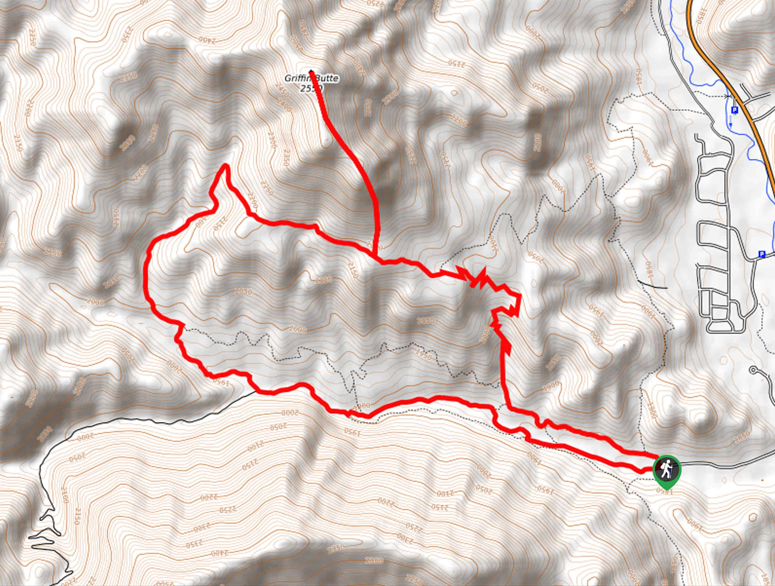
The Griffin Butte Hike is accessed from the Adams Gulch Trailhead off Adams Gulch Road.

About
| Backcountry Campground | No |
| When to do | Year-round |
| Pets allowed | Yes - On Leash |
| Family friendly | Older Children only |
| Route Signage | Poor |
| Crowd Levels | Low |
| Route Type | Lollipop |
Griffin Butte Hike
Elevation Graph
Weather
Griffin Butte Hike Description
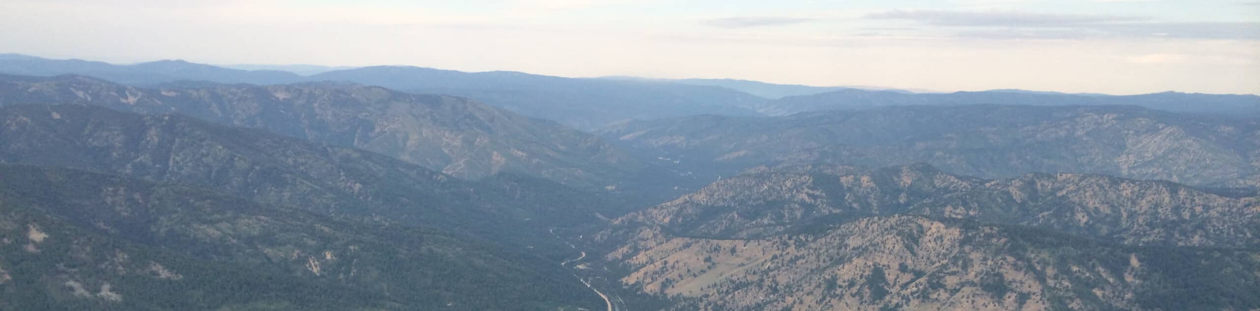
Immerse yourself in the backcountry and explore a variety of beautiful landscapes along the Griffin Butte Trail. Exhibiting a diversity of flora and fauna and incredible mountain views, this trek will not disappoint. Note this route is open and accessible year-round, so in the summer months, you will be in the company of mountain bikers and, in the winter, cross-country skiers and snowshoers. The exposed terrain along this trail boasts unparalleled mountain views. Still, it also warrants extreme conditions, so it is wise to check the forecast before heading out and to dress accordingly. Don’t forget your trail GPS to effortlessly navigate the route.
Setting out from the Adams Gulch Trailhead, those hiking to Griffin Butte will follow Lane’s Trail northwestwardly to an intersection. Here turn right, and you will be diverted onto the Adams Rib Trail, which tracks north, winding up to another trail fork; keep left along the same route. Enjoy views of Griffin Butte rising from the landscape, then using the trail GPS, trek off-route through the grasslands up to the butte. Mind your footing on the rocky terrain if you plan on ascending the butte. From atop the peak, you will be granted impressive views of the Pioneer Range. Marvel at the beauty of the mountainous landscape, then head back, reconnecting with the Adams Rib Trail.
After some hiking, you will come to a junction with the Griffin Butte Connector, veer left, and descend the ridge. At the subsequent junction, turn left onto Eve’s Gulch Trail and follow the route eastwardly all the way back to the trailhead.
Similar hikes to the Griffin Butte Hike hike
Hyndman Creek Trail
The Hyndman Creek Trail is an enchanting adventure up the slopes of the highest peak in the Hyndman Mountains. Explore…
Heart Lake Trail
The Heart Lake Hike explores an area of tree burn that is abundant with lush regrowth in the Sawtooth National…
Warm Springs Loop Hike
Remarkable mountain views await you on the Warm Springs Loop Hike in the Sawtooth National Forest. What is a popular…
Comments