Bald Mountain Hike
View Photos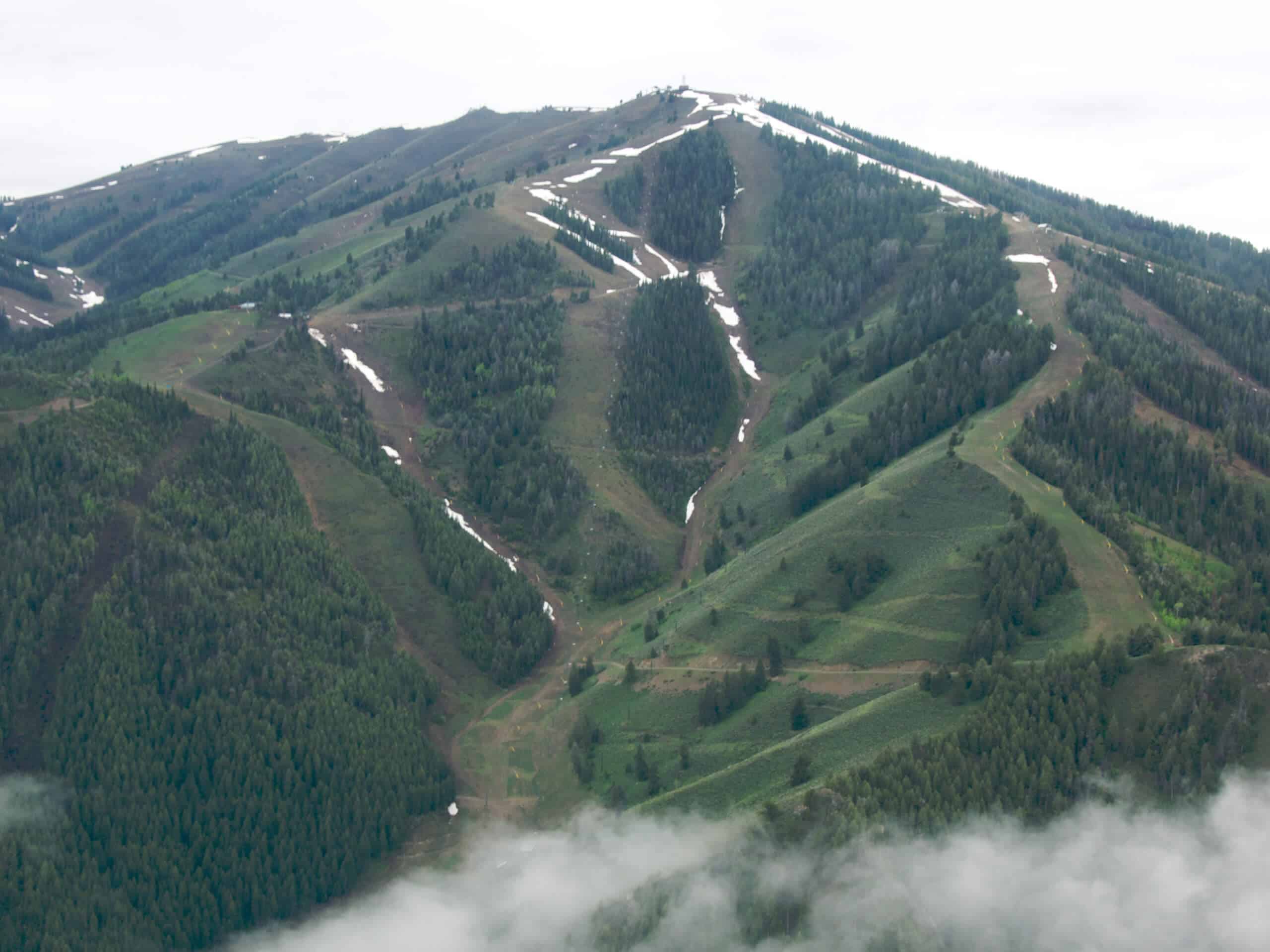
Bald Mountain Hike
Difficulty Rating:
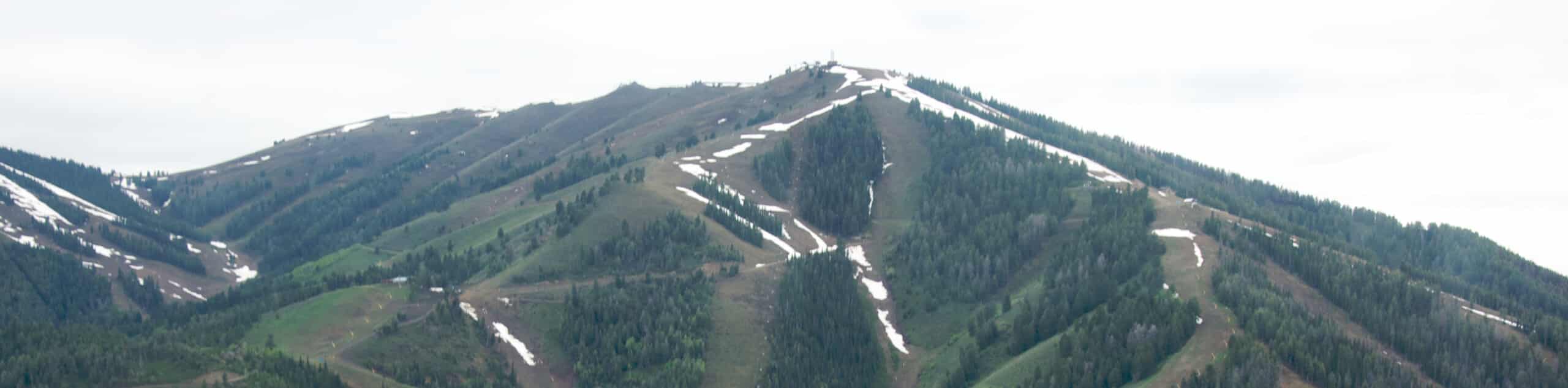
Put your stamina to the test along the Bald Mountain Hike. This demanding and dynamic adventure travels through various landscapes up to the summit, which boasts breathtaking views of the surrounding Smoky Mountains and Sun Valley below.
Getting there
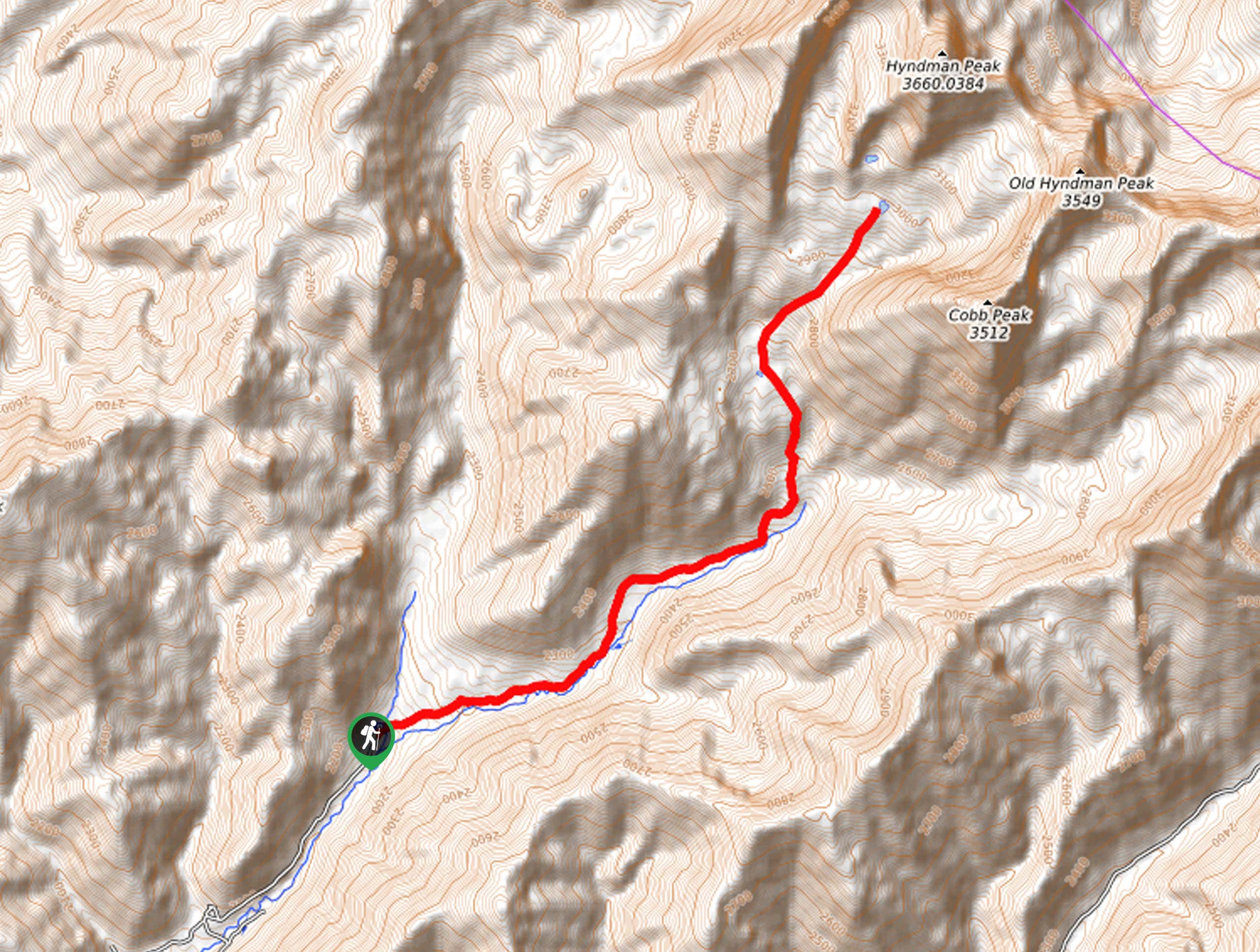
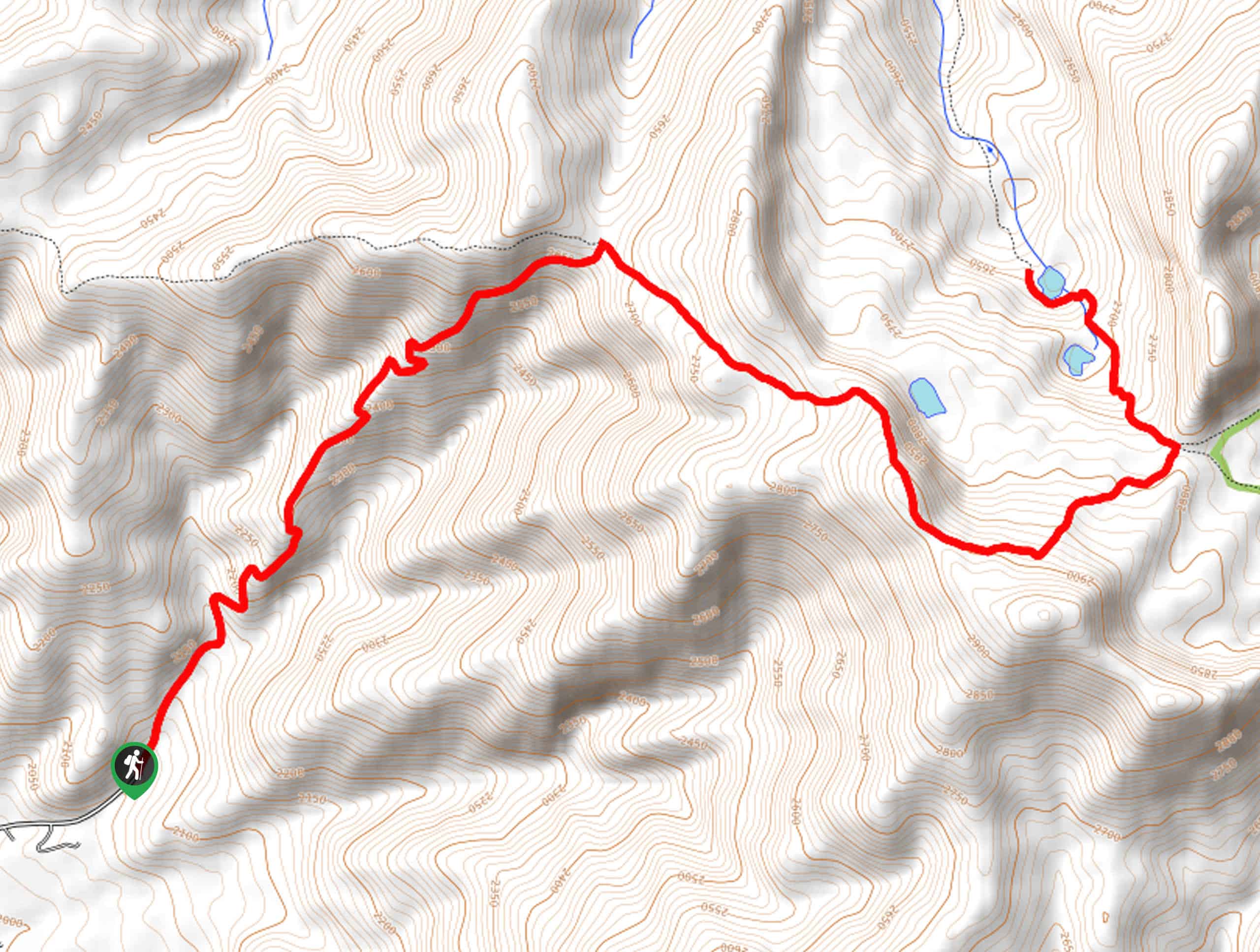
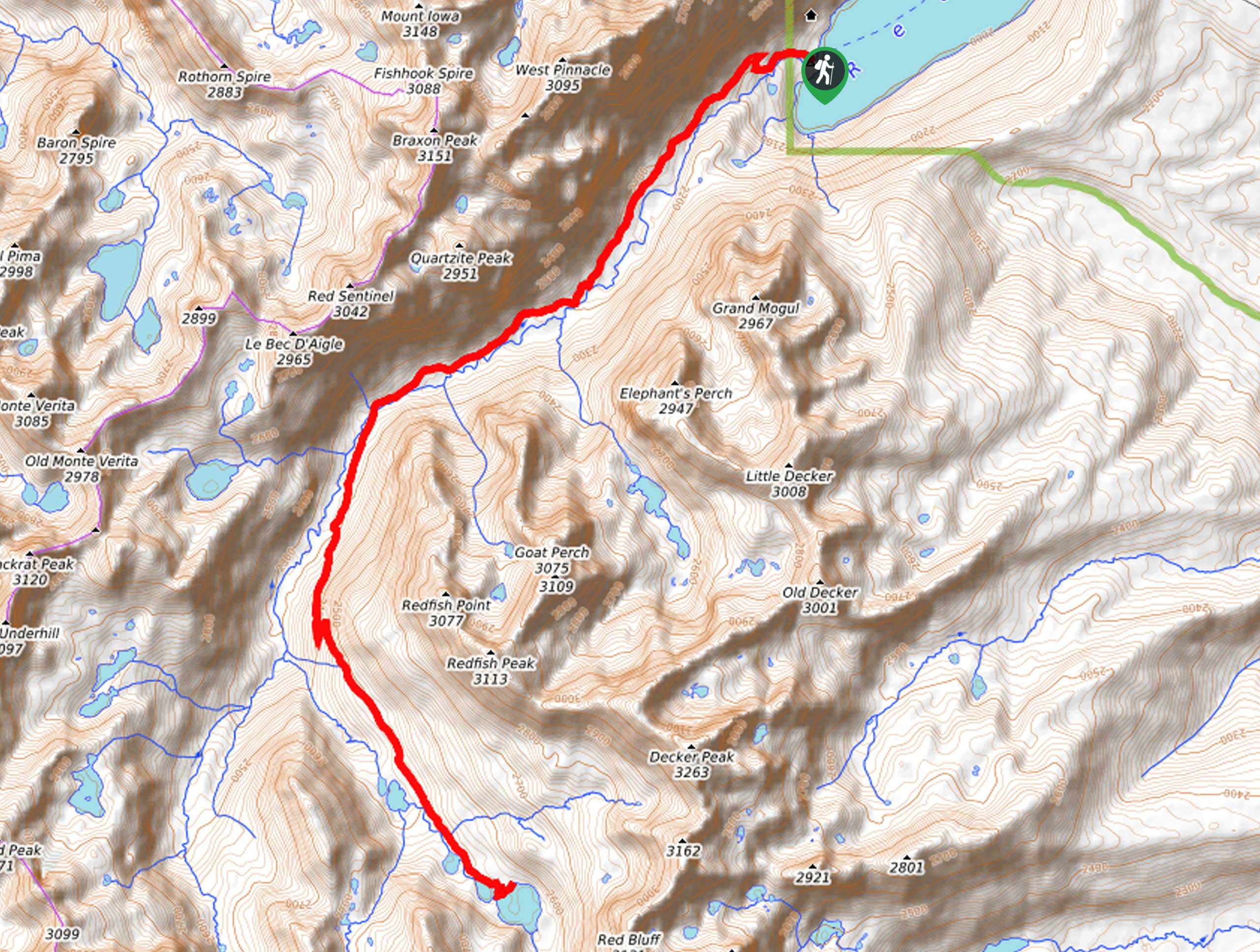
The Bald Mountain Hike departs from the parking lot off Serenade Lane.

About
| Backcountry Campground | No |
| When to do | May-September |
| Pets allowed | Yes - On Leash |
| Family friendly | No |
| Route Signage | Poor |
| Crowd Levels | Moderate |
| Route Type | Out and back |
Bald Mountain Hike
Elevation Graph
Weather
Bald Mountain Hike Description
Challenge yourself as you tackle the Bald Mountain Trail in Sawtooth National Forest. While the climb up to the peak is arduous, the spellbinding mountain views are worth the sweat. What is a busy ski resort in the winter turns into a hikers and bikers oasis in the warmer season. Explore pine forests and exposed grasslands as you wind up the mountainside. As much of the route is exposed and the ascent is tireless, you must pack a copious amount of water to stay hydrated—it is also wise to wear SPF. Note that several ski runs and trails are not well signposted, so we strongly encourage the use of the trail GPS.
Setting out from the parking lot, your journey up to Bald Mountain travels northwest along the roadside before entering the wilderness. Gradually climbing beneath the shade of the pine tree canopy, the path will eventually switch back, opening into a meadow. Beyond this point, the trail GPS is necessary—or you can map your own adventure. Either way, the Bald Mountain Trail will contour the mountainside, winding back and forth, alternating through open meadows and shaded tree stands.
As you near the summit, the terrain will become more barren, offering astounding views of the mountainscape. Make sure to rehydrate as you take the time to admire the gorgeous landscape. When you are ready, head back down the mountainside the way you came.
Similar hikes to the Bald Mountain Hike hike
Hyndman Creek Trail
The Hyndman Creek Trail is an enchanting adventure up the slopes of the highest peak in the Hyndman Mountains. Explore…
Boundary Creek Trail
The Boundary Creek Trail boasts a relentless climb, but it reveals some of the greatest views of the Sawtooth Mountain…
Redfish Inlet to Cramer Lakes Hike
The Redfish Inlet to Cramer Lakes Hike travels into the heart of the Sawtooth Mountains, exhibiting breathtaking mountain views and…
Comments