

Alpine Creek Trail
View Photos
Alpine Creek Trail
Difficulty Rating:
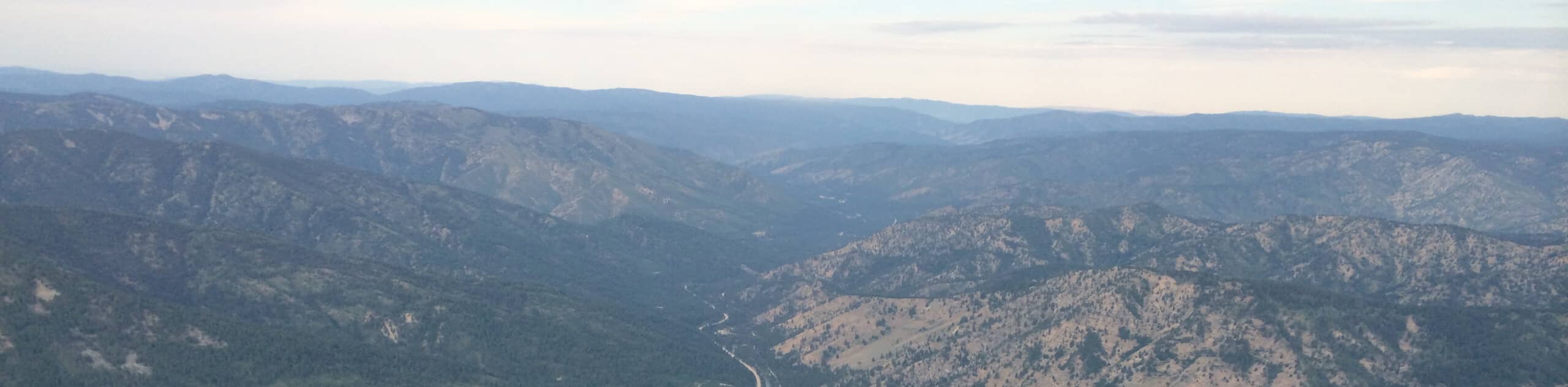
The Alpine Creek Trail is a beautiful adventure in the Sawtooth National Forest that explores lush meadows, dense woodlands, and a meandering creek. Exhibiting a diversity of flora and fauna along the way, this wonderful path also offers mesmerizing mountain views.
As of August 2022 this route is closed due to wildfires in the area.
Getting there
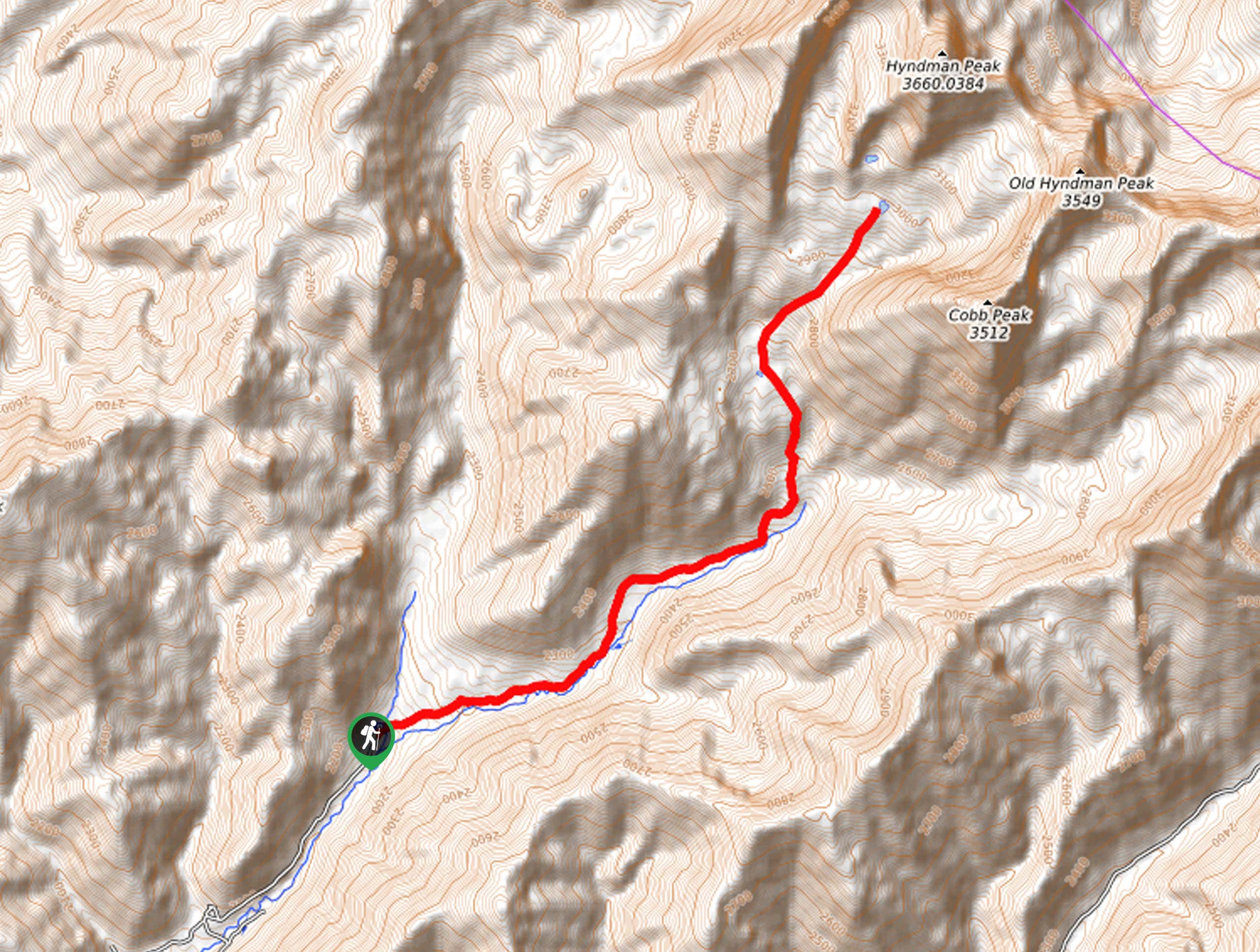
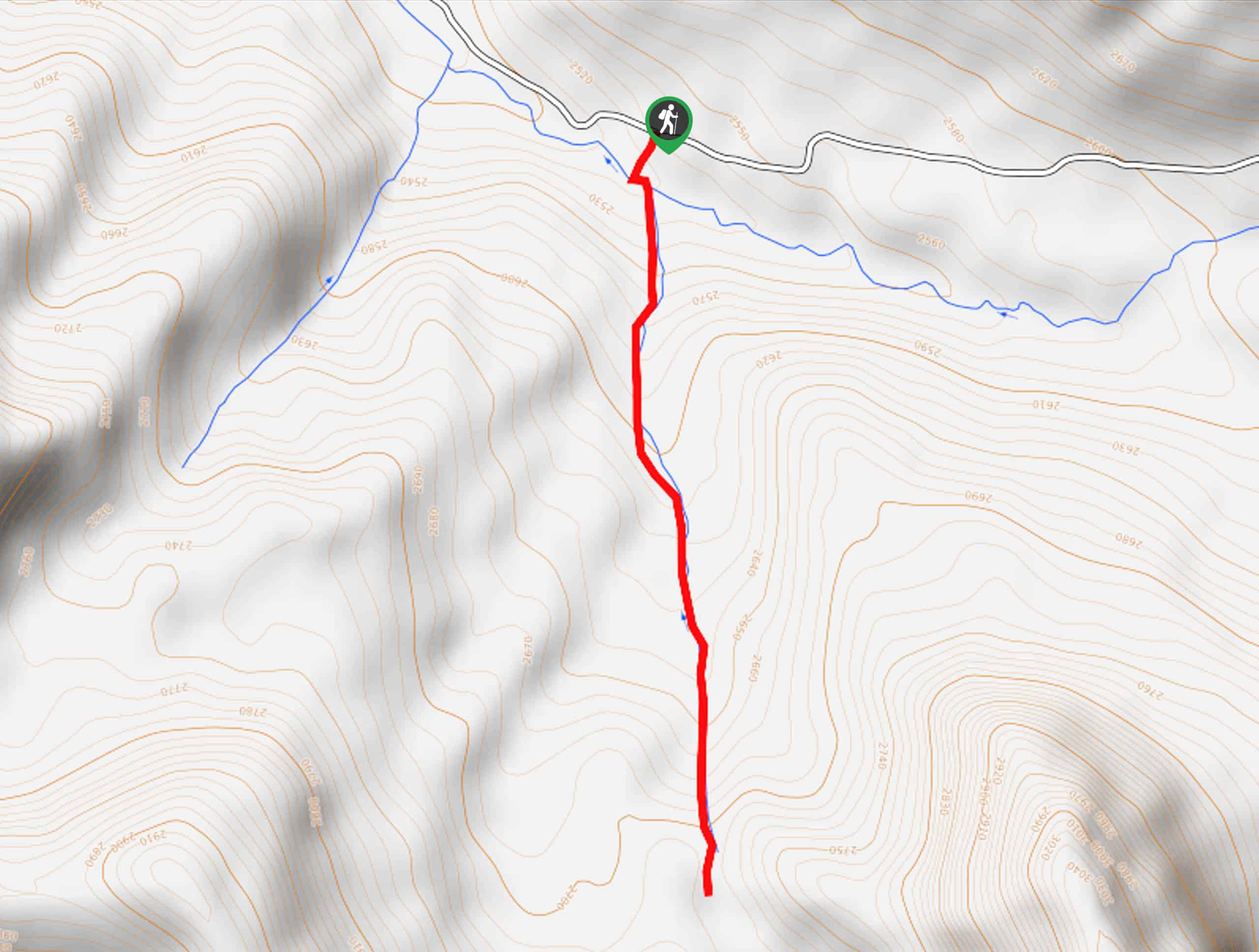
The Alpine Creek Trail is accessed from the trailhead off National Forest Development Road 205.

About
| Backcountry Campground | Dispersed Camping |
| When to do | April-October |
| Pets allowed | Yes - On Leash |
| Family friendly | Yes |
| Route Signage | Average |
| Crowd Levels | Moderate |
| Route Type | Out and back |
Alpine Creek Trail
Elevation Graph
Weather
Alpine Creek Hike Description
The Alpine Creek Trail would make an excellent addition to your Sawtooth Mountains hiking itinerary. The whole family can enjoy this scenic stroll that explores lush spruce-fir woodlands, tree-lined meadows, and a lazy-moving creek. In addition, those seeking quintessential views of the craggy crest without tackling an arduous trek will likely enjoy this scenic expedition. While the trail is family-friendly, there are rocky and steep sections of terrain, so we encourage hikers to wear a sturdy pair of footwear. Additionally, it is essential to note that much of the path is unshaded, so SPF and plenty of water are wise.
Embark on your journey into the backcountry from the trailhead off National Forest Development Road 205. Setting out from here, you will be guided northwestwardly along the Alpine Creek Trail, which will gently climb into the pine woodlands. The open tree canopy provides shade while offering views of the surrounding cliffs anchored by Perfect Peak. After some hiking, the route will near Alpine Creek, providing a wonderful scene and relaxing sounds. From here, the route will travel westwardly, alternating through exposed meadows and shaded forests along the streamlet.
As you progress further into the wilderness sights of the Alpine Creek Lakes Peak and Snowyside Peak. Admire the scene of the granite oasis, then head back along the path the way you came to the trailhead.
Similar hikes to the Alpine Creek Trail hike
Hyndman Creek Trail
The Hyndman Creek Trail is an enchanting adventure up the slopes of the highest peak in the Hyndman Mountains. Explore…
Heart Lake Trail
The Heart Lake Hike explores an area of tree burn that is abundant with lush regrowth in the Sawtooth National…
Warm Springs Loop Hike
Remarkable mountain views await you on the Warm Springs Loop Hike in the Sawtooth National Forest. What is a popular…
Comments