Tabeguache Peak via Jennings Creek Hike
View Photos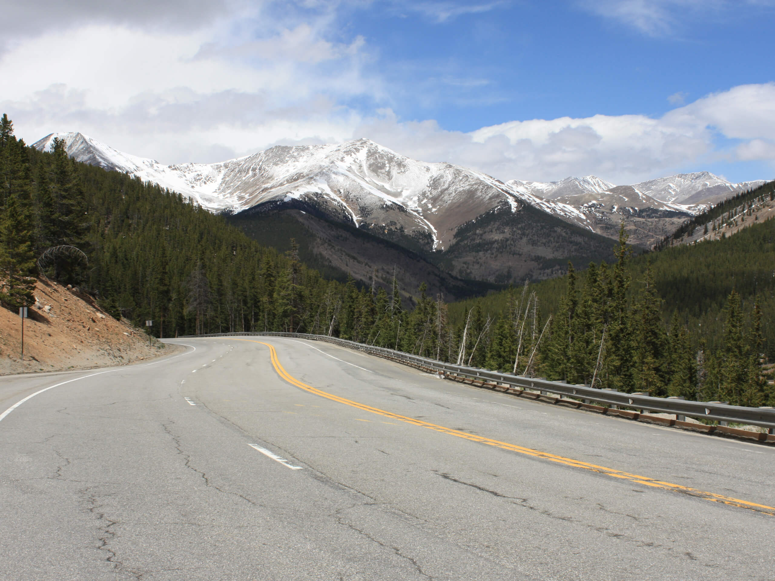
Tabeguache Peak via Jennings Creek Hike
Difficulty Rating:
The Tabeguache Peak via Jennings Creek Hike is a demanding adventure reserved for experienced hikers. Requiring an intrepid spirit, this hike is a stimulating off-roading adventure up an unmarked and primitive trail to the summit of the 14er. Though challenging, the secluded nature and stunning scenery are well worth the sweat.
Getting there
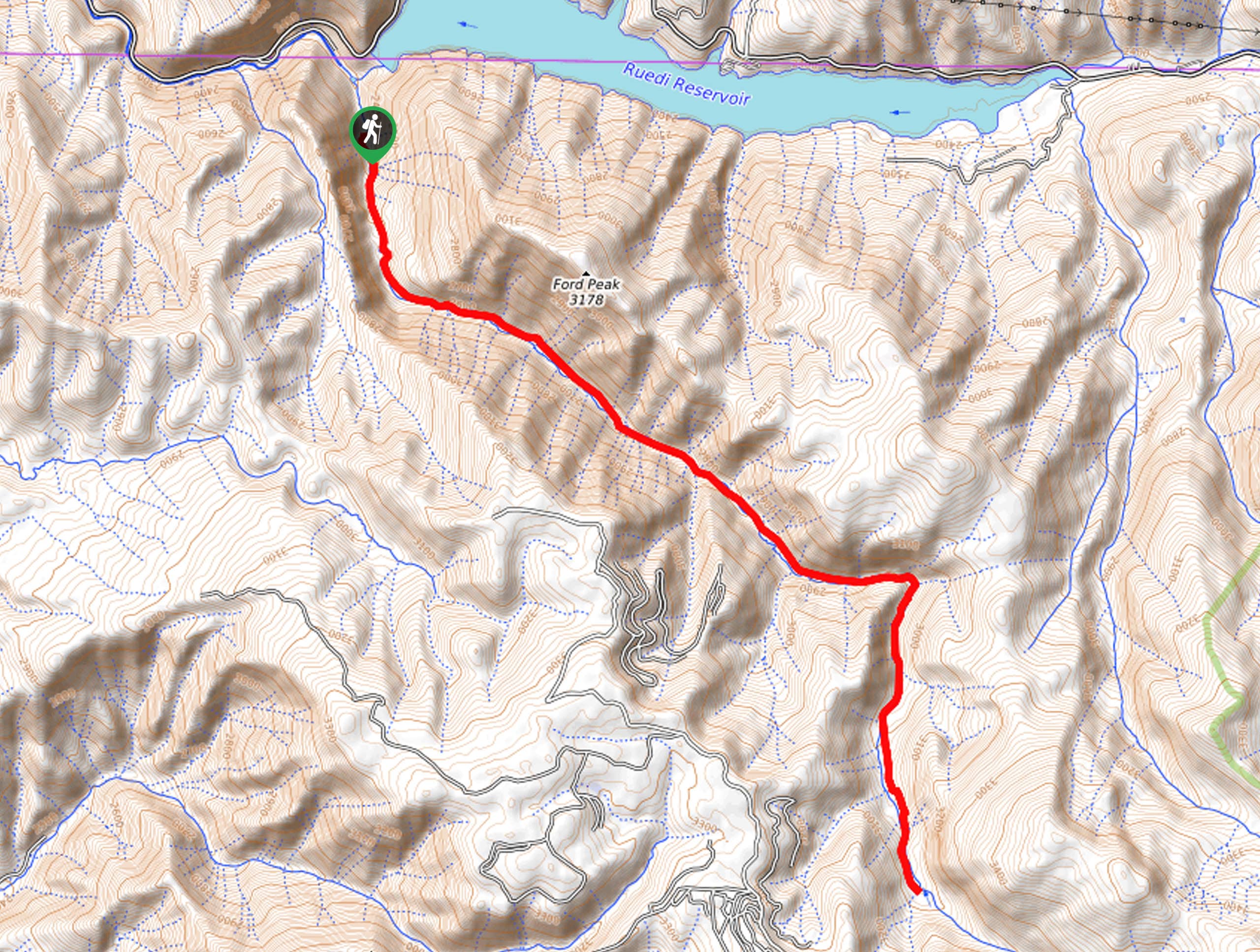
The Tabeguache Peak via Jennings Creek Hike departs from the trailhead off Forest Road 240.

About
| Backcountry Campground | Dispersed Backcountry Camping |
| When to do | June-October |
| Pets allowed | Yes - On Leash |
| Family friendly | No |
| Route Signage | Poor |
| Crowd Levels | Low |
| Route Type | Out and back |
Tabeguache Peak via Jennings Creek Hike
Elevation Graph
Weather
Tabeguache Peak via Jennings Creek Hike Description
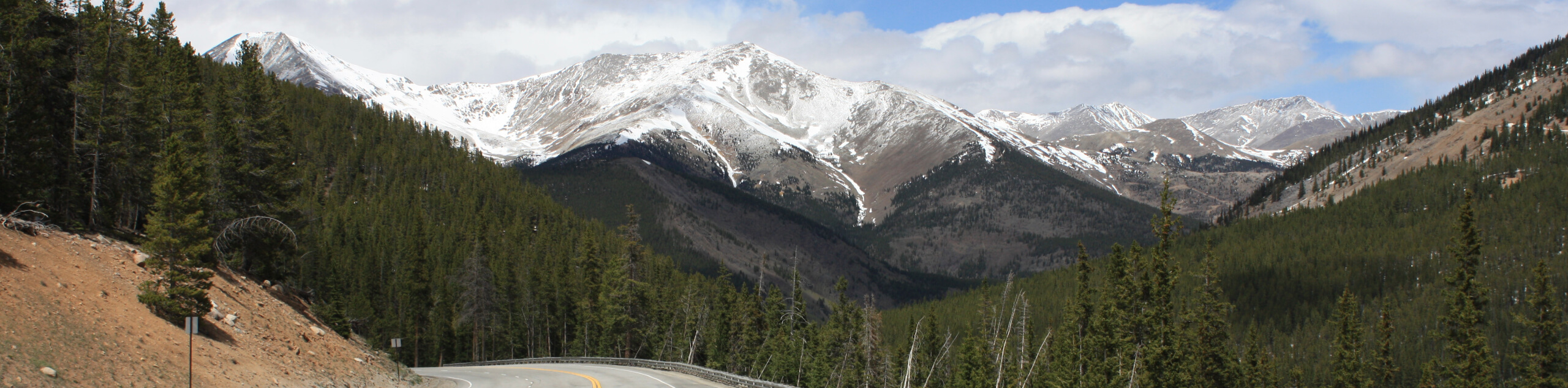
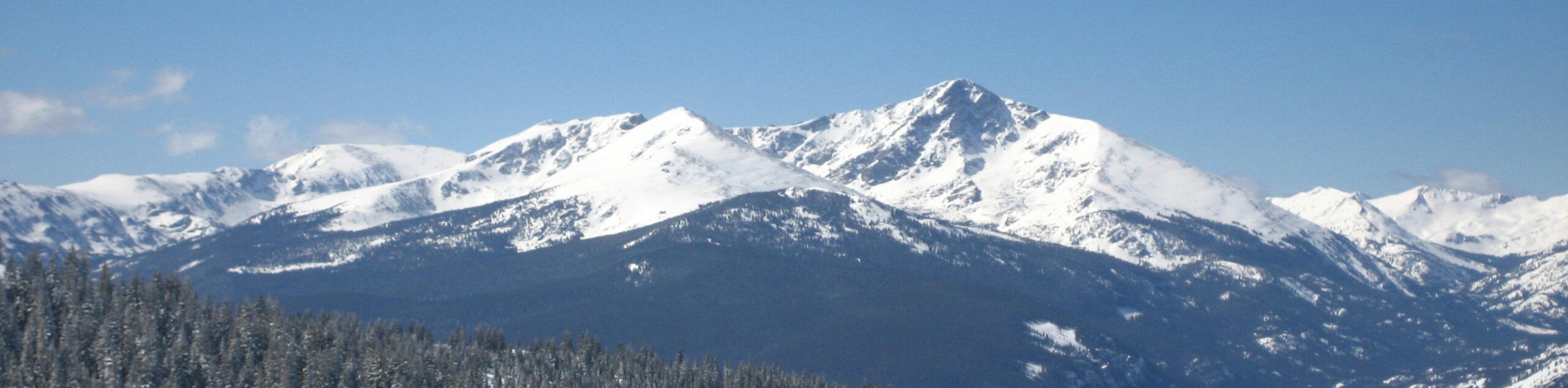
The Tabeguache Peak via Jennings Creek Hike is an exciting expedition in the Sawatch Mountain Range. With no explicit trail, this path warrants navigation and dedication. We highly suggest using the trail GPS to safely navigate the terrain and be sure to be prepared in case of an emergency. Pack plenty of water, wear layers and consider trekking poles and microspikes in the fall and winter months. Additionally, be sure to check the forecast prior to your ascent and summit before noon to mitigate the chances of getting caught in an afternoon storm. Though dogs are permitted, there is some rocky terrain that requires bouldering and scrambling near the peak that may not be manageable by your pup.
Begin your journey along the Tabeguache Peak via Jennings Creek Hike from the trailhead. From here, track north along the unmarked trail, following the curves of Jennings Creek. Soon after your departure, the terrain will become exposed, guiding adventurers through a lush alpine tundra. Hike up the gully, and you will eventually ridge the saddle. From here, you will notice Carbonate Mountain on your left. Veer right and hike east along the exposed and increasingly rocky ridge.
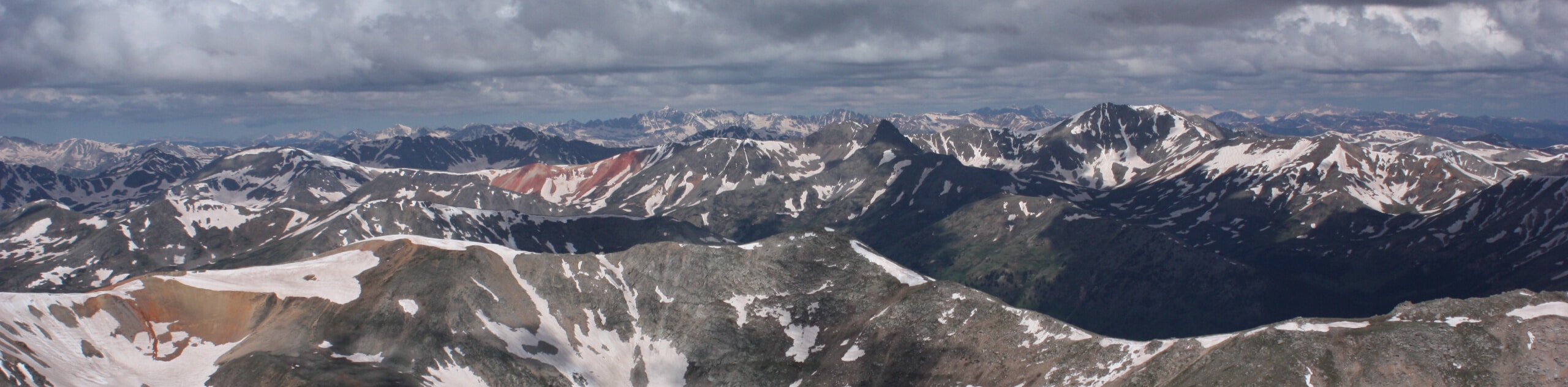
Let the expansive mountain views motivate you as you scramble up the scree to the summit of Tabeguache Peak. Revel in your accomplishment and the 360-degree panoramic views of the neighboring snow-capped Sawatch Peaks. When you are rested and rehydrated, simply retrace your footing to the best of your abilities all the way back to the trailhead.
Similar hikes to the Tabeguache Peak via Jennings Creek Hike hike
Mount of the Holy Cross Loop Trail
Hike up to one of the most famous Colorado 14ers along the Mount of the Holy Cross Loop Trail. This…
Rocky Fork Trail
The Rocky Fork Trail is an unassumingly picturesque adventure through the Rocky Fork Creek’s forested canyon that reveals awe-inspiring views…
La Plata Ellingwood Ridge Hike
The La Plata Ellingwood Ridge Hike is a demanding feat that requires an experienced adventurer with an intrepid spirit. If…
Comments