Mount Shavano Hike
View Photos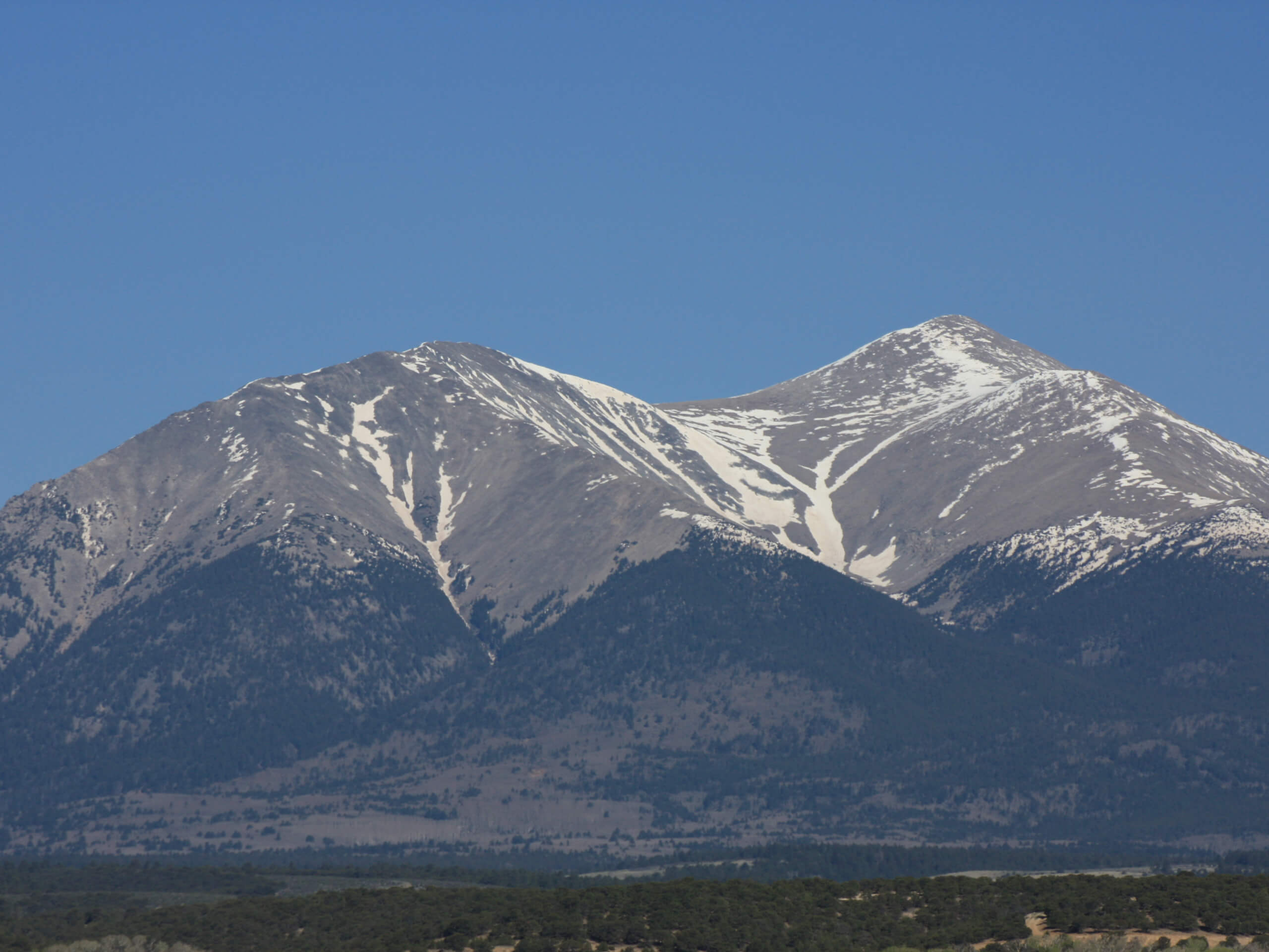
Mount Shavano Hike
Difficulty Rating:
Put your endurance to the test as you adventure the Mount Shavano Hike. This demanding excursion is unassumingly picturesque but warrants an intrepid spirit and stamina! Traveling over 3281ft up to the summit, the sweeping vistas of the encompassing peaks will undoubtedly motivate even the most discouraged hikers. We love this expedition, and we think you will too.
Getting there
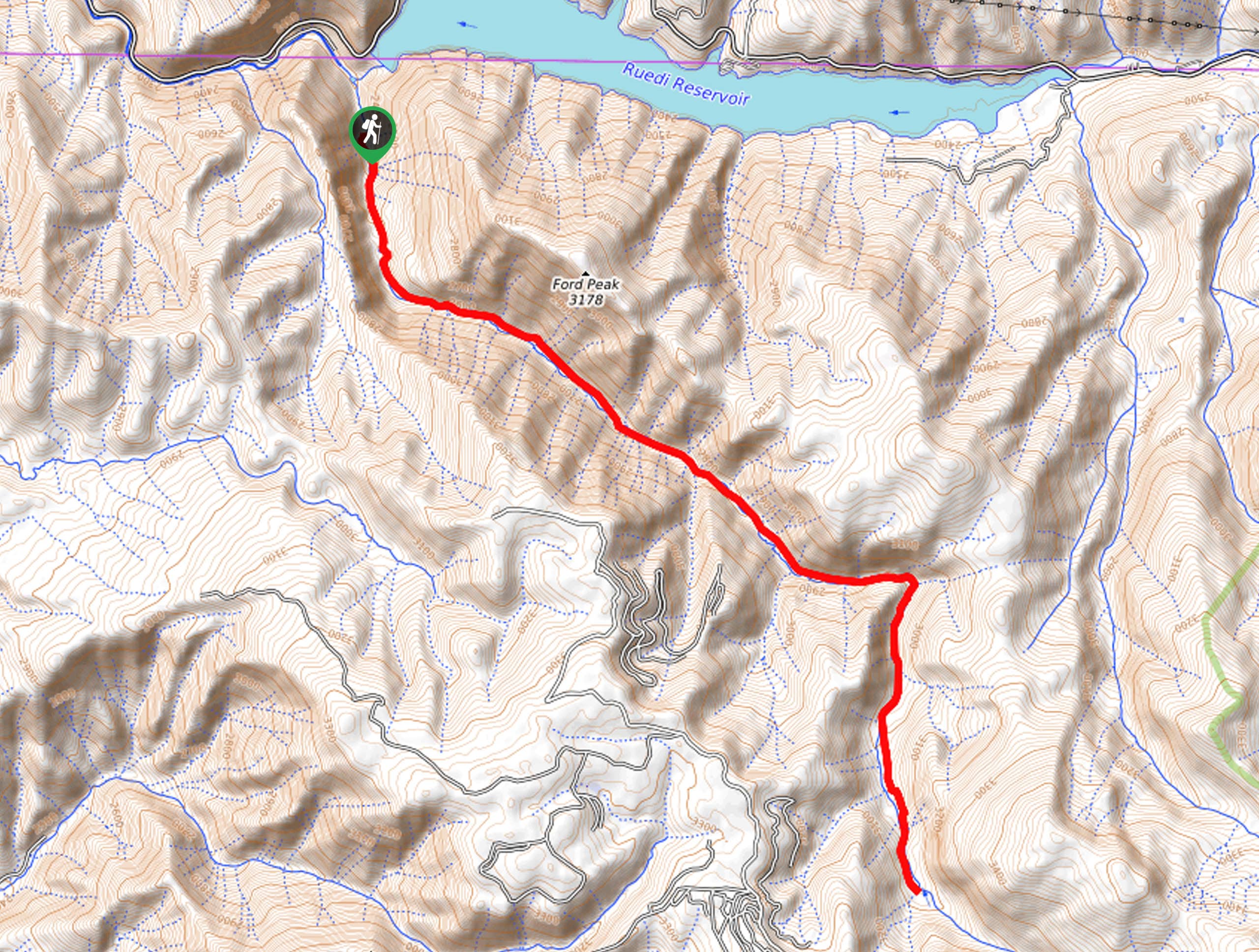
The Mount Shavano Hike departs from the Mount Shavano and Tabeguache Peak Trailhead off Forest Road 252.

About
| Backcountry Campground | Dispersed Backcountry Campsites |
| When to do | April-September |
| Pets allowed | Yes - On Leash |
| Family friendly | No |
| Route Signage | Average |
| Crowd Levels | Moderate |
| Route Type | Out and back |
Mount Shavano Hike
Elevation Graph
Weather
Mount Shavano Hike Description
Summiting a Colorado fourteener is at the top of many adventure travelers’ bucket lists, and it is certainly one of ours! The Mount Shavano Hike is a great option for those seeking a relatively manageable ascent to the summit. With a Class 2 scramble up to the peak, the 17th highest ranked fourteener will challenge even the most experienced hikers without over-exhausting its venturers. With the ideal balance between strenuous and scenery, a high-altitude hike such as this posses’ inherent risks. It is important to be mindful of avalanches in the winter months, and crampons and an ice pick are recommended. In the warmer season, be sure to check the forecast and head out at dawn to summit before noon—mitigating the chances of getting caught in a dangerous afternoon storm. We also suggest using the trail GPS as the path can be difficult to follow, and making a wrong turn can be dangerous! Additionally, be sure to acclimate to the area’s high altitude before your climb.
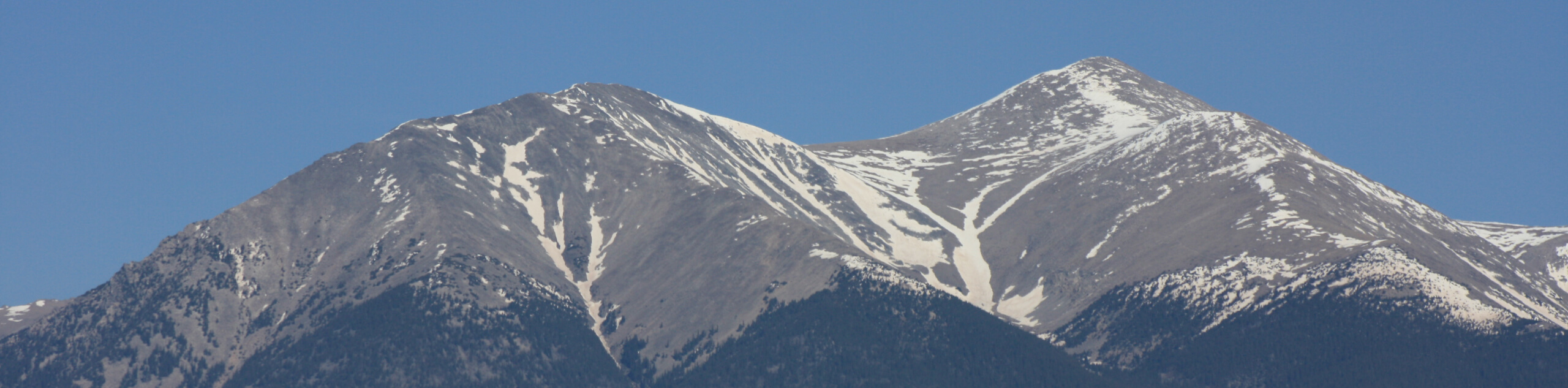
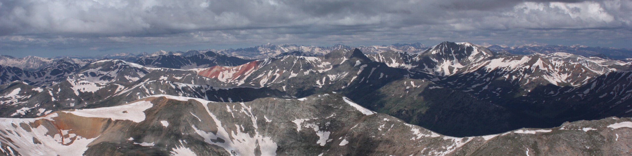
Though taxing and sometimes dangerous, the Mount Shavano Hike is a highly rewarding adventure. Once you summit the Colorado fourteener and revel in the unparalleled vistas of the mountainous landscape, you will undoubtedly be overwhelmed with the sensation of personal achievement. Not an easy feat, the incredible scenery along the trail is an excellent distraction from tired feet. Exhibiting the diversity of the area’s flora and fauna, you will be in the company of pikas and marmots as you hike through the alpine tundra. Be sure to pack plenty of water, and don’t forget to charge your camera– the picturesque views warrant endless photo opportunities! Remember to keep an eye out for the “angel” that is etched by a snowfield into the eastern flank of the peak!
Embark on your adventure along the Mount Shavano Hike from the Mount Shavano and Tabeguache Peak Trailhead off Forest Road 252. From here, the unnamed trail will guide hikers northwest through the tree shade and past several dispersed campsites before arriving at a junction. Here, keep right and trek northeast along the Colorado Trail Segment 14. Passing through aspen groves, the route will eventually encounter another intersection, veer left here, and you will be diverted onto the Mount Shavano Trail. Still hiking beneath the timberline, the path will curve northwest. Expect the route to intersect with several alpine streams, granting several opportunities to filter water or to let your pup rehydrate.
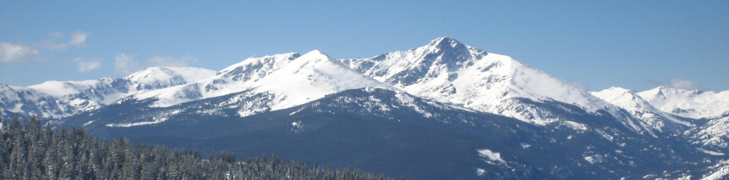
As you continue to climb, the tree shade will become increasingly sparse, revealing epic views of the “angel” looming above. Soon you will meet another junction. Here, keep right, navigating a few sets of switchbacks before graduating from the timberline. Now trekking through the vibrant and exposed alpine tundra, be sure to keep an eye on the skies. As you walk, you will likely be in the company of overly friendly marmots as you make your way north to the summit. Let the expansive views of the surrounding mountainous wilderness motivate you as you scramble up the talus. You will be rewarded with sweeping vistas of the snow-capped Sawatch Peaks that flank the verdant woodlands below from the summit.
Notice Mount Antero in the north and Tabeguache Peak across the saddle in the northwest. If you still have some gas left in the tank, consider following the path across the saddle to the summit of another Colorado fourteener. This extension is technical and lengthy, so make sure you are prepared and that you have enough time. If you do cross over to Tabeguache Peak, be sure to avoid the McCoy Gulch, as this route can be deceivingly dangerous and difficult. From the summit of Mount Shavano, retrace your footing back along the path to return to the trailhead, marking the end of your adventure.
Trail Highlights
Mount Shavano is a 14232ft fourteener in the San Isabel National Forest. This impressive peak is ranked as the 17th highest fourteener in Colorado. Named for Chief Shavano of the Ute tribe, this impressive peak boasts awe-inspiring vistas of the encompassing snow-capped summits in the San Isabel National Forest. Known also for its “Angel of Shavano”, a snowfield on the eastern face of the peak depicts what looks to be an image of an angel stretching its wings. This lovely adventure up to the summit of a Colorado fourteener is a must-add to intrepid explorers’ bucket lists.
Frequently Asked Questions
How high is Mount Shavano?
Mount Shavano sits at an elevation of 14232ft in the Sawatch Mountain Range.
What class is Mount Shavano?
Mount Shavano requires a Class 2 scramble up to the summit.
Is the Mount Shavano Hike difficult?
Yes, the Mount Shavano Hike is a technical and demanding ascent in the San Isabel National Forest.
Insider Hints
Similar hikes to the Mount Shavano Hike hike
Mount of the Holy Cross Loop Trail
Hike up to one of the most famous Colorado 14ers along the Mount of the Holy Cross Loop Trail. This…
Rocky Fork Trail
The Rocky Fork Trail is an unassumingly picturesque adventure through the Rocky Fork Creek’s forested canyon that reveals awe-inspiring views…
La Plata Ellingwood Ridge Hike
The La Plata Ellingwood Ridge Hike is a demanding feat that requires an experienced adventurer with an intrepid spirit. If…
Comments