Mount Antero Trail
View Photos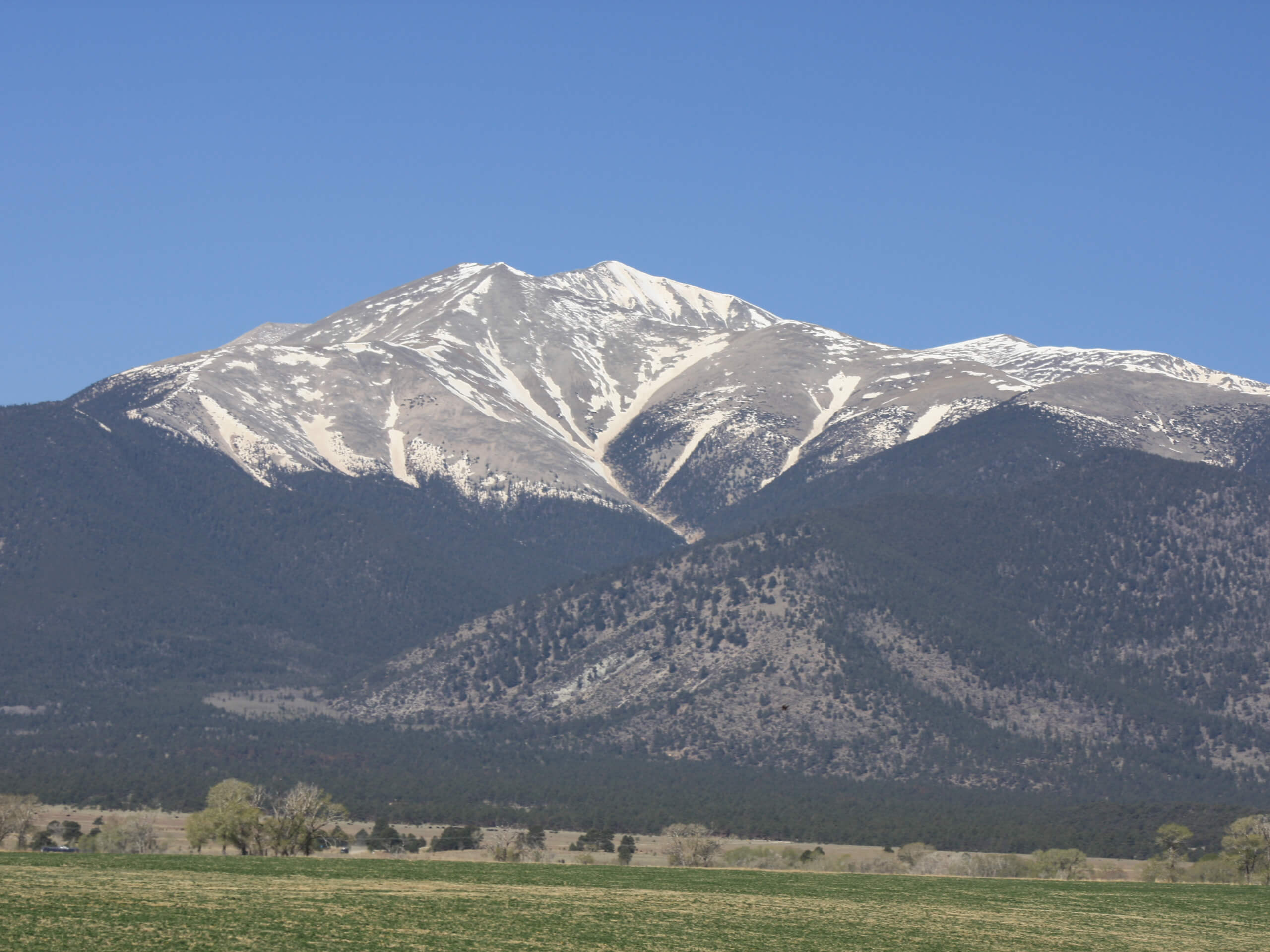
Mount Antero Trail
Difficulty Rating:
The Mount Antero Trail is a demanding but rewarding adventure up one of Colorado’s famous fourteeners (14ers). Shared with courageous 4x4 drivers, the initial segment of the hike treks along one of the highest roads in the United States. This epic summit expedition necessitates an adventurous spirit and stamina. We love this exciting excursion and we know you will too—this hike is a must add to your Colorado adventure bucket list.
Getting there
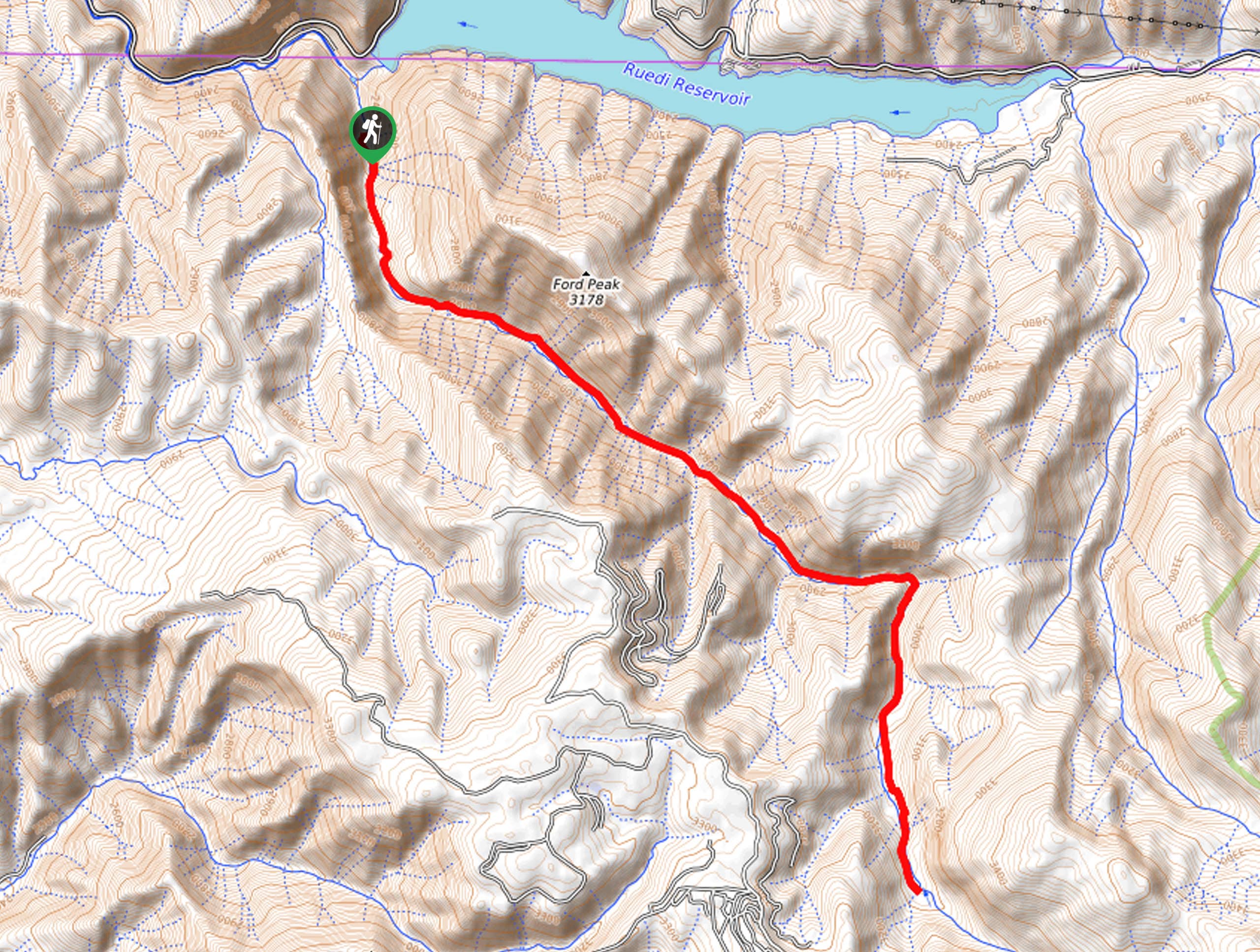
The Mount Antero Trail is accessed via the Baldwin Gulch Trailhead off County Road 162.

About
| Backcountry Campground | Dispersed backcountry campsites |
| When to do | March-October |
| Pets allowed | Yes - On Leash |
| Family friendly | No |
| Route Signage | Average |
| Crowd Levels | Moderate |
| Route Type | Out and back |
Mount Antero Trail
Elevation Graph
Weather
Mount Antero Trail Description
Put your endurance to the test as you ascend challenging terrain to the summit of Mount Antero. One of the famous Colorado 14ers, this demanding hike will exhaust you, so make sure to pack plenty of water and snacks to stay fueled. Ascending high elevations along exposed terrain, it is important to check the forecast and head out before dawn to mitigate the chances of getting caught in an afternoon storm. It is also good to wear layers as insurance against extreme conditions at the summit. Crampons are a must to safely maneuver the snow-packed and icy terrain in the winter months. Additionally, we suggest using the trail GPS to easily navigate the more primitive and unmarked sections of the trail.
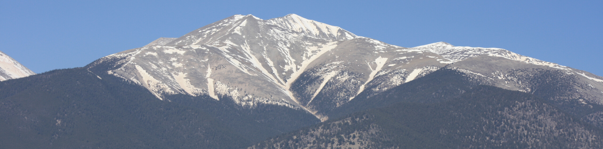
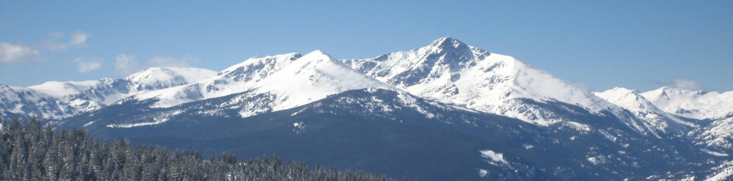
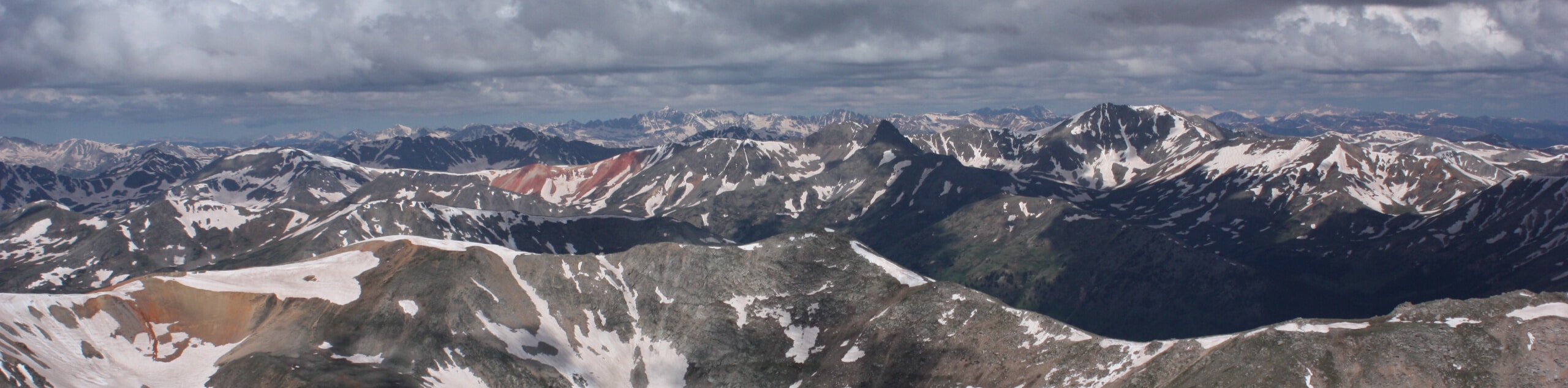
The Mount Antero Trail is a stunning summit hike in the Sawatch Mountain Range. With exciting terrain and beautiful scenery to motivate you, you won’t even have the time to think about your tired feet. This trek packs a punch by travelling through vibrant aspen groves, lodgepole pine forest, and lush alpine meadows. Though the sights prior to graduating the treeline are picturesque, the views from the exposed tundra are unparalleled. Revel in the sights of Mount Shavano in the south and the snow-capped Collegiate Peaks in the north. Exhibiting some of the most beautiful panoramic views, the effort and exhaustion required will prove to be worth it once you summit the Colorado 14er.
Begin your journey along the Mount Antero Trail from the Baldwin Gulch Trailhead off County Road 162. From here, track southeast along County Road 277—a 4×4 road shared with off-roading vehicles. Note this road is subject to seasonal closures to vehicle traffic, so you may have the route all to yourself. As you hike southeast along the semi-forested trail, you will intersect with several alpine streams. Not too long after your departure from the trailhead, you will encounter an intersection. At the junction, keep left, and the route will near Baldwin Creek.
Continue hiking up County Road 277, passing several dispersed campsites along the way. The terrain will become increasingly exposed as you near the summit. As you wander south, you will be rewarded with commanding views of Boulder Mountain in the southwest and Cronin Peak in the south. Soon you will confront another junction. Here, veer left, and you will be diverted onto FDR 278—this is your final push up to the summit. This section of the path will become increasingly steep and technical, demanding navigation through what seems like a never-ending set of switchbacks.
At the next junction, keep left and trek along the FDR 278A Mount Antero Trail. This path is extremely rough and rugged, so mind your footing. Follow the rock cairns through the talus field as you scramble up the southern flank of Mount Antero. When you summit the 14er you will be granted 360-degree, panoramic vistas of the neighboring snow-dusted peaks that stretch for as far as the eye can see. Notice Mount Princeton in the north and Mount White in the southeast. Revel in the grandeur of the mountainous wilderness and rest atop the peak prior to beginning your descent. Retrace your footing along the route back to the trailhead when you are ready to return.
Trail Highlights
Mount Antero
Mount Antero is a prominent peak in the Sawatch Mountain Range that was named after Chief Antero of the Uintah band of the Ute tribe. Sitting at an elevation of 14275ft, Mount Antero ranks 11th on the list of Colorado summits. Possessing the most lucrative concentrations of aquamarine in the country, the impressive Colorado 14er has an active mining industry as well as frequented hiking trails. Boasting the highest gem field in the lower 48, it is illegal to mine or remove gemstones without a Notice of Intent or Plan of Operations from the US Forest Service. Mount Antero also possesses one of the highest roads within the United States.
Frequently Asked Questions
Is the Mount Antero Trail a difficult hike?
The Mount Antero Hike is a demanding and lengthy adventure up to the summit of a Colorado 14er.
Can you drive up to the summit of Mount Antero?
Yes, there is a rough and rugged 4-wheel drive road (County Road 277) through Baldwin Gulch up to the summit of Mount Antero.
Are there gems on Mount Antero?
Yes, Mount Antero is and has always been a popular mining site for gems such as aquamarine, smoky quartz, blue topaz, and more.
Insider Hints
Pack plenty of water, this is a demanding venture to the summit of Mount Antero
Note it is illegal to take or mine for gems on Mount Antero without a Notice of Intent or Plan of Operations from the US Forest Service
Wear microspikes and bring trekking poles when hiking up to Mount Antero in the late fall and winter months
If you are feeling adventurous and you have a 4x4 vehicle with high clearance, then consider driving up one of the highest roads in the country
Charge up your camera, this stunning adventure presents countless photo opportunities
Similar hikes to the Mount Antero Trail hike
Mount of the Holy Cross Loop Trail
Hike up to one of the most famous Colorado 14ers along the Mount of the Holy Cross Loop Trail. This…
Rocky Fork Trail
The Rocky Fork Trail is an unassumingly picturesque adventure through the Rocky Fork Creek’s forested canyon that reveals awe-inspiring views…
La Plata Ellingwood Ridge Hike
The La Plata Ellingwood Ridge Hike is a demanding feat that requires an experienced adventurer with an intrepid spirit. If…
Comments