Missouri Mountain Trail
View Photos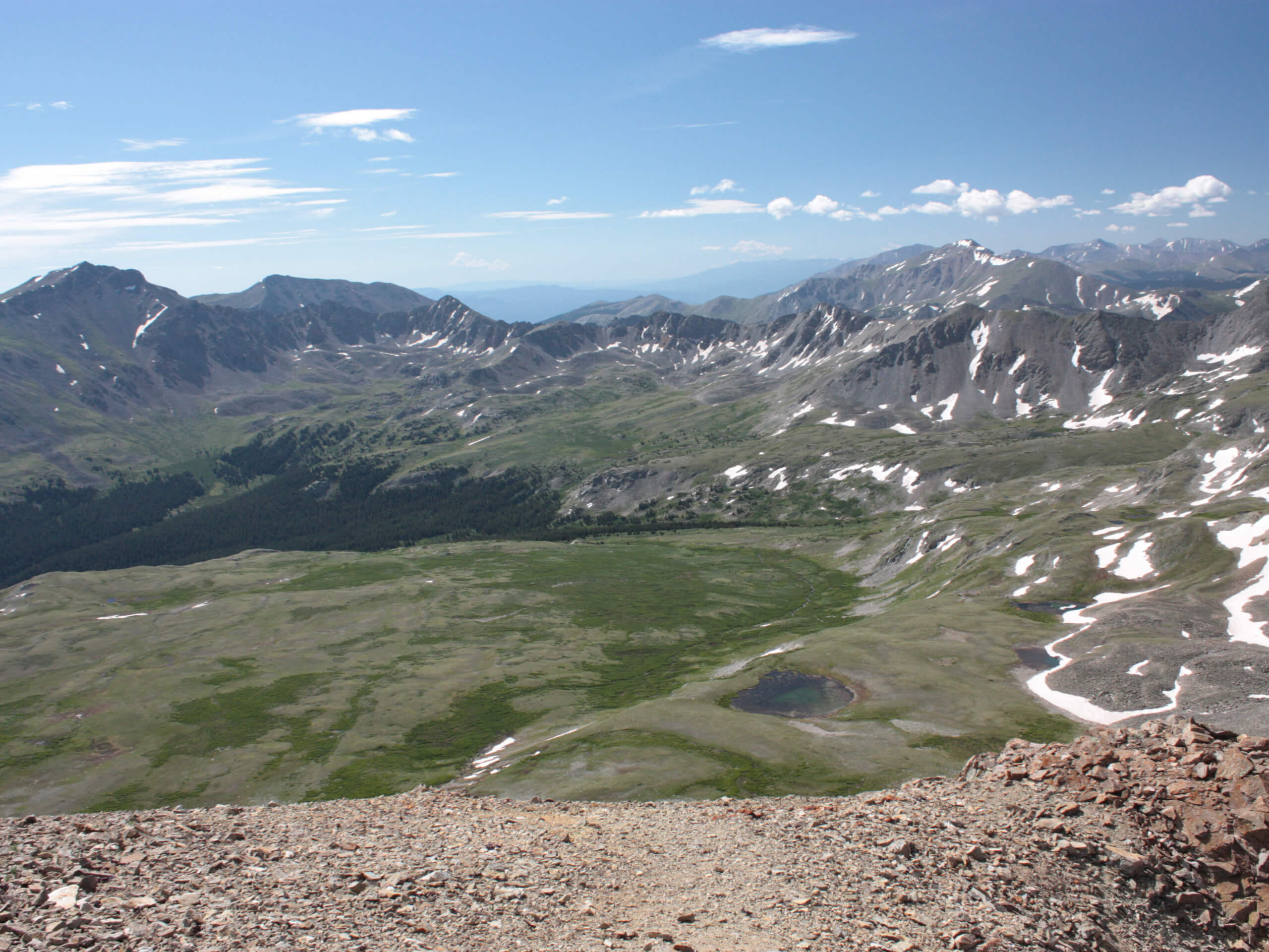
Missouri Mountain Trail
Difficulty Rating:
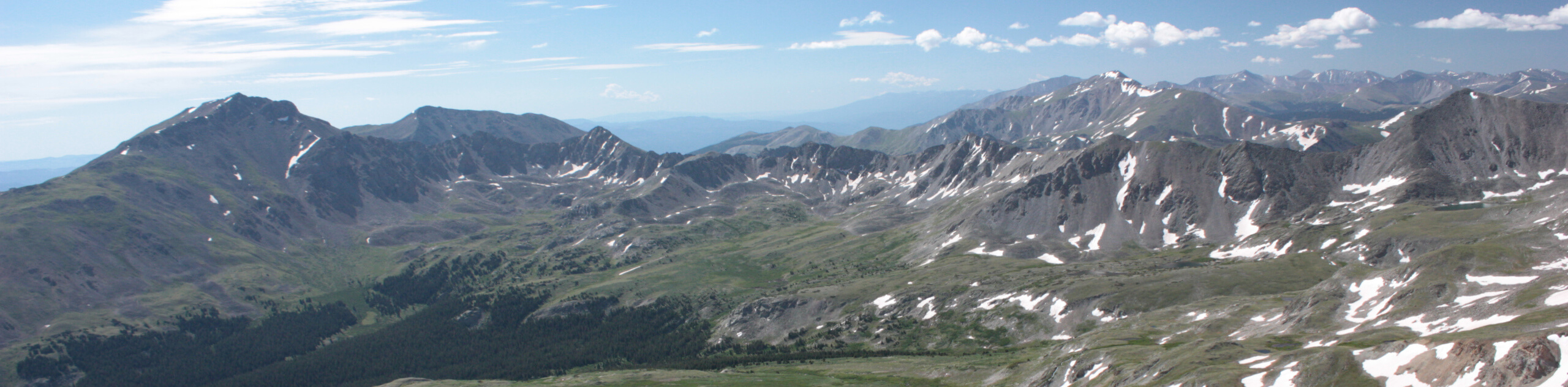
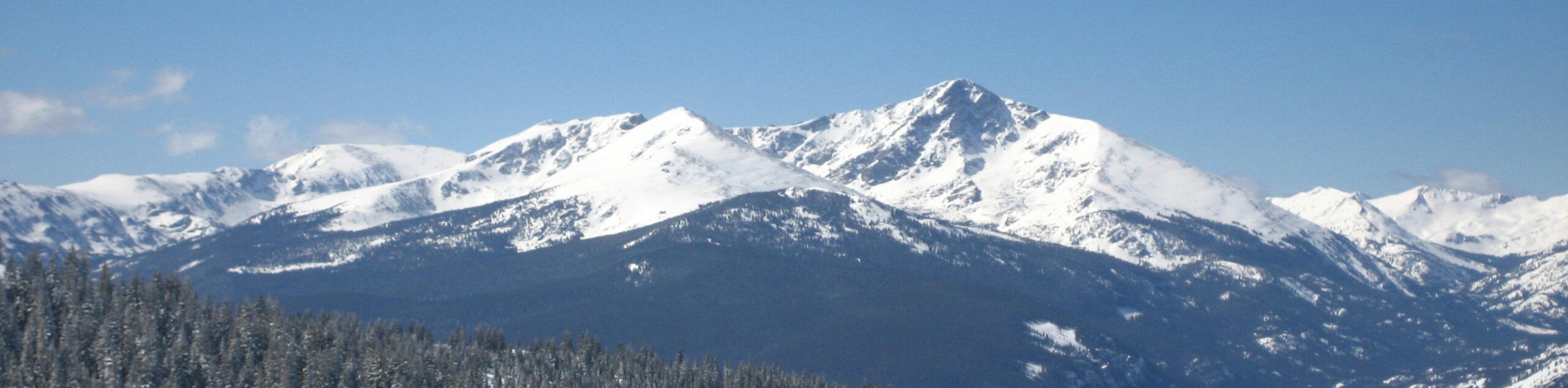
Ironically, you will not find the Missouri Mountain Hike in Missouri, instead, this epic adventure is located near Leadville, Colorado. This amazing hike is truly one of a kind. Travel through enchanting aspen groves along the alpine stream before summiting the ridgeline and peak, which deliver 360-degree, panoramic views of the neighboring Collegiate Peaks that flank the verdant woodlands below. This trek is a must-add to your Colorado hiking itinerary!
Getting there
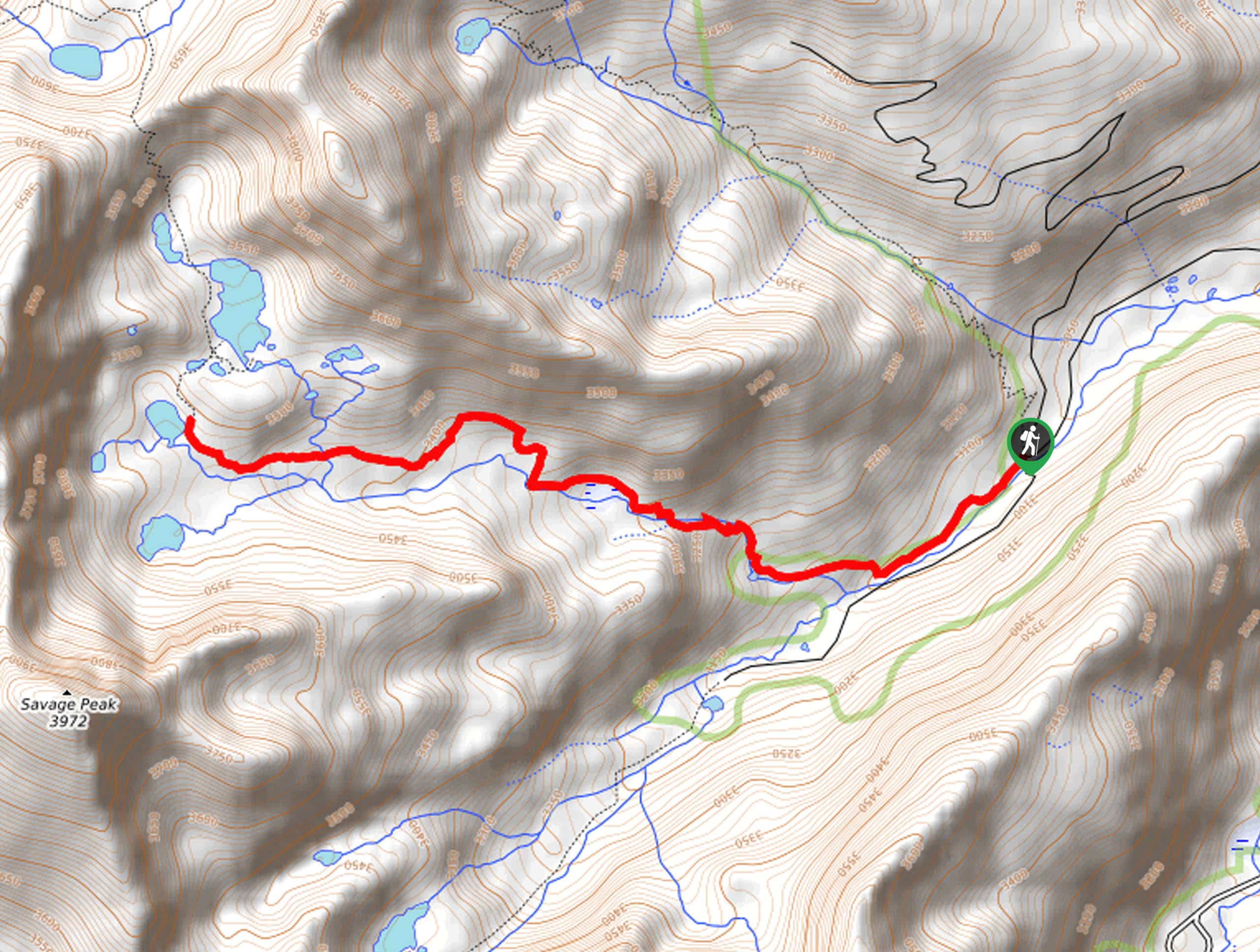
The Missouri Mountain Trail is accessed via the Missouri Gulch Trailhead off County Road 390.

About
| Backcountry Campground | Dispersed Backcountry Camping |
| When to do | March-October |
| Pets allowed | Yes - On Leash |
| Family friendly | No |
| Route Signage | Average |
| Crowd Levels | Moderate |
| Route Type | Out and back |
Missouri Mountain Trail
Elevation Graph
Weather
Missouri Mountain Trail Description
The Missouri Mountain Hike is incredible, but it is not for the faint of heart! This trek will undoubtedly get your blood pumping with extreme elevation gain, scrambling, and exposed terrain. Don’t let us discourage you, though; the challenging epic scenery and alpine views prove well worth the effort! Make sure you are acclimated to the area’s elevation and try to summit before noon to mitigate the chances of getting caught in an afternoon storm. We also suggest microspikes and trekking poles when venturing in the fall or winter months!
Begin your journey up to the Colorado fourteener from the trailhead off Country Road 360. From the trailhead, the Missouri Mountain Hike follows the Missouri Gulch Trail south. Immediately after departing the trailhead, the path will begin to climb, guiding hikers through a set of switchbacks. Follow the trail, enjoy the sparse tree shade and the sights of the encompassing craggy walls. Eventually, the route will pass several dispersed campsites before arriving at a junction; keep right here. Intersecting with an alpine stream, the path will guide adventurers west up a rocky scree to the ridgeline.
Once you summit the ridgeline, you will be rewarded with breathtaking views of the mountains that stretch for as far as the eye can see. Hook onto the Missouri Mountain West Ridge Trail here, and hike southeast up to the peak. From here, revel in the grandeur of the neighboring Collegiate Peaks, and don’t forget to take photos! When you are done enjoying the scenery, simply retrace your footing along the path back to the trailhead.
Similar hikes to the Missouri Mountain Trail hike
Mount of the Holy Cross Loop Trail
Hike up to one of the most famous Colorado 14ers along the Mount of the Holy Cross Loop Trail. This…
Sopris Lake via Brady Lake Trail
Immerse yourself in the jaw-dropping scenery that the Swatch Mountain Range has to offer, as you venture to Sopris Lake…
First Missouri Lake Trail
The First Missouri Lake Trail is a stunning day hike into Colorado’s high country. Explore the alpine terrain and revel…
Comments