Collegiate Peaks Campground Hike
View Photos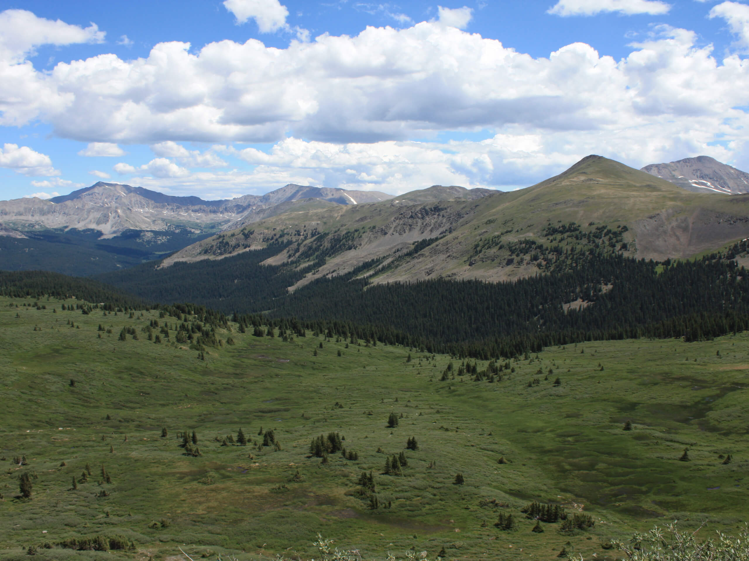
Collegiate Peaks Campground Hike
Difficulty Rating:
The Collegiate Peaks Campground Hike is a wonderful spontaneous adventure through the forested campground and into the enchanting woodlands. Open year-round, this versatile trail is a great cross-country skiing or snowshoeing route in the winter month! The next time you stay at the campground make sure to take the time to venture this scenic path.
Getting there
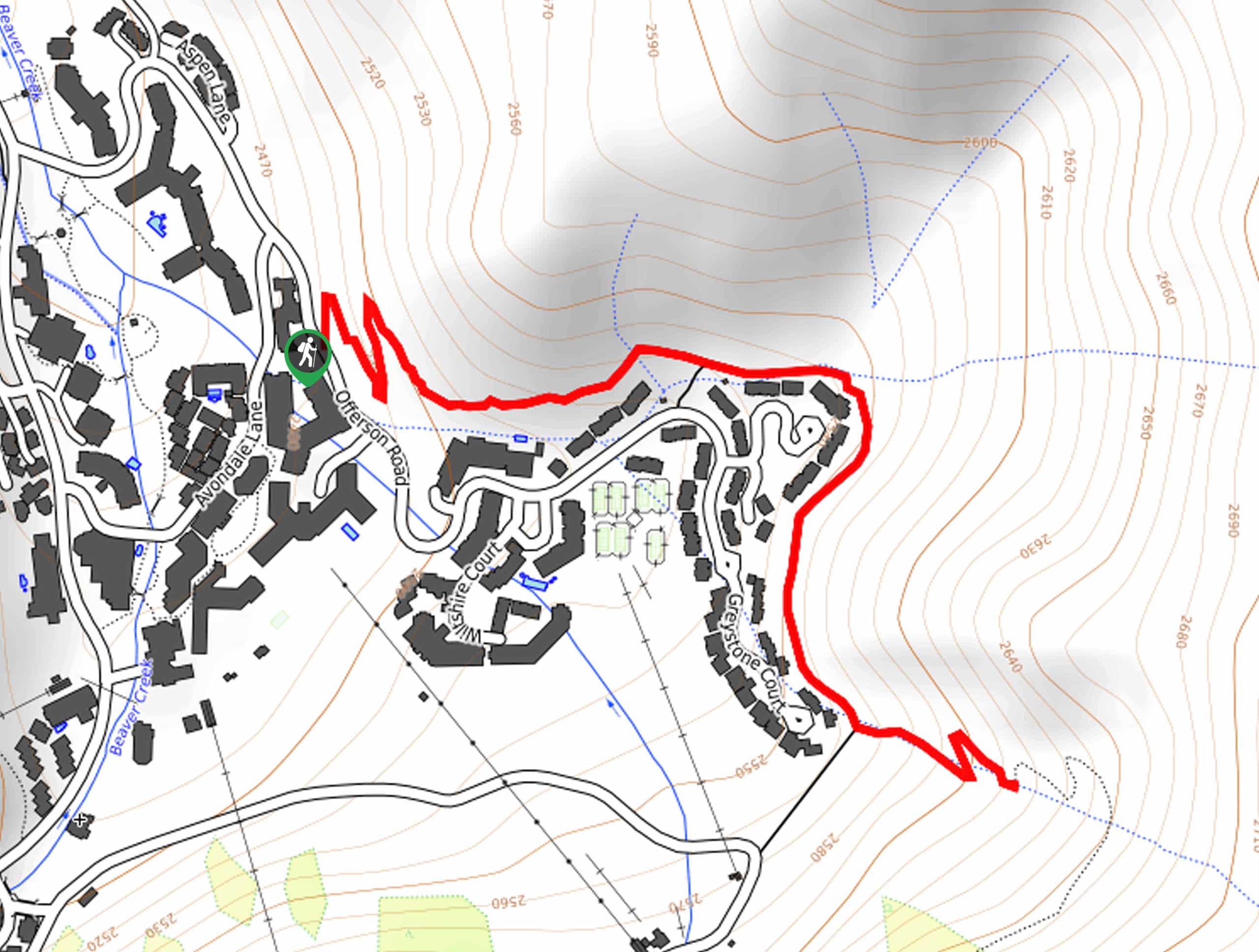
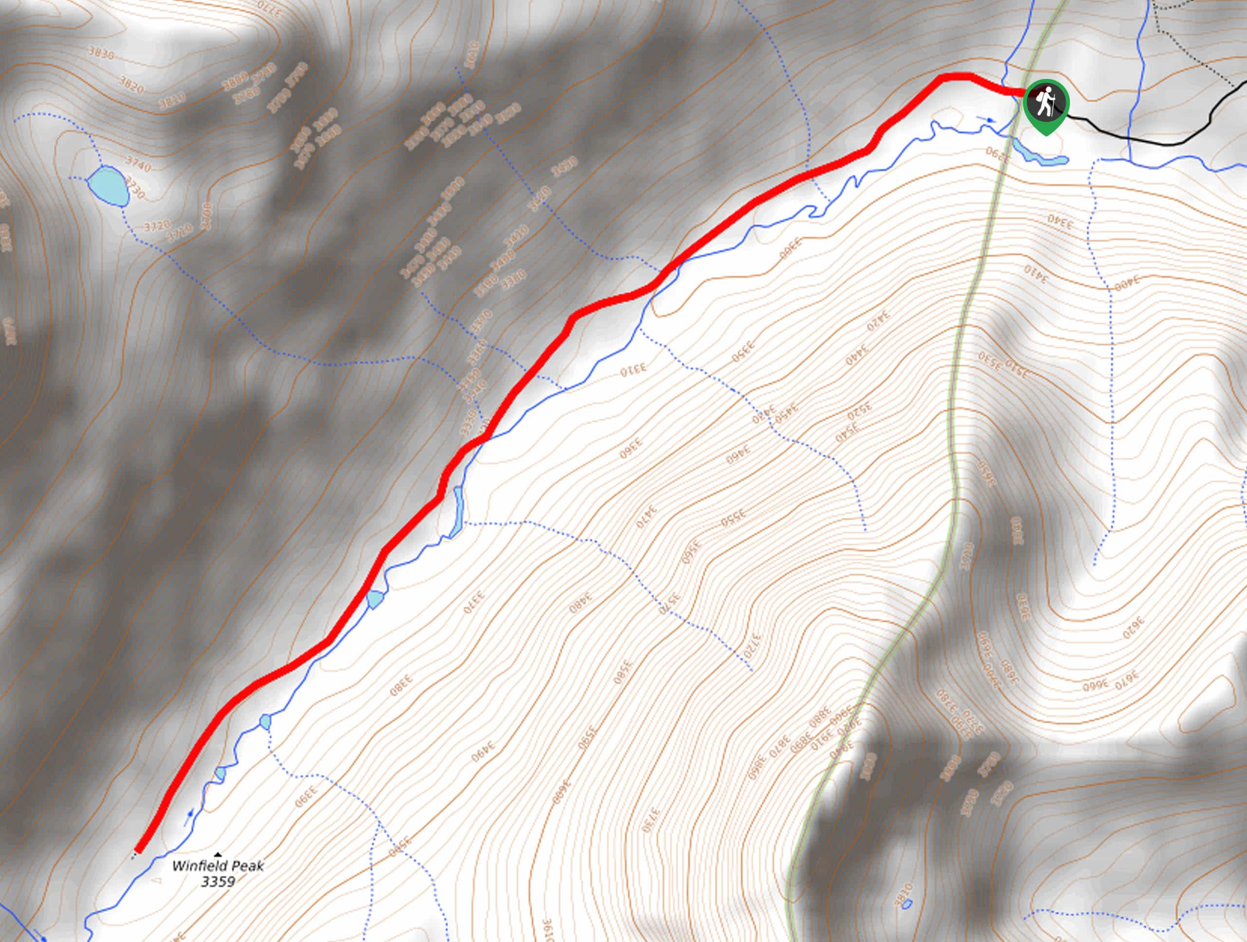
The Collegiate Peaks Campground Hike departs from the Campground entrance off County Road 306.

About
| Backcountry Campground | |
| When to do | Year-round |
| Pets allowed | Yes - On Leash |
| Family friendly | Yes |
| Route Signage | Average |
| Crowd Levels | Moderate |
| Route Type | Out and back |
Collegiate Peaks Campground Hike
Elevation Graph
Weather
Collegiate Peaks Campground Hike Description
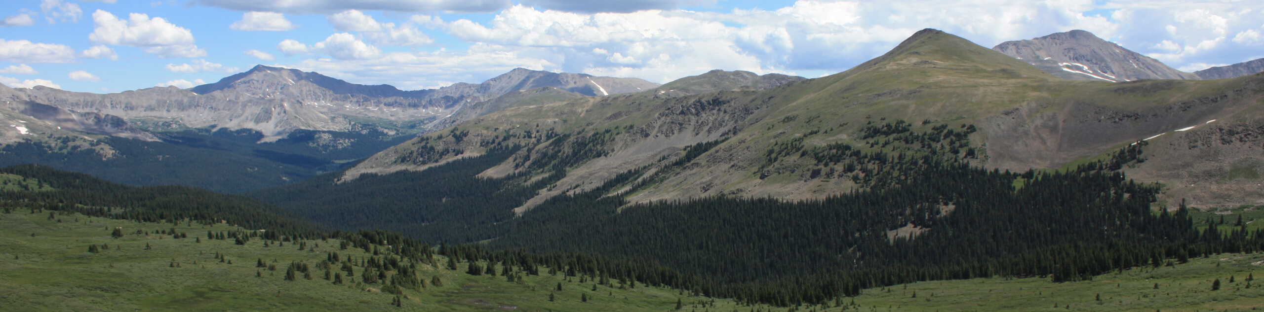
Explore the grounds of the charming camExplore the grounds of the charming campground, socialize and venture into the woodlands of the Collegiate Peaks Wilderness. This unique adventure along the Collegiate Peaks Campground Trail guides hikers through the campground before delivering outdoor enthusiasts beneath the timberline. Though not an ideal adventure as it travels along the shared road for a few clicks, this is a great option for those staying in the campground and seeking an early morning escape into the fresh air without having to go very far.
Begin your walk along the Collegiate Peaks Campground Trail from the entrance to the campground off County Road 306. From here, wander west through the campground, along the shoulder of the shared road. Soon the route will near Middle Cottonwood Creek and divert adventurers away from the campsites and into the forestland. The treeline path also exhibits sparse views of looming snow-capped peaks.
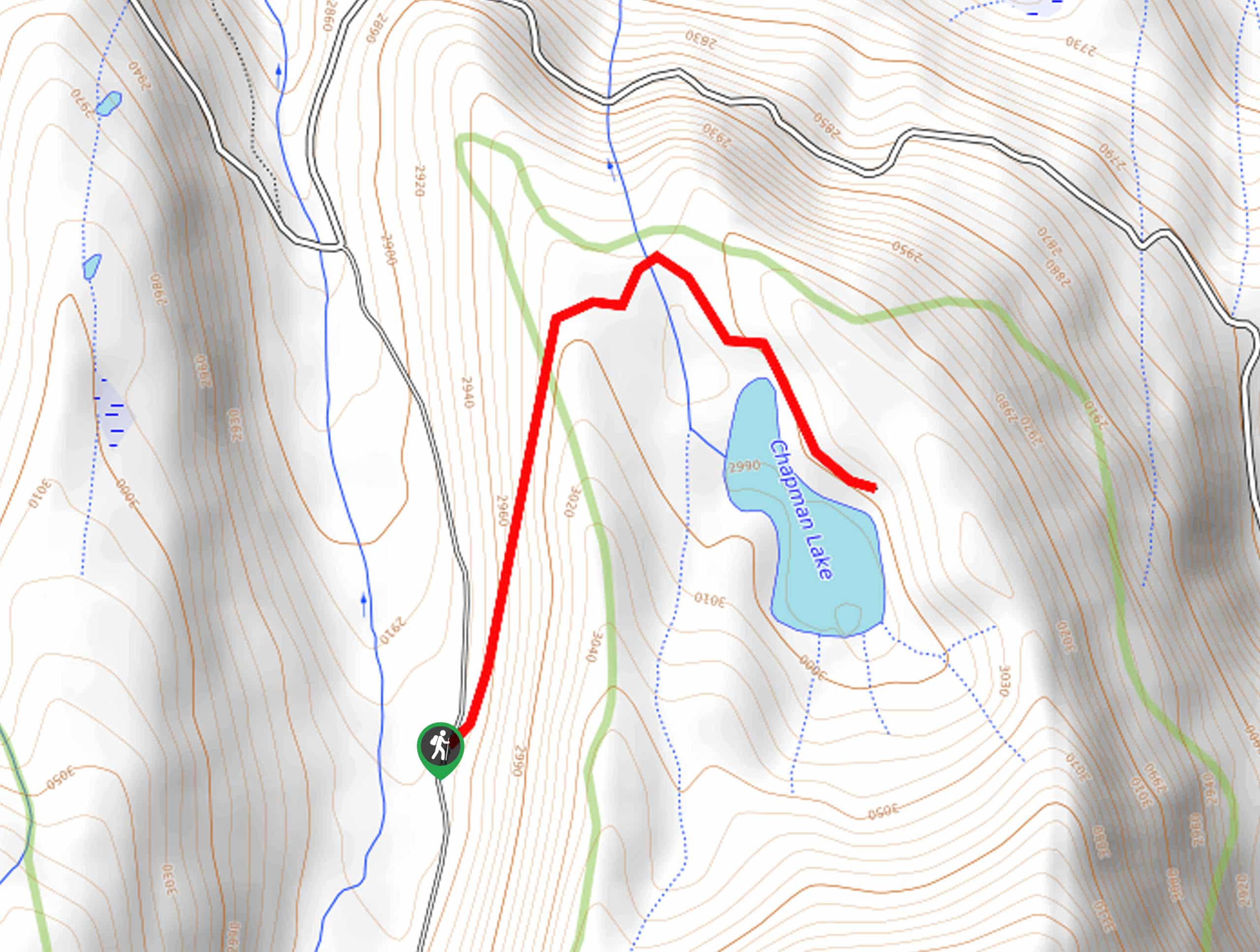
Eventually, you will intersect with a snowmelt stream before confronting the Gladstone Mine and a small boarded-up cabin. Soon after passing the cabin, you will meet the trail’s end. From here, simply retrace your footing along the woodland path all the way back to your starting point, marking the end of your adventure.
pground, socialize and venture into the woodlands of the Collegiate Peaks Wilderness. This unique adventure along the Collegiate Peaks Campground Trail guides hikers through the campground before delivering outdoor enthusiasts beneath the timberline. Though not an ideal adventure as it travels along the shared road for a few clicks, this is a great option for those staying in the campground and seeking an early morning escape into the fresh air without having to go very far.
Begin your walk along the Collegiate Peaks Campground Trail from the entrance to the campground off County Road 306. From here, wander west through the campground, along the shoulder of the shared road. Soon the route will near Middle Cottonwood Creek and divert adventurers away from the campsites and into the forestland. The treeline path also exhibits sparse views of looming snow-capped peaks.
Eventually, you will intersect with a snowmelt stream before confronting the Gladstone Mine and a small boarded-up cabin. Soon after passing the cabin, you will meet the trail’s end. From here, simply retrace your footing along the woodland path all the way back to your starting point, marking the end of your adventure.
Similar hikes to the Collegiate Peaks Campground Hike hike
Village Creek Trail
Explore the Beaver Creek Ski Resort and revel in the vibrance of the encompassing woodlands as you venture the Village…
Chapman Trail
The Chapman Trail is an easy-going nature walk up to a serene lake laden with lilies pads. Suitable for the…
North Fork Clear Creek Trail
The North Fork Clear Creek Trail is a must-add to your Colorado hiking itinerary if you are seeking a more…
Comments