Colorado Trail Segment 12
View Photos
Colorado Trail Segment 12
Difficulty Rating:
The Colorado Trail Segment 12 is a great piece of the cross-state trail system. Get a taste of what trekking the famous network of routes is all about, as you hike in the company of like-minded adventurers also exploring what Colorado has to offer. It may be long, but this is an amazing route to explore!
Getting there
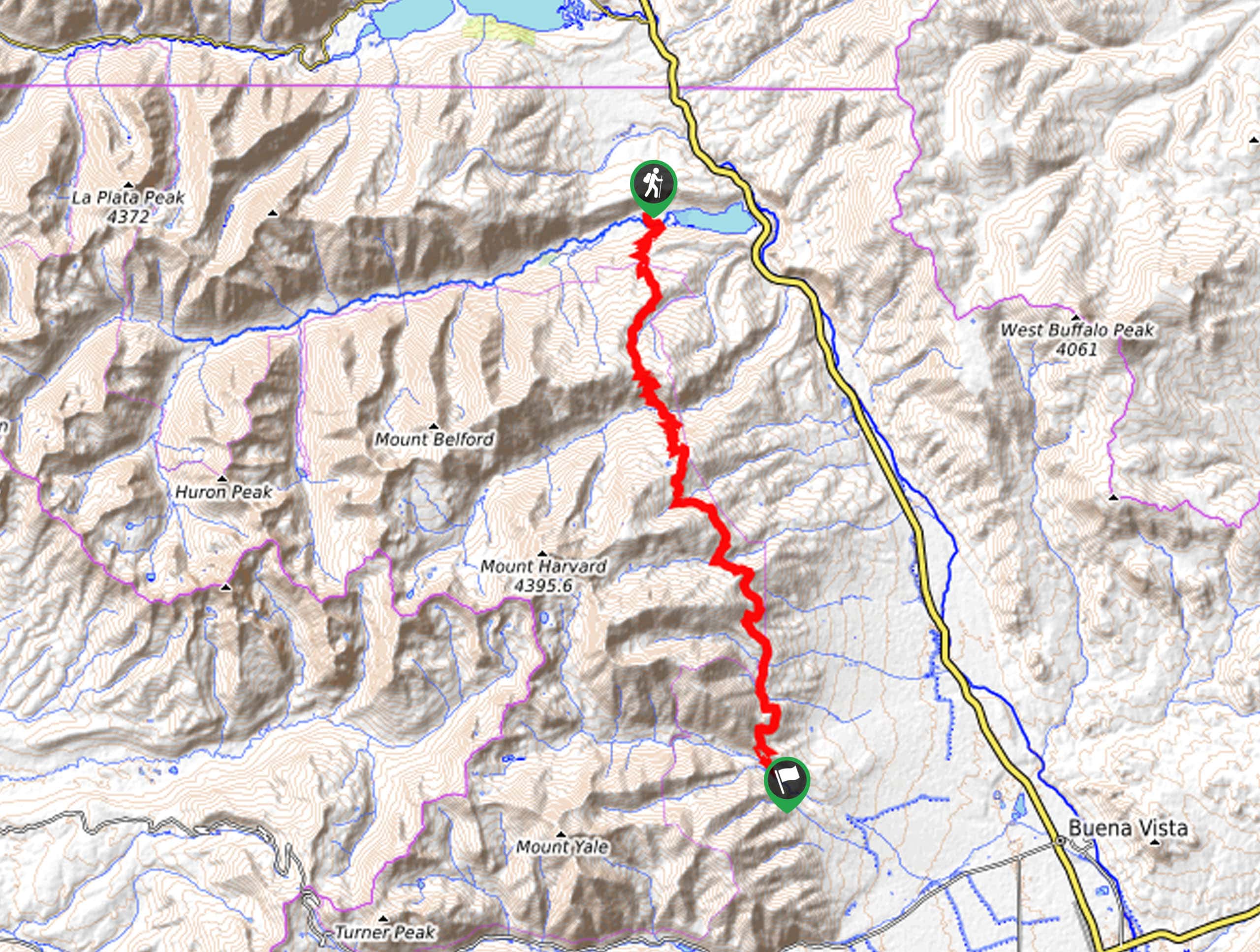
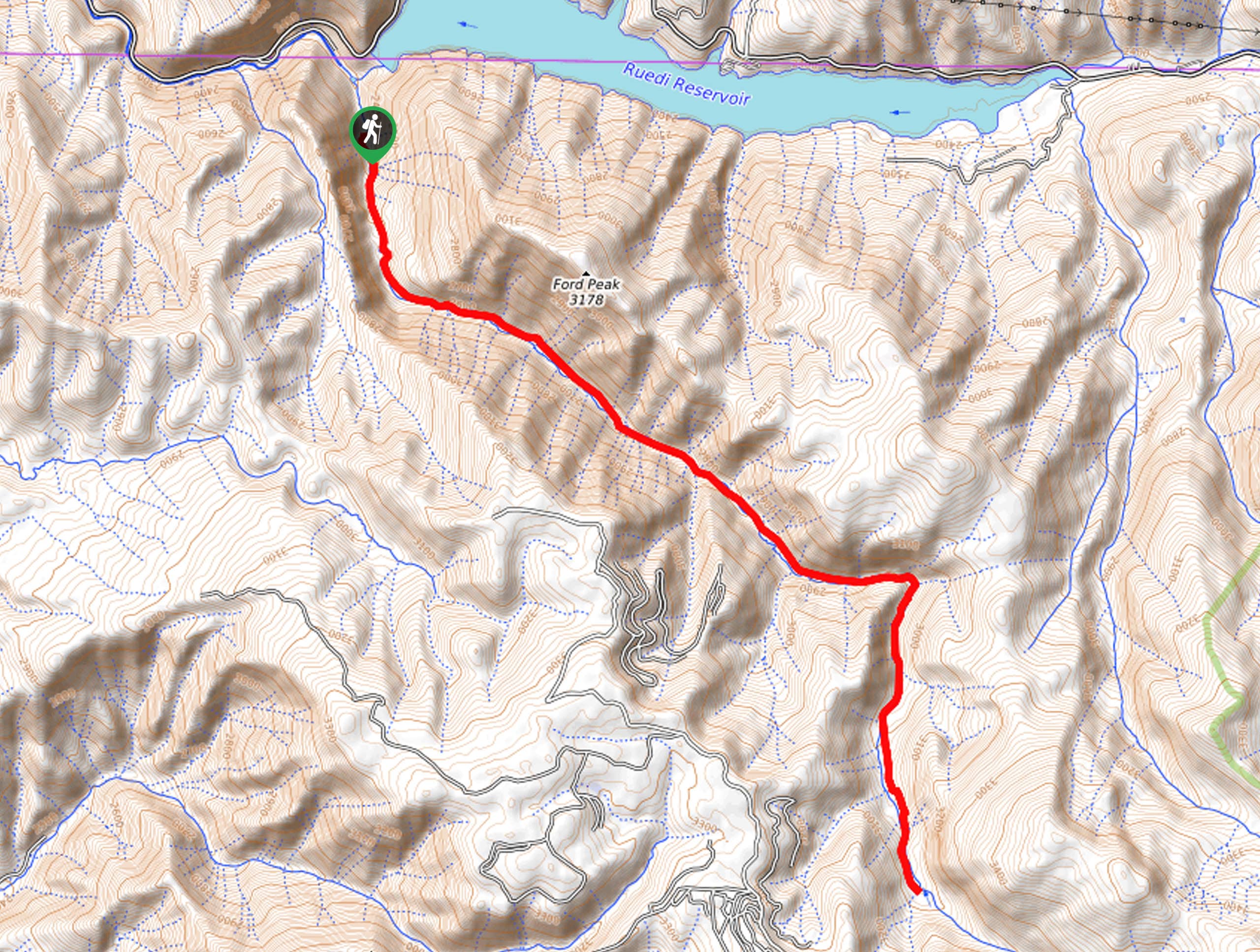
The Colorado Trail Segment 12 departs from the trailhead off County Road 390.

About
| Backcountry Campground | Backcountry Dispersed Camping |
| When to do | March-October |
| Pets allowed | Yes - On Leash |
| Family friendly | No |
| Route Signage | Average |
| Crowd Levels | Low |
| Route Type | One Way |
Colorado Trail Segment 12
Elevation Graph
Weather
Colorado Trail Segment 12 Description
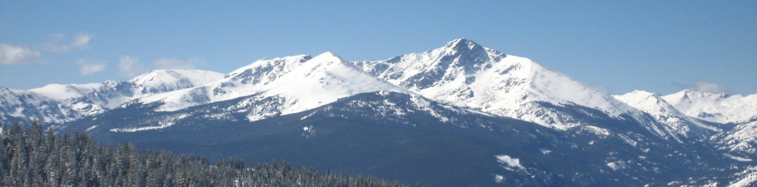
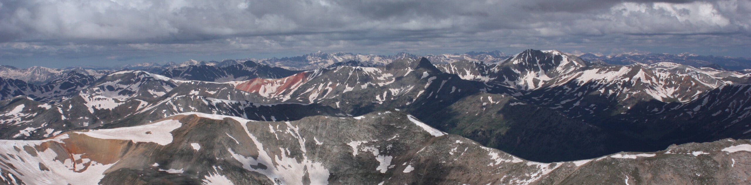
There is no shortage of jaw-dropping scenery along the Colorado Trail Segment 12, as it travels through the Collegiate Peaks Wilderness. Enjoy dense pine forests, luxuriant meadowlands, alpine lakes, gurgling streams, and epic mountain views as you travel along this amazing route. Note: this one-way segment is long, so if you are planning to hike it in a day, make sure you leave before dawn and bring a headlamp for the final few miles! Additionally, consider trekking poles to help more easily navigate the undulating terrain. Don’t forget to arrange for pickup or leave a car at the southern Colorado Trail Segment 12 Trailhead!
Embark on your adventure along the Colorado Trail Segment 12 from the trailhead off County Road 390. From here, head south along the trail and immediately climb up the rocky ridge. Enjoy the fresh mountain air as you venture into the woodlands of the Collegiate Peaks Wilderness. Intersecting with several snowmelt streams, you will eventually pass Waverly Mountain before dipping down to Pine Creek. From here you will begin climbing again up to Rainbow Lake, before passing Mount Harvard and Mount Columbia.
Soon you will reach the shoreline of the Harvard Lakes. Revel in the sight of the picturesque alpine lakes then continue south along the trail all the way to your endpoint at the southern Colorado Trail Segment 12 off County Road 365.
Similar hikes to the Colorado Trail Segment 12 hike
Mount of the Holy Cross Loop Trail
Hike up to one of the most famous Colorado 14ers along the Mount of the Holy Cross Loop Trail. This…
Rocky Fork Trail
The Rocky Fork Trail is an unassumingly picturesque adventure through the Rocky Fork Creek’s forested canyon that reveals awe-inspiring views…
La Plata Ellingwood Ridge Hike
The La Plata Ellingwood Ridge Hike is a demanding feat that requires an experienced adventurer with an intrepid spirit. If…
Comments