Shower Bath Hot Springs Hike
View Photos
Shower Bath Hot Springs Hike
Difficulty Rating:
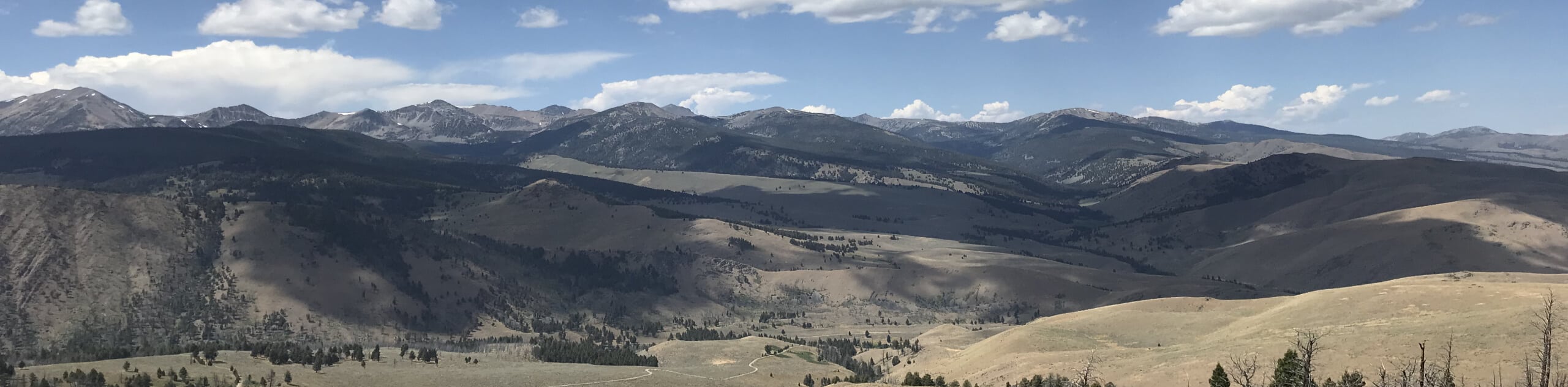
Discover a little slice of heaven hidden in the Salmon-Challis National Forest on the Shower Bath Hot Springs Hike. This incredibly scenic adventure explores a forested valley nestled amongst the Salmon River Mountains, culminating at a collection of hot springs showered by warm water tumbling over a precipitous rockface.
Getting there
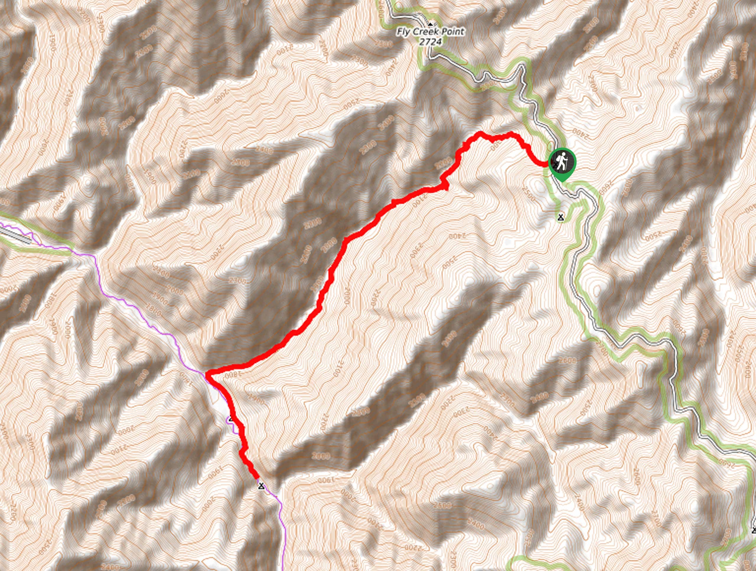
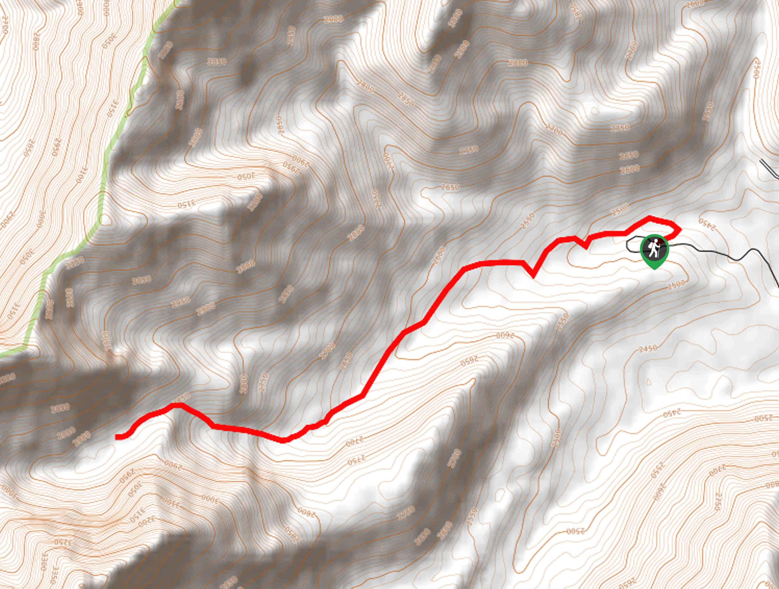
The Shower Bath Hot Springs Hike departs from the Mahoney Creek Trailhead off Sleeping Deer Road.

About
| Backcountry Campground | Dispersed Camping |
| Pets allowed | Yes - On Leash |
| Family friendly | No |
| Route Signage | Average |
| Crowd Levels | Moderate |
| Route Type | Out and back |
Shower Bath Hot Springs Hike
Elevation Graph
Weather
Shower Bath Hot Springs Hike Description
Somehow, someway the Shower Bath Hot Springs Trail has remained relatively undiscovered and unspoiled. The wild character of the remoteness of the area boasts a rustic charm and tranquility that no other hike in the Salmon-Challis National Forest can provide. Due to the inactivity in the area, the wilderness is undisturbed, meaning hikers should come prepared to do some fording and bushwhacking. Bring a pair of water shoes as the ford through the slot canyon is not easy on the feet, but do not attempt this if the water is running high! Additionally, it is important to note that the road to the trailhead is rough and rugged—only vehicles with high ground clearance should attempt the journey.
Tackle a technical trek through the preserved wilderness, and you will be rewarded with a spectacular hot spring! Those in good fitness should be able to effortlessly manage the hike and the elevation change, but the poorly signposted trail and overgrowth will give you a run for your money. Luckily you can download the trail GPS for easy navigation, and trekking poles can help maneuver the fords and brush! Although this trek is tiring, it boasts the opportunity to explore a unique environment of tree burn, lush regrowth, wildflowers, rugged canyons, wild waterways, and wildlife. Providing the ideal setting for self-reflection and reconnection with nature, hiking the Shower Bath Hot Springs Trail is a memorable experience—notably due to the idyllic natural hot tubs.
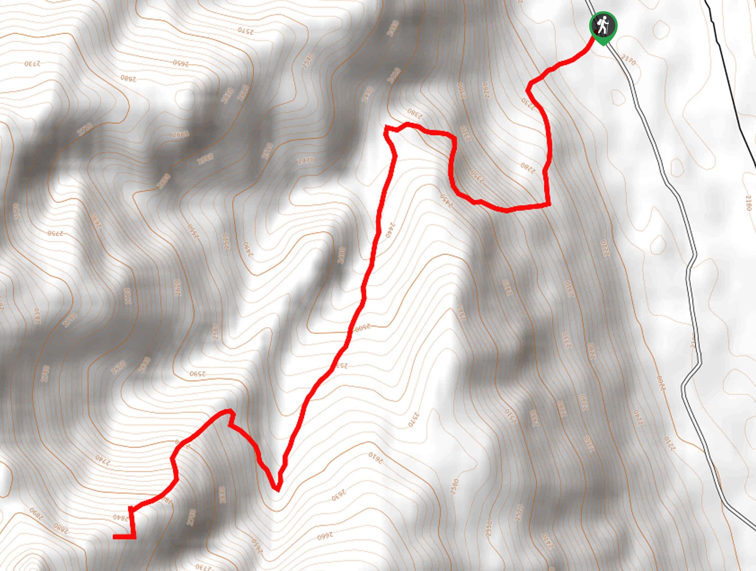
Embark on your amazing adventure from the Mahoney Creek Trailhead. Setting out from here, you will be guided west, dipping beneath the shade of subalpine firs. Soon after your departure, you will pass an old-rustic run-down cabin. Explore the grounds, then continue your descent, alternating between the shaded tree canopy and exposed grasslands. After some hiking, the route will approach Mahoney Creek, providing a great soundtrack of running water to your adventure. Traveling through the steep-walled canyon, you will have to cross the creek on several occasions, winding back and forth through the dense foliage. Eventually, the canyon will widen, offering more expansive views of the scar-burned woodlands. You may want to use the GPS here as it is easy to get off-track.
Ultimately you will reach the convergence of Warm Springs Creek and Mahoney Creek. Here, veer left, and you will be diverted onto the Warm Springs Trail. Beyond this point, the route will travel upstream, passing the Warm Springs Ranger Cabin and the Sitz Bath—do not be mistaken, this is not the Shower Bath Springs. Take a break here and judge whether it’s safe to progress further depending on water levels. To get to Shower Bath Hot Springs, you will have to ford through the slot canyon known as ‘the Narrows’, so be prepared to get wet; the water runs high year-round. From here, the canyon will open to the springs. Luxuriate in the pools and shower beneath the spray of the tumbling falls. When you are through relaxing in the natural spa, begin your return to the trailhead the way you came, marking the end of your unforgettable experience.
Frequently Asked Questions
How long is the Shower Bath Hot Springs Hike?
The Shower Bath Hot Springs Hike is a 10.5mi out-and-back trail in the Salmon-Challis National Forest.
Where is the trailhead for the Shower Bath Hot Springs Hike?
Access the Shower Bath Hot Springs Hike from the Mahoney Creek Trailhead off Sleeping Deer Road or
Insider Hints
The road to the trailhead requires a vehicle with high ground clearance
Be mindful of wildlife as you explore this remote area of wilderness
Much of the path is exposed, so SPF and sun protection is wise
The insects are relentless, bring bug repellent
Don’t forget your towel and swimsuit!
Practice Leave No Trace Principles
Come prepared to ford the creek
Similar hikes to the Shower Bath Hot Springs Hike hike
Boulder Lake via Boulder Creek Trail
Explore a rugged and remote area of the Salmon-Challis National Forest on Boulder Lake via Boulder Creek Trail. This pleasant…
Burnt Aspen Trail
The Burnt Aspen Trail is a scenic hike that demands a relentless climb through the forested foothills of the Pioneer…
North Fork Lake Trail
Explore Idaho’s Boulder Mountains and enjoy a refreshing swim in an idyllic alpine pool on the North Fork Lake Trail.…
Comments