
Copper Basin via Lake Creek Trail
View Photos
Copper Basin via Lake Creek Trail
Difficulty Rating:
Immerse yourself amongst the Pioneer and White Knob Mountains on the Copper Basin via Lake Creek Trail. This pleasant day hike explores scenic montane meadows abundant with flora and fauna before culminating in the lake-adorned basin. This amazing adventure has earned a place on our list of the Salmon-Challis National Forest’s greatest hikes, and it will likely be added to your greatest’s hikes too!
Getting there
The Copper Basin via Lake Creek Trail is accessed from the Lake Creek Trailhead off National Forest Development Road 138.

About
| Backcountry Campground | Dispersed Camping |
| When to do | April-October |
| Pets allowed | Yes - On Leash |
| Family friendly | Older Children only |
| Route Signage | Average |
| Crowd Levels | Moderate |
| Route Type | Lollipop |
Copper Basin via Lake Creek Trail
Elevation Graph
Weather
Copper Basin via Lake Creek Hike Description
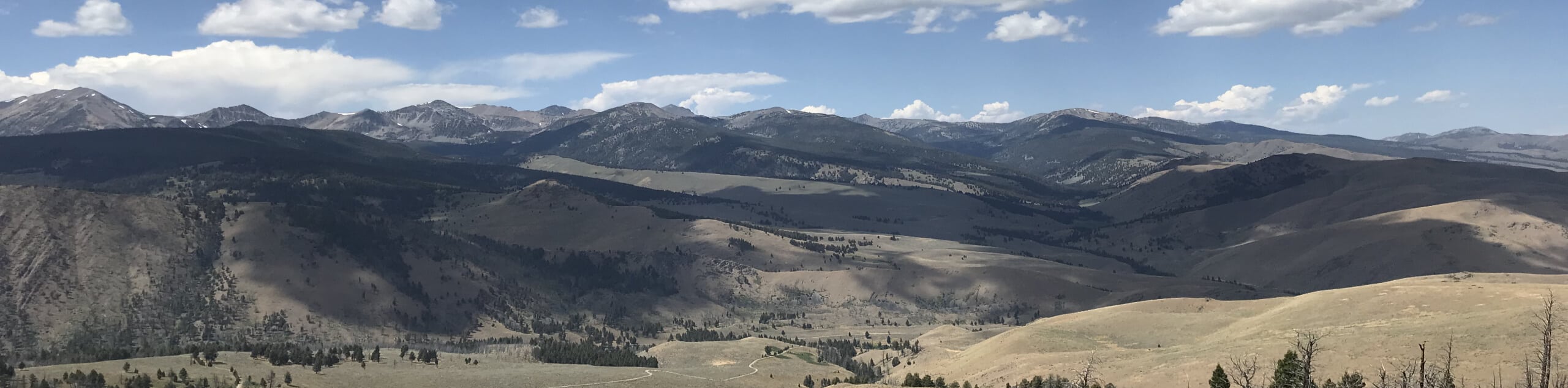
Sweeping mountain views await you on the Copper Basin via Lake Creek Trail. This wonderful day hike yields a diversity of flora and fauna while exhibiting the grandeur and beauty of Idaho’s mountain ranges as you progress through the valley. As this is a popular recreational area, you can expect to share the trail. Those seeking a more tranquil experience are encouraged to head out in the early morning to beat the crowds. No matter the time of day, it is worth noting that the terrain is exposed; thus, it is wise to check the forecast before departure and to dress in layers as insurance against changing conditions.
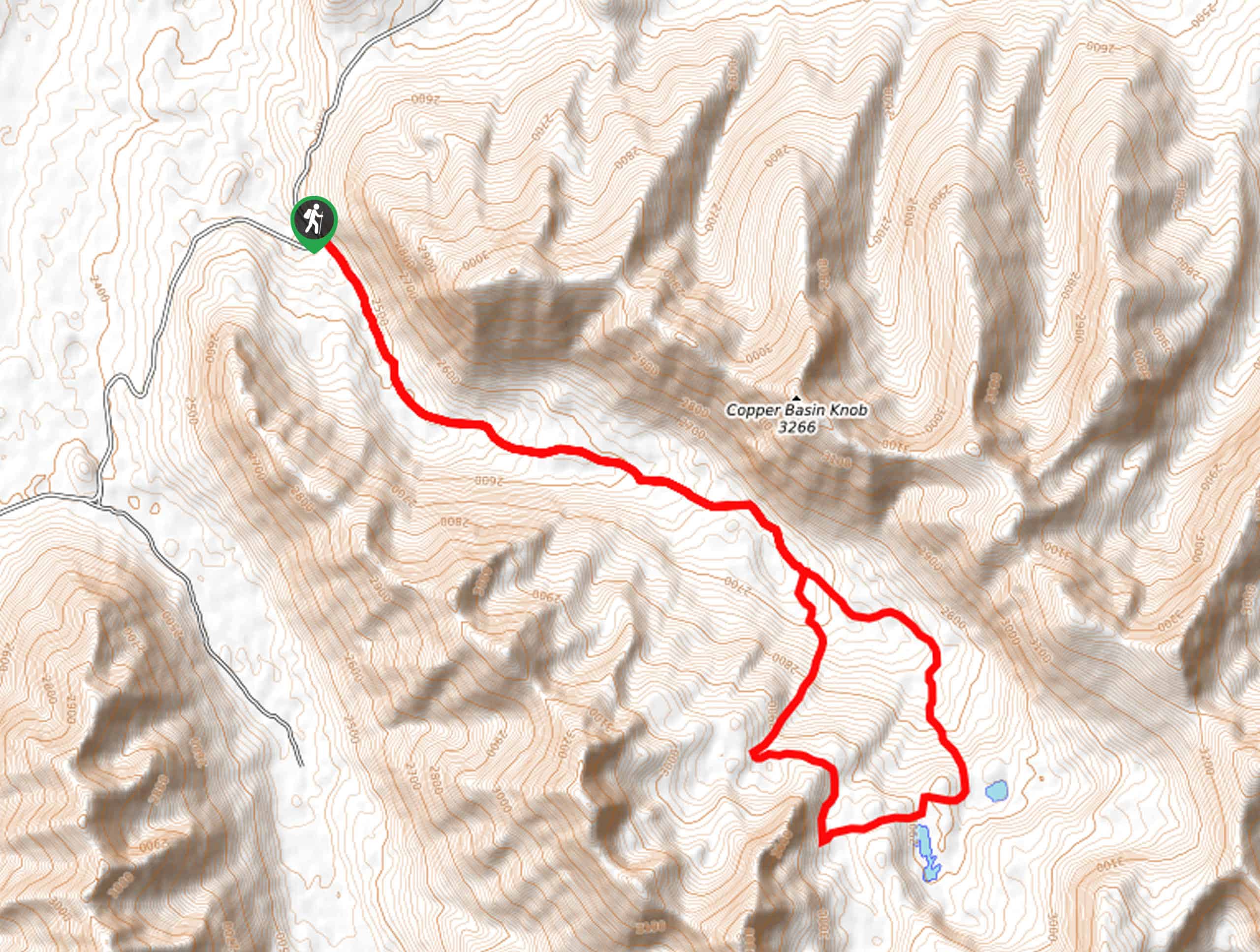
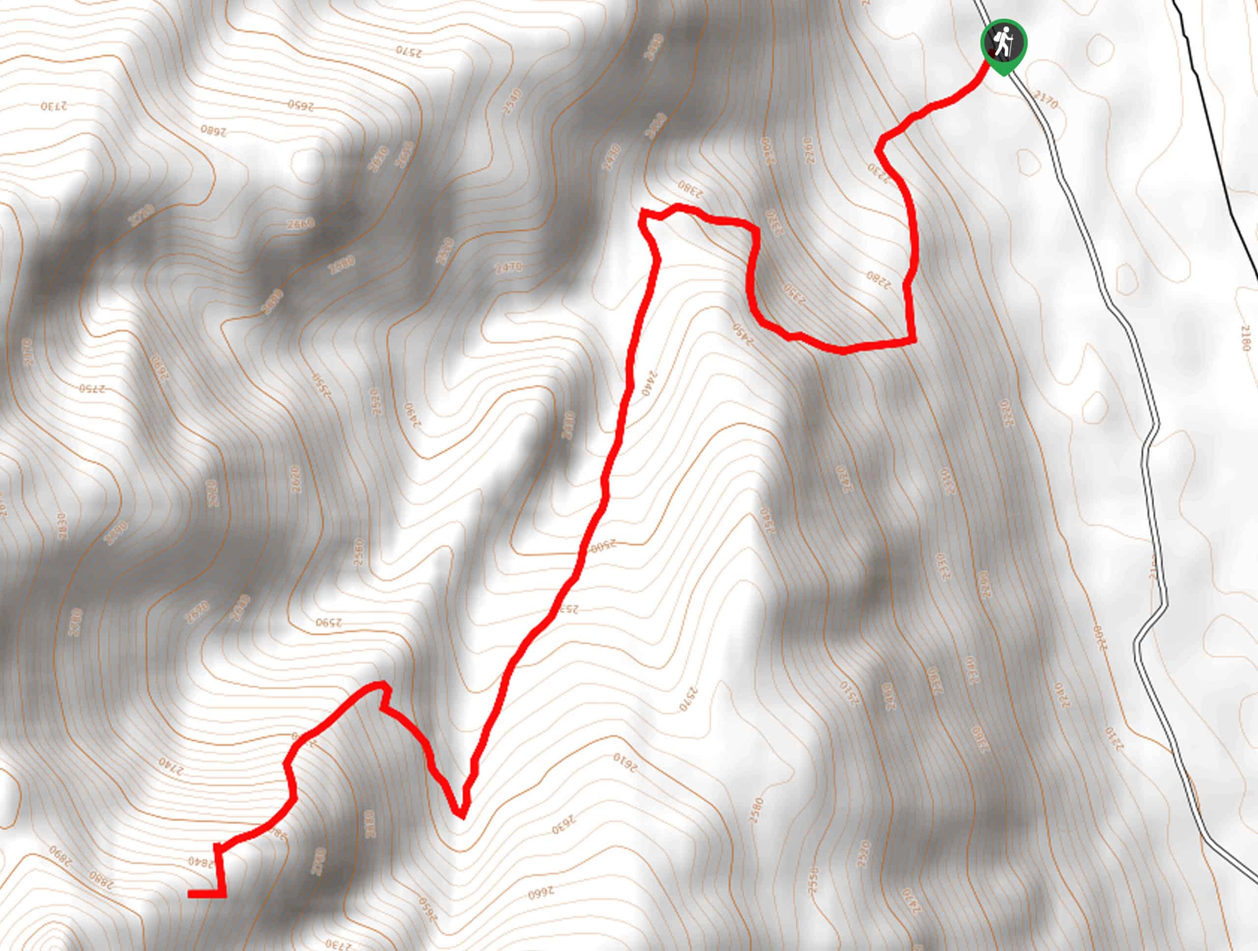
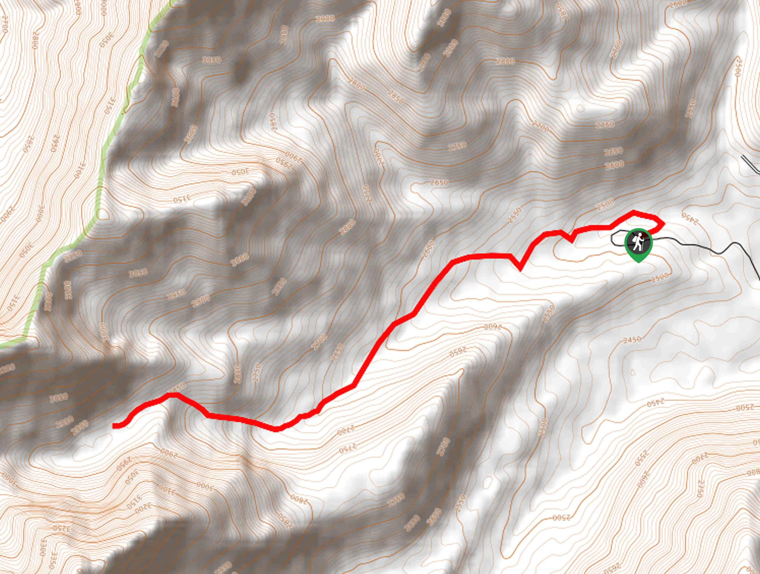
When you are ready to roll, your adventure into Copper Basin begins from the Lake Creek Trailhead. Setting out from here, the path travels southeastward into the mountain-bound valley, progressing through communities of low-lying brush and flowering meadows. After some hiking, the path will approach Lake Creek, escaping beneath the shade of towering pine and aspens. Consistently climbing, the terrain will begin to alternate between exposed grasslands and shaded tree stands. Eventually, you will confront an intersection; keep left to complete the loop in a clockwise direction. Beyond this point, views of the towering mountains will come into view as you explore the basin. The first lake you will pass is the smallest—Round Lake.
From Round Lake, you will pass Long Lake, then Rough Lake, and lastly, Big Lake. Take the time to admire the beauty of the blue-hued crystalline lakes before completing the circuit. When you reconnect with the main trail, all you have to do is turn left and retrace your steps beneath the ridges of Copper Basin Knob to the trailhead.
Similar hikes to the Copper Basin via Lake Creek Trail hike
Boulder Lake via Boulder Creek Trail
Explore a rugged and remote area of the Salmon-Challis National Forest on Boulder Lake via Boulder Creek Trail. This pleasant…
Burnt Aspen Trail
The Burnt Aspen Trail is a scenic hike that demands a relentless climb through the forested foothills of the Pioneer…
North Fork Lake Trail
Explore Idaho’s Boulder Mountains and enjoy a refreshing swim in an idyllic alpine pool on the North Fork Lake Trail.…
Comments