Peak 12150 Hike
View Photos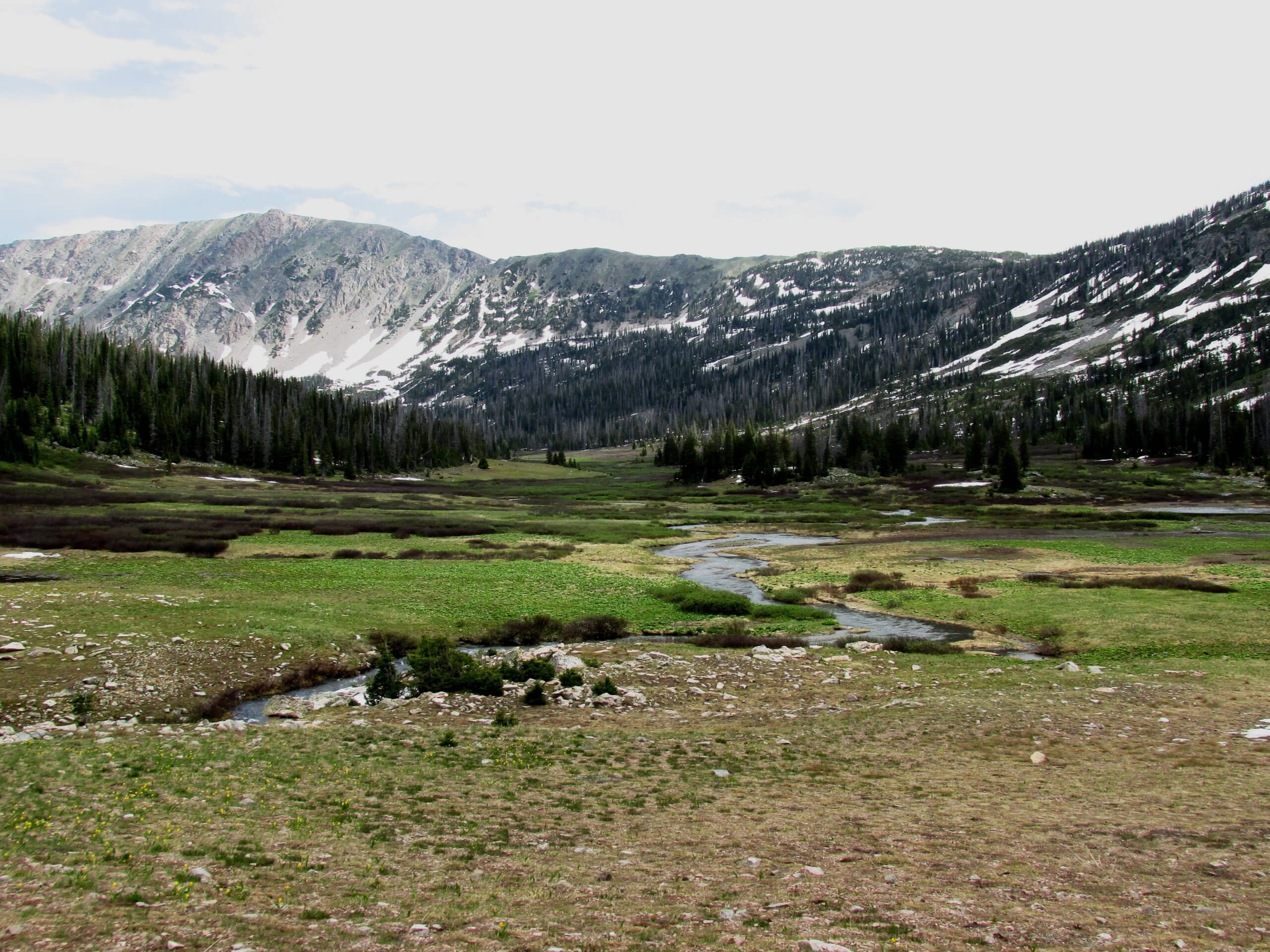
Peak 12150 Hike
Difficulty Rating:
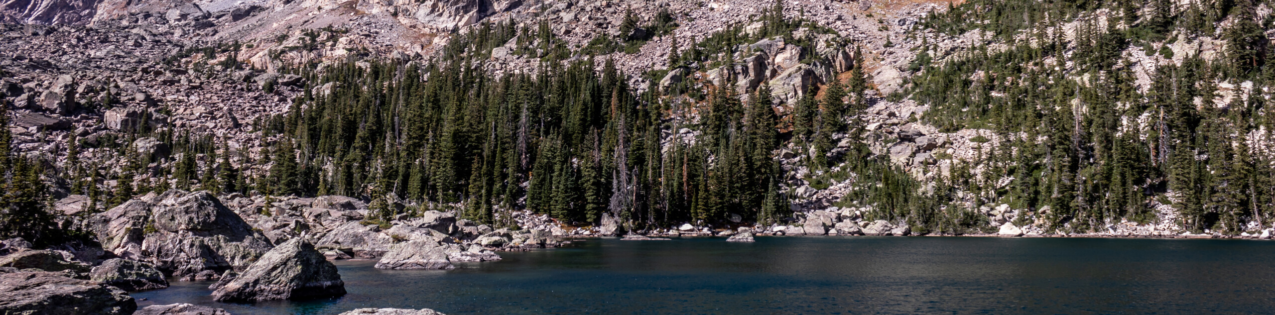
Walk amongst the clouds and feel as though you are on top of the world as you trek the Peak 12150 Hike. Walk along the top of the Continental Divide and admire the panoramic views as you walk among unafraid marmots and moose. This excursion is a must-add to your Rocky Mountain National Park itinerary.
Getting there
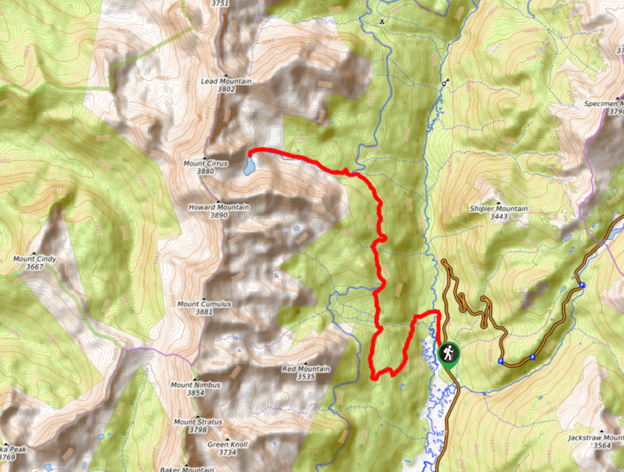
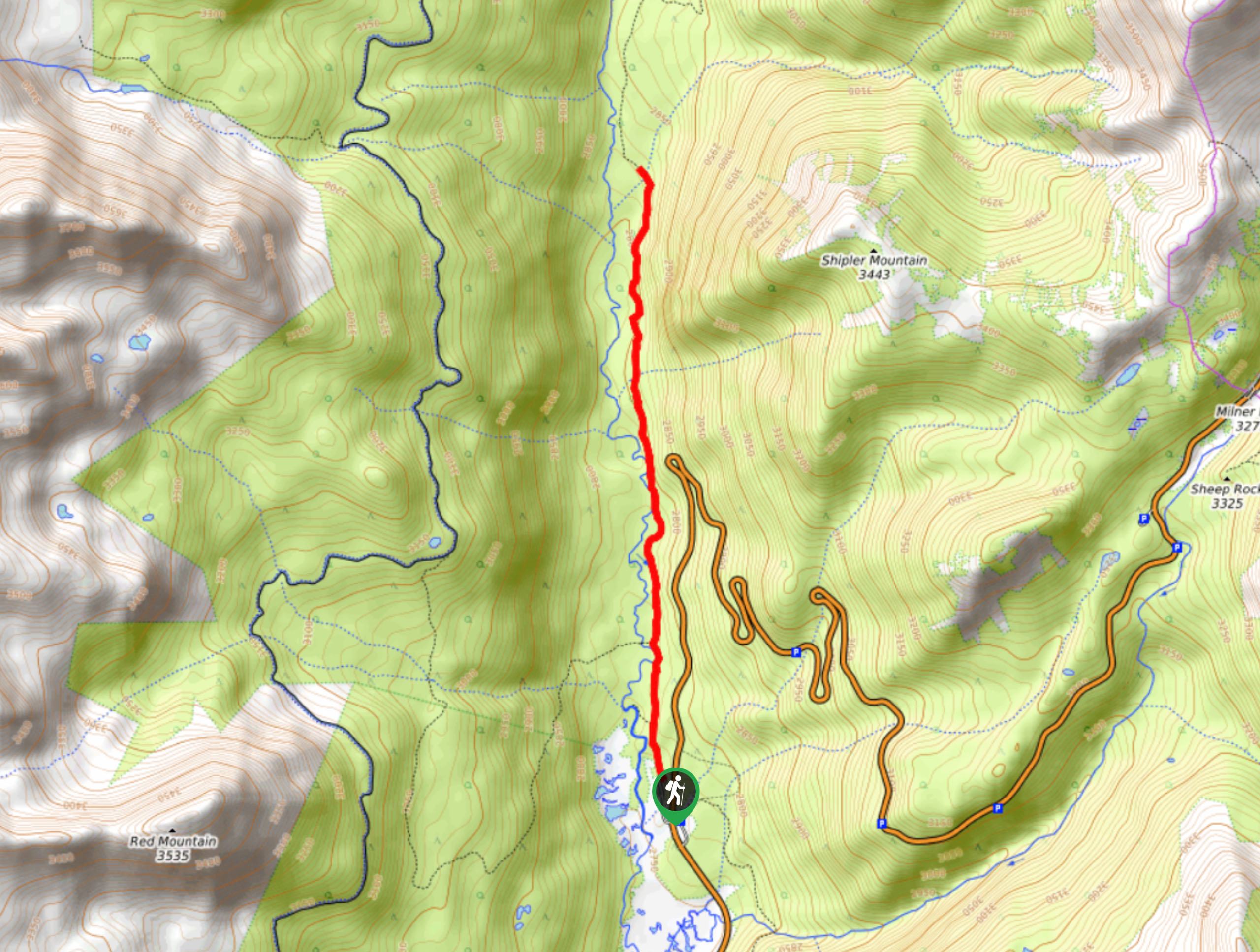
The Peak 12150 Hike departs from the Milner Pass Trailhead off the Trail Ridge Road.

About
| Backcountry Campground | No |
| When to do | April-October |
| Pets allowed | No |
| Family friendly | Older Children only |
| Route Signage | Poor |
| Crowd Levels | High |
| Route Type | Out and back |
Peak 12150 Hike
Elevation Graph
Weather
Peak 12150 Hike Description
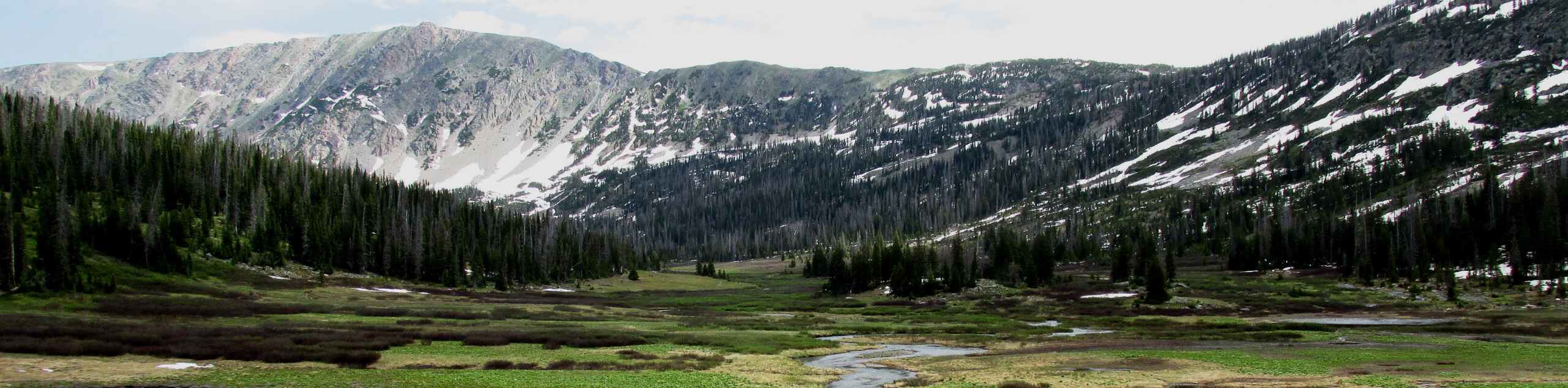
The Peak 12150 Hike is a scenic adventure up to an unimpressive peak in the Rocky Mountain National Park. Though the peak itself is uninteresting, the views it rewards are unforgettable. If you are just starting summit hikes, then this is a perfect conditioning trail. The exposed terrain presents its own sets of challenges as you trek up the steep terrain to the Continental Divide. Make sure to check the forecast prior to your adventure and head out in the early morning to mitigate the chances of getting caught in an afternoon thunderstorm at the summit. Additionally, if you hope to venture this scenic trail in the autumn or winter, we highly recommend microspikes or snowshoes to help navigate the icy and likely snowy terrain. Note that because the path is located within the Rocky Mountain National Park, visitors are required to purchase a pass.
Embark on your journey to Peak 12150 from the Milner Pass Trailhead. From here, take the Ute Trail along the shores of the Poudre Lake. Keep left at the first intersection, and at the next, veer right, and you will be diverted onto the Mount Ida Trail. Continue along the Mount Ida Trail and it will quickly deliver you above the timberline. Once you graduate the treeline you will be granted panoramic views of the mountainous landscape. Hike amongst marmots along the exposed ridge. Continue trekking through the alpine tundra, and you will eventually ascend Peak 12150.
Some find it hard to pinpoint the unmarked summit, the trail GPS can be useful if you are having difficulties. If you enjoy treasure hunts, try to locate the geological marker at the summit! Revel in the expansive views of the Mummy Range and Continental Divide from here. When you are ready to descend, simply retrace your footing back along the route back to the trailhead.
Similar hikes to the Peak 12150 Hike hike
Lake of the Clouds Hike
The Lake of the Clouds Hike is a picturesque adventure on the western border of the Rocky Mountain National Park.…
Shipler Cabin Trail
The Shipler Cabin Trail is a magical adventure in the Rocky Mountain National Park through meadowlands and towering pines. Perfect…
Six Lakes Hike
The Six Lakes Hike is a stunning alpine adventure in the Rocky Mountain National Park. If you love lake hikes…
Comments