
MacGregor Falls Hike
View Photos
MacGregor Falls Hike
Difficulty Rating:
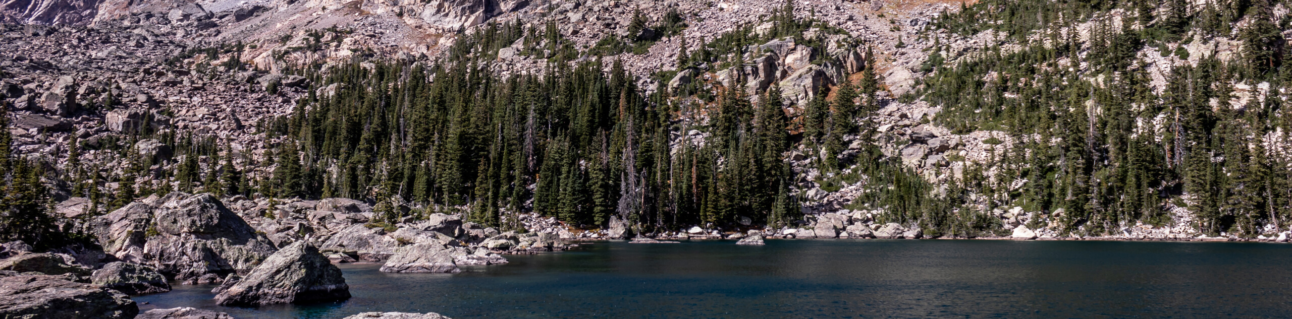
Who doesn’t love a waterfall hike right? We love them and the MacGregor Falls Hike is a wonderful adventure to the cascades. This awesome day hike will guide hikers through verdant woodlands, vast meadows and up a rocky valley to the falls. Make sure to add this trail to your Colorado adventure list.
Getting there
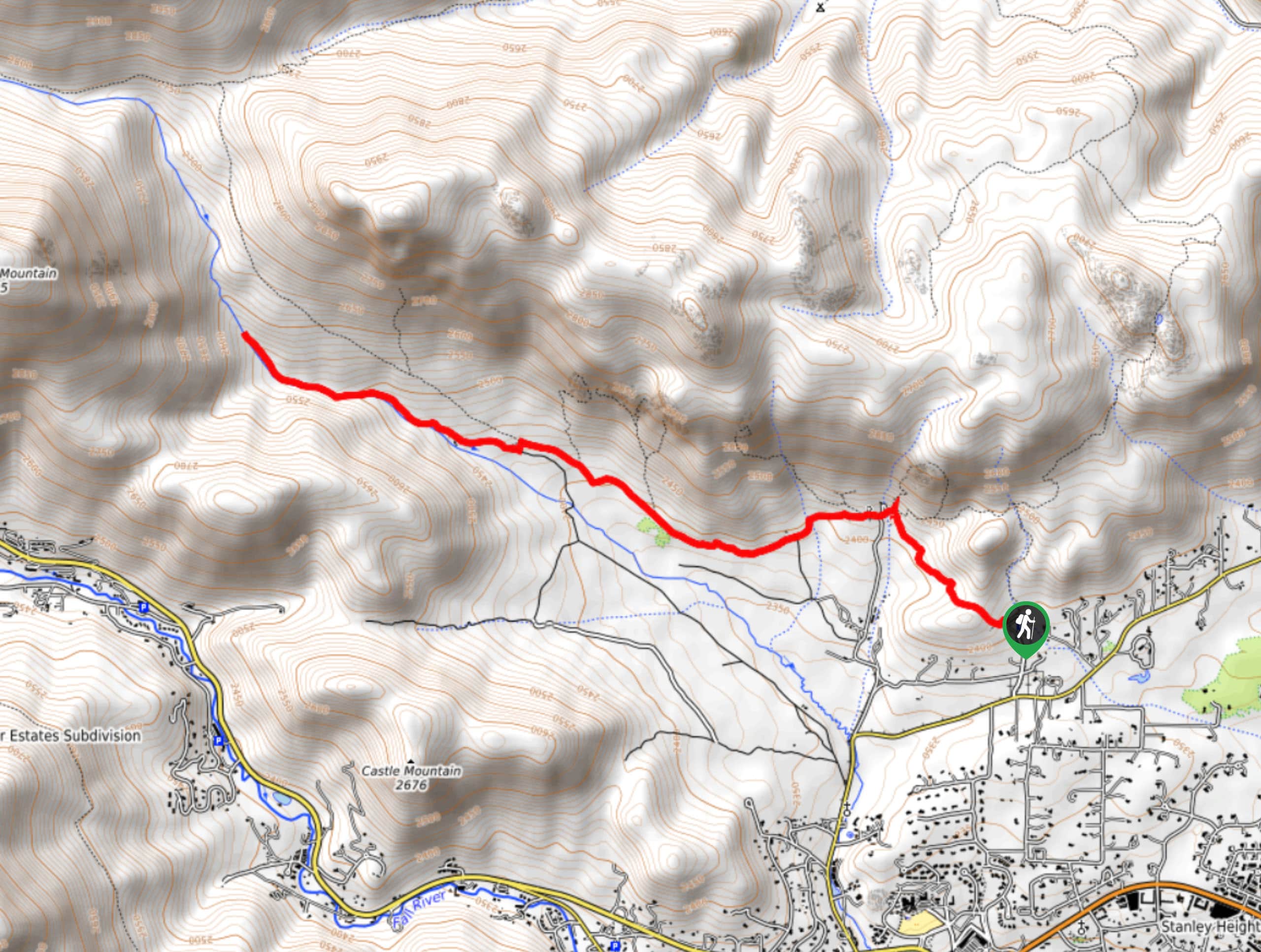
The MacGregor Falls Hike departs from the Gem Lake Trailhead off Lumpy Ridge Road.

About
| Backcountry Campground | No |
| When to do | Reasonable start/end dates for route |
| Pets allowed | No |
| Family friendly | Older Children only |
| Route Signage | Average |
| Crowd Levels | Moderate |
| Route Type | Out and back |
MacGregor Falls Hike
Elevation Graph
Weather
MacGregor Falls Hike Description
The MacGregor Falls Hike is a great excursion that families and novice hikers can enjoy. The path is level up until the final push to the falls, where adventurers will have to navigate fallen trees and scramble up the rocky terrain. This hike is a hidden gem, and it is one of the Rocky Mountain National Parks (RMNP) few secluded hikes, so if you are lucky, you may just get the trail to yourself. The isolation may be a result of the path’s primitive nature, but we love a good off the beaten path experience. Use the trail GPS to help navigate the tricky terrain and don’t forget to purchase a park pass to access the trails.
Begin your hike along the MacGregor Falls Trail from the Gem Lake Trailhead. From here, track northwest along the Lumpy Ridge Trail, past the Twin Owls and beneath tree shade. The route will guide you to an intersection, veer left, and you will be diverted onto the Black Canyon Trail. Hike this path west through a meadow, ignoring off shooting paths. Eventually you will near the Black Canyon Creek and meet a junction with a Private Trail. Keep left onto the Private Trail which will merge onto the MacGregor Falls Trail. This section of the path will become increasingly steep and rocky.
Hike along the Black Canyon Creek and navigate the technical terrain up to the MacGregor Falls. Enjoy the ambiance of the cascading water and notice sights of MacGregor Mountain looming above through the tree breaks. Appreciate the secluded falls and rest alongside the cascades on one of the many boulders. When you are ready to return, retrace your footing along the path back to the trailhead.
Similar hikes to the MacGregor Falls Hike hike
Lake of the Clouds Hike
The Lake of the Clouds Hike is a picturesque adventure on the western border of the Rocky Mountain National Park.…
Shipler Cabin Trail
The Shipler Cabin Trail is a magical adventure in the Rocky Mountain National Park through meadowlands and towering pines. Perfect…
Six Lakes Hike
The Six Lakes Hike is a stunning alpine adventure in the Rocky Mountain National Park. If you love lake hikes…
Comments